Sujet
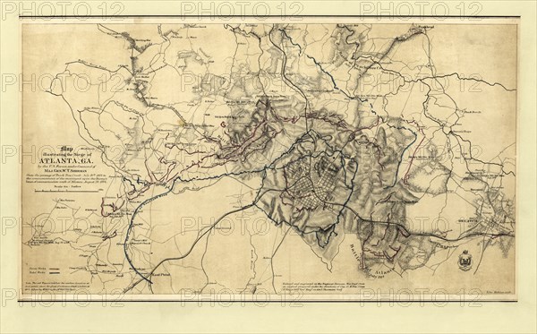
Map illustrating the Siege of Atlanta
Légende
Map illustrating the Siege of Atlanta, Georgia by U.S. Forces, under Command of Maj. Gen. W.T. Sherman from the Passage of Peach Tree Creek, July 19th, 1864 to the Commencement of the movement upon the Enemy's Lines of Communication south of Atlanta, August 26, 1864
Date
01 janv. 0001
Crédit
Glasshouse Images/Photo12/Circa Images
Notre référence
GLS20A01_180
Model release
NA
Property release
NA
Licence
Droits gérés
Format disponible
51.8Mo (5.7Mo) / 45.6cm x 28.4cm / 5391 x 3356 (300dpi)