Sujet
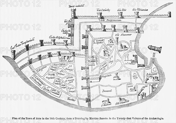
Plan of the Town of Acre in the 14th Century, from a Drawing by Martino Santo in the Twenty-Twenty-First Volume of the Archaeologia, Illustration from John Cassell's Illustrated History of England, Vol. I from the earliest period to the reign of Edward the Fourth, Cassell, Petter and Galpin, 1857
Légende
Plan of the Town of Acre in the 14th Century, from a Drawing by Martino Santo in the Twenty-Twenty-First Volume of the Archaeologia, Illustration from John Cassell's Illustrated History of England, Vol. I from the earliest period to the reign of Edward the Fourth, Cassell, Petter and Galpin, 1857
Date
06 janv. 1857
Crédit
Glasshouse Images/Photo12
Notre référence
GLS19A07_080
Model release
NA
Property release
NA
Licence
Droits gérés
Format disponible
50.5Mo (2.3Mo) / 42.4cm x 29.8cm / 5010 x 3522 (300dpi)