Sujet
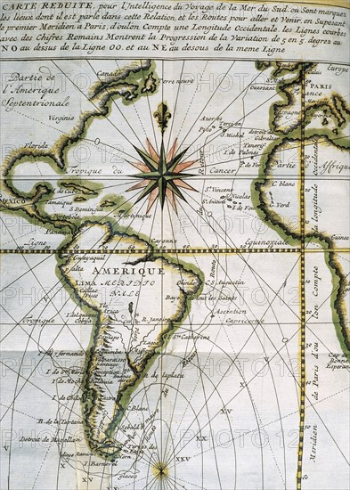
Map of the Atlantic Ocean. 18th century.
Légende
Map of the Atlantic Ocean from Newfoundland to Cape Horn. At A Voyage to the South-sea and along the coasts of Chili and Peru, in the years 1712, 1713 and 1714 by Amedee-François Frezier (1682-1773). Published in Paris, 1716. Library of Catalonia. Barcelona. Spain.
Info+
Verwendung weltweit, usage worldwide
Crédit
Photo12/dpa-pa
Notre référence
DPA15A00_482
Licence
Droits gérés
Format disponible
35.4Mo (3.3Mo) / 25.2cm x 35.2cm / 2977 x 4159 (300dpi)