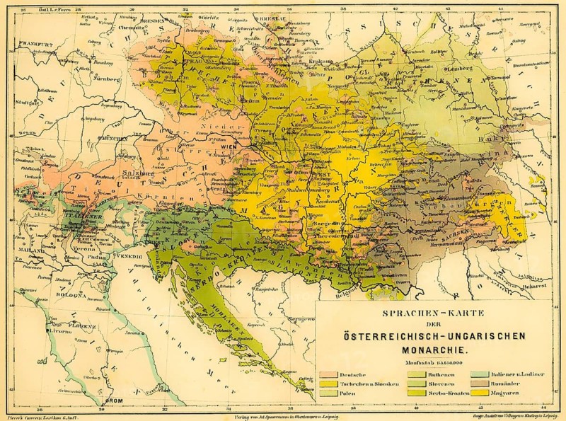
Légende
Language map of the Austro-Hungarian Empire, color map with scale, Czech Poland, German Slovaks, Margyars, Serbo-Croats, Slavenians, Germans, Ruthenians, Slovenians, Italians and Ladins, Romanians, European languages, Croatia, Hungary, Romania, Poland, Czech Republic, Slovakia, Germany, Austria, Italy, diversity, scale, geography, grid, rivers, cities, seas, states, historical illustration 1877
Date
26 avr. 2026
Crédit
Photo12/ImageBROKER/Wolfgang Diederich
Notre référence
BRK26H14_229
Model release
Non
Property release
Non
Licence
Libre de droits
Format disponible
72.9Mo (24.3Mo) / 49.6cm x 36.9cm / 5854 x 4354 (300dpi)