Légende
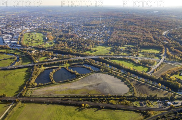
Aerial view, sewage sludge landfill at Ruhrbogen Ruhrschifffahrtskanal, Schleuseninsel, Styrumer Ruhrauen, city triangle DU - OB - MH, Speldorf - Nordwest, Mülheim an der Ruhr, Ruhr area, North Rhine-Westphalia, Germany, motorway A40, railway tracks, DE, railway bridge, Europe, distant view, aerial view, aerial photography, aerial photography, overview, bird's-eye view, overview
Date
30 oct. 2020
Crédit
Photo12/imageBROKER/Hans Blossey
Notre référence
BRK25K36_396
Model release
NA
Property release
Non
Licence
Droits gérés
Format disponible
85.7Mo (8.1Mo) / 56.9cm x 37.7cm / 6720 x 4455 (300dpi)