Légende
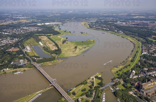
Aerial photograph, flood river Rhine, Rhine meadows near Duisburg Homberg, Ruhr estuary into the Rhine, Friedrich-Ebert-Bridge, Ruhrort, Duisburg, Ruhr area, North Rhine-Westphalia, Germany, bridge, DE, Europe, flood, flood of the century, aerial photograph, aerial photography, aerial photography, water level Duisburg, Rhine floodplain, Rhine flood, shipping traffic, heavy rain, overview, bird's eye view, birds-eyes view, overview, flooding
Date
20 juil. 2021
Crédit
Photo12/imageBROKER/Hans Blossey
Notre référence
BRK25J43_377
Model release
NA
Property release
Non
Licence
Droits gérés
Format disponible
125.9Mo (11.1Mo) / 69.4cm x 45.5cm / 8192 x 5370 (300dpi)