Légende
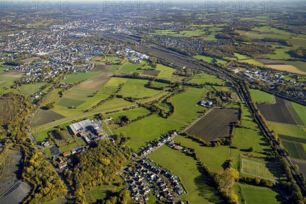
Aerial view, flooded area between marshalling yard, Wiescher Bach, Heeringer Bach, Kamener Straße and Daberg in the district Pelkum in Hamm, Ruhr area, North Rhine-Westphalia, Germany, DE, Europe, Hamm, aerial view, aerial photography, aerial photography, overview, bird's-eye view, meadows and fields, birds-eyes view, overview, flooded area, flooded area
Date
27 oct. 2021
Crédit
Photo12/imageBROKER/Hans Blossey
Notre référence
BRK25J33_207
Model release
NA
Property release
Non
Licence
Droits gérés
Format disponible
128,1Mo (11,3Mo) / 69,4cm x 46,3cm / 8192 x 5464 (300dpi)