Légende
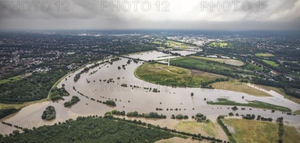
Aerial photo, Ruhr flood, flooding, Ruhrbogen between Oberhausen-Alstaden and Mülheim, Alstaden, Oberhausen, Ruhr area, North Rhine-Westphalia, Germany, Duisburg, DE, Europe, birds-eyes view, aerial photo, aerial photography, aerial photography, overview, overview, bird's eye view, floods, floods of the century
Date
14 juil. 2021
Crédit
Photo12/imageBROKER/Hans Blossey
Notre référence
BRK25J20_377
Model release
NA
Property release
Non
Licence
Droits gérés
Format disponible
91,6Mo (5,0Mo) / 69,4cm x 33,1cm / 8192 x 3907 (300dpi)