Légende
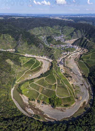
Aerial view, flood area at the river Ahr at vineyards in the districts Laach, Lochmühle and Mayschoß in Altenahr, Ahr valley, Rhineland-Palatinate, Germany, Ahr flood, Ahrschleife, Altenahr, DE, Europe, flood disaster, flood disaster of the century, aerial view, aerial photography, aerial photography, Mayschoß, overview, bird's eye view, vineyards, birds-eyes view, overview, flooding, flood area
Date
24 août 2021
Crédit
Photo12/imageBROKER/Hans Blossey
Notre référence
BRK25J10_185
Model release
NA
Property release
Non
Licence
Droits gérés
Format disponible
140.3Mo (10.0Mo) / 50.7cm x 69.4cm / 5988 x 8192 (300dpi)