Légende
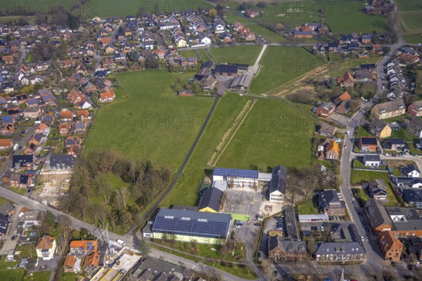
Aerial view, meadow area and planned building area between Hof Northoff and catholic Lambertischule primary school, Lambertistrasse Lambertischule primary school, Lambertistraße, residential area, Ahlen, Dolberg, Ruhr area, Germany, meadow area, planned building area, Hof Northoff, catholic Lambertischule, primary school, fields, green areas, development, urban planning, development, infrastructure, landscape, urbanisation, planning, city, settlement, building project, aerial view, architecture, school, educational institution, municipality, housing, spatial planning, green zone, rural, urban, educational institution, land use, redesign
Date
09 mars 2024
Crédit
Photo12/imageBROKER/Hans Blossey
Notre référence
BRK25I69_022
Model release
Non
Property release
Non
Licence
Droits gérés
Format disponible
146.4Mo (12.8Mo) / 74.2cm x 49.5cm / 8760 x 5843 (300dpi)