Légende
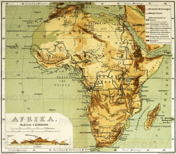
Topographical map of Africa in the 19th century with longitude and latitude, elevation profile east west through the continent, mountains, deserts, rivers, Nubia, Sudan, Congo, Cape Verde Islands, travelling, historical illustration 1886, Africa
Date
01 févr. 2025
Crédit
Photo12/imageBROKER/Wolfgang Diederich
Notre référence
BRK25E50_060
Model release
Non
Property release
Non
Licence
Droits gérés
Format disponible
66.6Mo (5.7Mo) / 43.7cm x 38.2cm / 5160 x 4510 (300dpi)