Sujet
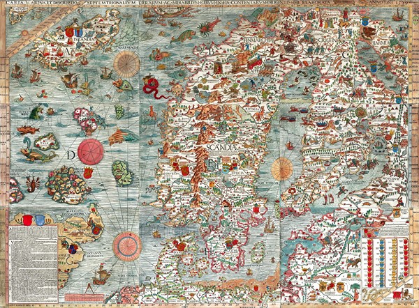
The Carta Marina
Légende
The Carta Marina (Latin 'map of the sea'), created by Olaus Magnus in the 16th century, is the earliest map of the Nordic countries that gives details and placenames. The map was created in Rome by the Swedish ecclesiastic Olaus Magnus (1490–1557),
Date
1539
Crédit
Photo12/Ann Ronan Picture Library
Notre référence
ARP15A02_459
Licence
Droits gérés
Format disponible
65.0Mo (9.9Mo) / 47.0cm x 34.7cm / 5552 x 4094 (300dpi)