Sujet
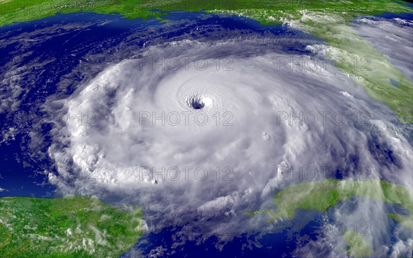
Satellite image of Hurricane Rita
Légende
Satellite image of Hurricane Rita, the fourth-most intense Atlantic hurricane ever recorded and the most intense tropical cyclone ever observed in the Gulf of Mexico. Rita caused $11.3 billion in damage on the U.S. Gulf Coast in September 2005.
Date
sept. 2005
Crédit
Photo12/Ann Ronan Picture Library
Notre référence
ARP11A00_247
Licence
Droits gérés
Format disponible
50.2Mo (1.8Mo) / 44.9cm x 28.1cm / 5300 x 3313 (300dpi)