3412 results for: water levels
- Page
-
- of
- 35
Please sign in for more results

BRK26C59_098
Beach of Playa de Benijo at high tide with the roc...
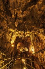
BRK26C69_396
The cave is located about 11 kilometres from Alany...
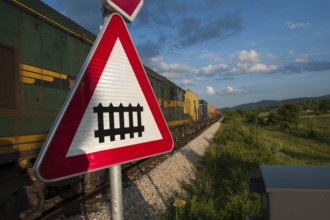
BRK26C76_454
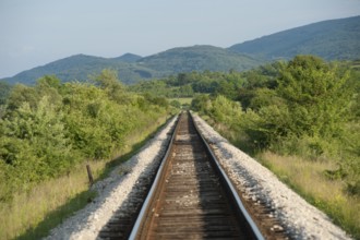
Rail Travel in Serbia, The Balkans

BRK26C62_047
Seagrass meadows on the mudflats in the Schleswig-...

BRK26C55_386
Grey seal, also Atlantic or horsehead seal (Halich...
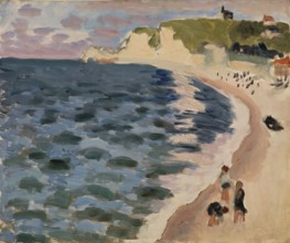
BRK26D05_145
Henri Matisse, Henri Emile Benoit Matisse (born 31...

BRK26C55_335
Nile crocodile (Crocodylus niloticus) resting, ref...
BRK26C77_040
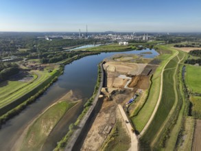
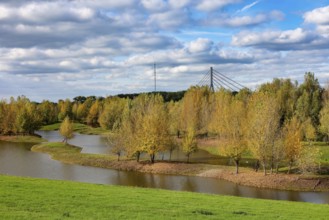
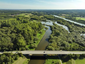
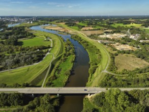
Datteln, North Rhine-Westphalia, Germany - Lippe, ...
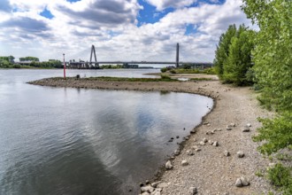
BRK26C81_394
Wesel, Lower Rhine, North Rhine-Westphalia, German...
BRK26C73_331
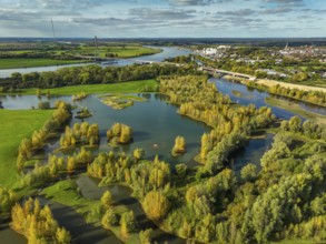
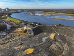
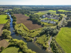
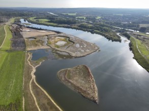
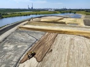
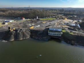
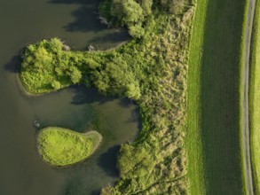
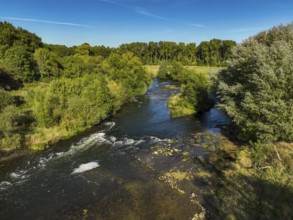
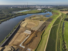
Haltern-Marl, North Rhine-Westphalia, Germany - Li...
BRK26C69_104
Haltern-Marl, North Rhine-Westphalia, Germany - Li...
BRK26C81_098
Haltern-Marl, North Rhine-Westphalia, Germany - Li...
BRK26C90_329
Haltern-Marl, North Rhine-Westphalia, Germany - Li...
BRK26C69_134
Haltern-Marl, North Rhine-Westphalia, Germany - Li...
BRK26C96_299
Datteln, North Rhine-Westphalia, Germany - Lippe l...
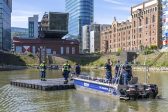
BRK26C48_313
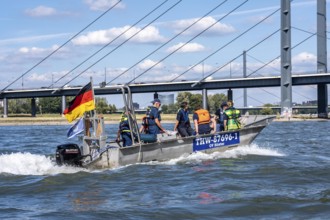
Multi-purpose boat of the THW during a training tr...

BRK26B92_330
Evacuation sign in Toba with instructions for eart...
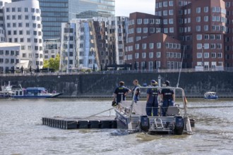
BRK26C48_314
Transport of a floating platform with the jet-floa...
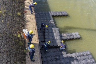
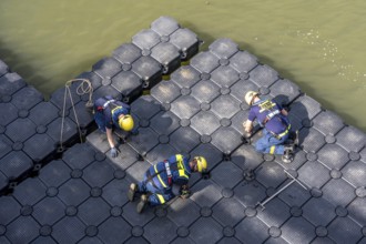
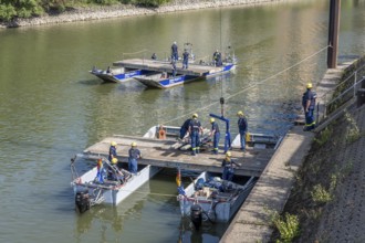
BRK26C48_315
Construction of a floating platform with the jet-f...
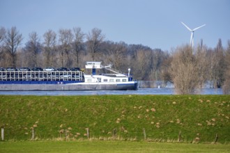
BRK26C09_166
Floods on the Rhine, Lower Rhine near Xanten, Bisl...
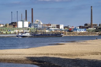
BRK26C50_259
Low water of the Rhine near Leverkusen, Rhine bank...
BRK26C50_260
Low water level of the Rhine at Leverkusen, new Rh...
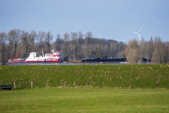
BRK26C09_171
Schubverband HGK Herkules II, coal for the steel i...
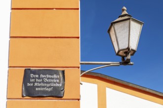
BRK26B82_147
Lantern and façade with sign, Floods are prohibite...
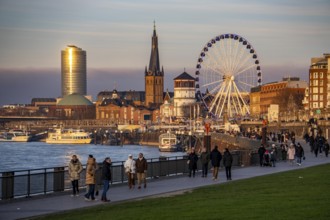
BRK26C44_298
Rhine promenade in Düsseldorf, Ferris wheel, old c...
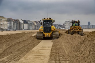
BRK26C28_122
Bulldozers when distributing sand on the beach in ...
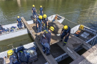
BRK26C48_312
Construction of a multi-purpose pontoon, the speci...
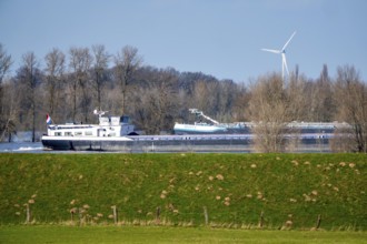
BRK26C09_187
Floods on the Rhine, Lower Rhine near Xanten, heig...
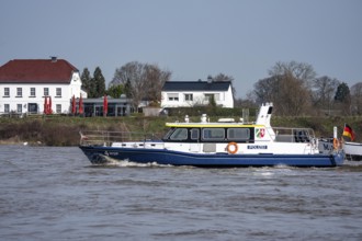
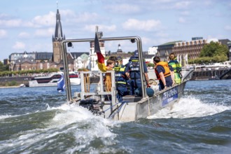
BRK26C09_188
Boat of the North Rhine-Westphalia Water Protectio...
BRK26C48_038
Wesel, Lower Rhine, North Rhine-Westphalia, German...
BRK26C25_179
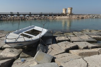
Alexandria, Egypt. December 1st 2022 A boat on con...

BRK26C25_012
Alexandria, Egypt. December 1st 2022 Young Egyptia...
BRK26C25_177
Alexandria, Egypt. December 2nd 2022 Construction ...

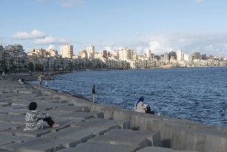
BRK26C25_202
Alexandria, Egypt. December 1st 2022 People on con...
BRK26C25_017
Alexandria, Egypt. December 1st 2022 Young Egyptia...
BRK26C25_180
Alexandria, Egypt. December 1st 2022 Construction ...

BRK26C18_447
Rail Travel in Serbia, The Balkans
BRK26C25_013
Alexandria, Egypt. December 1st 2022 Egyptian peop...
BRK26C25_011
Alexandria, Egypt. December 2nd 2022 Egyptian Musl...
BRK26C25_188
Alexandria, Egypt. December 1st 2022 Young Egyptia...
BRK26C25_035
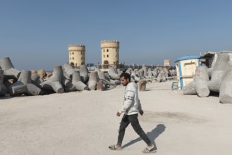
Alexandria, Egypt. December 1st 2022 An informal t...
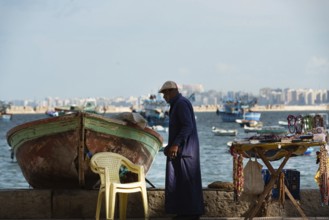
BRK26C25_183
Alexandria, Egypt. December 1st 2022 A local fishe...
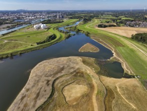
BRK26C27_232
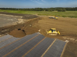
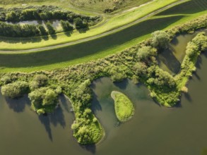
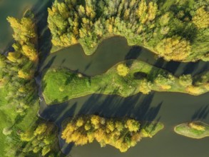
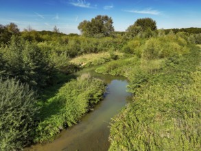
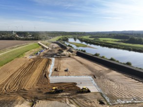
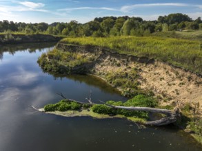
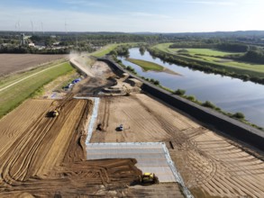
Datteln, North Rhine-Westphalia, Germany - Restore...
BRK26C25_178
Alexandria, Egypt. December 1st 2022 Young Egyptia...
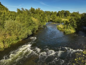
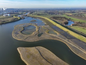
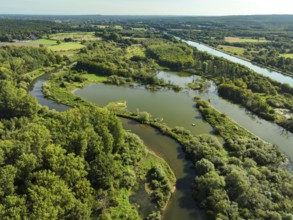
BRK26C27_231
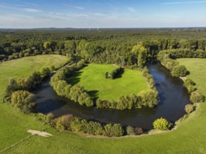
Datteln, North Rhine-Westphalia, Germany - Renatur...
BRK26C48_037
Wesel, Lower Rhine, North Rhine-Westphalia, German...
BRK26C18_463
Rail Travel in Serbia, The Balkans
BRK26C27_227
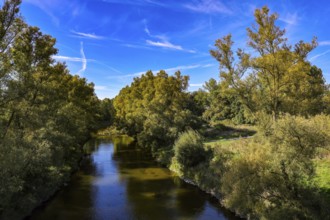
Datteln, North Rhine-Westphalia, Germany - Lippe l...
BRK26C27_228
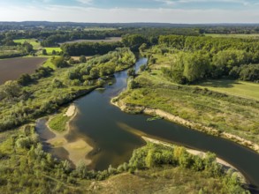
Olfen, North Rhine-Westphalia, Germany - Lippe, in...
BRK26C28_070
Art on the North Sea beach, in Knokke-Heist, La Me...
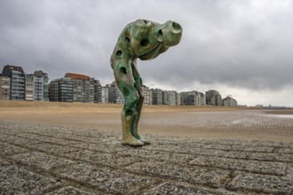
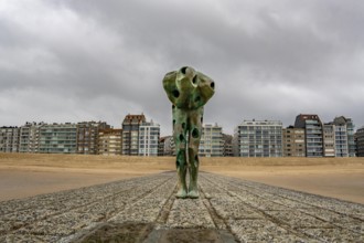
BRK26C28_069
Art on the North Sea beach, in Knokke-Heist, Tomor...
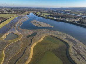
BRK26C27_230
Datteln, North Rhine-Westphalia, Germany - Lippe, ...
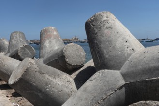
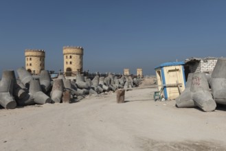
BRK26C24_495
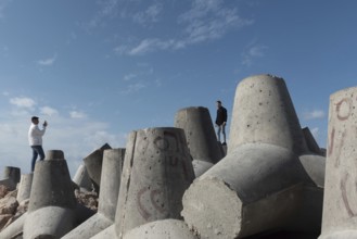
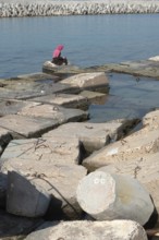
Huge concrete bollards placed on the Mediterranean...
BRK26C30_106
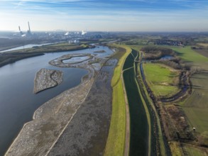
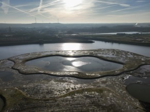
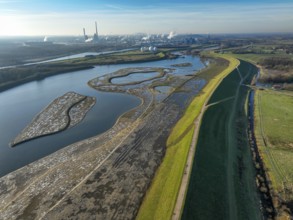
Haltern-Marl, North Rhine-Westphalia, Germany - Li...
BRK26C30_114
Haltern-Marl, North Rhine-Westphalia, Germany - Li...
BRK26C30_109
Haltern-Marl, North Rhine-Westphalia, Germany - Li...
BRK26C30_115
Haltern-Marl, North Rhine-Westphalia, Germany - Li...
BRK26C30_110
Haltern-Marl, North Rhine-Westphalia, Germany - Li...
BRK26C30_118
Haltern-Marl, North Rhine-Westphalia, Germany - Li...
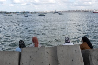
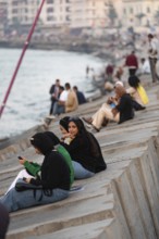
BRK26C25_201
Alexandria, Egypt. December 1st 2022 Muslim women ...
BRK26C30_117
Haltern-Marl, North Rhine-Westphalia, Germany - Li...

BRK26C30_107
Haltern-Marl, North Rhine-Westphalia, Germany - Li...
BRK26C52_365
Haltern-Marl, North Rhine-Westphalia, Germany - Li...
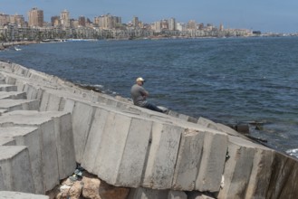
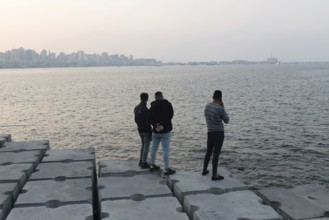
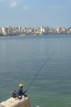
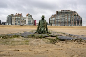
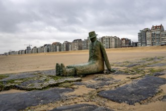
BRK26C24_496
A man sits alone on the concrete breakwater, a bar...
BRK26C30_108
Haltern-Marl, North Rhine-Westphalia, Germany - Li...
BRK26C30_116
Haltern-Marl, North Rhine-Westphalia, Germany - Li...
BRK26C27_229
Datteln, North Rhine-Westphalia, Germany - Lippe, ...
BRK26C27_225
Datteln, North Rhine-Westphalia, Germany - Lippe, ...
BRK26C30_111
Haltern-Marl, North Rhine-Westphalia, Germany - Li...

BRK26C52_285
Eurasian Coot (Fulica atra) also called coot, typi...
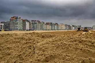
BRK26B63_043
Bulldozers when distributing sand on the beach in ...
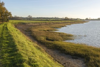
BRK26B99_242
River Deben earthwork bank flood defence wall, Sut...
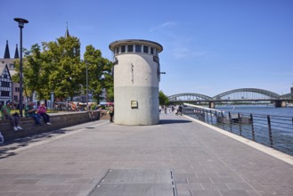
BRK26B65_242
Level, river Rhine, waterfront, metal railing, lan...
BRK26B60_417
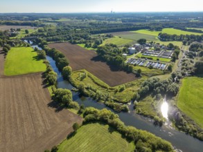
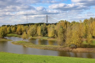
Olfen, North Rhine-Westphalia, Germany - Lippe, fo...
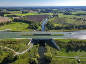
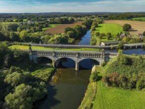
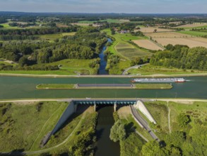
BRK26B60_418
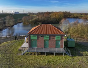
Kanalbrücke Lippe Neue Fahrt, Dortmund-Ems Canal, ...
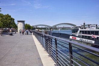
BRK26B65_243
Rhine river, waterfront, metal railing, pier, gang...
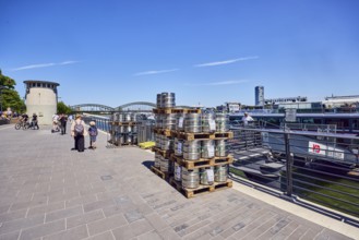
BRK26B65_259
Pallets with beer barrels, boat launch, gangway, R...
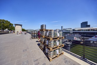
BRK26B65_241
Pallets with beer barrels, boat launch, gangway, R...
BRK26C02_048
Wesel, Lower Rhine, North Rhine-Westphalia, German...
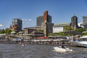
BRK26B98_405
The St. Pauli Landungsbrücken at Hafengeburtstag H...
BRK26C02_047
Wesel, Lower Rhine, North Rhine-Westphalia, German...
BRK26C03_335
Multi-purpose boat of the THW during a training tr...
BRK26C03_336
Transport of a floating platform with the jet-floa...
BRK26B62_337
Art on the North Sea beach, in Knokke-Heist, Tomor...
BRK26B62_338
Art on the North Sea beach, in Knokke-Heist, La Me...
BRK26C03_337
Construction of a floating platform with the jet-f...
BRK26C03_334
Construction of a multi-purpose pontoon, the speci...
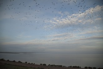
BRK26B57_340
Red knot (Calidris canutus) flock of wading birds ...
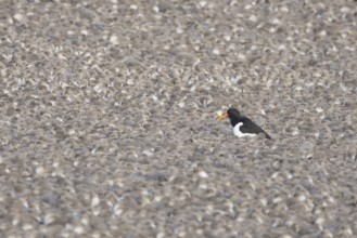
BRK26B57_345
Eurasian oystercatcher (Haematopus ostralegus) adu...
BRK26B67_214
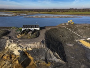
Haltern-Marl, North Rhine-Westphalia, Germany - Li...
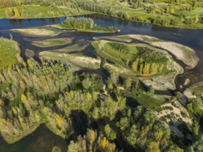
BRK26B60_415
Datteln, North Rhine-Westphalia, Germany - Lippe, ...
BRK26B60_422
Datteln, North Rhine-Westphalia, Germany - Restore...
BRK26B67_213
Haltern-Marl, North Rhine-Westphalia, Germany - Li...
BRK26B67_211
Haltern-Marl, North Rhine-Westphalia, Germany - Li...
BRK26B67_209
Haltern-Marl, North Rhine-Westphalia, Germany - Li...
BRK26B60_426
Datteln, North Rhine-Westphalia, Germany - Lippe, ...
BRK26B67_195
Haltern-Marl, North Rhine-Westphalia, Germany - Li...
BRK26B67_196
Haltern-Marl, North Rhine-Westphalia, Germany - Li...
BRK26B60_421
Datteln, North Rhine-Westphalia, Germany - Lippela...

BRK26B67_198
Haltern-Marl, North Rhine-Westphalia, Germany - Li...
- Page
-
- of
- 35