6704 results for: swabian alps
- Page
-
- of
- 68
Please sign in for more results
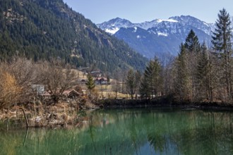
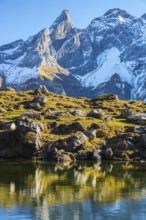
BRK26C60_325
Small lake near Hinterstein, behind mountains of t...
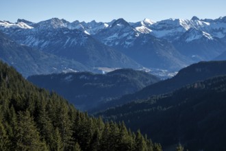
BRK26C76_346
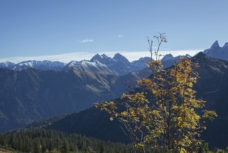
View from the high-altitude hiking trail from Bols...
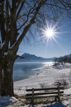
BRK26C72_190
Winter idyll on Lake Forggensee in the Allgäu, in ...
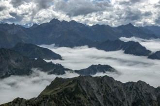
BRK26C83_415
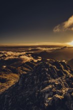
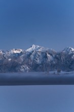
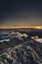
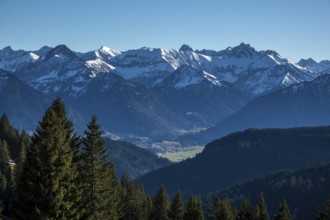
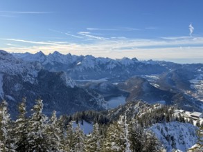
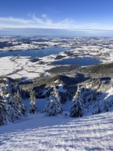
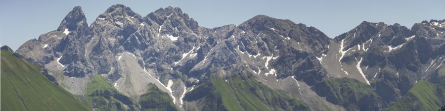
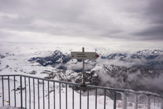
View from the Nebelhorn summit to mountains of the...
BRK26C72_248
Boats in the autumnal Schmutter Weiher in the Allg...
BRK26C66_236
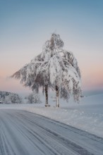
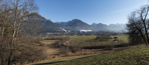
Winter landscape, snowy landscape, view of Oberstd...
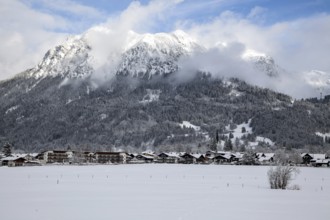
BRK26C61_231
Winter, snowy landscape, view of Oberstdorf, behin...
BRK26C71_405
Sunrise hike on the Hochplatte near Halblech in th...
BRK26C88_355
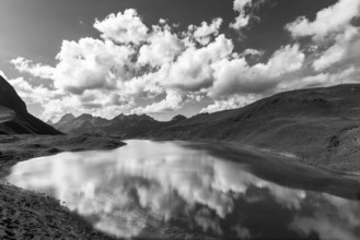
Panorama of Lake Gugger See, central main ridge of...
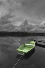
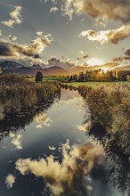
BRK26D05_108
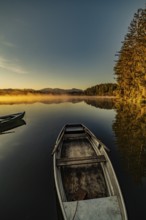
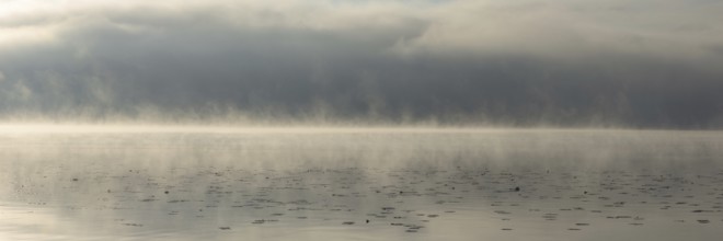
Storm clouds at sunset, a green rowing boat lashed...
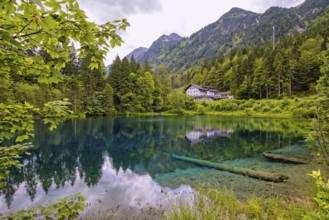
BRK26C62_176
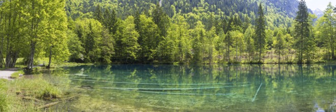
Christlessee, a mountain lake in the Trettachtal v...
BRK26C74_369
Eissee, Oytal, behind it Großer Wilder, 2379m, Hoc...
BRK26C64_260
Autumn in the Allgäu, mountain panorama from Fellh...
BRK26C83_390
Shortly after sunset, twilight at Lake Hopfensee i...
BRK26C93_261
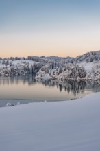
Dawn and sunrise at the wintry Forggensee in a sno...
BRK26C56_178
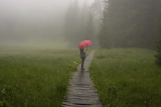
Woman 60-65 with umbrella in the Hühnermoos on a c...
BRK26C78_053
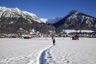
Deep snowy winter morning mood near Halblech in th...
BRK26C58_357
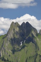
View from Wildengundkopf, 2238m to Höfats 2259m, A...
BRK26C62_474
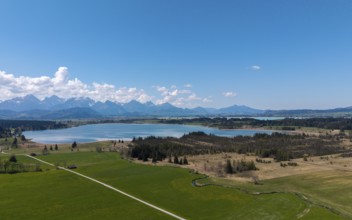
View of the Bannwaldsee in front of a mountain bac...
BRK26C63_042
Christlessee, a mountain lake in the Trettachtal v...
BRK26C99_015
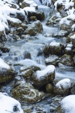
Mountain stream, Stillachtal, near Oberstdorf, All...
BRK26C59_468
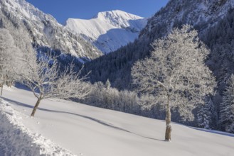
Winter landscape, Dietersbachtal near Oberstdorf, ...
BRK26D04_027
Eissee, Oytal, behind it Großer Wilder, 2379m, Hoc...
BRK26C62_396
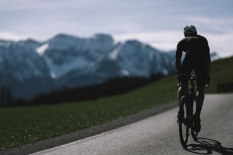
Road bike rider in spring near Halblech in the All...
BRK26C69_175
Autumn sunrise in the foothills of the Alps with f...
BRK26C73_339
Lake Hopfensee in the Allgäu in autumn with warm s...
BRK26C77_036
Hegratsrieder See near Füssen, Allgäu Alps, snow, ...
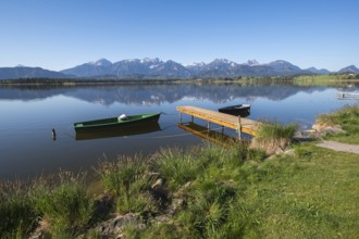
BRK26C59_298
Landscape with green and black boat at a lake, sur...
BRK26C62_310
Panorama from the Grünten over the Illertal with r...
BRK26C57_200
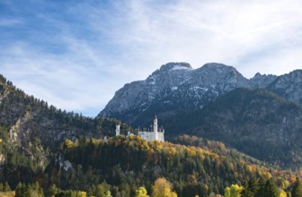
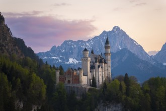
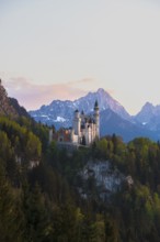
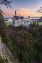
Neuschwanstein Castle in autumn, Schwangau, East A...
BRK26C84_325
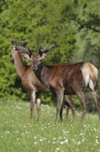
Red deer (Cervus elaphus) deer with velvet antlers...
BRK26C68_080
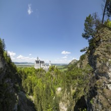
Neuschwanstein Castle and Pöllat Gorge near Hohens...
BRK26C74_046
Sunrise hike on the Hochplatte in the Ammergau Alp...
BRK26C55_282
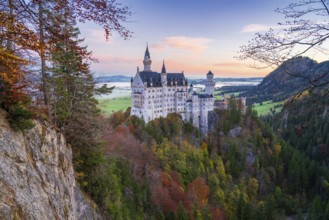
Fairytale Neuschwanstein Castle framed by the Alps...
BRK26C65_179
Sunrise with early morning fog at Lake Hopfensee n...
BRK26C59_207
Romantic Neuschwanstein Castle in front of picture...
BRK26C62_031
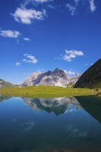
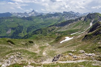
Panorama from the Kemptner Hütte, 1844m, to the Mu...

BRK26C58_131
View from the Kemptner Hütte, 1844m, to the Muttle...
BRK26C68_056
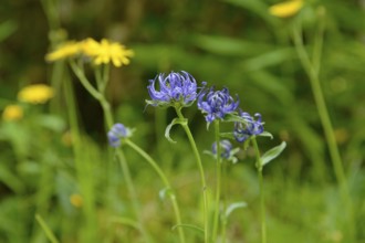
Hemispherical devil's claw (Phyteuma hemisphaericu...
BRK26C84_179
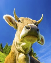
Single dairy cow, Allgäu Braunvieh, alpine meadow,...

BRK26C60_203
Swans (cygnus olor) at sunrise on Lake Hopfensee n...
BRK26C64_166
Panorama from the Fellhorn, 2038m, to the cloudy A...
BRK26C45_251
View from the high-altitude hiking trail from Bols...
BRK26C48_049
View from the Nebelhorn summit to mountains of the...
BRK26C48_074
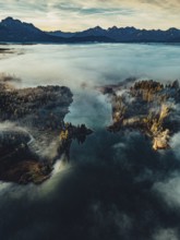
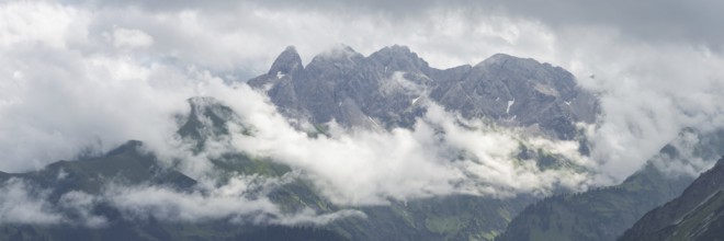
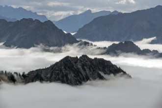
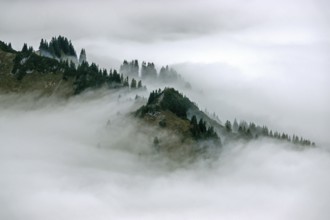
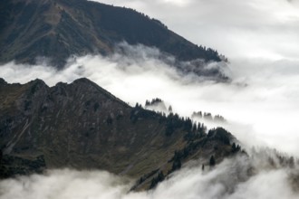
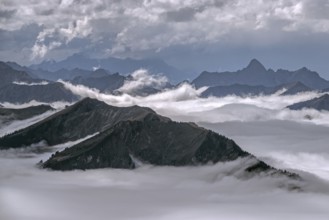
Ridge with conifers sticking out of fog, Allgäu Al...
BRK26C51_393
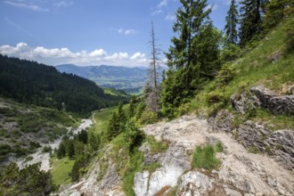
Hiking trail from the Gaißalpe to Unterer Gaißalps...
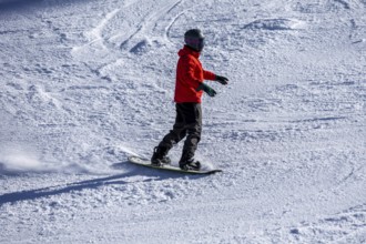
BRK26C25_167
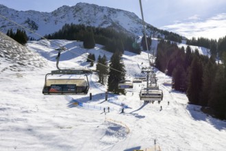
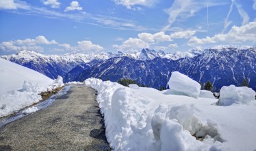
Oberjoch, Bavaria: Experienced snowboarder on red ...
BRK26C53_053
View of the Allgäu Alps from the Nebelhorn, Hochvo...
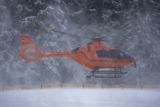
BRK26C25_165
Air rescue helicopter (Federal Ministry of the Int...
BRK26C51_392
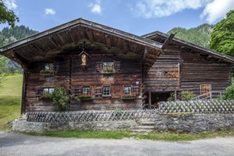
Old farmhouses in the historic mountain farming vi...
BRK26C25_166
Sun and good snow conditions in the Oberjoch ski a...
BRK26C34_423
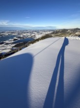
Shades of a ski tourer on fresh snow, view of Forg...
BRK26C34_496
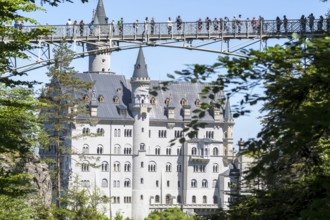
People on the Marienbrücke over the Pöllat Gorge, ...
BRK26C34_424
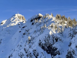
Snow-covered summit of Branderschrofen with summit...
BRK26C29_440
Meadows on the Stubental Alpe, near Jungholz, Ober...
BRK26C34_422
View of Forggensee and Bannwaldsee with snow in wi...
BRK26C29_455
Alpe Beilstein bei Görisried, Ostallgäu, Swabia, B...
BRK26C34_421
Snow-covered summit of Branderschrofen with summit...
BRK26C29_414
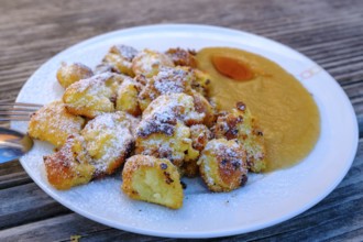
Kaiserschmarrn, food, Stubental Alpe, bei Jungholz...
BRK26C33_118
Hay harvest at the Friedenslinde (Tilia) on the Wi...
BRK26C34_425
View of snowy mountain landscape of the Allgäu Alp...
BRK26C34_426
View of Forggensee and Bannwaldsee with snow in wi...
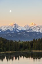
BRK26C34_420
Zugspitze peaks, snowy mountain peaks, view from T...
BRK26C29_442
On the Stubental Alpe, under the Pfeiferberg, near...
BRK26C29_443
Stubental Alpe, near Jungholz, Oberallgäu, Tyrol, ...
BRK26C45_052
View of Oberstdorf, Rubihorn and Schattenberg and ...
BRK26C15_118
Nestled in the Bavarian Alps, Neuschwanstein Castl...
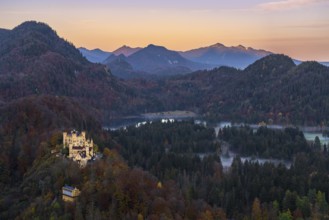
BRK26C11_034
Scenic view of Hohenschwangau Castle amidst the vi...
BRK26C11_187
Neuschwanstein Castle stands majestically amidst a...
BRK26C35_427
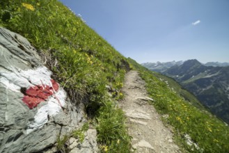
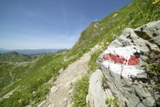
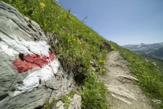
Trail marker on the Laufbacher-Eckweg, a demanding...
BRK26C51_043
Mountain panorama from Fellhorn 2037m, to the Allg...
BRK26C40_079
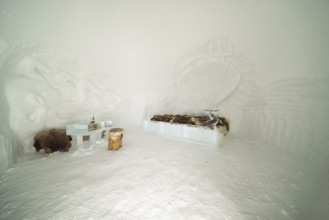
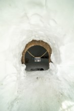
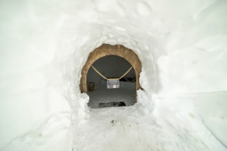
Igloo Suite, Igloo Lodge at Höfatsblick am Nebelho...
BRK26C35_428
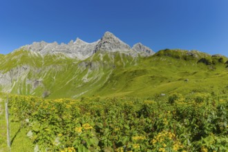
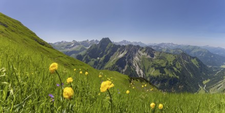
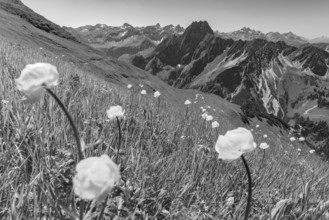
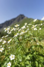
Mountain panorama with troll flowers (Trollius eur...
BRK26C29_408
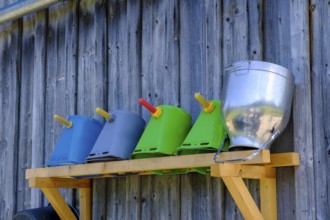
Calf rearing, calf drinking bucket, Haslacher Alpe...
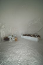
BRK26C40_078
Igloo Suite, Igloo Lodge at Höfatsblick am Nebelho...

BRK26C34_108
Mountain panorama with troll flowers (Trollius eur...
BRK26C02_096
Ridge with conifers sticking out of fog, Allgäu Al...
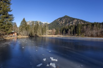
BRK26B98_028
Moor, moor pond, icy, winter, behind Allgäu Alps, ...
BRK26B97_331
View from the high-altitude hiking trail from Bols...
BRK26B96_419
View of Oberstdorf, Rubihorn and Schattenberg and ...
BRK26B66_114
Alpine mountain landscape, hiking trail on the Fel...
BRK26C02_063
View from the Nebelhorn summit to mountains of the...
BRK26B75_012
Mountain panorama with troll flowers (Trollius eur...
BRK26B87_059
Igloo Suite, Igloo Lodge at Höfatsblick am Nebelho...
BRK26B77_024
Trail marker on the Laufbacher-Eckweg, a demanding...
BRK26B79_355
Mountain panorama with white alpine anemones (Puls...
BRK26B87_058
Igloo Suite, Igloo Lodge at Höfatsblick am Nebelho...
BRK26B72_138
Hay harvest at the Friedenslinde (Tilia) on the Wi...
BRK26B89_336
Rappensee, left Kleiner Rappenkopf, 2276m, behind ...
BRK26B77_025
Mountain panorama with troll flowers (Trollius eur...
BRK26B72_137
Hay harvest at the Friedenslinde (Tilia) on the Wi...
BRK26B82_203
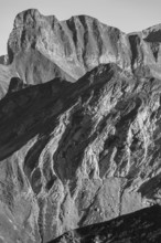
Layered folds in limestone, behind the snail, 2268...
BRK26B98_099
Another onset of winter in May, panorama from the ...
BRK26B75_013
Trail marker on the Laufbacher-Eckweg, a demanding...
BRK26B88_419
Rappensee, left Kleiner Rappenkopf, 2276m, behind ...
BRK26B33_345
Moor, moor pond, icy, winter, behind Allgäu Alps, ...
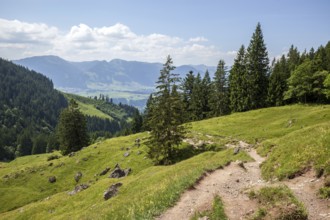
BRK26B44_071
Hiking trail from the Gaißalpe to Unterer Gaißalps...
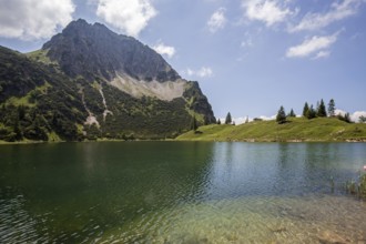
BRK26B44_072
Lower Gaißalpsee, behind Rubihorn, near Oberstdorf...
BRK26B32_307
Bare trees in backlight on the hiking trail near R...
BRK26B32_479
View from the high-altitude hiking trail from Bols...
- Page
-
- of
- 68