593 results for: ruhrtal
- Page
-
- of
- 6
Please sign in for more results
BRK26C80_238
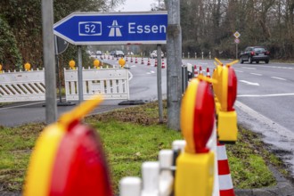
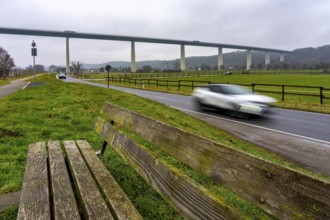
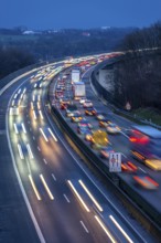
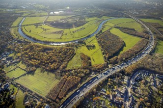
Closure of the A52 motorway, between AK Breitschei...
BRK26C75_483
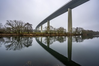
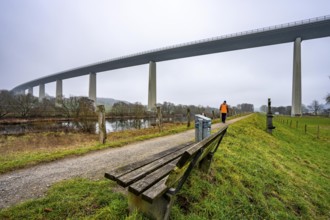
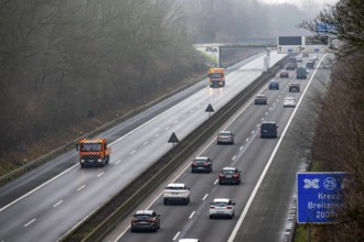
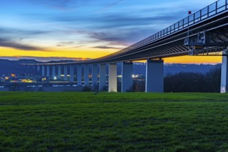
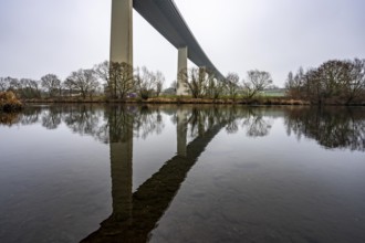
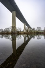
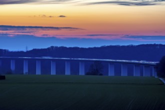
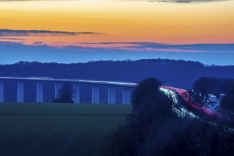
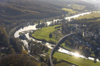
The Mintarder Ruhr Valley Bridge, A52 motorway bri...
BRK26C73_193
The Mintarder Ruhr Valley Bridge, A52 motorway bri...
BRK26C38_135
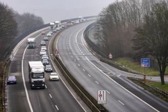
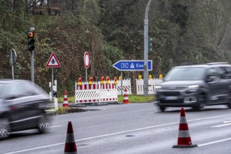
Closure of the A52 motorway, between AK Breitschei...
BRK26C38_136
The Mintarder Ruhr Valley Bridge, A52 motorway bri...
BRK26C38_133
The Mintarder Ruhr Valley Bridge, A52 motorway bri...
BRK26C38_139
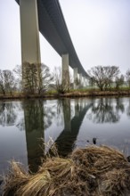
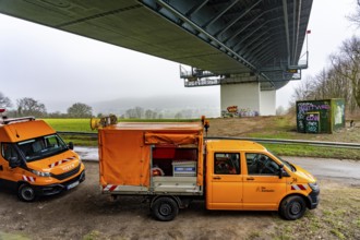
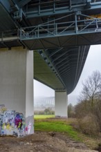
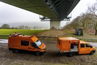
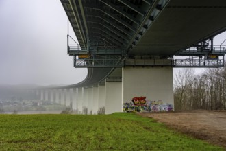
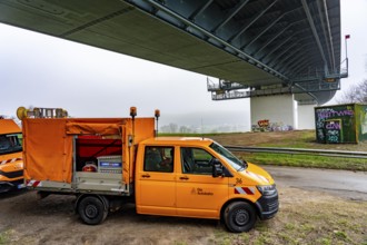
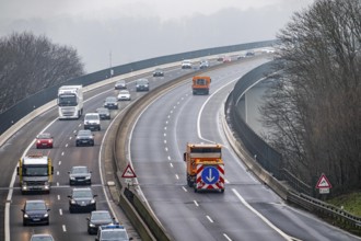
Autobahn GmbH vehicles under the Ruhr Valley Bridg...
BRK26C45_375
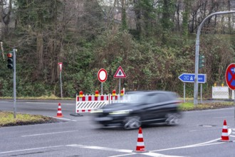
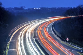
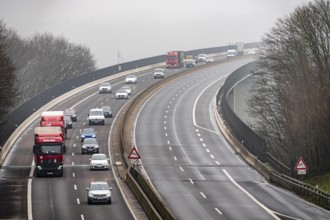
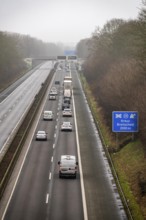
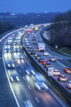
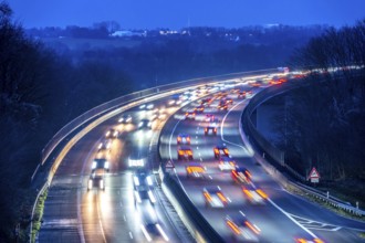
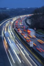
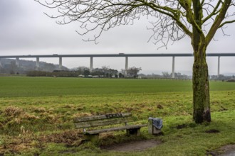
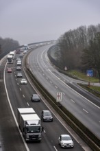
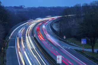
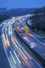
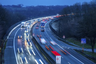
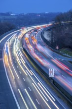
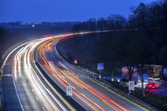
Evening traffic on the A52 motorway, between Düsse...
BRK26C38_134
The Mintarder Ruhr Valley Bridge, A52 motorway bri...
BRK26C38_138
Closure of the A52 motorway, between AK Breitschei...
BRK26C38_137
Closure of the A52 motorway, between AK Breitschei...
BRK26C45_376
Evening traffic on the A52 motorway, between Düsse...
BRK26B98_174
Evening traffic on the A52 motorway, between Düsse...
BRK26B82_463
Closure of the A52 motorway, between AK Breitschei...
BRK26B82_466
Closure of the A52 motorway, between AK Breitschei...
BRK26B82_465
Closure of the A52 motorway, between AK Breitschei...
BRK26B82_464
Autobahn GmbH vehicles under the Ruhr Valley Bridg...
BRK26B97_495
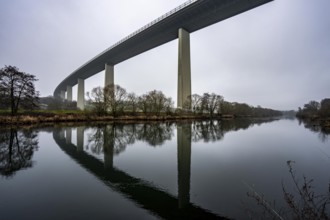
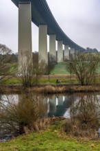
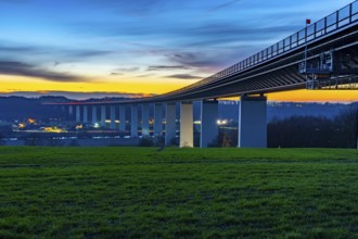
The Ruhr Valley Bridge, motorway bridge of the A52...
BRK26B98_172
Evening traffic on the A52 motorway, between Düsse...
BRK26B82_469
The Mintarder Ruhr Valley Bridge, A52 motorway bri...
BRK26B82_467
The Mintarder Ruhr Valley Bridge, A52 motorway bri...
BRK26B82_468
The Mintarder Ruhr Valley Bridge, A52 motorway bri...
BRK26B14_293
The Mintarder Ruhr Valley Bridge, A52 motorway bri...
BRK26B14_295
The Mintarder Ruhr Valley Bridge, A52 motorway bri...
BRK26B14_298
Closure of the A52 motorway, between AK Breitschei...
BRK26B14_299
Autobahn GmbH vehicles under the Ruhr Valley Bridg...
BRK26B14_294
The Mintarder Ruhr Valley Bridge, A52 motorway bri...
BRK26B34_093
Evening traffic on the A52 motorway, between Düsse...
BRK26B14_296
Closure of the A52 motorway, between AK Breitschei...
BRK26B34_091
Evening traffic on the A52 motorway, between Düsse...
BRK26B33_160
The Ruhr Valley Bridge, motorway bridge of the A52...
BRK26B14_297
Closure of the A52 motorway, between AK Breitschei...
BRK26A83_147
Evening traffic on the A52 motorway, between Düsse...
BRK26A81_431
The Ruhr Valley Bridge, motorway bridge of the A52...
BRK26A83_149
Evening traffic on the A52 motorway, between Düsse...
BRK26A19_402
The Ruhr Valley Bridge, motorway bridge of the A52...
BRK26A20_492
Evening traffic on the A52 motorway, between Düsse...
BRK26A20_491
Evening traffic on the A52 motorway, between Düsse...

BRK25M65_028
Evening traffic on the A52 motorway, between Düsse...
BRK25M65_031
Evening traffic on the A52 motorway, between Düsse...

BRK25M65_029
Evening traffic on the A52 motorway, between Düsse...
BRK25L75_179
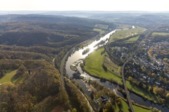
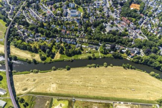
The Ruhr valley near Hattingen, Ruhr bend, groynes...
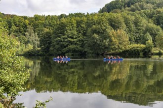
BRK25L27_352
Kayaking on the Ruhr near Hattingen, direction Boc...
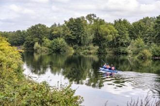
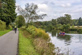
BRK25L27_351
Canoeing on the Ruhr near Hattingen, direction Boc...
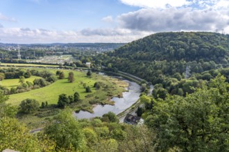
BRK25L27_376
The Ruhr valley near Hattingen, Ruhr bend, groynes...
BRK25L27_350
Canoeing on the Ruhr near Hattingen, towards Bochu...
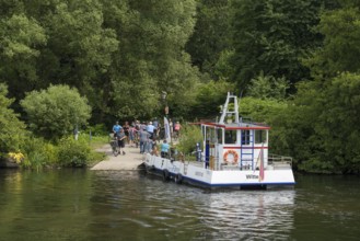
BRK25L26_486
People at the Ruhr Valley ferry, Hardenstein Castl...
BRK25K30_159
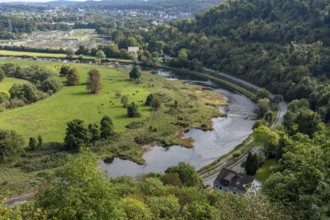
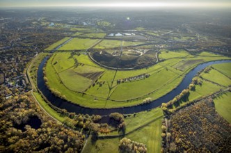
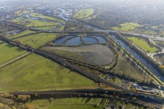
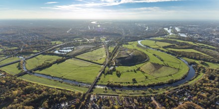
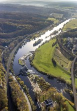
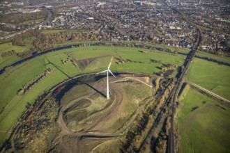
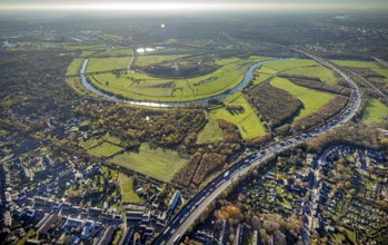
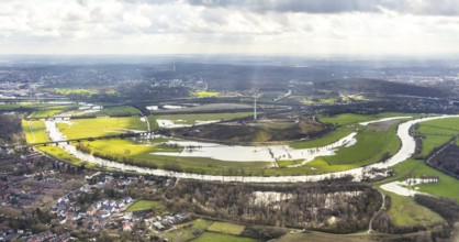
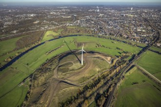
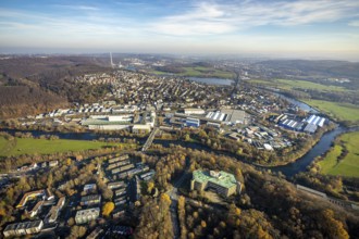
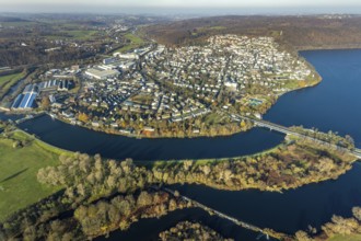
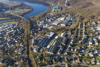
Aerial view, Styrumer Ruhrbogen, Ruhrwiesen, landf...
BRK25K30_209
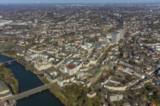
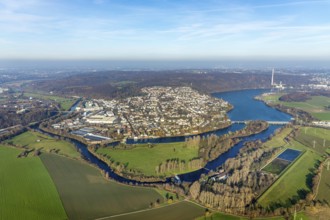
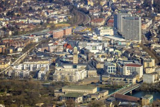
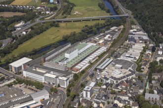
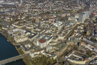
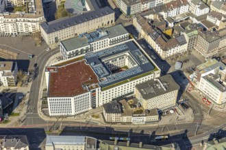
Aerial view, Ruhrbania in the city centre of Mülhe...
BRK25K33_330
Aerial view, Ruhr river, Ruhr island, Ruhr viaduct...
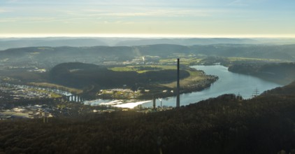
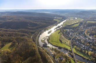
BRK25K47_092
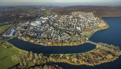
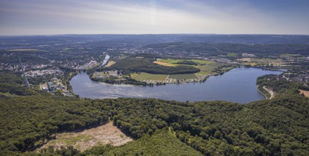
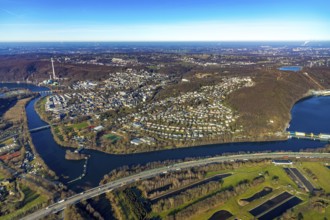
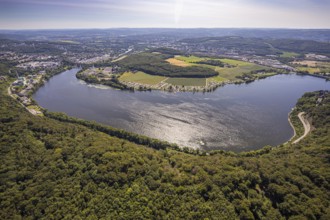
Aerial view, landscape panorama, Harkortsee, river...
BRK25K30_185
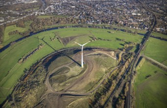
Aerial view, sewage sludge landfill at Styrumer Ru...
BRK25K32_427
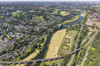
Aerial view, overview Wetter, Ruhr, Ruhr valley, O...
BRK25K33_348
Aerial view, Ruhr river, Ruhr island, Ruhr viaduct...
BRK25K36_398
Aerial view, Ruhrbogen Fluss Ruhr, city triangle D...
BRK25K30_184
Aerial view, Styrumer Ruhrbogen, Ruhrwiesen, landf...
BRK25K32_304
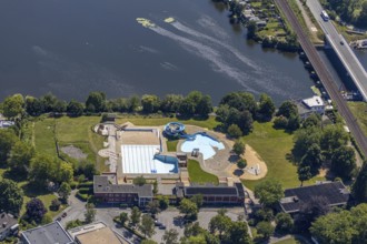
Aerial view, nature outdoor swimming pool Wetter, ...
BRK25K32_399
Aerial view, overview Wetter, Harkortsee, Ruhr, Ru...
BRK25K33_377
Aerial view, Ruhr river, Ruhr island, Ruhr viaduct...
BRK25K47_219
Aerial view, Harkortsee, view to Kaisberg Hagen-Vo...
BRK25K30_182
Aerial view, Styrumer Ruhrbogen, Ruhrwiesen, landf...
BRK25K47_062
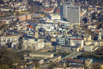
Aerial view, town view, Ruhr river, Ruhr viaduct, ...
BRK25K30_163
Aerial view, Styrumer Ruhrbogen, Ruhrwiesen, landf...
BRK25K32_141
Aerial view, industrial area Solinger Straße, Köln...

BRK25K32_169
Aerial view, Styrumer Ruhrbogen, Ruhrwiesen, landf...
BRK25K33_218
Aerial view, Villa Ruhr Valley, Friedr. Lohmann Gm...

BRK25K30_162
Aerial view, Styrumer Ruhrbogen, Ruhrwiesen, landf...
BRK25K32_185
Aerial view, Styrumer Ruhrbogen, Ruhrwiesen, landf...
BRK25K30_161
Aerial view, Styrumer Ruhrbogen, Ruhrwiesen, landf...
BRK25K33_333
Aerial view, Ruhr river, Ruhr island, Ruhr viaduct...
BRK25K30_160
Aerial view, Styrumer Ruhrbogen, Ruhrwiesen, landf...
BRK25K30_232
Aerial view, Ruhrbania in the city centre of Mülhe...
BRK25K32_299
Aerial view, industrial estate, DEMAG, Ruhr Valley...
BRK25K47_231
Aerial view, Harkortsee, view to Kaisberg Hagen-Vo...
BRK25K30_233
Aerial view, Ruhrbania in the city centre of Mülhe...
BRK25K30_342
Aerial view, Styrumer Ruhrbogen, landfill Kolkerho...
BRK25K32_324
Aerial view, industrial estate, DEMAG, Ruhr Valley...
BRK25K30_197
Aerial view, Ruhr, Ruhrbania, StadtQuartier Schlos...
BRK25K30_208
Aerial view, Ruhrbania in the city centre of Mülhe...
BRK25K32_374
Aerial view, Elsche estuary viewpoint, Elbsche, Ru...
BRK25K37_120
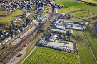
Aerial view, aerial view Wennemen, industrial area...
BRK25K47_091
Aerial view, landscape panorama, Harkortsee, river...
BRK25K47_170
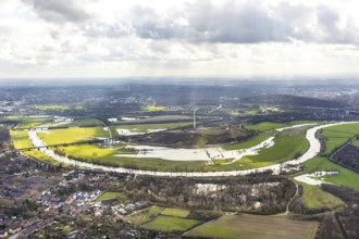
Aerial view, river Ruhr, Ruhr-Aue Center quarter, ...
BRK25K47_223
Aerial view, Quartier Ruhr-Aue Center, Ruhr promen...
BRK25K30_207
Aerial view, Ruhrbania in the city centre of Mülhe...
BRK25K30_340
Aerial view, Styrumer Ruhrbogen, landfill Kolkerho...
BRK25K32_391
Aerial view, Elsche estuary viewpoint, Elbsche, Ru...
BRK25K33_071
Aerial view, Ruhr river, possible natural outdoor ...
BRK25K37_121
Aerial view, aerial view Wennemen, industrial area...
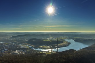
BRK25K47_088
Aerial view, landscape panorama, Harkortsee, river...
BRK25K30_183
Aerial view, Styrumer Ruhrbogen, Ruhrwiesen, landf...
BRK25K30_206
Aerial view, Ruhrbania in the city centre of Mülhe...
BRK25K32_387
Aerial view, overview Wetter, Harkortsee, Ruhr, Ru...
BRK25K32_396
Aerial view, overview Wetter, Harkortsee, Ruhr, Ru...
BRK25K33_070
Aerial view, Ruhr river, possible natural outdoor ...
BRK25K47_022
Aerial view, Ruhr river, Ruhr viaduct, commercial ...
BRK25K47_028
Aerial view, Ruhr river, Ruhr-Aue district, local ...
BRK25K47_063
Aerial view, townscape, Quartier Ruhr-Aue Center, ...
BRK25K47_069
Aerial view, townscape, Ruhr river, Ruhr viaduct, ...
BRK25K47_135
Aerial view, Quartier Ruhr-Aue Center, Ruhr promen...
- Page
-
- of
- 6