2941 results for: ruhr bridge
- Page
-
- of
- 30
Please sign in for more results
BRK26C89_479
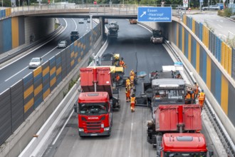
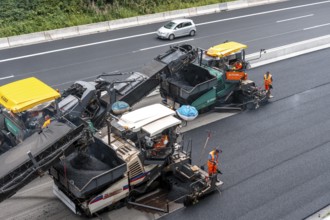
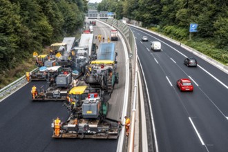
Rehabilitation of the A52 motorway near Essen, an ...
BRK26C91_242
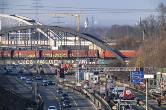
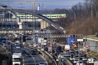
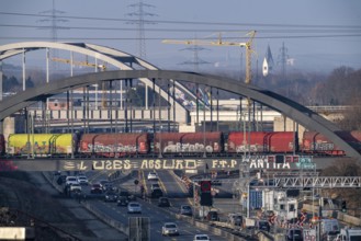
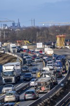
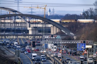
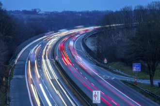
Motorway A40, Ruhrschnellweg, near Bochum, dense e...
BRK26C80_238
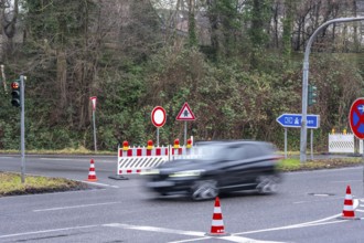
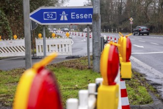
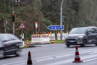
Closure of the A52 motorway, between AK Breitschei...
BRK26C95_105
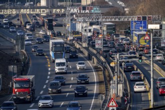
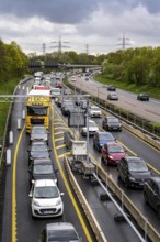
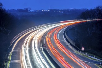
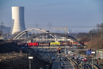
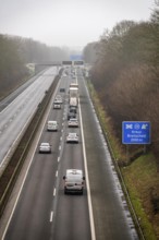
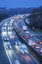
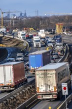
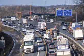
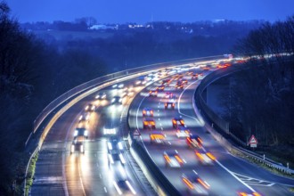
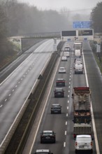
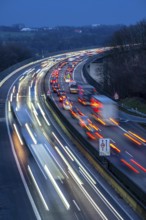
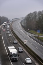
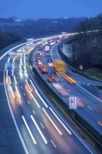
Traffic jam on the A43 motorway near Herne, headin...
BRK26C75_483
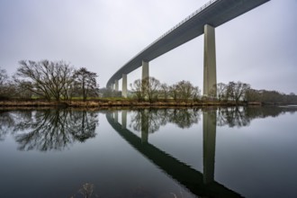
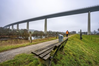
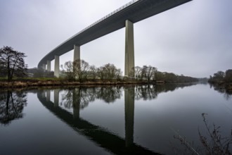
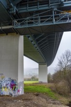
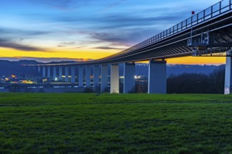
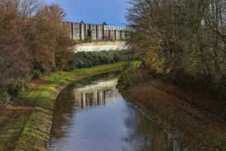
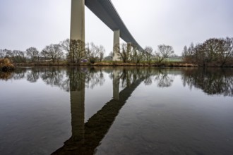
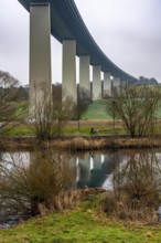
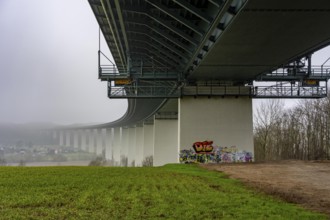
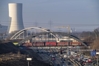
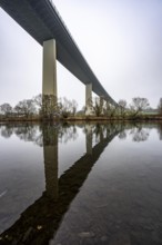
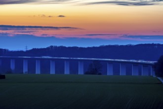
The Mintarder Ruhr Valley Bridge, A52 motorway bri...
BRK26C91_244
Traffic jam on the A43 motorway near Herne, headin...
BRK26C91_098
The Hardenberg bridge, A40 motorway in Mülheim an ...
BRK26C73_193
The Mintarder Ruhr Valley Bridge, A52 motorway bri...
BRK26C89_457
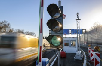
Weighing and barrier system on the A42 motorway, i...
BRK26C60_017
Recklinghausen, North Rhine-Westphalia, Germany - ...
BRK26C38_135
Closure of the A52 motorway, between AK Breitschei...
BRK26C38_136
The Mintarder Ruhr Valley Bridge, A52 motorway bri...
BRK26C39_236
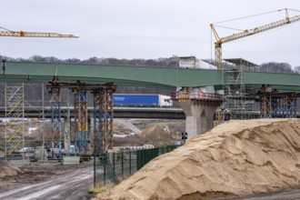
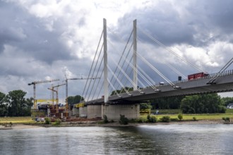
New construction of steel bridges Parts at the Dui...
BRK26C10_466
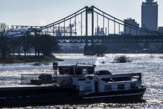
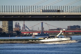
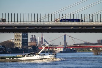
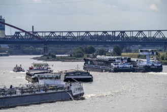
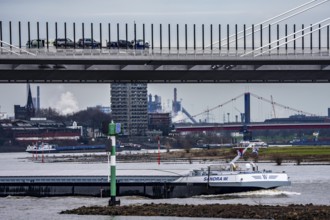
Cargo ship, Krefeld-Uerdinger bridge across the Rh...
BRK26C38_133
The Mintarder Ruhr Valley Bridge, A52 motorway bri...
BRK26C38_139
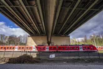
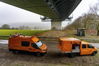
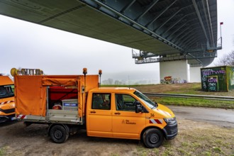
Autobahn GmbH vehicles under the Ruhr Valley Bridg...
BRK26C45_375
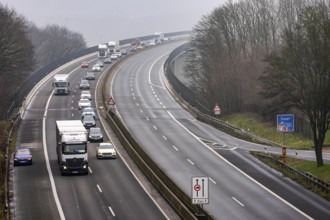
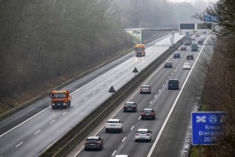
Evening traffic on the A52 motorway, between Düsse...
BRK26C10_460
Shipping on the Rhine near Duisburg-Homberg, new A...
BRK26C38_134
The Mintarder Ruhr Valley Bridge, A52 motorway bri...
BRK26C40_349
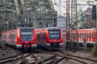
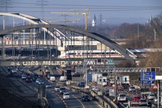
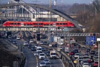
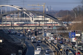
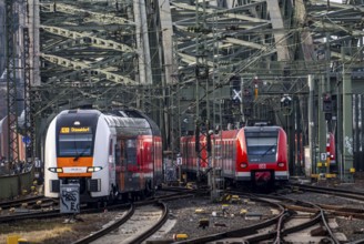
Rail system in front of Cologne Central Station, H...
BRK26C09_195
Shipping on the Rhine near Duisburg-Homberg, new A...
BRK26C35_301
Traffic jam on the A43 motorway near Herne, headin...
BRK26C38_138
Closure of the A52 motorway, between AK Breitschei...
BRK26C47_098
Duisburg-Neuenkamp Rhine bridge, the A40 motorway,...
BRK26C25_348
Duisburg-Neuenkamp Rhine bridge, the A40 motorway,...
BRK26C35_297
Traffic jam on the A43 motorway near Herne, headin...
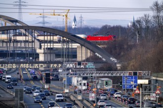
BRK26C35_300
Traffic jam on the A43 motorway near Herne, headin...
BRK26C38_137
Closure of the A52 motorway, between AK Breitschei...
BRK26C36_449
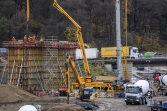
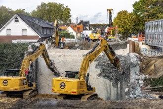
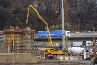
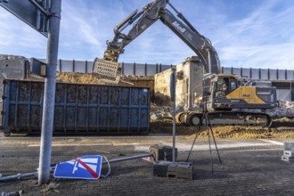
Construction work on a concrete retaining wall at ...
BRK26C45_376
Evening traffic on the A52 motorway, between Düsse...
BRK26C47_022
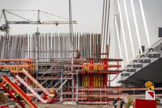
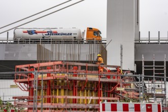
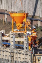
Concreting of a new bridge pillar at the Duisburg-...
BRK26C35_299
Traffic jam on the A43 motorway near Herne, headin...
BRK26C36_455
A3 motorway at the Duisburg-Kaiserberg interchange...
BRK26C08_393
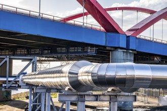
Iqony district heating pipes at the city port, cro...
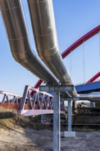
BRK26C08_395
Iqony district heating pipes at the city port, cro...
BRK26C51_336
Cargo ships on the Rhine, in the background the Rh...
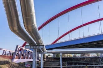
BRK26C08_414
Iqony district heating pipes at the city port, cro...
BRK26C36_451
A3 motorway at the Duisburg-Kaiserberg interchange...
BRK26C42_148
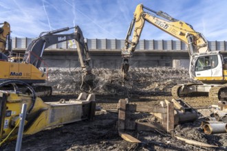
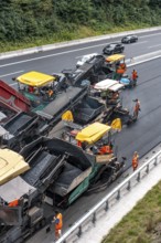
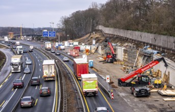
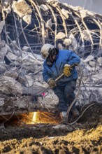
Demolition of the 120 meter long motorway bridge o...
BRK26C42_150
Demolition of the 120 meter long motorway bridge o...
BRK26C49_099
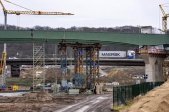
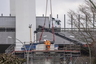
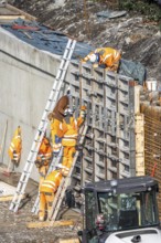
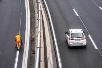
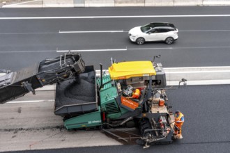
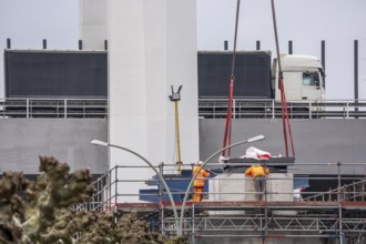
Rehabilitation of the A52 motorway near Essen, an ...
BRK26C49_100
Rehabilitation of the A52 motorway near Essen, an ...
BRK26C42_149
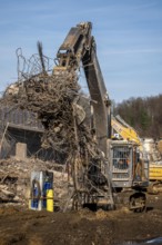
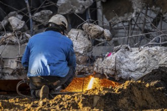
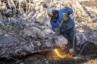
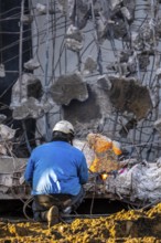
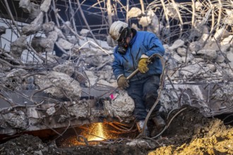
Workers with cutting torches demolishing the 120-m...
BRK26C49_097
Rehabilitation of the A52 motorway near Essen, an ...
BRK26C48_039
Demolition of an old road bridge, Weierstraße, the...
BRK26C49_095
Rehabilitation of the A52 motorway near Essen, an ...
BRK26C49_098
Rehabilitation of the A52 motorway near Essen, an ...
BRK26B80_248
A3 motorway at the Duisburg-Kaiserberg interchange...
BRK26B91_060
Workers with cutting torches demolishing the 120-m...
BRK26C00_306
Duisburg-Neuenkamp Rhine bridge, the A40 motorway,...
BRK26B76_222
Traffic jam on the A43 motorway near Herne, headin...
BRK26B91_061
Demolition of the 120 meter long motorway bridge o...
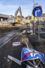
BRK26B91_062
Demolition of the 120 meter long motorway bridge o...
BRK26B98_174
Evening traffic on the A52 motorway, between Düsse...
BRK26B76_218
Traffic jam on the A43 motorway near Herne, headin...
BRK26B82_463
Closure of the A52 motorway, between AK Breitschei...
BRK26B82_466
Closure of the A52 motorway, between AK Breitschei...
BRK26B82_465
Closure of the A52 motorway, between AK Breitschei...
BRK26B84_384
New construction of steel bridges Parts at the Dui...
BRK26B82_464
Autobahn GmbH vehicles under the Ruhr Valley Bridg...
BRK26B91_063
Workers with cutting torches demolishing the 120-m...
BRK26B97_495
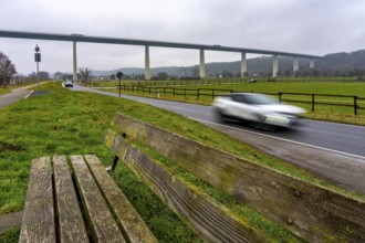
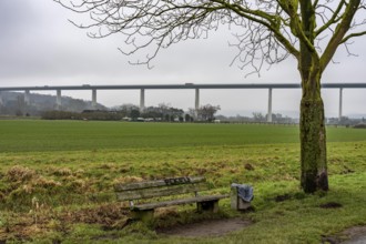
The Ruhr Valley Bridge, motorway bridge of the A52...
BRK26B98_172
Evening traffic on the A52 motorway, between Düsse...
BRK26C00_078
Concreting of a new bridge pillar at the Duisburg-...
BRK26B76_217
Traffic jam on the A43 motorway near Herne, headin...
BRK26B94_110
Shipping traffic on the Rhine near Duisburg-Homber...
BRK26B76_216
Traffic jam on the A43 motorway near Herne, headin...
BRK26B80_252
A3 motorway at the Duisburg-Kaiserberg interchange...
BRK26B57_046
Duisburg-Neuenkamp Rhine bridge, the A40 motorway,...
BRK26B80_249
Construction work on a concrete retaining wall at ...
BRK26B80_257
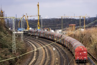
Freight train on the railway line at the Duisburg-...
BRK26B60_418
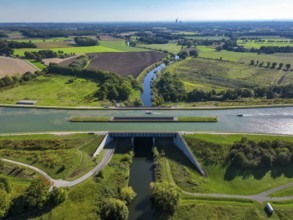
Kanalbrücke Lippe Neue Fahrt, Dortmund-Ems Canal, ...
BRK26B67_208
Castrop-Rauxel, North Rhine-Westphalia, Germany - ...
BRK26B91_064
Spectators, teethers during the demolition of the ...
BRK26B82_469
The Mintarder Ruhr Valley Bridge, A52 motorway bri...
BRK26B82_467
The Mintarder Ruhr Valley Bridge, A52 motorway bri...
BRK26B82_468
The Mintarder Ruhr Valley Bridge, A52 motorway bri...
BRK26C02_049
Demolition of an old road bridge, Weierstraße, the...
BRK26B88_101
Rail system in front of Cologne Central Station, H...
BRK26B98_071
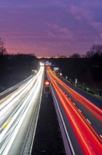
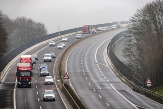
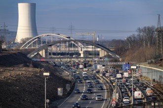
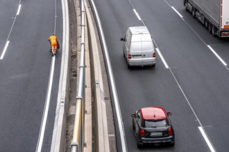
Lots of traffic on the A 40 motorway on four lanes...
BRK26B14_293
The Mintarder Ruhr Valley Bridge, A52 motorway bri...
BRK26B14_295
The Mintarder Ruhr Valley Bridge, A52 motorway bri...
BRK26B14_298
Closure of the A52 motorway, between AK Breitschei...
BRK26B14_299
Autobahn GmbH vehicles under the Ruhr Valley Bridg...
BRK26B03_394
Traffic jam on the A43 motorway near Herne, headin...
BRK26B23_060
Workers with cutting torches demolishing the 120-m...
BRK26B43_468
Rhine bridge Duisburg-Neuenkamp, motorway A40, sta...
BRK26B03_392
Traffic jam on the A43 motorway near Herne, headin...
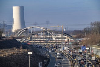
BRK26B03_393
Traffic jam on the A43 motorway near Herne, headin...
BRK26B23_057
Workers with cutting torches demolishing the 120-m...
BRK26B23_058
Demolition of the 120 meter long motorway bridge o...
BRK26B14_294
The Mintarder Ruhr Valley Bridge, A52 motorway bri...
BRK26B34_093
Evening traffic on the A52 motorway, between Düsse...
BRK26B14_296
Closure of the A52 motorway, between AK Breitschei...
BRK26B34_091
Evening traffic on the A52 motorway, between Düsse...
BRK26B40_181
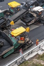
Rehabilitation of the A52 motorway near Essen, an ...
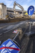
BRK26B23_059
Demolition of the 120 meter long motorway bridge o...
BRK26B33_160
The Ruhr Valley Bridge, motorway bridge of the A52...
BRK26B40_183
Rehabilitation of the A52 motorway near Essen, an ...
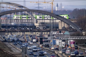
BRK26B03_395
Traffic jam on the A43 motorway near Herne, headin...
- Page
-
- of
- 30