4846 results for: river navigations
- Page
-
- of
- 49
Please sign in for more results
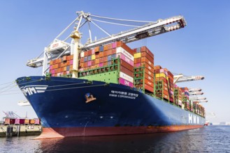
BRK26C64_156
The container ship HMM Copenhagen has a length of ...
BRK26C58_445
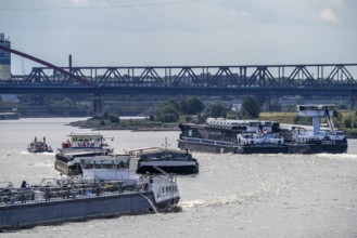
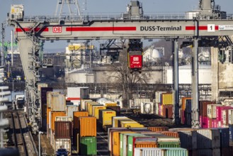
The port of Mannheim is one of the most important ...
BRK26C60_060
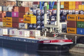
Container ship TIHAMA from Hapag Lloyd. With a len...
BRK26C59_190
The port of Mannheim is one of the most important ...
BRK26C64_193
Pioneering Spirit. Workboat of the Swiss offshore ...
BRK26C61_006
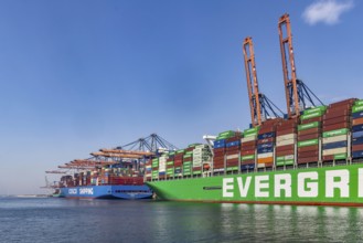
Container ship EVER GIFTED at Euromax Container Te...
BRK26C81_399
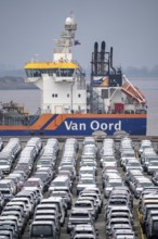
Parking space for import vehicles, hundreds of Hyu...
BRK26C70_099
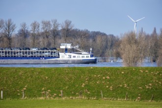
View on a waterway with a boat lying in the water ...
BRK26C81_370
View on a waterway with boats lying in the water i...
BRK26C93_361
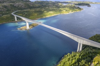
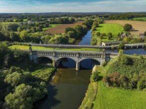
Concrete bridge Raftsundbrua, spanning the Raftsun...
BRK26C68_465
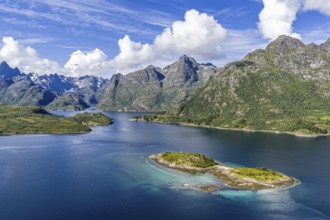
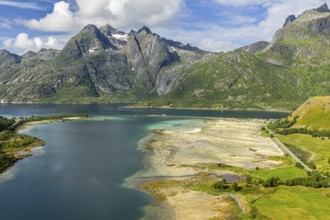
Aerial view over the Raftsund, the waterway betwee...
BRK26C83_416
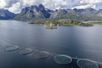
Cages of a salmon farm, at Raften at the Raftsund,...
BRK26C61_112
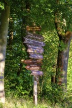
Hiking trail signs, Werra Burgensteig Trail, Nente...
BRK26C66_490
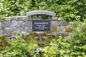
Elster spring, the source of the Black Elster, sou...
BRK26C68_078
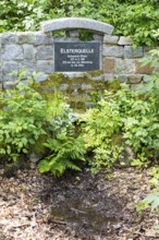
Elster spring, the source of the Black Elster, sou...
BRK26C74_012
Aerial view of a bay at Raften at the Raftsund, th...
BRK26C82_295
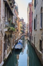
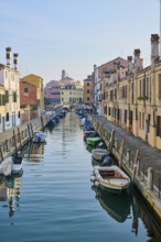
Waterway in Venice next to 'Fondamenta de la fabri...
BRK26C58_139
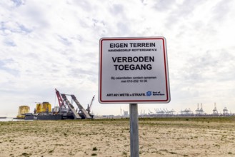
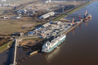
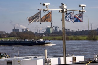
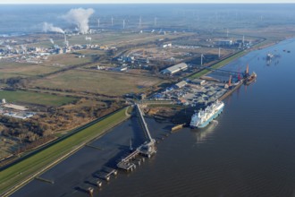
Europe, Germany, Schleswig-Holstein, Brunsbüttel, ...
BRK26C59_386
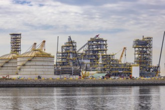
A bio-refinery is being built here. Construction s...
BRK26C92_194
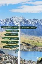
Directions sign post, Queenstown, South Island, Ne...
BRK26C80_416
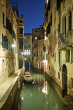
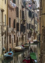
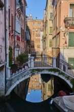
Narrow canal between tall old buildings, lined wit...
BRK26C71_337
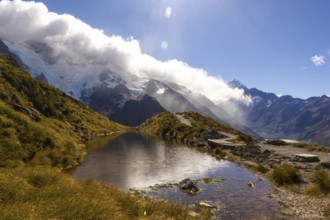
Breathtaking beauty of autumn at Mount Cook, New Z...
BRK26C58_347
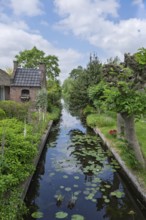
Idyllic landscape with a canal between gardens and...
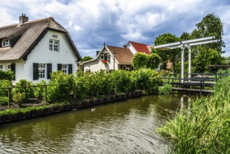
BRK26C67_030
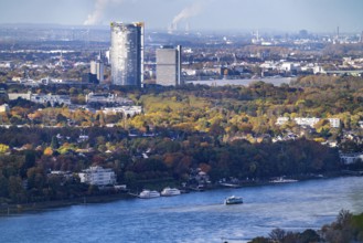
Bonn skyline on the Rhine, UNFCCC Secretariat of t...
BRK26C80_133
Walk along the Rotte, route from the modern city c...

BRK26C64_492
Signpost of tour operator for rafting, kayaking, t...
BRK26C70_477
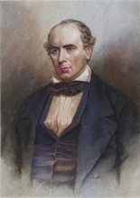
Elisha Mitchell (1793-1857) American naturalist an...
BRK26C99_006
View from a gondola on a waterway in Venice going ...
BRK26C81_118
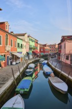
Colorful houses beside the waterway in between 'Fo...
BRK26D00_438
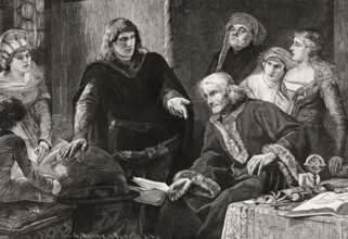
Martin von Behaim, German astronomer, showing his ...
BRK26C10_464
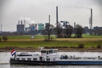
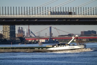
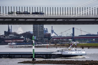
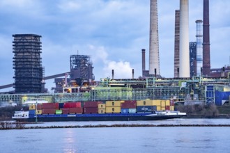
Backdrop of the HKM steelworks, Krupp-Mannesmann s...
BRK26C10_207
Bislicher Insel, nature reserve on the Rhine, Altr...
BRK26C40_475
The port of Mannheim is one of the most important ...
BRK26C49_277
The Liniebrug, bicycle and pedestrian bridge over ...
BRK26C39_188
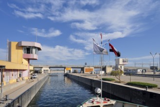
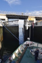
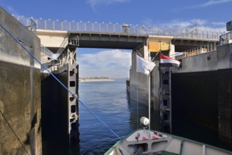
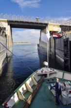
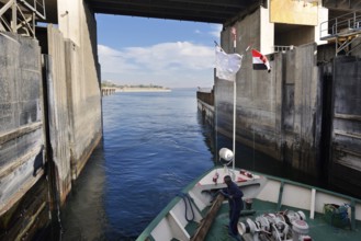
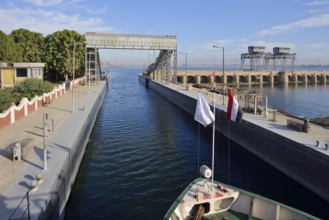
Nile cruise ship enters the lock at the Esna dam, ...
BRK26C50_111
Construction of a new logistics hall on the Mercat...
BRK26B83_437
Nile cruise ship enters the lock at the Esna dam, ...
BRK26C42_153
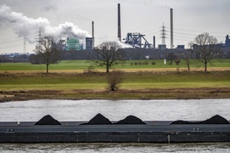
Hüttenwerke Krupp-Mannesmann, HKM in Duisburg-Hütt...
BRK26C10_466
Cargo ship, Krefeld-Uerdinger bridge across the Rh...
BRK26B83_422
Nile cruise ship enters the lock at the Esna dam, ...
BRK26C39_192
Nile cruise ship leaves the lock at the Esna dam, ...
BRK26C10_460
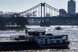
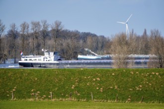
Shipping on the Rhine near Duisburg-Homberg, new A...
BRK26C25_349
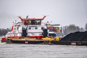
Veerhaven-4 push association with coal for the cok...
BRK26C39_196
Nile cruise ship leaves the lock at the Esna dam, ...
BRK26B83_436
Nile cruise ship leaves the lock at the Esna dam, ...
BRK26B83_430
Nile cruise ship leaves the lock at the Esna dam, ...
BRK26C40_476
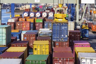
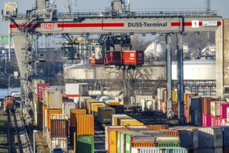
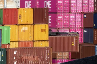
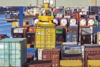
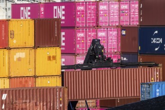
Colourful sea containers in the container port. Th...
BRK26C09_166
Floods on the Rhine, Lower Rhine near Xanten, Bisl...
BRK26C50_259
Low water of the Rhine near Leverkusen, Rhine bank...
BRK26C50_260
Low water level of the Rhine at Leverkusen, new Rh...
BRK26C09_171
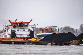
Schubverband HGK Herkules II, coal for the steel i...
BRK26C40_474
The port of Mannheim is one of the most important ...
BRK26C39_182
Nile cruise ship enters the lock at the Esna dam, ...
BRK26C51_336
Cargo ships on the Rhine, in the background the Rh...
BRK26C09_187
Floods on the Rhine, Lower Rhine near Xanten, heig...
BRK26C09_188
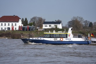
Boat of the North Rhine-Westphalia Water Protectio...
BRK26C50_112
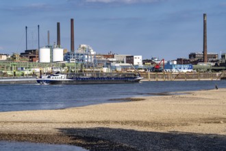
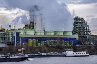
Scenery of Chempark Leverkusen, Bayer Leverkusen, ...
BRK26B57_054
Veerhaven-4 push association with coal for the cok...
BRK26C22_187
Istanbul, Turkey. March 31st 2014 Shipping in the ...
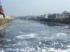
BRK26C18_114
February 2012: Partially frozen harbor basins in L...
BRK26C39_304
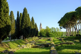
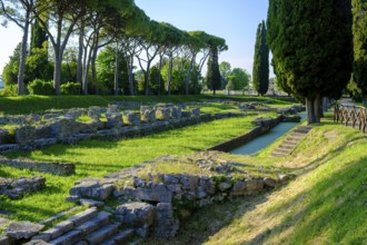
Roman port, former Roman river port, Basilica of A...
BRK26B62_017
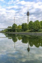
The Nuremberg Telecommunication Tower and the Main...
BRK26C54_217
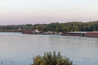
Tug boat pushing multiple barges on the Tennessee ...
BRK26C19_086
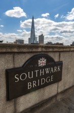
London, United Kingdom. July 9th 2022 Sign for the...
BRK26C26_342
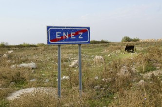
Enez, Turkey. October 15th 2013 Sign post for the ...
BRK26C27_228
Olfen, North Rhine-Westphalia, Germany - Lippe, in...
BRK26C34_112
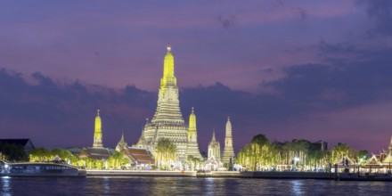
Festive lighting on New Year's Eve at Wat Arun, Te...
BRK26C45_016
Europe, Germany, Schleswig-Holstein, Brunsbüttel, ...

BRK26C50_109
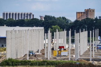
Construction of a new logistics hall on the Mercat...
BRK26C15_272
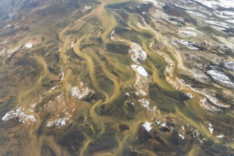
Aerial view of Iceland's rivers showcasing intrica...
BRK26C50_110
Construction of a new logistics hall on the Mercat...
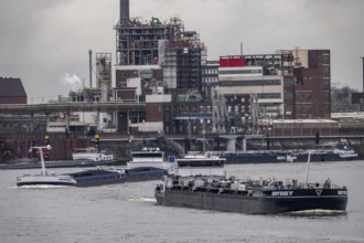
BRK26C41_489
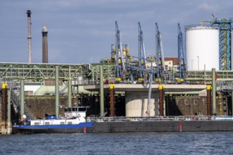
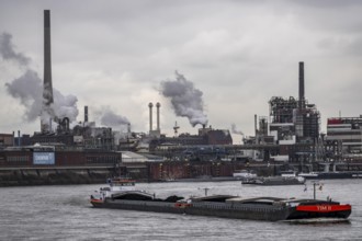
Chempark Krefeld-Uerdingen, around 40 companies ar...
BRK26C44_230
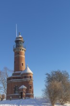
Holtenau lighthouse at the entrance of the Kiel Ca...

BRK26C17_167
Niederfinow boat lift on the Oder-Havel Canal in w...
BRK26C35_425
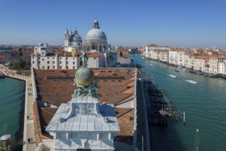
Drone footage of the Dogana da Mar, moving wind va...
BRK26C16_343
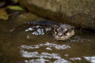
Captivating image of a wet nutria emerging from a ...
BRK26C32_204
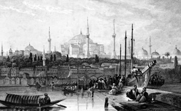
Constantinople and St. Sophia Church, Hagia Sophia...
BRK26B83_221
Datteln-Hamm Canal and Gersteinwerk power plant in...
BRK26B66_412
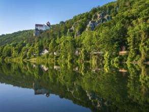
Prunn Castle on steep rock above the Altmühl Valle...
BRK26B94_110
Shipping traffic on the Rhine near Duisburg-Homber...
BRK26B56_170
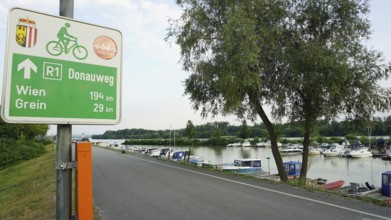
Signpost on Danube trail R1 with river and boats i...
BRK26B60_417
Olfen, North Rhine-Westphalia, Germany - Lippe, fo...
BRK26B60_418
Kanalbrücke Lippe Neue Fahrt, Dortmund-Ems Canal, ...
BRK26B88_391
The port of Mannheim is one of the most important ...
BRK26B96_343
Europe, Germany, Schleswig-Holstein, Brunsbüttel, ...
BRK26B69_188
London cityscape with St Paul's Cathedral, England...
BRK26B91_065
Hüttenwerke Krupp-Mannesmann, HKM in Duisburg-Hütt...
BRK26B88_389
The port of Mannheim is one of the most important ...
BRK26B88_388
The port of Mannheim is one of the most important ...
BRK26B94_109
Shipping traffic on the Rhine near Duisburg-Bruckh...
BRK26B88_390
Colourful sea containers in the container port. Th...
BRK26B81_480
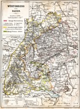
Colored topographic map of the Kingdom of Würtembe...
BRK26B91_066
Hüttenwerke Krupp-Mannesmann, HKM in Duisburg-Hütt...
BRK26B89_449
Chempark Krefeld-Uerdingen, around 40 companies ar...
BRK26B94_106
Shipping traffic on the Rhine near Duisburg-Bruckh...
BRK26B72_464
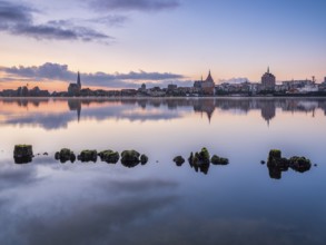
Old town and city port are reflected in the Warnow...
BRK26B85_047
Roman port, former Roman river port, Basilica of A...
BRK26B85_084
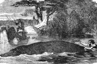
Hippopotamus (Hippopotamus amphibius) river, swim,...
BRK26B56_121
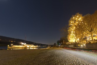
Atmospheric night view at the Blue Wonder, the dec...
BRK26B60_419
Olfen, North Rhine-Westphalia, Germany - Lippe, hi...
- Page
-
- of
- 49