1196 results for: rhine level
- Page
-
- of
- 12
Please sign in for more results
BRK26C70_314
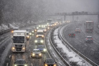
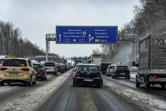
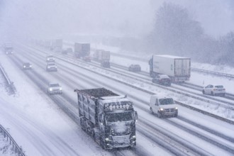
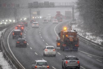
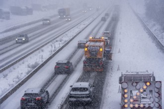
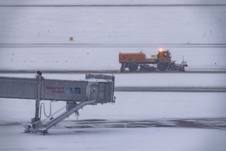
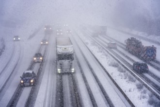
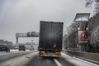
The onset of winter in North Rhine-Westphalia, hea...
BRK26C66_132
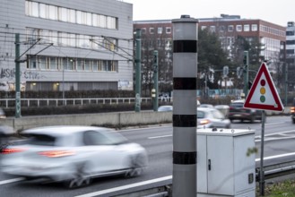
New speed camera on the A40 motorway, in the direc...

BRK26C99_062
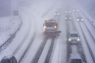
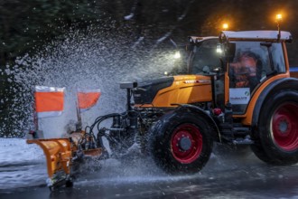
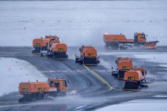
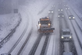
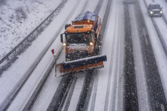
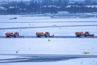
Winter service, spreader and snow plough in use, c...
BRK26C91_038
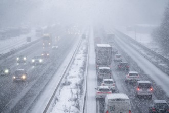
The onset of winter in North Rhine-Westphalia, hea...

BRK26C72_378
New exhibition at Gasometer Oberhausen, art sculpt...
BRK26C93_076
The onset of winter in North Rhine-Westphalia, hea...
BRK26C68_408
New exhibition at Gasometer Oberhausen, art sculpt...
BRK26C80_162
New exhibition at Gasometer Oberhausen, Mythos Wal...
BRK26C77_040
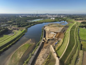
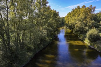
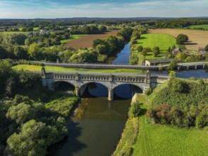
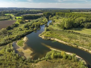
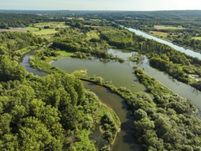
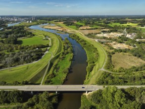
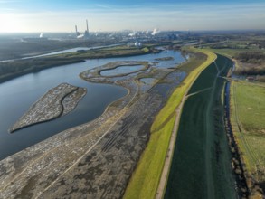
Datteln, North Rhine-Westphalia, Germany - Lippe, ...
BRK26C81_394
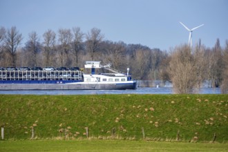
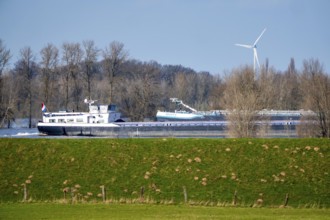
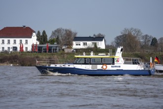
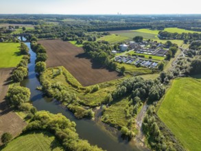
Wesel, Lower Rhine, North Rhine-Westphalia, German...
BRK26C73_331
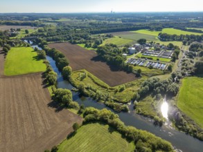
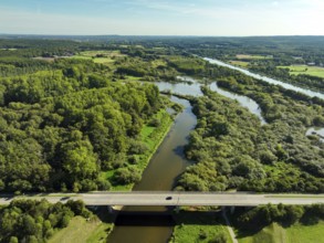
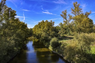
Haltern-Marl, North Rhine-Westphalia, Germany - Li...
BRK26C69_104
Haltern-Marl, North Rhine-Westphalia, Germany - Li...
BRK26C81_098
Haltern-Marl, North Rhine-Westphalia, Germany - Li...
BRK26C90_329
Haltern-Marl, North Rhine-Westphalia, Germany - Li...
BRK26C69_134
Haltern-Marl, North Rhine-Westphalia, Germany - Li...
BRK26C96_299
Datteln, North Rhine-Westphalia, Germany - Lippe l...
BRK26C44_065
The onset of winter in North Rhine-Westphalia, hea...
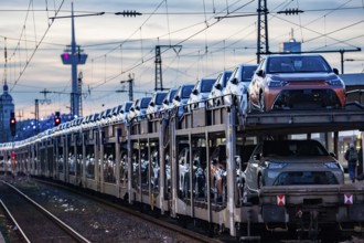
BRK26C40_452
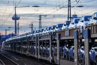
Car train, transport of Toyota small cars with a f...

BRK26C44_064
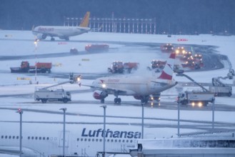
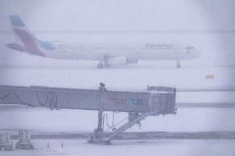
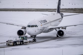
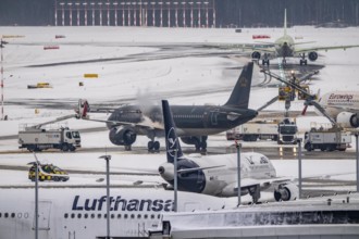
The onset of winter in North Rhine-Westphalia, fli...
BRK26C48_313
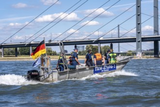
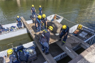
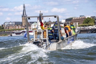
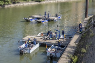
Multi-purpose boat of the THW during a training tr...
BRK26C44_072
The onset of winter in North Rhine-Westphalia, hea...
BRK26C48_314
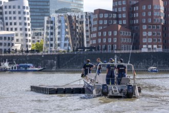
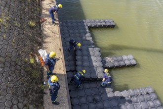
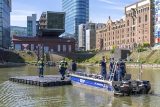
Transport of a floating platform with the jet-floa...
BRK26C48_315
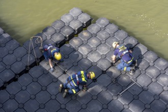
Construction of a floating platform with the jet-f...

BRK26C44_066
The onset of winter in North Rhine-Westphalia, hea...
BRK26C44_068
The onset of winter in North Rhine-Westphalia, hea...
BRK26C09_166
Floods on the Rhine, Lower Rhine near Xanten, Bisl...
BRK26C50_259
Low water of the Rhine near Leverkusen, Rhine bank...
BRK26C50_260
Low water level of the Rhine at Leverkusen, new Rh...
BRK26C09_171
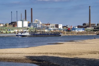
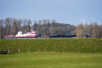
Schubverband HGK Herkules II, coal for the steel i...
BRK26C44_298
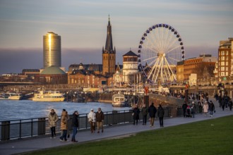
Rhine promenade in Düsseldorf, Ferris wheel, old c...
BRK26C44_061
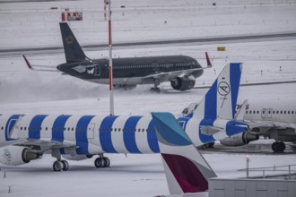
The onset of winter in North Rhine-Westphalia, fli...
BRK26C48_312
Construction of a multi-purpose pontoon, the speci...
BRK26C43_409
Winter service, spreader and snow plough in use, c...

BRK26C44_062
The onset of winter in North Rhine-Westphalia, fli...
BRK26C44_070
The onset of winter in North Rhine-Westphalia, hea...
BRK26C09_187
Floods on the Rhine, Lower Rhine near Xanten, heig...
BRK26C09_188
Boat of the North Rhine-Westphalia Water Protectio...
BRK26B88_361
Car train, transport of Toyota small cars with a f...
BRK26C30_122
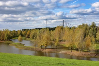
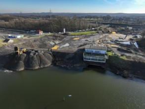
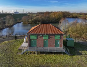
Mülheim, North Rhine-Westphalia, Germany - Transfo...
BRK26C48_038
Wesel, Lower Rhine, North Rhine-Westphalia, German...
BRK26C30_123
Mülheim, North Rhine-Westphalia, Germany - Transfo...
BRK26C27_232
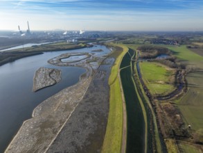
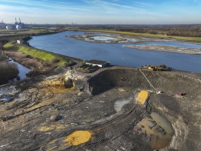
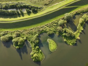
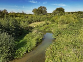
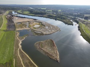
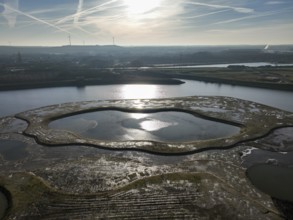
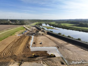
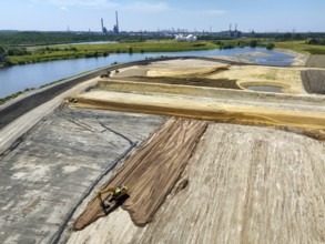
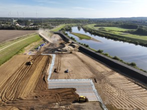
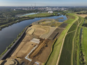
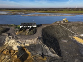
Datteln, North Rhine-Westphalia, Germany - Restore...
BRK26C27_231
Datteln, North Rhine-Westphalia, Germany - Renatur...
BRK26C48_037
Wesel, Lower Rhine, North Rhine-Westphalia, German...
BRK26C27_227
Datteln, North Rhine-Westphalia, Germany - Lippe l...
BRK26C27_228
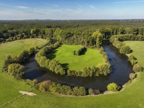
Olfen, North Rhine-Westphalia, Germany - Lippe, in...
BRK26C44_063
The onset of winter in North Rhine-Westphalia, fli...
BRK26C44_067
The onset of winter in North Rhine-Westphalia, fli...
BRK26C44_071
The onset of winter in North Rhine-Westphalia, fli...
BRK26C27_230
Datteln, North Rhine-Westphalia, Germany - Lippe, ...
BRK26C30_106
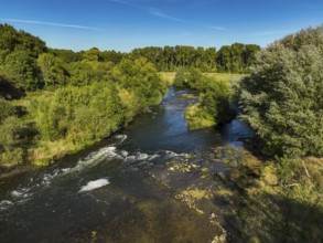
Haltern-Marl, North Rhine-Westphalia, Germany - Li...
BRK26C30_114
Haltern-Marl, North Rhine-Westphalia, Germany - Li...
BRK26C30_109
Haltern-Marl, North Rhine-Westphalia, Germany - Li...
BRK26C30_115
Haltern-Marl, North Rhine-Westphalia, Germany - Li...
BRK26C30_110
Haltern-Marl, North Rhine-Westphalia, Germany - Li...
BRK26C30_118
Haltern-Marl, North Rhine-Westphalia, Germany - Li...
BRK26C30_117
Haltern-Marl, North Rhine-Westphalia, Germany - Li...

BRK26C30_107
Haltern-Marl, North Rhine-Westphalia, Germany - Li...
BRK26C52_365
Haltern-Marl, North Rhine-Westphalia, Germany - Li...
BRK26C30_108
Haltern-Marl, North Rhine-Westphalia, Germany - Li...
BRK26C30_116
Haltern-Marl, North Rhine-Westphalia, Germany - Li...
BRK26C27_229
Datteln, North Rhine-Westphalia, Germany - Lippe, ...
BRK26C27_225
Datteln, North Rhine-Westphalia, Germany - Lippe, ...
BRK26C30_111
Haltern-Marl, North Rhine-Westphalia, Germany - Li...

BRK26C52_285
Eurasian Coot (Fulica atra) also called coot, typi...
BRK26B95_202
The onset of winter in North Rhine-Westphalia, fli...
BRK26B95_206
The onset of winter in North Rhine-Westphalia, hea...
BRK26B95_211
The onset of winter in North Rhine-Westphalia, hea...

BRK26B95_207
The onset of winter in North Rhine-Westphalia, fli...

BRK26B95_209
The onset of winter in North Rhine-Westphalia, fli...
BRK26B95_210
The onset of winter in North Rhine-Westphalia, hea...
BRK26B95_205
The onset of winter in North Rhine-Westphalia, fli...

BRK26B94_400
Winter service, spreader and snow plough in use, c...
BRK26B95_204
The onset of winter in North Rhine-Westphalia, fli...
BRK26B95_201
The onset of winter in North Rhine-Westphalia, fli...
BRK26B65_270
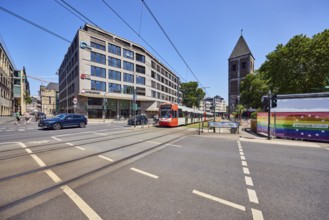
Gürzenich-Quartier, ASTOC Architects and Planners ...
BRK26B65_242
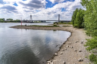
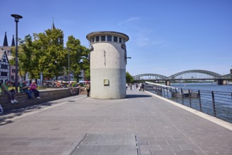
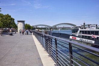
Level, river Rhine, waterfront, metal railing, lan...
BRK26B60_417
Olfen, North Rhine-Westphalia, Germany - Lippe, fo...
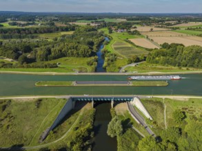
BRK26B60_418
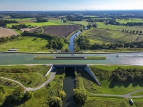
Kanalbrücke Lippe Neue Fahrt, Dortmund-Ems Canal, ...
BRK26B65_243
Rhine river, waterfront, metal railing, pier, gang...
BRK26B65_275
Gürzenich-Quartier, ASTOC Architects and Planners ...
BRK26B65_259
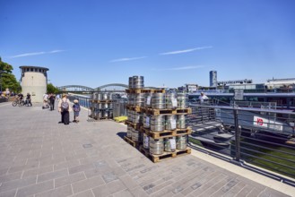
Pallets with beer barrels, boat launch, gangway, R...
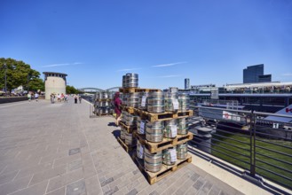
BRK26B65_241
Pallets with beer barrels, boat launch, gangway, R...
BRK26C02_048
Wesel, Lower Rhine, North Rhine-Westphalia, German...
BRK26C02_047
Wesel, Lower Rhine, North Rhine-Westphalia, German...
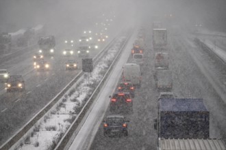
BRK26B95_200
The onset of winter in North Rhine-Westphalia, hea...
BRK26C03_335
Multi-purpose boat of the THW during a training tr...
BRK26C03_336
Transport of a floating platform with the jet-floa...
BRK26B95_203
The onset of winter in North Rhine-Westphalia, hea...
BRK26C03_337
Construction of a floating platform with the jet-f...
BRK26C03_334
Construction of a multi-purpose pontoon, the speci...
BRK26B67_214
Haltern-Marl, North Rhine-Westphalia, Germany - Li...
BRK26B60_415
Datteln, North Rhine-Westphalia, Germany - Lippe, ...
BRK26B60_422
Datteln, North Rhine-Westphalia, Germany - Restore...
BRK26B67_213
Haltern-Marl, North Rhine-Westphalia, Germany - Li...
BRK26B67_211
Haltern-Marl, North Rhine-Westphalia, Germany - Li...
BRK26B67_209
Haltern-Marl, North Rhine-Westphalia, Germany - Li...
BRK26B60_426
Datteln, North Rhine-Westphalia, Germany - Lippe, ...
BRK26B67_195
Haltern-Marl, North Rhine-Westphalia, Germany - Li...
BRK26B67_196
Haltern-Marl, North Rhine-Westphalia, Germany - Li...
- Page
-
- of
- 12