19163 results for: resting places
- Page
-
- of
- 192
Please sign in for more results
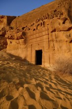
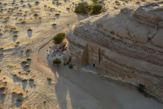
BRK26C74_450
Nabataean tomb at Djabal Khraymat in first dayligh...
BRK26C76_460
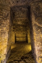
Pre-Columbian hypogea or tombs, Unesco world herit...
BRK26C66_378
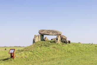
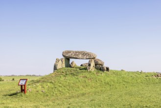
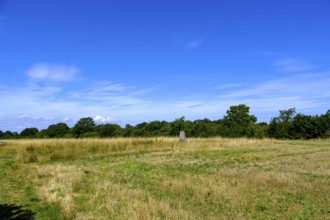
Passage grave on a hill with big boulders in a rur...
BRK26C67_006
Luttra Passage grave on a hill from the Neolithic ...
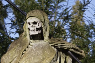
BRK26C61_449
Grim Reaper, allegory of death with hourglass and ...
BRK26C76_006
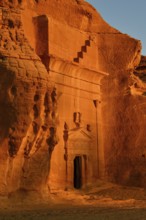
Nabataean tomb at Djabal Al-Ahmar in first dayligh...
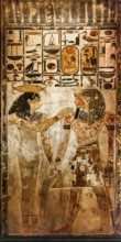
BRK26C75_064
Reproduction of the tomb of Ramses II's father, Se...
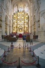
BRK26C85_466
Visitors at the tomb of El Cid in the Cathedral of...
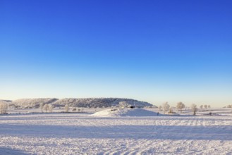
BRK26C66_214
Winter landscape with snow and frost in the countr...
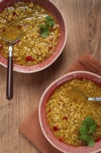
BRK26C98_156
Enjoy a hearty grain soup featuring a vibrant mix ...
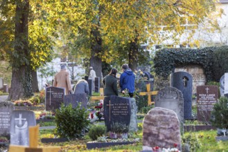
BRK26C62_066
All Saints' Day at the Bergfriedhof cemetery in St...
BRK26C98_172
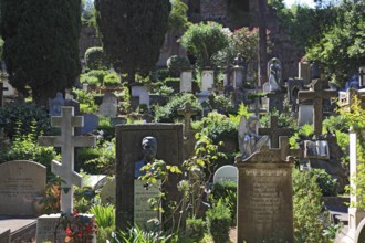
Sculpture, crypt arcades, grave counters in the ar...
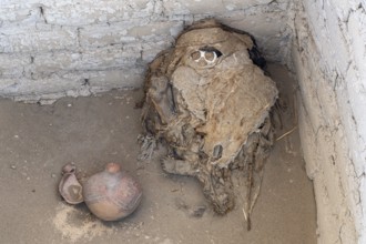
BRK26C56_084
Mummy in the Cemetery of Chauchilla, Chauchilla Ce...
BRK26C66_019
Nabataean tomb at the rock Qasr Al-Bint, blue hour...
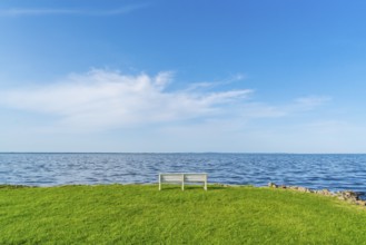
BRK26C66_386
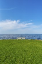
Isolated, white, empty bench in a meadow on the sh...
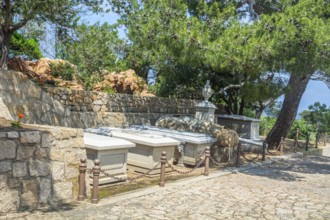
BRK26C67_042
Burial site of the Garibaldi family on Isola Capre...
BRK26C61_278
Isolated, white, empty bench in a meadow on the sh...
BRK26C66_231
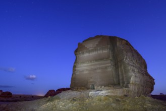
Qasr Al-Farid, 2000 year old Nabataean tomb, blue ...
BRK26C67_487
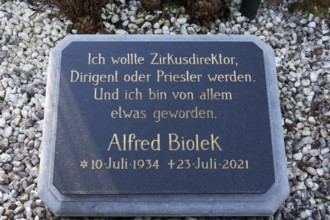
Stone slab with grave inscription Alfred Biolek, c...
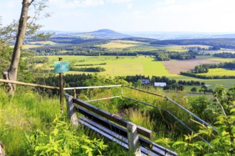
BRK26C60_323
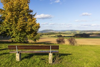
Bench with a view of Löbauer Berg and the Upper Lu...
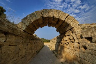
BRK26C72_200
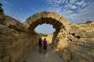
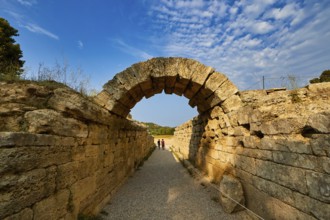
Crypt, vaulted passage to the stadium, two people ...
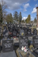
BRK26C62_343
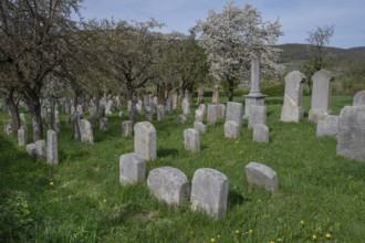
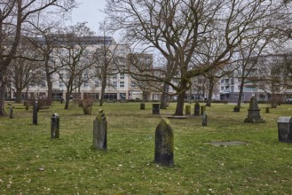
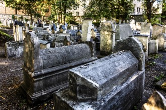
Jewish cemetery, established 1734, last occupancy ...
BRK26C73_279
A natural burial grave site, Hofgeismar, Weser Upl...
BRK26C60_332
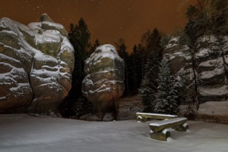
Snow-covered natural monument Kelchsteine at night...
BRK26C65_498
Old St. Nikolai Cemetery, historic cemetery, old g...
BRK26C57_269
Trethevy Quoit Megalithic Stone Tomb, Dolmen, Port...
BRK26C99_340
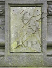
Symbolic grave of dead European euro due to crisis
BRK26C71_394
Crypt, vaulted entrance to the stadium, ancient st...
BRK26D03_031
Epitaph with an angel, St Wilhadi-Church, Stade, L...
BRK26C92_097
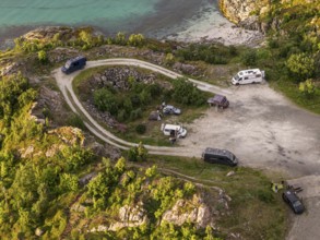
Rest area at Sommaroy Bridge, camper vans, sunset,...
BRK26C71_453
Crypt, vaulted entrance to the stadium, ancient st...
BRK26D03_358
Grave of honour of the composer Wolfgang Amadeus M...
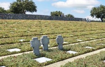
BRK26C57_116
Three stone crosses between rows of grave slabs Gr...
BRK26C93_397
New graves at the Israeli cemetery, inaugurated in...
BRK26C65_398
Viewpoint Schneiderfelsen with bench and view of t...
BRK26C71_151
Crypt, vaulted walkway to the stadium, old stone a...
BRK26C67_124
The Karlevi stone is a rune stone and part of a bu...
BRK26C65_058
Church with tombstones in the Swedish countryside ...
BRK26C67_187
The Protestant Cemetery, Cimitero acattolico, also...
BRK26C67_339
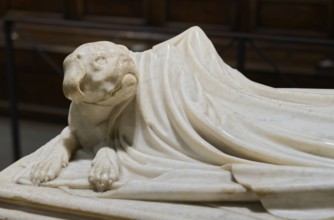
Dog eternally guards his dead mistress, detail, To...
BRK26C81_051
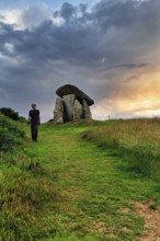
Le Dehus prehistoric passage burial tomb, Vale, Gu...
BRK26C82_288
Remuh Cemetery, 1551, Remuh Synagogue, 1553, one o...
BRK26C95_419
A megalithic grave in the Lüneburger Heide, 1890, ...
BRK26C62_106
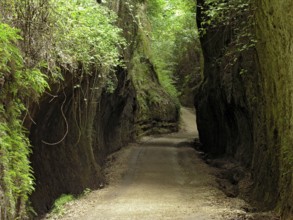
Etruscan path carved into tuff rock, ancient road ...
BRK26C65_193
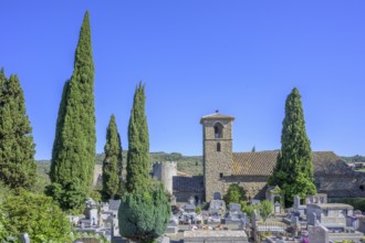
Church and cemetery of Villerouge-Termenès, Départ...
BRK26C77_449
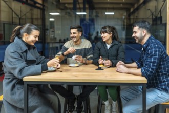
Four diverse friends are sitting at a wooden table...
BRK26C93_242
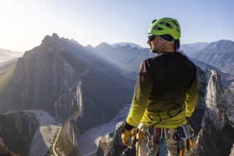
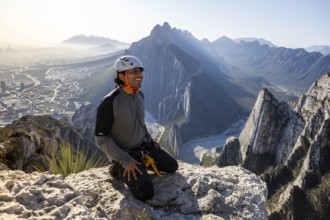
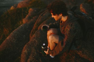
A man pauses to rest while mountaineering and rapp...
BRK26C73_071
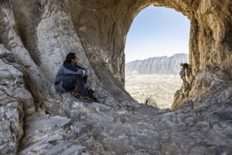
A climber rests on rocky terrain while two others ...
BRK26C99_114
A multiethnic lesbian couple sits on a bench outdo...
BRK26D00_236
A couple sits on stone steps, the woman leaning on...
BRK26C64_178
View from Castel Sant'Angelo to the Cathedral, St ...

BRK26C90_343
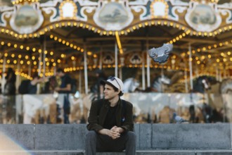
A person in a cozy, striped sweater sits cross-leg...
BRK26C58_457
Display Guardian Statues Tomb of Tutankhamun Museu...
BRK26C62_147
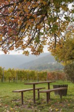
Wooden tables under a colourful tree, vineyards an...
BRK26C74_233
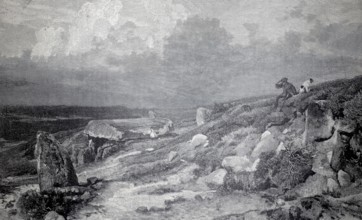
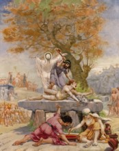
Sacrifice on a dolmen, painting by Jean-Baptiste C...
BRK26C91_119
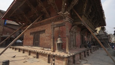
Traditional Nepalese building, temple with detaile...
BRK26C99_247
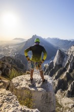
A man pauses on a rocky ledge in Eagle’s Nest, M...
BRK26C60_130
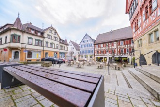
Historic square with colourful half-timbered house...

BRK26C72_253
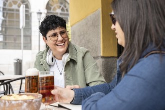
Two women engage in conversation in a cozy cafe se...
BRK26C75_300
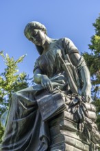
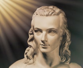
Portrait of Georg Philipp Friedrich Freiherr von H...
BRK26C96_193
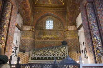
Magnificent interior with ornate ornaments and cal...
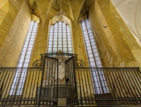
BRK26C71_480
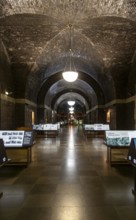
Lutyens Crypt, Liverpool Metropolitan Cathedral. L...
BRK26C76_389
A man takes a break after practicing mountaineerin...
BRK26C80_069
A young man sits casually in front of a brightly l...

BRK26C82_478
A woman with glasses sits at a cafe table with a l...
BRK26C93_362
A joyful scene of a curvy lesbian couple enjoying ...

BRK26D01_383
A professional black woman sits at a table in an u...
BRK26C70_032
Portrait of Georg Philipp Friedrich Freiherr von H...
BRK26C76_449
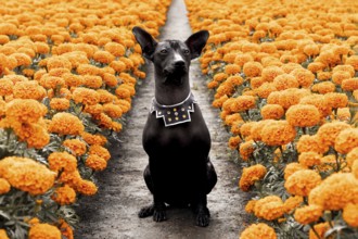
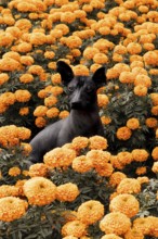
A majestic Xoloitzcuintle dog sits among vibrant C...
BRK26C81_386
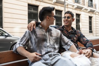
A cheerful latin gay couple sits close together on...
BRK26C85_474
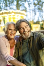
Senior couple taking selfie sitting on bench in th...

BRK26C92_330
Group of diverse friends taking a break on an indo...
BRK26C76_215
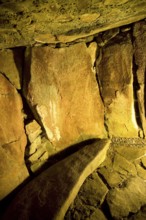
Etruscan tomb, reconstructed central pillar, tumul...
BRK26C80_496
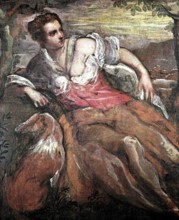
An Allegory of Fidelity, painting by Domenico Tint...
BRK26D04_500
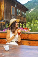
Woman relaxing at lake dobbiaco with a mug, enjoyi...
BRK26D05_071
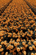
Vibrant orange cempasuchil flowers bloom in neat r...
BRK26C65_317
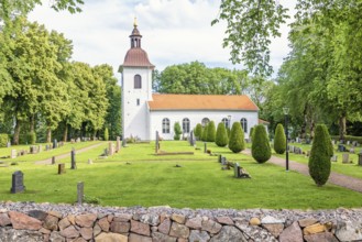
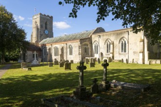
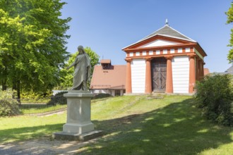
Village parish church of Saints Peter and St Paul,...
BRK26C79_114
Interior photo, St Mary's Church in the old town o...
BRK26C81_426
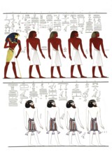
The different kinds of men known to the Egyptians,...
BRK26C82_207
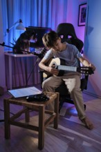
A young boy tuning his guitar in a cozy, blue lit ...
BRK26C85_022
A young male hiker sits on rugged rocks at Cape Sp...
BRK26C58_288
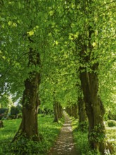
Tree avenue at the cemetery of Sieseby church, sun...
BRK26C59_331
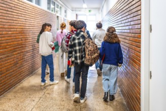
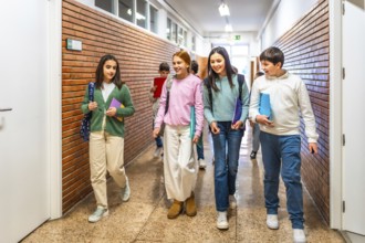
Group of elementary school students walking down t...
BRK26C65_123
German castle ruin called Strahlenburg in Odenwald...
BRK26C77_251
A Xoloitzcuintle dog sits gracefully amidst vibran...

BRK26C96_019
A young girl sits at a desk, appearing stressed an...
BRK26C56_132
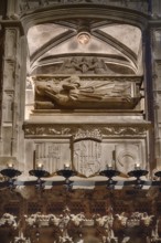
Tomb of the philosopher and theologian Ramon Llull...
BRK26C64_370
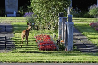
Roe deer (Capreolus capreolus), Hörnli cemetery, C...
BRK26C69_442
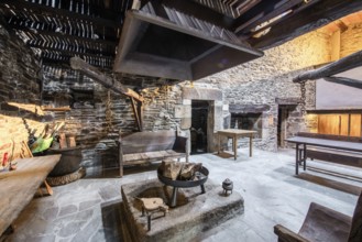
Traditional Lugo, Spain country house featuring ru...
BRK26C72_060
Interior photo, St Mary's Church in the old town o...
BRK26C76_365
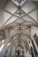
Vault with coat of arms in the late Gothic mortuar...
BRK26C62_216
Group of cheerful students walking together in sch...
BRK26C65_166
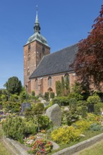
Church of St Nikolai, cemetery, Burg auf Fehmarn, ...
BRK26C96_034
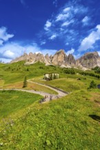
Bikers taking a break at gardena pass admiring the...
BRK26C75_307
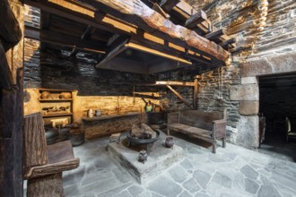
Traditional rustic kitchen inside a country house ...
BRK26C79_065
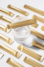
From above an esthetic arrangement of golden jelly...
BRK26C83_278
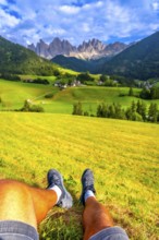
Tourist resting on a green meadow, enjoying the br...

BRK26D04_266
Group of colleagues in a contemporary office setti...
BRK26C67_241
Count's hereditary burial place, in front of it a ...
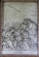
BRK26C72_148
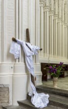
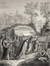
Burial of the Virgin Mary, Steel engraving 1853, d...
- Page
-
- of
- 192