8579 results for: resting areas
- Page
-
- of
- 86
Please sign in for more results
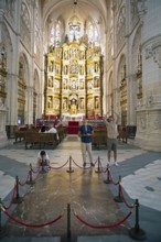
BRK26C85_466
Visitors at the tomb of El Cid in the Cathedral of...
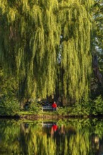
BRK26C58_017
Woman in red jacket sitting on a bench under a Bab...
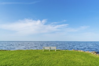
BRK26C66_386
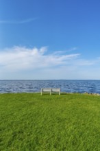
Isolated, white, empty bench in a meadow on the sh...
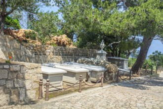
BRK26C67_042
Burial site of the Garibaldi family on Isola Capre...
BRK26C61_278
Isolated, white, empty bench in a meadow on the sh...
BRK26C66_361
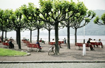
People sitting on benches on a terrace overlooking...
BRK26C72_200
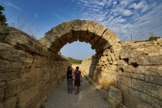
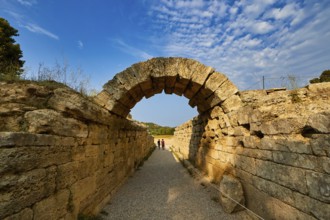
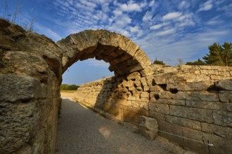
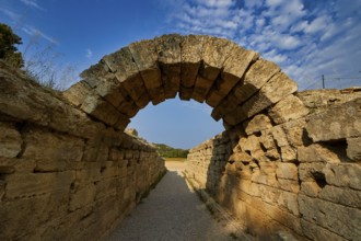
Crypt, vaulted passage to the stadium, two people ...
BRK26C62_343
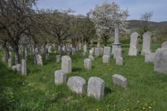
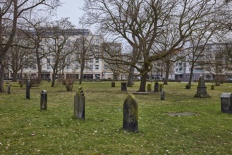
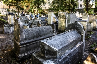
Jewish cemetery, established 1734, last occupancy ...
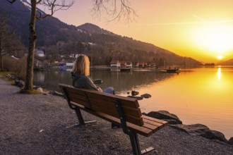
BRK26C87_427
A person sitting on a bench by the lake at sunset ...
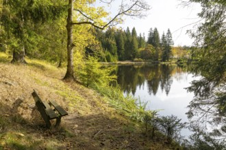
BRK26C62_345
Bench overlooking a pond at the edge of a forest, ...
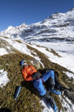
BRK26C58_358
Ski tourer taking a break in the sun, lying down, ...
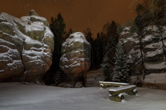
BRK26C60_332
Snow-covered natural monument Kelchsteine at night...
BRK26C65_498
Old St. Nikolai Cemetery, historic cemetery, old g...
BRK26C57_269
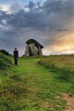
Trethevy Quoit Megalithic Stone Tomb, Dolmen, Port...
BRK26C71_394
Crypt, vaulted entrance to the stadium, ancient st...
BRK26C92_097
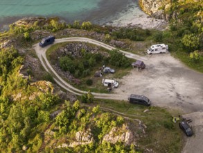
Rest area at Sommaroy Bridge, camper vans, sunset,...
BRK26C71_453
Crypt, vaulted entrance to the stadium, ancient st...
BRK26C71_151
Crypt, vaulted walkway to the stadium, old stone a...
BRK26C56_140
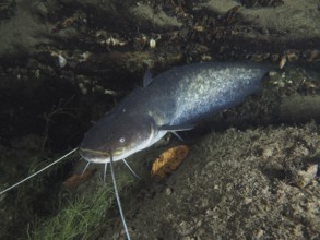
A catfish (Silurus glanis), Waller, resting under ...
BRK26C67_339
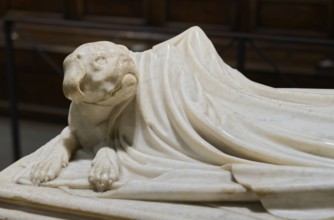
Dog eternally guards his dead mistress, detail, To...
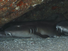
BRK26C67_466
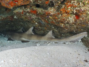
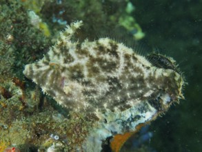
A Brownbanded bamboo shark (Chiloscyllium punctatu...
BRK26C82_288
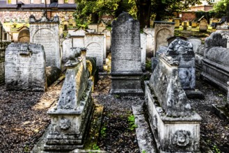
Remuh Cemetery, 1551, Remuh Synagogue, 1553, one o...
BRK26C95_419
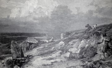
A megalithic grave in the Lüneburger Heide, 1890, ...
BRK26C63_314
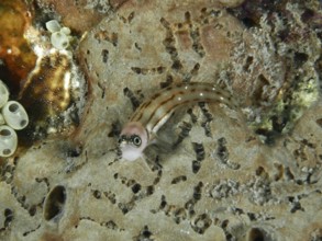
A small brown and white striped fish, three-stripe...
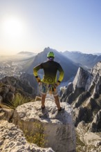
BRK26C93_242
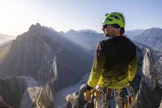
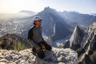
A man pauses to rest while mountaineering and rapp...
BRK26C64_021
A Brownbanded bamboo shark (Chiloscyllium punctatu...
BRK26C70_043
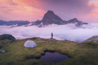
A camper stands near a tent overlooking a majestic...
BRK26C73_071
A climber rests on rocky terrain while two others ...
BRK26C64_178
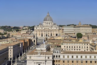
View from Castel Sant'Angelo to the Cathedral, St ...
BRK26C69_295
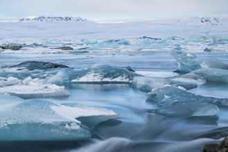
Tranquil beauty of blue icebergs resting on the bl...
BRK26C92_473
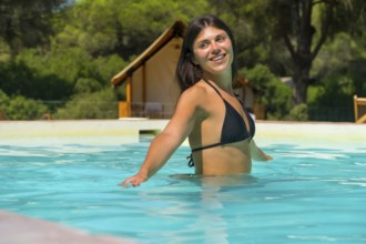
Young woman relaxing in a turquoise swimming pool ...
BRK26C96_317
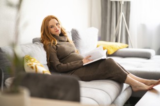
A pregnant woman sits comfortably on a cozy couch,...
BRK26C60_039
A pearled pufferfish (Sphoeroides spengleri) resti...
BRK26C67_447
Burbot, burbot (Lota lota), rudd with a distinctiv...
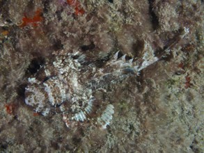
BRK26C68_043
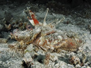
A camouflaged Black scorpionfish (Scorpaena porcus...
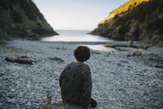
BRK26C89_087
Back view of a man sitting contemplatively on a pe...
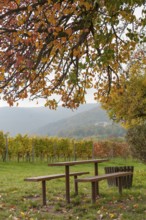
BRK26C62_147
Wooden tables under a colourful tree, vineyards an...

BRK26C65_266
A shark, Brownbanded bamboo shark (Chiloscyllium p...
BRK26C99_247
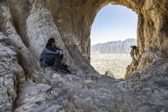
A man pauses on a rocky ledge in Eagle’s Nest, M...
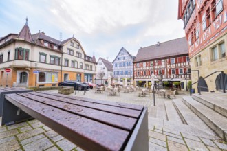
BRK26C60_130
Historic square with colourful half-timbered house...
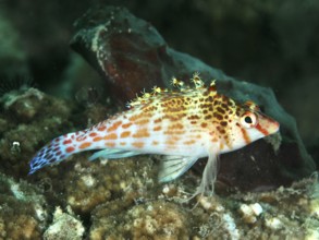
BRK26C63_334
A vividly coloured fish, Dwarf Hawkfish (Cirrhitic...
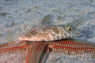
BRK26C67_010
Seagrass filefish (Acreichthys tomentosus) resting...
BRK26C67_400
A well camouflaged Mediterranean parrotfish (Spari...
BRK26C97_137
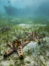
Underwater view of three starfish resting on the s...
BRK26C71_480
Lutyens Crypt, Liverpool Metropolitan Cathedral. L...
BRK26C76_389
A man takes a break after practicing mountaineerin...
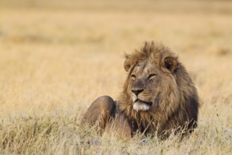
BRK26C55_418
Lion (Panthera leo), resting male at dawn, Savuti,...

BRK26C64_267
Mottled grouper (Epinephelus marginatus) (Mycterop...
BRK26C79_051
A mature woman enjoys a tranquil moment in a vibra...
BRK26C91_288
A serene image of a young girl in a white dress ge...
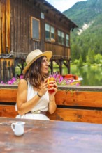
BRK26D04_500
Woman relaxing at lake dobbiaco with a mug, enjoyi...
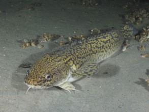
BRK26C67_321
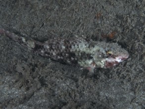
A well camouflaged fish, gracile lizardfish (Sauri...
BRK26C79_114
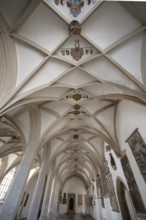
Interior photo, St Mary's Church in the old town o...
BRK26C60_023
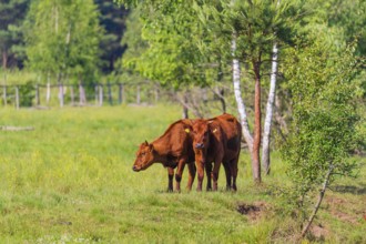
A herd of Polish red cattle (Bos primigenius f. ta...
BRK26C66_392
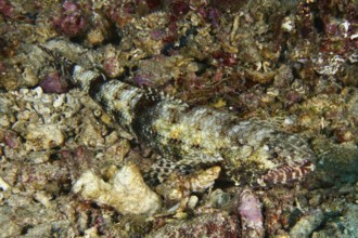
Camouflaged fish, Spiny Devilfish (Inimicus didact...
BRK26C83_300
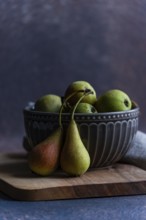
A collection of fresh wild pears displayed in a de...

BRK26C85_023
Snowy bench at an orange sunset with a view of Kro...
BRK26C62_463
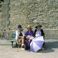
Women on a bench in front of the city wall of St.M...
BRK26C72_060
Interior photo, St Mary's Church in the old town o...
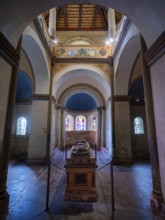
BRK26C76_365
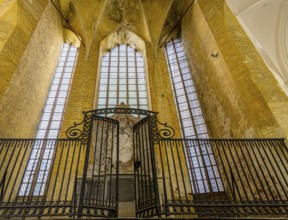
Vault with coat of arms in the late Gothic mortuar...
BRK26C96_034
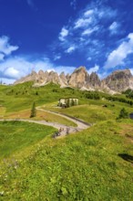
Bikers taking a break at gardena pass admiring the...
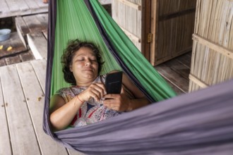
BRK26C97_426
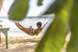
A woman and a cat enjoy a serene moment in a hammo...
BRK26C83_278
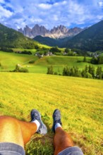
Tourist resting on a green meadow, enjoying the br...
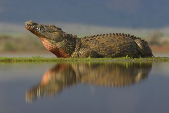
BRK26C55_335
Nile crocodile (Crocodylus niloticus) resting, ref...
BRK26C66_117
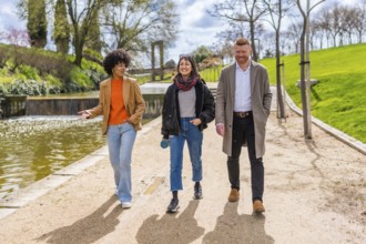
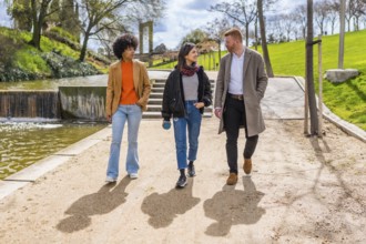
Three young professionals enjoy a walk and talk to...
BRK26C94_327
Monumental tomb slab of Bishops Ludolf and Heinric...
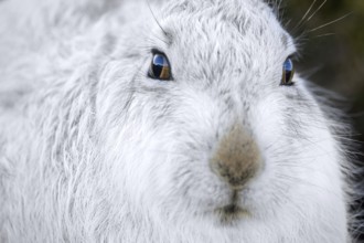
BRK26C62_492
Close-up of mountain hare, snow hare (Lepus timidu...
BRK26C90_346
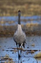
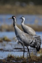
Common crane (Grus grus), Hornborga, Sweden
BRK26C95_149
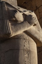
Hieroglyphic relief details from the Ramesseum, me...
BRK26D00_359
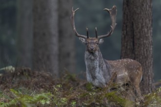
A fallow deer (Dama dama) leaves the rut and looks...
BRK26D01_354
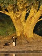
Canada Goose (Branta canadensis), a serene scene f...
BRK26C59_320
Wooden cross on grave of fallen soldier and worker...
BRK26C62_154
Three young professionals are enjoying a walk and ...
BRK26C64_472
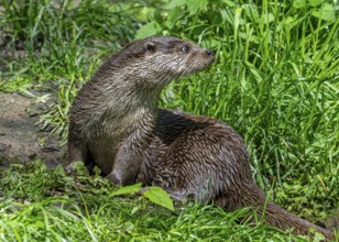
Eurasian otter, European river otter (Lutra lutra)...
BRK26C93_270
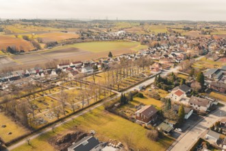
Nice view of a village with trees and fields, the ...
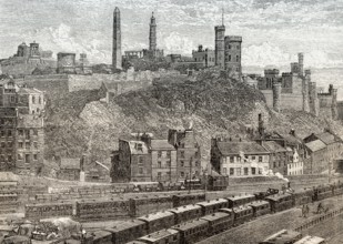
BRK26D00_284
A view of Calton Hill, Edinburgh, Scotland, 19th c...
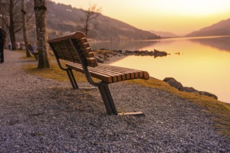
BRK26C98_471
An empty wooden bench on the lakeside at sunset on...
BRK26C83_360
Common crane (Grus grus), Hornborga, Sweden
BRK26C91_417
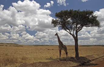
Masai Giraffe (Giraffa camelopardalis tippelskirch...
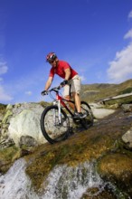
BRK26C84_180
A man on a mountain bike in an alpine landscape
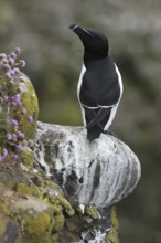
BRK26D03_301
Razorbill (Alca torda) resting on ledge in cliff f...
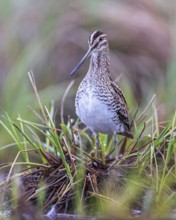
BRK26C87_058
Common snipe (Gallinago gallinago) or marsh snipe....
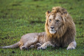
BRK26C88_012
Resting lion (Panthera leo), male, Masai Mara, Ken...
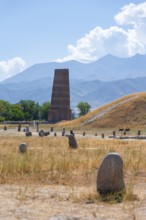
BRK26C62_148
Burana Tower, remains of Karakhanid Minaret, histr...
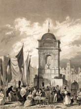
BRK26C89_491
The Fontaine des Innocents, Paris, antique steel e...
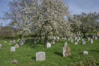
BRK26C63_135
Flowering cherry trees (Prunus avium) in the Jewis...
BRK26C73_015
The imperial palace of Goslar covers an area of ar...
BRK26C81_385
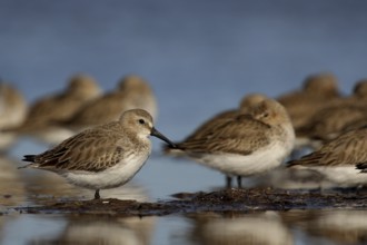
Red Knot (Calidris canutus) resting flock, Banc d'...
BRK26C56_293
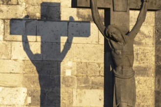
Stone cross with shadow cast at sunrise, cathedral...
BRK26C55_493
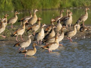
Egyptian goose (Alopochen aegyptiacus), flock of a...
BRK26C20_362
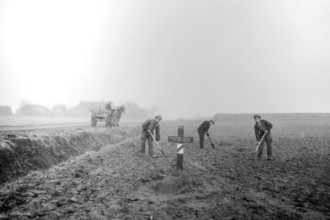
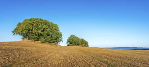
Mound graves covered with oak trees in a ploughed ...
BRK26B92_150
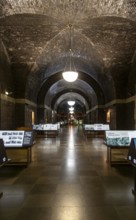
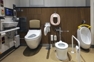
Modern Japanese rest stop toilets with advanced fe...
BRK26C37_402
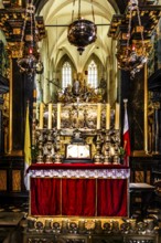
Mausoleum of St. Stanislaw, Krakow Bishop and Patr...
BRK26C38_136
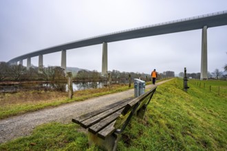
The Mintarder Ruhr Valley Bridge, A52 motorway bri...
BRK26C15_423
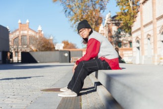
A young Latina woman in a red shirt and black pant...
BRK26C37_396
Remuh Cemetery, 1551, Remuh Synagogue, 1553, one o...
BRK26C55_111
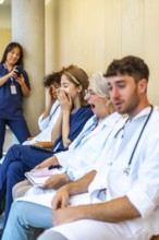
Exhausted doctors and nurses yawning while sitting...
BRK26C53_300
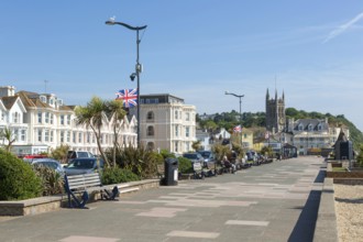
Seafront promenade view east towards St Michael's ...
BRK26C52_396
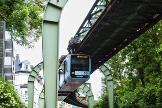
The Wuppertal suspension railway runs through Vohw...

BRK26C55_112
Exhausted doctors and nurses yawning and sitting i...
- Page
-
- of
- 86