109 results for: oberallgäu
- Page
-
- of
- 2
Please sign in for more results

BRK25M98_434
Dietersberg, Trettachtal, near Oberstdorf, Oberall...

BRK25N00_374
Moorland spotted orchid (Dactylorhiza maculata), a...
BRK25N00_377
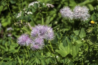
Greater meadow-rue (Thalictrum aquilegiifolium), a...

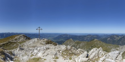
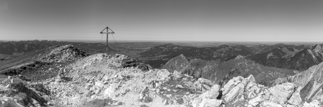
BRK25M98_462
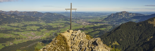
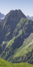
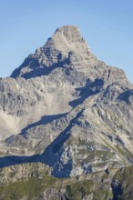
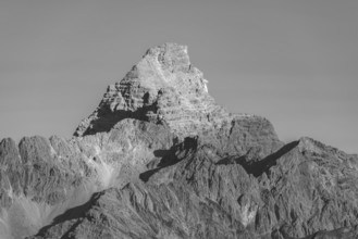
Mountain peak Rubihorn with summit cross, near Obe...

BRK25N00_373
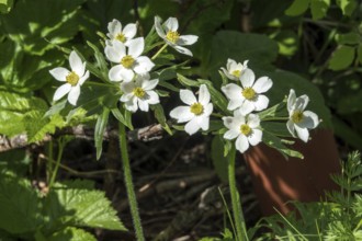
European Trollflower (Trollius europaeus), Oberstd...

BRK25N00_378
Rusty-leaved alpenrose (Rhododendron ferrugineum),...
BRK25N00_382
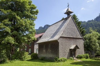
Catholic St Anne's Chapel, oldest wooden chapel in...

BRK25N00_379
Doronicum pardalianches (Doronicum pardalianches),...
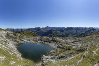
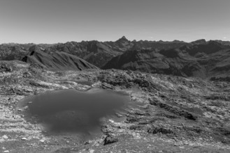
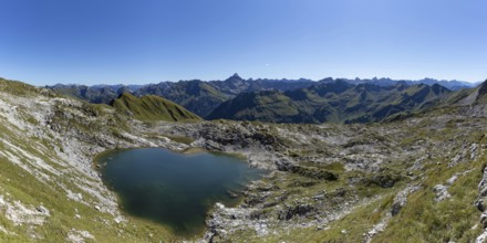
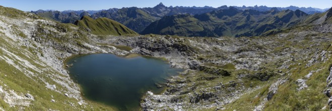
BRK25M98_459
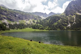
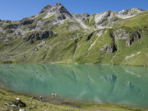
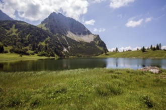
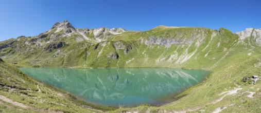
Unterer Gaißalpsee, near Oberstdorf, Oberallgäu,...
BRK25N00_376
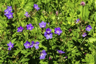
Meadow cranesbill (Geranium pratense), also known ...
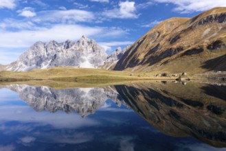
BRK25M96_408
HIker at lake Engeratsgundsee, mountain range betw...
BRK25N00_375
Narcissus anemone (Anemone narcissiflora), also kn...
BRK25N00_383
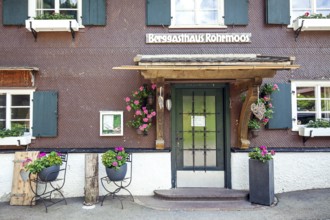
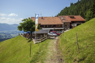
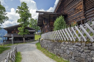
Entrance Berggasthof Rohrmoos, Rohrmoostal, near O...

BRK25M98_451
Hiking trail from the Gaißalpe to Unterer Gaißal...
BRK25N00_381
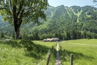
Osterberg Alpe, between Tiefenbach and Riezlern, O...

BRK25N00_380
Cattle on the terrace of the Osterberg Alpe, betwe...
BRK25M98_454
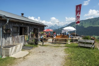
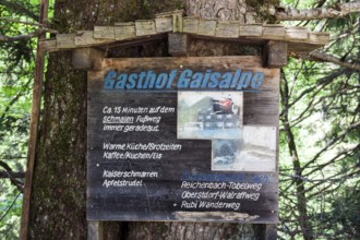
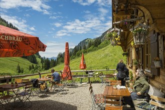
Berggasthof Gaißalpe, near Oberstdorf, Oberallgä...
BRK25M98_461
View from the hiking trail from Gaißalpe to Unter...
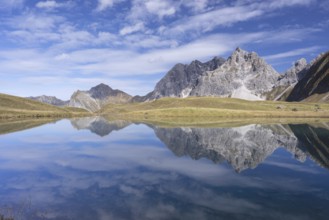
BRK25M98_435
Hiking trail to Hölltobel to Gerstruben, behind Mu...
BRK25M98_456
View from the hiking trail from Gaißalpe to Unter...
BRK25M98_450
Hiking trail from Gaißalpe to Unterer Gaißalpsee...
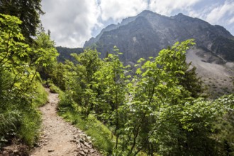
BRK25M98_428
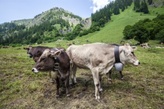
Cattle on the hiking trail in Dietersbachtal betwe...
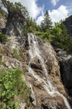
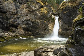
BRK25M98_426
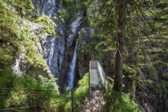
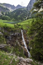
Dietersbach waterfall with viewing platform, Höllt...
BRK25M98_427
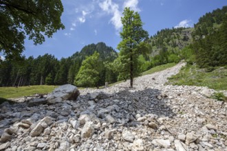
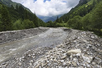
Landslide, Dietersbachtal, near Gerstruben, Allgä...
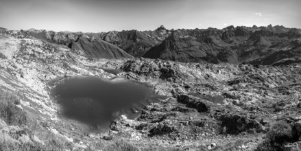
BRK25M98_453
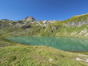
Lower Gaißalpsee, behind Rubihorn, near Oberstdor...
BRK25M98_458
View from the hiking trail from Gaißalpe to Unter...
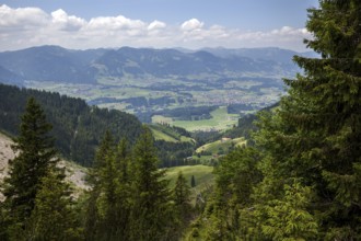
BRK25N00_384
View from the Osterberg Alpe into Kleinwalsertal a...
BRK25M98_425
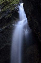
Dietersbach waterfall, Hölltobel, between Gerstrub...
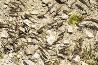
BRK25M98_455
Small fish in Gaißalpsee, near Oberstdorf, Oberal...
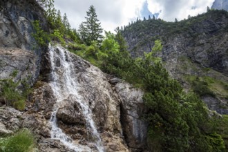
BRK25M98_457
Gaißalpbach waterfall on the hiking trail from th...
BRK25M98_432
Bridge over Dietersbach, Rautweg, near Gerstruben,...
BRK25M98_460
Gaißalpbach waterfall on the hiking trail from th...
BRK25M98_430
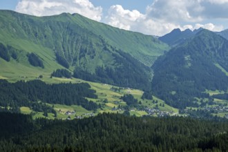
Old farmhouses in the historic mountain farming vi...
BRK25M96_407
Lake Engeratsgundsee, mountain range between Obers...

BRK25M98_433
Dietersbach am Rautweg, near Gerstruben, Dietersba...
BRK25M96_406
Hiker at lake Engeratsgundsee, mountain range betw...
BRK25M98_431
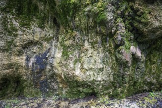
Mineral deposits and moss on a rock at the Dieters...
BRK25M99_476
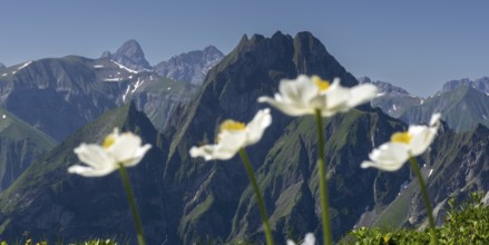
Mountain panorama with wood anemone (Anemone nemor...
BRK25M98_452
Signpost to the Gaißalpe on the hiking trail from...
BRK25M99_478
Mountain panorama from the Koblat-Höhenweg on the ...
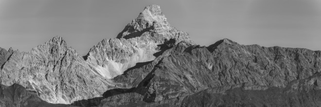
BRK25M99_473
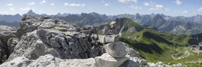
Panorama from the Rubihorn, 1957m, into the Illert...
BRK25M98_429
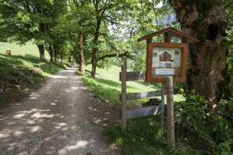
Path with tree-lined avenue and signpost to the Di...
BRK25M98_274
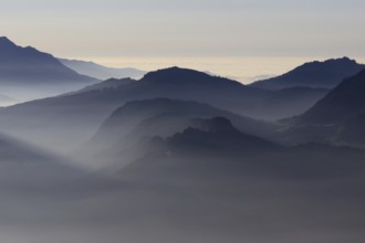
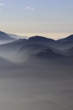
Mountain silhouettes... Alpine peaks and mountain ...
BRK25M98_269
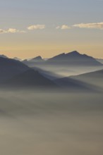
Grazing light in the mountains... Alpine panorama,...
BRK25M98_273
Mountain silhouettes... Alpine peaks and mountain ...
BRK25M99_475
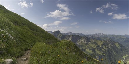
Mountain panorama from Laufbacher-Eckweg to Höfats...
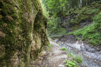
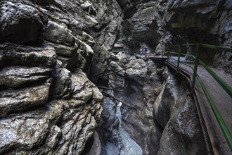
BRK25M97_405
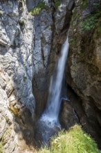
Waterfall in the Breitachklamm, a deep gorge in th...
BRK25M26_184
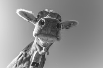
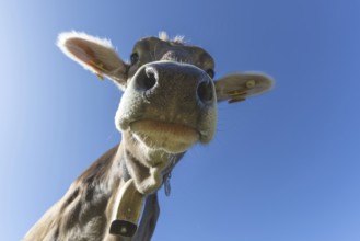
Curious Allgäu Brown Swiss, (Bos primigenius taur...
BRK25M33_227
Mountain panorama from the Koblat-Höhenweg on the...
BRK25M38_188
Mountain panorama in autumn, Eissee, Oytal, behind...
BRK25M30_392
Mountain panorama from the Koblat-Höhenweg on the...
BRK25M33_224
Mountain panorama over Laufbichlsee, behind it the...
BRK25M30_389
Mountain panorama over Laufbichlsee, behind it the...
BRK25M28_149
Mountain panorama with summit cross from Großer D...
BRK25M33_226
Mountain panorama from the Koblat-Höhenweg on the...
BRK25M28_148
Mountain panorama over Laufbichlsee, behind it the...
BRK25M35_180
Mountain panorama over Laufbichlsee, behind it the...
BRK25M30_390
Mountain panorama with summit cross from Großer D...
BRK25M35_181
Mountain panorama from the Koblat-Höhenweg on the...
BRK25M35_199
Mountain panorama in autumn, Eissee, Oytal, behind...
BRK25M26_186
Mountain panorama over Laufbichlsee, behind it the...
BRK25M34_278
Mountain panorama from the Koblat-Höhenweg on the...
BRK25M35_164
Curious Allgäu brown cattle, (Bos primigenius tau...
BRK24E68_185
Kalkofenweg, snow-covered Allgäu Alps in the back...
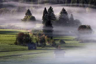
BRK24E68_019
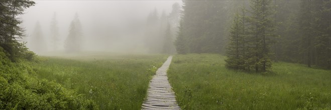
Morning atmosphere, fog between the trees, near Ob...

BRK24E85_178
View of Seealpsee, Seeköpfel and Allgäu Alps, Neb...
BRK24E84_484
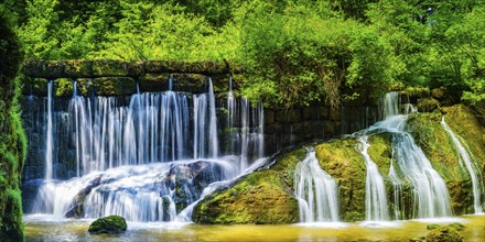
The lower part of the Buchenegg waterfalls, surrou...
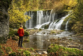
BRK24E84_131
The Geratser waterfall in autumn. A hiker stands o...
BRK24E67_120
Morning atmosphere, fog near Oberstdorf, OberallgÃ...
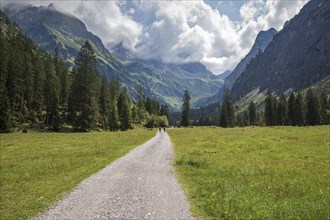
BRK24E68_107
Hiker in the Oytal, near Oberstdorf, Allgäu Alps,...
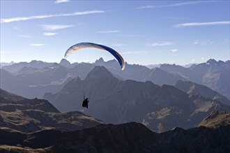
BRK24E69_003
Paragliders on the Nebelhorn, behind mountains of ...
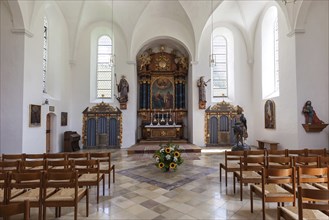
BRK24E58_452
Chancel of St Maria Loretto Chapel, Oberstdorf, Ob...

BRK24E66_392
Old farmhouse and chapel in the historic mountain ...

BRK24E68_253
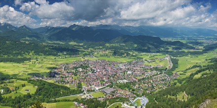
View of Oberstdorf and the Allgäu Alps from the A...
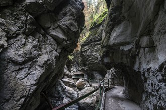
BRK24E62_072
River Breitach and Breitachklamm gorge near Oberst...
BRK24E67_033
River Breitach and Breitachklamm gorge near Oberst...
BRK24E84_048
Jubilee trail in the mountain landscape of the All...
BRK24E66_236
Hirschbergkreuz, Kleiner Hirschberg, view of Bad O...
BRK24E73_126
Winter hiking trail at the Hofmannsruh viewpoint a...
BRK24E78_390
Laufbacher Eck-Weg, a panoramic high-altitude trai...
BRK24E74_489
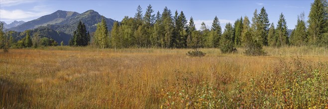
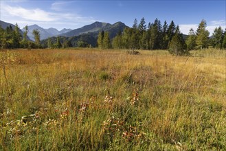
Moor in autumn, moor pond near Oberstdorf, behind ...
BRK24E85_097
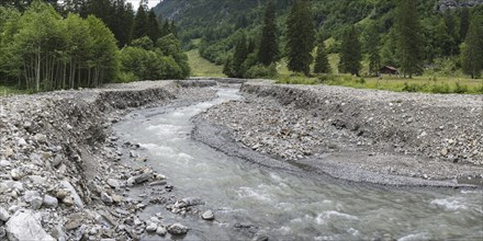
Illegal stream straightening in a nature reserve, ...

BRK24E67_037
Christlessee, a mountain lake in the Trettachtal v...

BRK24E81_490
Loretto meadows near Oberstdorf, behind Oberstdorf...
BRK24E71_344
Geratser waterfall, near Rettenberg, Allgäu, Bava...
BRK24E79_210
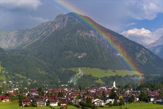
View over Oberstdorf with rainbow, behind it the S...
BRK24E70_499
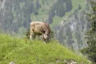
Allgäu Brown Swiss cattle (Bos primigenius taurus...
BRK24E67_255
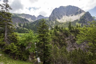
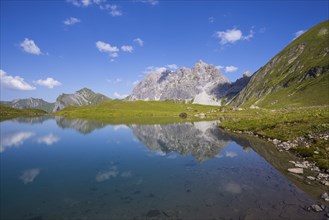
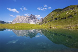
Eissee, Oytal, behind it Großer Wilder, 2379m, Ho...
BRK24E76_221
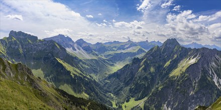
Mountain panorama from Laufbacher-Eckweg to Schnec...
BRK24E77_048
Moor in autumn, moor pond near Oberstdorf, behind ...
BRK24E76_356
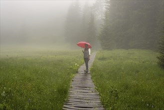
Woman 60-65 with umbrella in the Hühnermoos on a c...
BRK24E76_399
Laufbacher Eck-Weg, a panoramic high-altitude trai...

BRK24E82_084
Rossgundkopf, 2140m, Alpgundkopf, 2176m, and Gries...
BRK24E66_381
Eissee, Oytal, behind it Großer Wilder, 2379m, Ho...
BRK24E73_109
Hühnermoos on a cloudy day with fog, a high moor a...
BRK24E75_120
Panorama from Schattenberg, 1692m, on Oberstdorf, ...
BRK24E67_052
Illegal stream straightening in a nature reserve, ...
BRK24E69_468
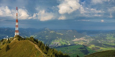
Bavarian Broadcasting Tower on the Grünten, 1738m,...
BRK24E81_350
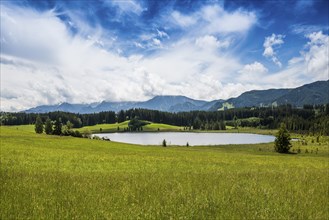
Attlesee, near Nesselwang, Oberallgäu, Allgäu, S...
BRK24E81_217
Dietersbach Alpe, Gerstruben, Dietersbachtal, near...
- Page
-
- of
- 2