1469 results for: mulheim an der ruhr
- Page
-
- of
- 15
Please sign in for more results
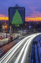
BRK26C84_066
Fibre optic connection, empty conduits protrude fr...
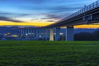
BRK26C75_483
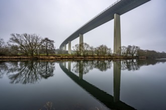
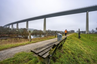
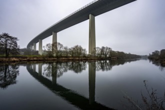
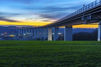
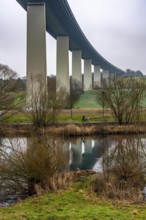
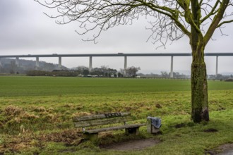
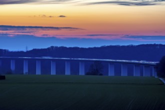
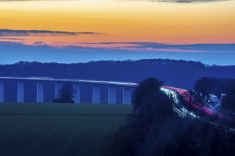
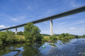
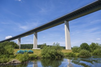
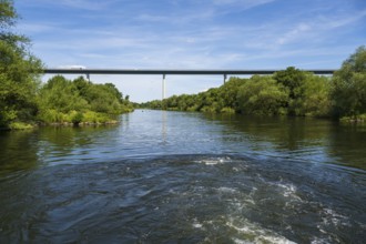
The Mintarder Ruhr Valley Bridge, A52 motorway bri...
BRK26C68_373
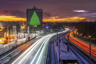
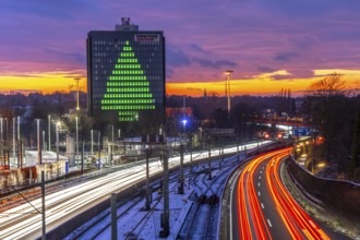
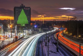
Autobahn A40, Ruhrschnellweg, between Essen and Mü...
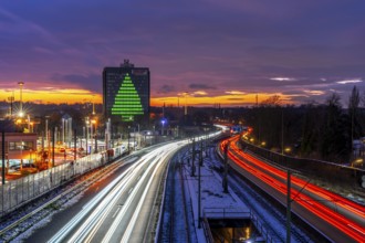
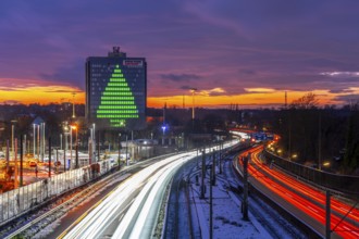
BRK26C91_098
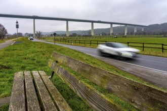
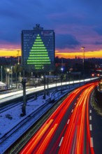
The Hardenberg bridge, A40 motorway in Mülheim an ...
BRK26C73_193
The Mintarder Ruhr Valley Bridge, A52 motorway bri...
BRK26C38_136
The Mintarder Ruhr Valley Bridge, A52 motorway bri...
BRK26C38_133
The Mintarder Ruhr Valley Bridge, A52 motorway bri...
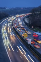
BRK26C45_375
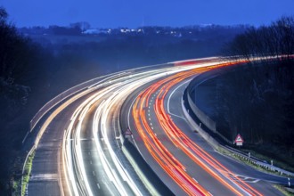
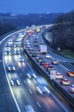
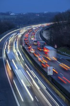
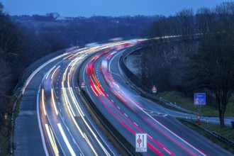
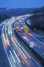
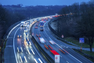
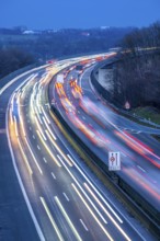
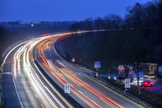
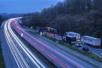
Evening traffic on the A52 motorway, between Düsse...
BRK26C38_134
The Mintarder Ruhr Valley Bridge, A52 motorway bri...
BRK26C45_376
Evening traffic on the A52 motorway, between Düsse...
BRK26C44_231
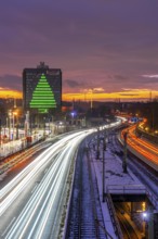
Autobahn A40, Ruhrschnellweg, between Essen and Mü...
BRK26B98_174
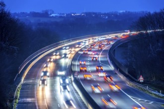
Evening traffic on the A52 motorway, between Düsse...
BRK26B97_495
The Ruhr Valley Bridge, motorway bridge of the A52...
BRK26B98_172
Evening traffic on the A52 motorway, between Düsse...
BRK26B82_469
The Mintarder Ruhr Valley Bridge, A52 motorway bri...
BRK26B82_467
The Mintarder Ruhr Valley Bridge, A52 motorway bri...
BRK26B82_468
The Mintarder Ruhr Valley Bridge, A52 motorway bri...
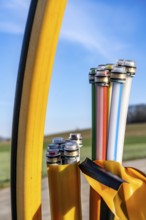
BRK26B82_092
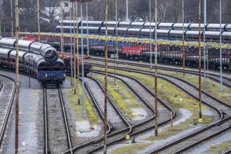
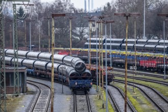
Wagons with pipes, including for gas pipelines, at...
BRK26B14_293
The Mintarder Ruhr Valley Bridge, A52 motorway bri...
BRK26B14_295
The Mintarder Ruhr Valley Bridge, A52 motorway bri...
BRK26B14_294
The Mintarder Ruhr Valley Bridge, A52 motorway bri...
BRK26B34_093
Evening traffic on the A52 motorway, between Düsse...
BRK26B34_091
Evening traffic on the A52 motorway, between Düsse...
BRK26B30_297
Autobahn A40, Ruhrschnellweg, between Essen and Mü...
BRK26B30_298
Autobahn A40, Ruhrschnellweg, between Essen and Mü...
BRK26B33_160
The Ruhr Valley Bridge, motorway bridge of the A52...
BRK26B13_269
Wagons with pipes, including for gas pipelines, at...
BRK26A83_147
Evening traffic on the A52 motorway, between Düsse...
BRK26A81_431
The Ruhr Valley Bridge, motorway bridge of the A52...
BRK26A83_149
Evening traffic on the A52 motorway, between Düsse...
BRK26A90_188
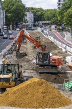
Renovation of the Dickswall street in the centre o...
BRK26A76_422
Autobahn A40, Ruhrschnellweg, between Essen and Mü...
BRK26A76_421
Autobahn A40, Ruhrschnellweg, between Essen and Mü...
BRK26A19_402
The Ruhr Valley Bridge, motorway bridge of the A52...
BRK26A20_492
Evening traffic on the A52 motorway, between Düsse...
BRK26A06_261
Autobahn A40, Ruhrschnellweg, between Essen and Mü...
BRK26A06_262
Autobahn A40, Ruhrschnellweg, between Essen and Mü...
BRK26A20_491
Evening traffic on the A52 motorway, between Düsse...
BRK26A07_157
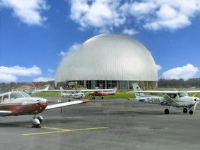
View of flight apron of Essen Mülheim airport with...

BRK25M14_190
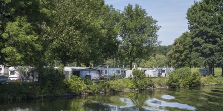
Caravan on the banks of the Ruhr, campsite, Mülhei...

BRK25M65_028
Evening traffic on the A52 motorway, between Düsse...
BRK25M65_031
Evening traffic on the A52 motorway, between Düsse...

BRK25M65_029
Evening traffic on the A52 motorway, between Düsse...
BRK25M40_409
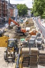
Renovation of the Dickswall street in the centre o...

BRK25M40_410
Renovation of the Dickswall street in the centre o...
BRK25M14_188
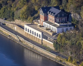
Water station, Mülheim an der Ruhr, Rur region, No...

BRK25M14_189
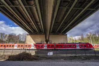
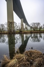
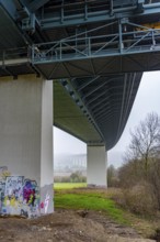
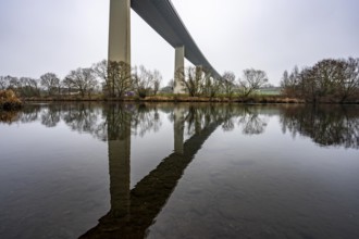
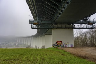
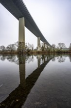
Motorway bridge A 52 over the Ruhr, from below, Mü...

BRK25M81_036
Motorway bridge A 52 over the Ruhr, from below, Mü...
BRK25M81_022
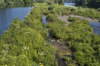
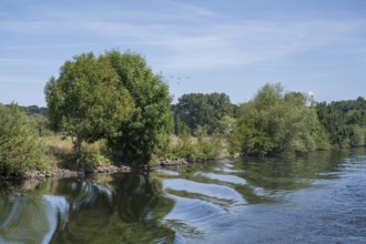
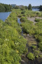
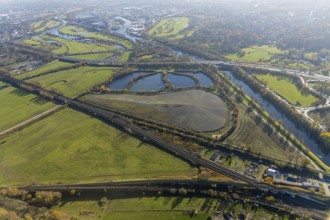
Saarn-Mendener Ruhraue, nature reserve, Mülheim an...

BRK25M81_023
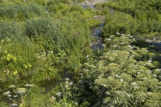
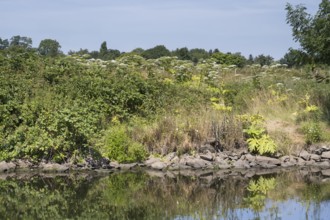
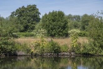
Nature on the banks of the Ruhr, giant hogweed (He...
BRK25M09_351
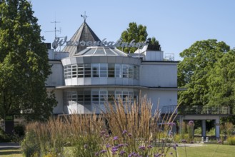
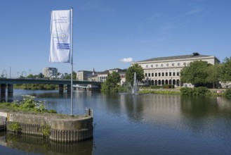
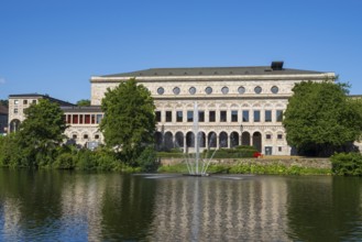
Civic hall an der Ruhr, Mülheim an der Ruhr, Rurge...
BRK25M14_172
Saarn-Mendener Ruhraue, nature reserve, Mülheim an...
BRK25M14_171
Nature on the banks of the Ruhr, giant hogweed (He...
BRK25L75_140
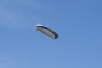
Zeppelin NT, airship in the sky, Mülheim an der Ru...
BRK25L75_134
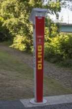
Emergency call pillar, SOS, DLRG, Mülheim an der R...
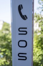
BRK25L75_135
Emergency call pillar, SOS, DLRG, detail, Mülheim ...
BRK25L75_148
Civic hall an der Ruhr, Mülheim an der Ruhr, Rurge...
BRK25L46_279
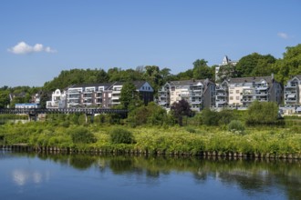
Residential building on the banks of the Ruhr, Saa...

BRK25L46_277
Water station, Mülheim an der Ruhr, Rur region, No...
BRK25L46_278
Building on the banks of the Ruhr, Saarn-Mendener ...
BRK25L46_285
Caravan on the banks of the Ruhr, campsite, Mülhei...
BRK25L46_276
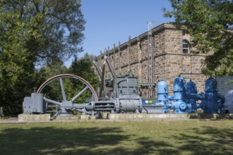
Compound steam engine in front of the RWW Kahlenbe...
BRK25L46_284
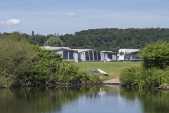
Caravan with awning on the banks of the Ruhr, camp...
BRK25L46_280
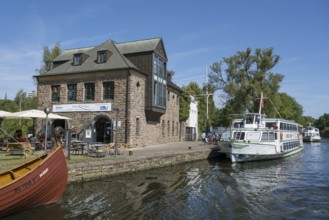
Haus Ruhrnatur, ships on the Ruhr, water station, ...
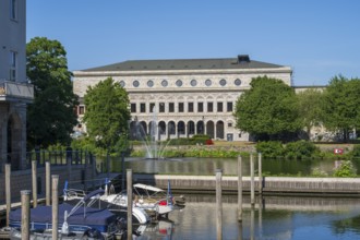
BRK25L27_249
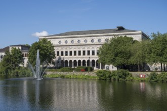
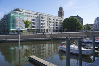
Town hall and town harbour, Mülheim an der Ruhr, R...
BRK25L46_244
Nature on the banks of the Ruhr, giant hogweed (He...
BRK25L46_245
Saarn-Mendener Ruhraue, nature reserve, Mülheim an...
BRK25L46_247
Nature on the banks of the Ruhr, Mülheim an der Ru...
BRK25L46_283
Motorway bridge A 52 over the Ruhr, from below, ka...
BRK25L27_247
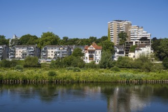
Modern residential and commercial building at the ...
BRK25L27_250
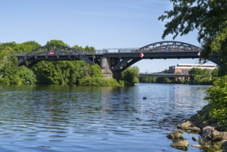
Cycle highway and pedestrian bridge over the Ruhr,...
BRK25L46_246
Saarn-Mendener Ruhraue, nature reserve, Mülheim an...
BRK25L27_246
Modern residential and commercial building at the ...
BRK25L46_282
Motorway bridge A 52 over the Ruhr, from below, Ni...
BRK25L27_245
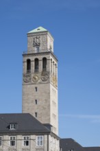
Town hall tower, town hall, Mülheim an der Ruhr, R...

BRK25L27_244
Town hall and town harbour, Mülheim an der Ruhr, R...
BRK25L27_248
Civic hall an der Ruhr, Mülheim an der Ruhr, Rurge...
BRK25L46_281
Motorway bridge A 52 over the Ruhr, from below, Mü...
BRK25K30_159
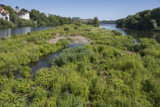
Aerial view, Styrumer Ruhrbogen, Ruhrwiesen, landf...
BRK25K30_209
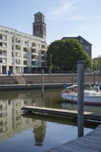
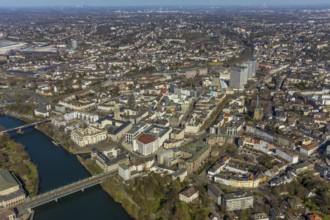
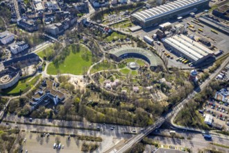
Aerial view, Ruhrbania in the city centre of Mülhe...
BRK25K30_213
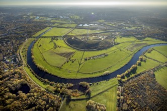
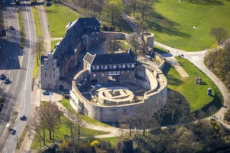
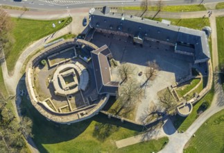
Aerial photo, Broich Castle, left, Ruhr, perpendic...
BRK25K30_218
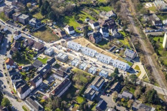
Aerial view, new development area Friedhofstrasse,...
BRK25K30_227
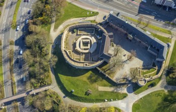
Aerial view, Park at Broich Castle, Alter Ringloks...
BRK25K32_129
Aerial view, city centre, construction site Düssel...
BRK25K32_132
Aerial view, residential arch Bremer Straße, Saarn...
BRK25K36_332
Aerial photo, Broich Castle, Linksruhr, Mülheim an...
BRK25K36_351
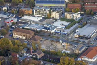
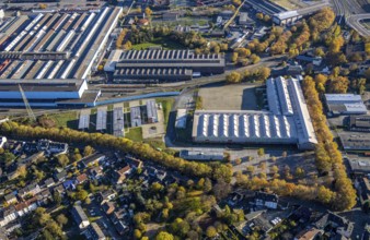
Aerial view, new office building ALDI SÜD, head of...
BRK25K36_363
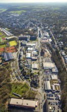
Aerial photography, HSPV North Rhine-Westphalia, N...
BRK25K36_367
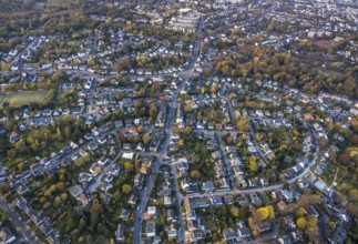
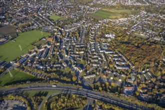
Aerial view, residential area Dümpten, motorway A4...
BRK25K36_385
Aerial view, reaparaturation of the railway bridge...
BRK25K36_416
Aerial view, residential building, former youth ho...

BRK25K36_432
Aerial view, Haus Ruhrgarten, Mendener Straße, riv...
BRK25K30_185
Aerial view, sewage sludge landfill at Styrumer Ru...
BRK25K30_199
Aerial photo, Broich Castle, left, Ruhr, perpendic...
BRK25K30_216
Aerial view, new development area Friedhofstrasse,...
BRK25K30_219
Aerial photo, Tengelmann Areal, Tengelmann head of...
BRK25K30_226
Aerial view, Park at Broich Castle, Alter Ringloks...
BRK25K32_123
Aerial view, residential area, Saarn, Mülheim an d...
BRK25K32_142
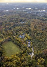
Aerial view, Landhaus Thyssen in the forest area, ...
BRK25K32_155
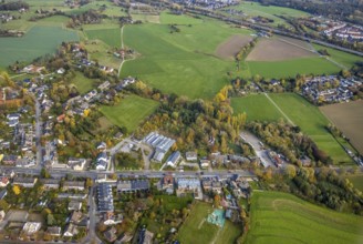
Aerial view, construction area Christof Rumbaum Ga...
- Page
-
- of
- 15