2423 results for: meanders
- Page
-
- of
- 25
Please sign in for more results
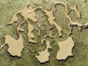
BRK26C62_006
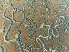
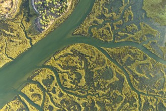
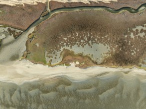
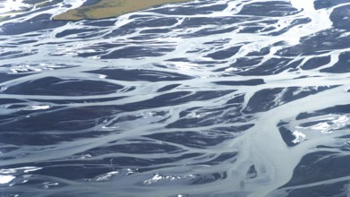
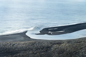
Network of channels and streams at low tide. In th...
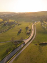
BRK26C79_179
Winding country road through green fields and tree...
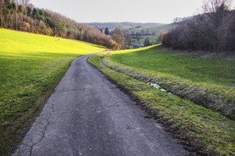
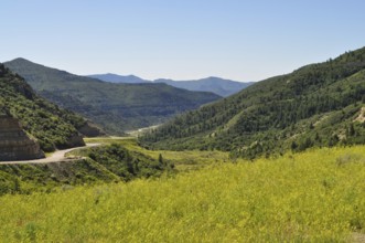
BRK26C99_041
A winding path through a green landscape with hill...
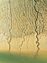
BRK26C58_265
Network of channels and streams at low tide. In th...
BRK26C79_267
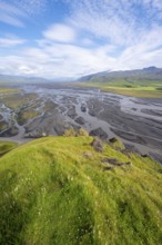
View from a hill, view over alluvial land, meander...
BRK26C63_156
Network of channels and streams at low tide. In th...
BRK26C79_116
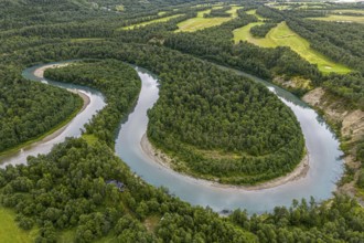
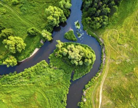
Aerial view of a river meandering through a forest...
BRK26C63_368
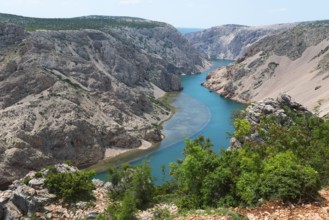
The river meanders through a stony gorge with turq...
BRK26C58_199
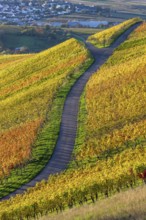
A winding path through colourful vineyards in an a...
BRK26C66_455
Pilke stream in the Upper Pilke Valley near Schirg...
BRK26C94_472
A road with a bend winds its way through impressiv...
BRK26C71_085
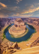
Sunset on Horseshoe Bend and the Colorado River in...
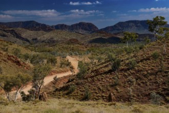
BRK26C69_373
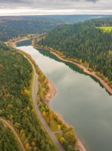
A serene mountain valley landscape with a winding ...
BRK26C77_476
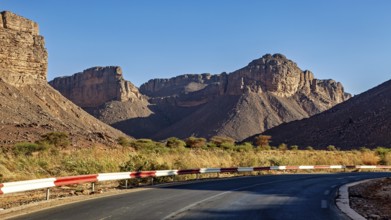
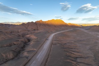
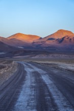
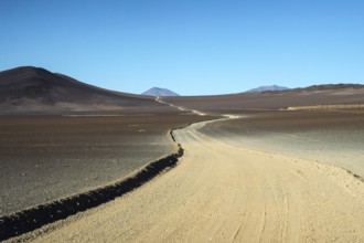
Aerial view of a vehicle in a empty desert road wi...
BRK26C85_020
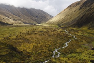
A meandering stream flows through a vast Andean va...
BRK26D00_009
Captivating aerial photograph showcasing the sinuo...
BRK26C95_172
A serene evening view of a winding road meandering...
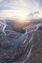
BRK26D00_354
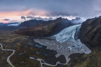
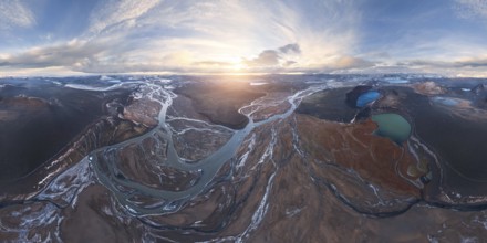
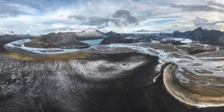
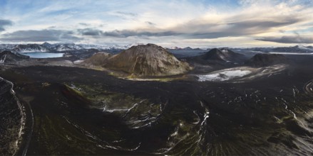
Stunning aerial shot capturing the expansive Vatna...
BRK26D01_440
Aerial view captures the diverse landscape of Cant...
BRK26C71_111
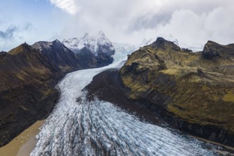
Stunning aerial capture of Vatnajökull Glacier win...
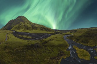
BRK26C71_060
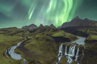
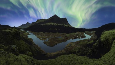
The breathtaking Northern Lights illuminate Icelan...
BRK26C74_147
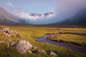
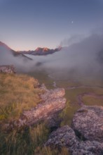
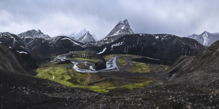
A breathtaking mountain landscape at dawn, with a ...
BRK26C86_133
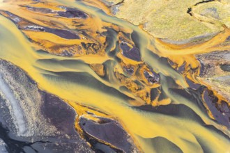
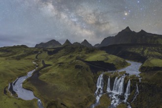
Stunning aerial capture of Iceland's golden rivers...
BRK26C99_258
Page, Arizona - Horseshoe Bend in the Colorado Riv...
BRK26C99_307
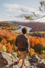
A person stands on a rocky overlook, admiring the ...

BRK26C73_147
A scenic boardwalk winds through a cave, surrounde...
BRK26C95_500
From above, this breathtaking aerial drone image c...
BRK26C58_197
Scenic hiking path winds through lush vegetation, ...
BRK26C56_208
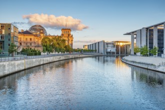
Reichstag, Paul-Löbe-Haus and Marie-Elisabeth-Lüde...
BRK26C73_104
A desolate yet striking view of a dirt road meande...
BRK26C93_476
Beautiful autumn scene in Gorbea Natural Park, Bas...
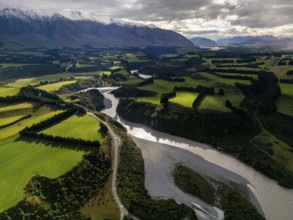
BRK26C69_110
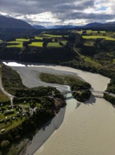
Aerial view of Canterbury region's lush green farm...
BRK26C71_199
Breathtaking aerial view of meandering rivers in I...
BRK26C65_372
Road winds through a mountainous landscape full of...
BRK26C88_405
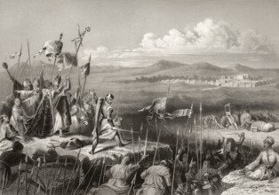
The Battle of Antioch on the Meander, 1211
BRK26C56_036
Spreebogen and Futurium building in Berlin, German...
BRK26C29_376
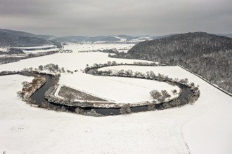
River flows in a loop through snow-covered fields,...
BRK26C17_368
View of a green valley with a winding road surroun...
BRK26C23_008
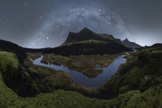
Majestic Northern Lights dance in the sky above a ...
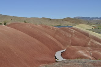
BRK26C10_188
Winding wooden trail through red mounds, John Day ...
BRK26C42_467
View of Purnululu National Park with winding hikin...
BRK26C29_375
Snow-covered fields with a gently rolling river, s...
BRK26C18_012
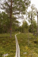
A winding path meanders through a pine forest (pin...

BRK26C14_176
Enigmatic, winding rock formations in Lanzarote, s...
BRK26C07_137
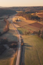
A country road winding through fields and hills in...
BRK26C12_085
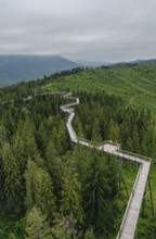
An aerial view of an elevated wooden walkway meand...
BRK26C12_140
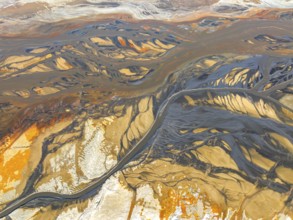
Aerial photograph capturing the intricate waterway...
BRK26C12_471
Panoramic aerial view of the San Juan canyon, show...
BRK26C14_212
A breathtaking aerial view captures the intricate ...
BRK26C15_232
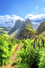
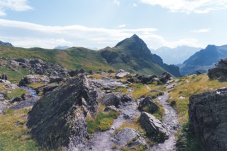
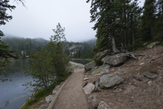
A scenic hiking trail winds through rocky terrain ...
BRK26C21_311
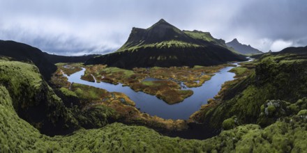
Captivating Icelandic scene with a lush green land...
BRK26C51_109
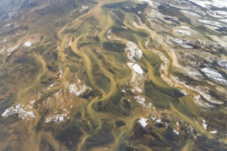
Marshes and streams at low tide in the Walvis Bay ...
BRK26C12_131
Stunning aerial view of a winding river cutting th...
BRK26C20_289
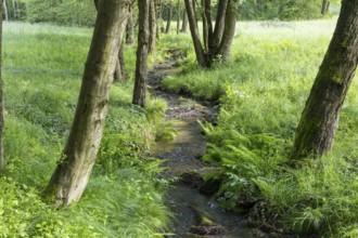
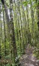
A narrow trail meanders through a dense forest of ...
BRK26C12_487
A stunning aerial view captures a serpentine river...
BRK26C15_490
Aerial view of the serpentine Rio San Juan meander...
BRK26C12_484
Aerial view showcasing a vibrant San Juan canyon w...
BRK26C12_478
An aerial view showcases a river elegantly meander...
BRK26C14_204
Captivating aerial image of the textured and windi...
BRK26C15_262
A stunning aerial photograph displaying the Rio Sa...
BRK26C16_007
Overhead drone shot capturing the expansive and ru...
BRK26C21_349
A striking aerial shot of the Rio San Juan winding...
BRK26C12_481
Aerial view of a vast desert landscape showcasing ...
BRK26C22_490
A stunning aerial view of a glacier cascading betw...
BRK26C12_482
A stunning aerial view captures a meandering river...
BRK26C14_220
A breathtaking aerial view of a desert landscape. ...
BRK26C21_496
A serene path winds along the edge of a tranquil l...
BRK26C15_272
Aerial view of Iceland's rivers showcasing intrica...
BRK26C22_481
A breathtaking aerial view of Iceland's Highlands ...
BRK26C24_219
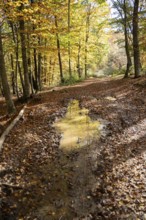
A tranquil pathway dotted with fallen leaves winds...
BRK26C14_223
A captivating aerial shot of the winding Rio San J...
BRK26C15_273
Stunning aerial photograph showcasing the intricat...
BRK26C22_494
A striking view of black volcanic mountains partia...
BRK26C12_476
Captivating aerial view of a river winding through...
BRK26C23_028
Aerial view of a winding Icelandic river meeting t...
BRK26C16_304
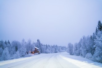
A tranquil winter scene of a snow-laden road windi...
BRK26C22_488
A stunning panoramic view of a moss-covered volcan...
BRK26C10_478
A peaceful wooden path meanders through a dense, l...
BRK26C14_216
Aerial photograph of Rio San Juan meandering throu...
BRK26C22_482
The Northern Lights unfurl in a vibrant dance acro...
BRK26C22_484
Experience the mesmerizing beauty of Iceland's nig...
BRK26C22_485
This stunning panoramic view captures the vast, dr...
BRK26C26_392
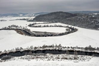
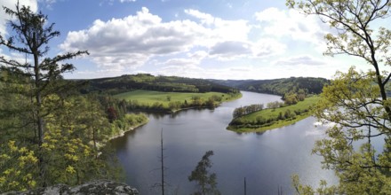
An impressive view of the meandering Saale between...
BRK26C10_481
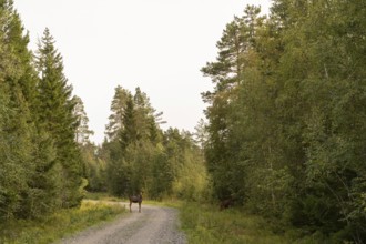
A tranquil scene in a Swedish forest with two moos...
BRK26C15_011
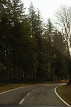
A peaceful road winds through tall evergreen trees...
BRK26C16_306
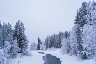
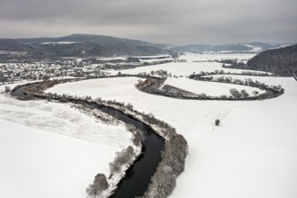
A serene winter scene of a river meandering throug...
BRK26C14_196
Aerial shot displays the meandering Rio San Juan s...
BRK26C23_003
A breathtaking view of a volcanic mountain surroun...
BRK26C04_359
Meander of the Storelva River, east of Tromsø, aer...
BRK26C29_313
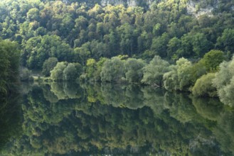
Beautiful green trees reflected in the River Doubs...
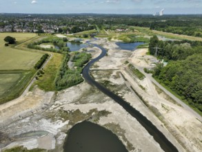
BRK26C49_449
Dortmund, Castrop-Rauxel, North Rhine-Westphalia, ...

BRK26C16_335
This artistic floral illustration features elegant...
BRK26C47_446
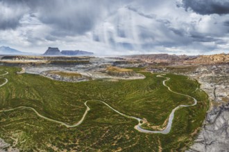
Ecology and environment concept. Green wilderness ...
BRK26C29_370
A quiet river landscape with curved river lines in...
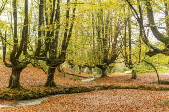
BRK26C48_160
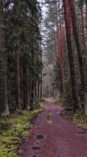
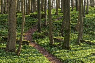
Winding forest path through an idyllic beech fores...
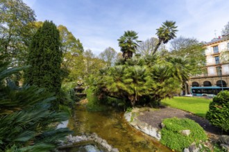
BRK26B94_048
Gipuzkoa square park showcasing lush palm trees an...
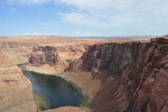
BRK26B66_062
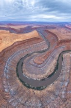
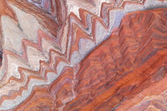
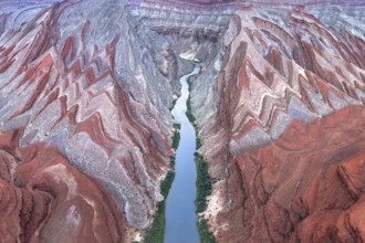
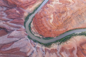
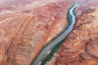
Red rock edges and a flowing river in the middle o...
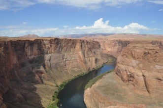
BRK26B66_061
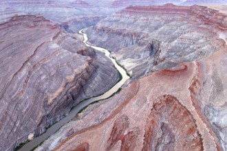
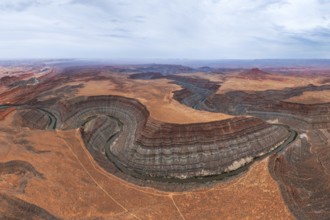
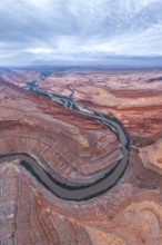
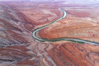
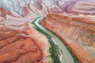
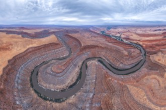
Aerial view of a deep gorge with the Colorado Rive...
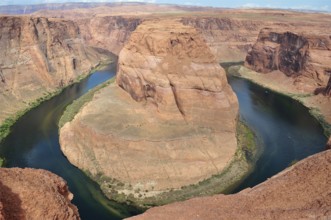
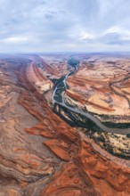
BRK26B66_063
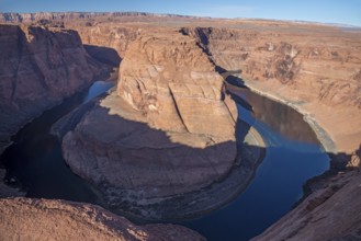
Impressive view of the Colorado River loop from Ho...
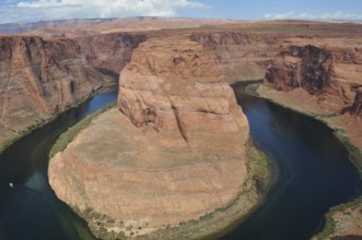
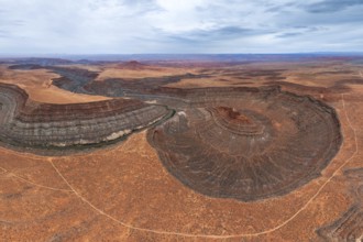
BRK26B66_064
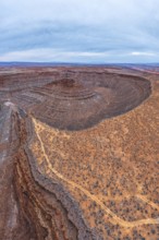
The distinctive rock formation at Horseshoe Bend, ...
- Page
-
- of
- 25