1129 results for: map of germany
- Page
-
- of
- 12
Please sign in for more results
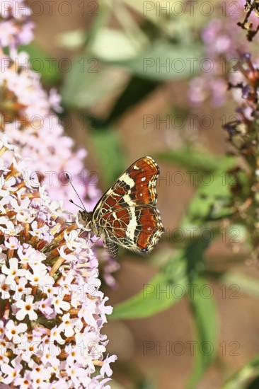
BRK26C57_290
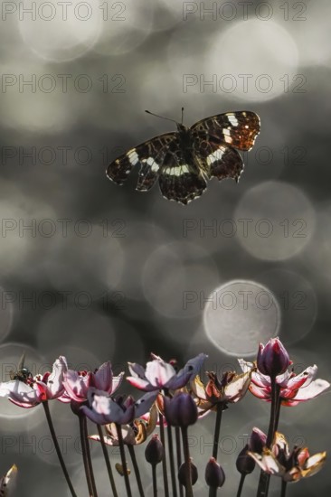
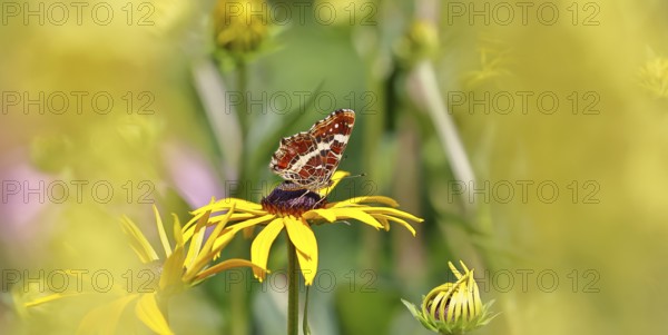
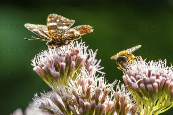
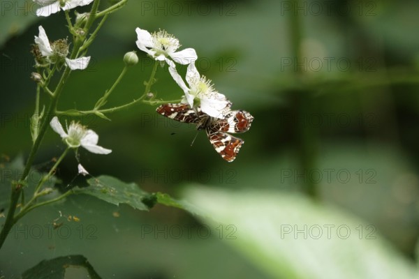
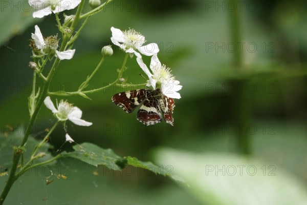
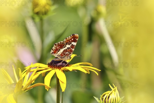
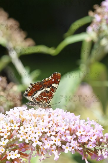
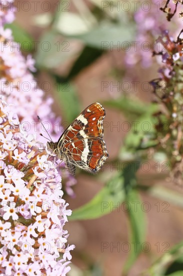
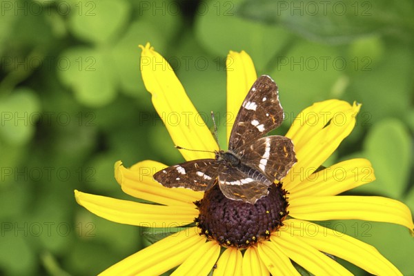
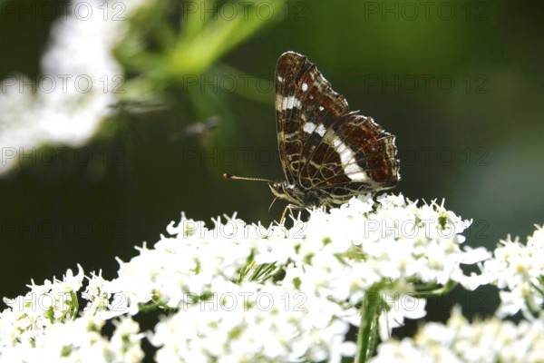
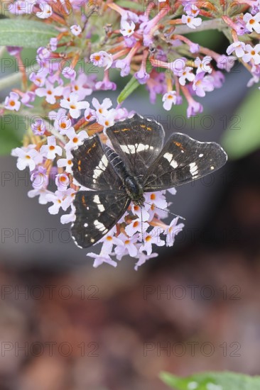
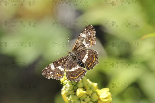
A map butterfly (Araschnia levana) flies over bloo...

BRK26C95_424
3 October, Day of German Unity, Studio
BRK26C85_048
Oberhausen, North Rhine-Westphalia, Germany, Gasom...
BRK26C85_186
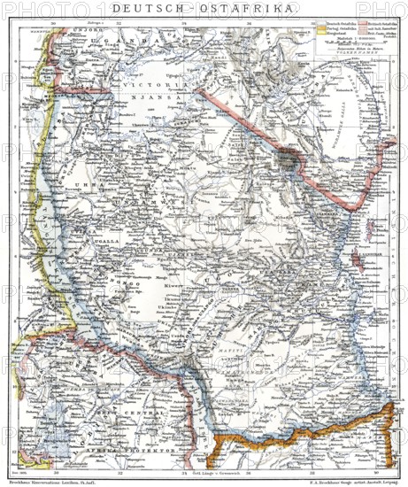
Map of the former German colony of East Africa, 18...
BRK26D00_438
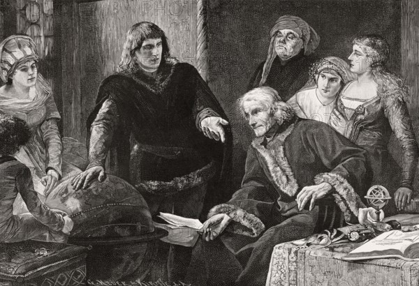
Martin von Behaim, German astronomer, showing his ...
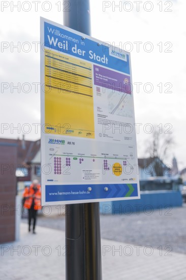
BRK26C33_289
An informative sign on the platform with city and ...
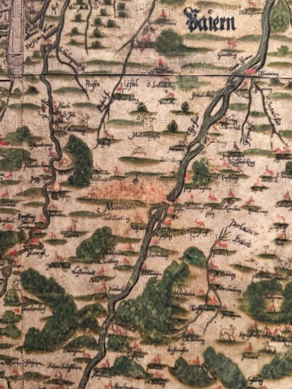
BRK26C34_405
Hand-painted historical map from 1579, Peter Weinh...
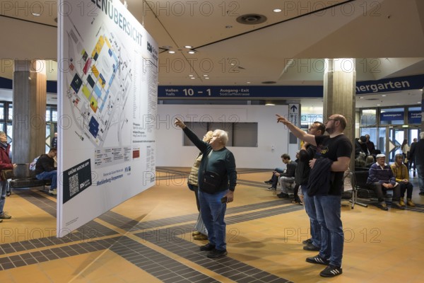
BRK26B91_243
Visitors point to a map of the Green Week at the e...
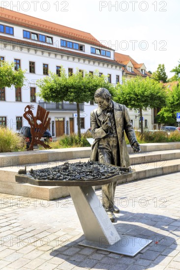
BRK26C32_412
Silver figure explorer traveling by Ekaterina Kova...
BRK26C32_414
Silver figure explorer traveling by Ekaterina Kova...
BRK26C33_303
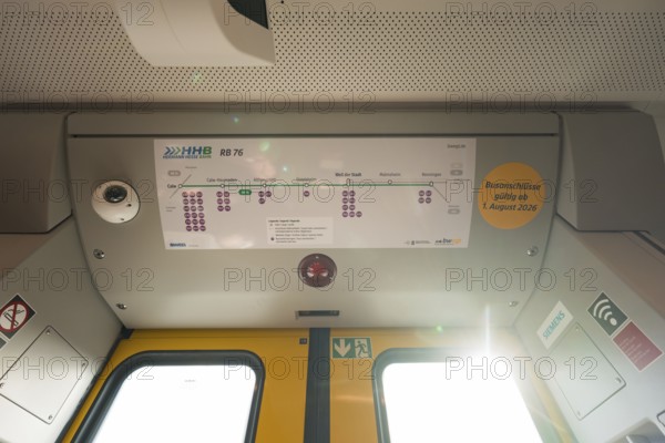
The interior of a train with a route plan and ligh...
BRK26C04_203
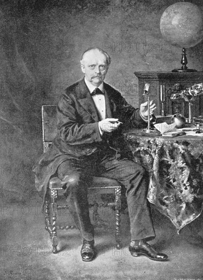
Hermann Ludwig Ferdinand Helmholtz, from 1883 von ...
BRK26C51_099
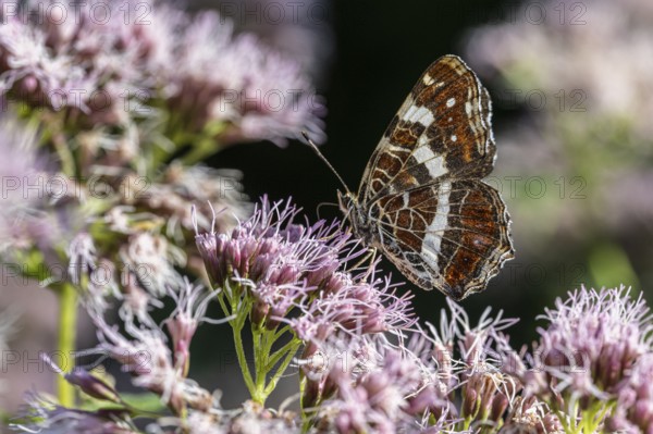
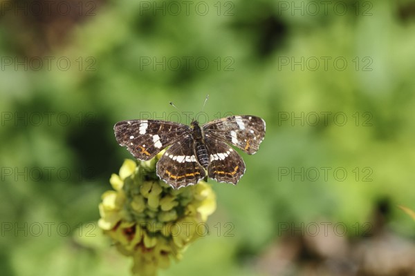
Map Butterfly (Araschnia levana, July, Saxony, Ger...
BRK26B81_394
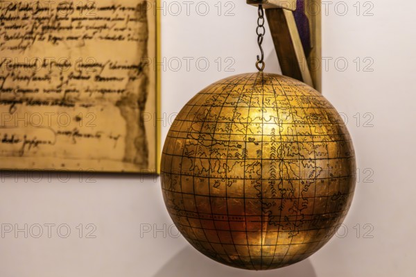
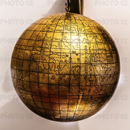
Jagiellonian globe, first globe, with the newly di...
BRK26B77_136
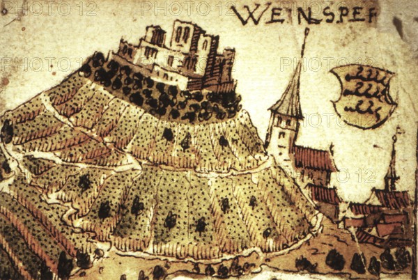
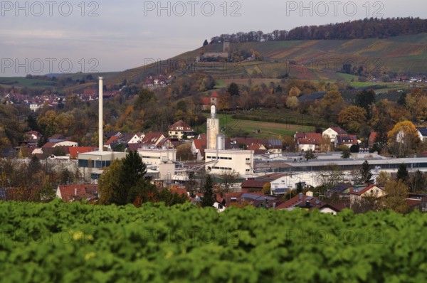
Weinsberg is a town in the district of Heilbronn, ...
BRK26B96_341
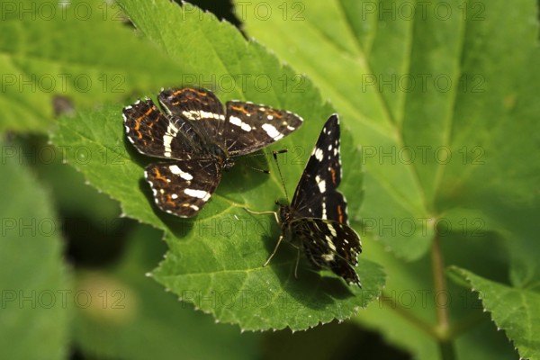
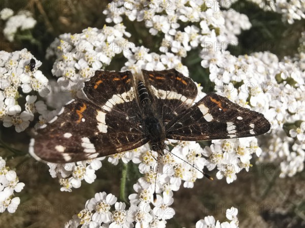
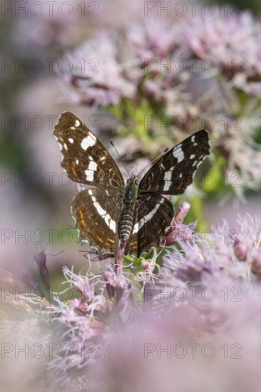
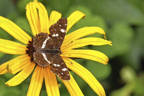
Land carder (Araschnia levana), summer generation,...
BRK26B67_176
Close-up, A land carder (araschnia levana) sits on...
BRK26B12_483
Jagiellonian globe, first globe, with the newly di...
BRK26B19_275
Map Butterfly (Araschnia levana), Ahlhorn, Lower S...
BRK26B19_243
Map Butterfly (Araschnia levana), Ahlhorn, Lower S...
BRK26B19_244
Map Butterfly (Araschnia levana), Ahlhorn, Lower S...
BRK26B42_473
Map Butterfly (Araschnia levana, July, Saxony, Ger...
BRK26B32_050
Land carder (Araschnia levana), summer generation,...
BRK26B25_225
Hatzte, Elsdorf, Lower Saxony, Germany, close-up o...
BRK26B08_160
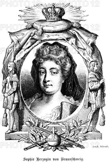
Sophie Dorothea Duchess of Brunswick and Lüneburg ...
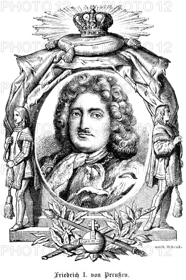
BRK26B08_161
King Frederick I of Prussia (1657-1713) House of H...
BRK26A91_391
Map Butterfly (Araschnia levana, July, Saxony, Ger...
BRK26A84_461
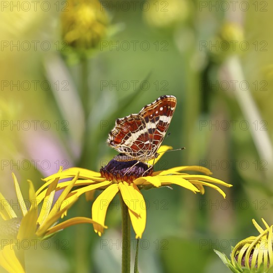
Map (Araschnia levana), summer generation, opened ...
BRK26A79_306
Land carder (Araschnia levana), summer generation,...
BRK26A59_253
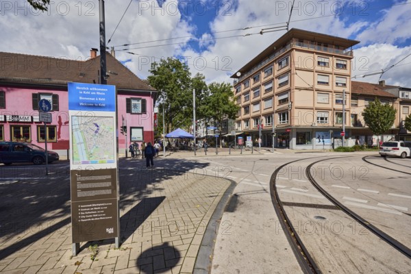
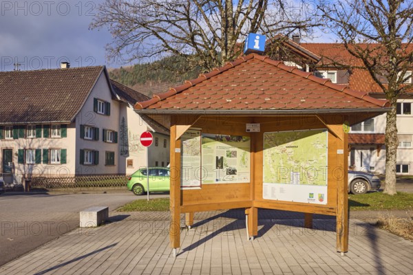
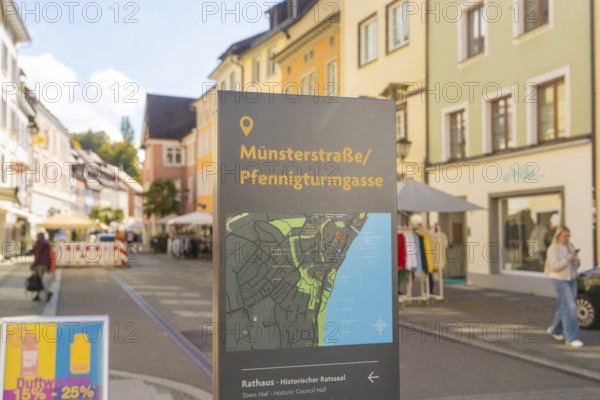
Site plan, public city map, sign for the building,...
BRK26A73_055
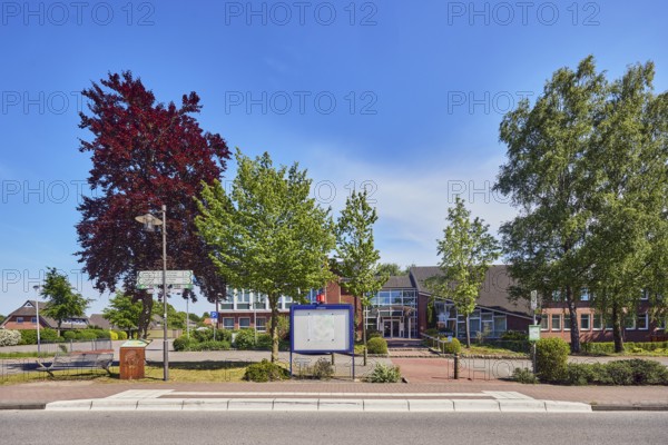
Neuenkirchen Rathaus bus stop, town hall of the mu...
BRK26A73_094
Historical cabinet map depicting Emperor Frederick...
BRK26A83_322
Land carder (Araschnia levana), summer generation,...
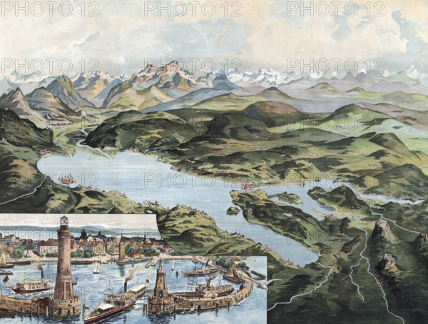
BRK26A07_337
Lake Constance with Lindau and Alpine Range, Swabi...
BRK26A30_483
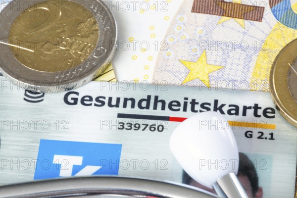
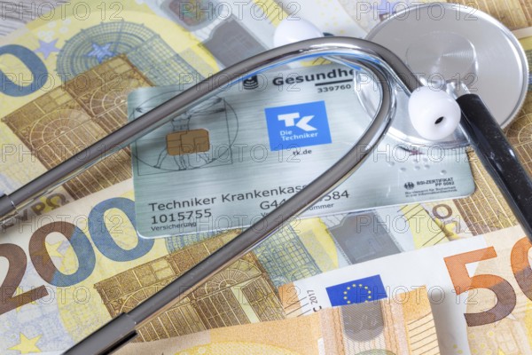
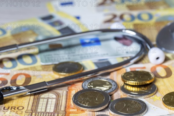
Health insurance contributions Symbolic image: hea...
BRK26A21_147
Land carder (Araschnia levana), summer generation,...
BRK26A11_045
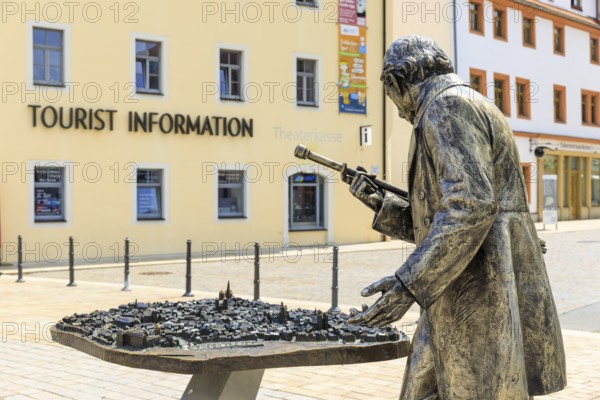
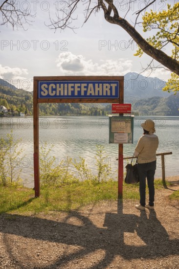
Information pavilion, information, tourism, site p...
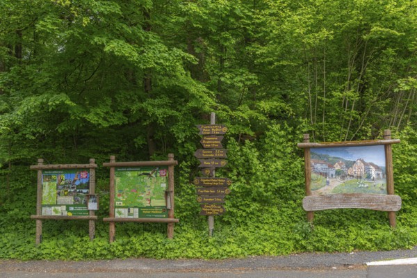
BRK26A50_007
Signposts with directions for hiking trails and pr...
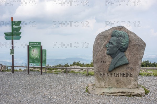
BRK26A51_429
Heinrich Heine memorial, Heine memorial on the sum...
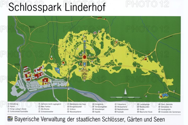
BRK25M44_457
Map of Linderhof Palace Park, UNESCO World Heritag...
BRK25M35_011
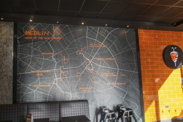
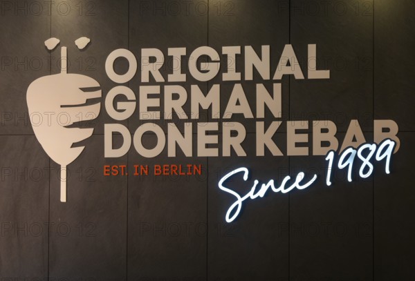
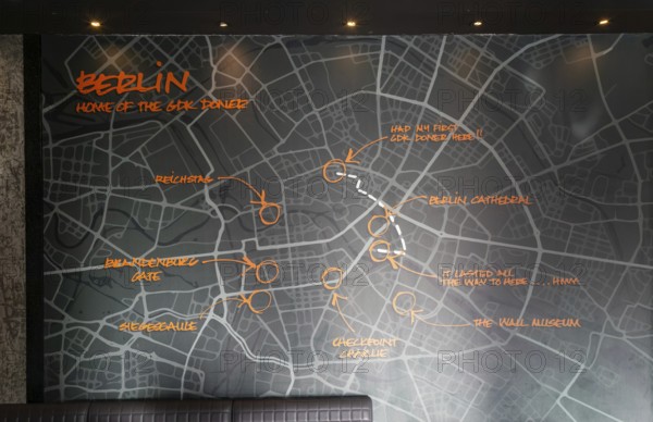
Map of Berlin inside GDK German Doner Kebab takeaw...
BRK25M15_118
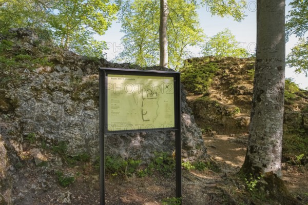
Ruin Alter Lichtenstein near Lichtenstein Castle, ...
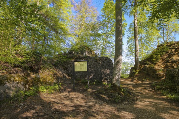
BRK25M66_194
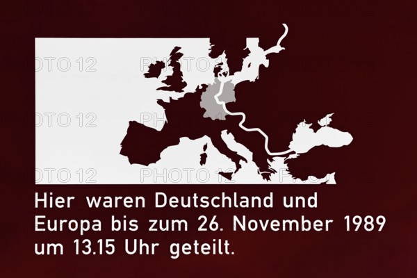
Sign to commemorate the division of Germany, forme...
BRK25M35_007
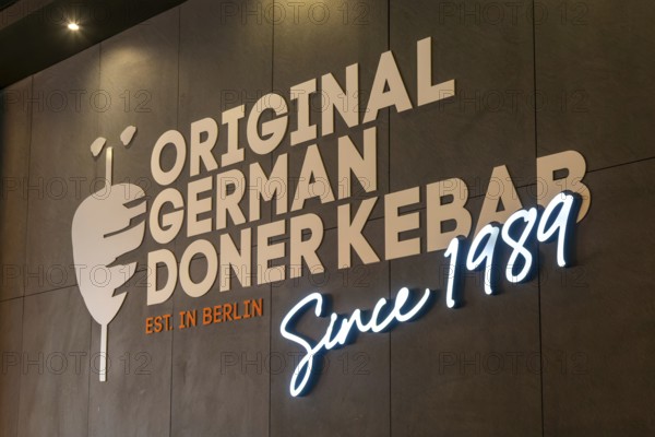
Inside GDK German Doner Kebab takeaway restaurant,...
BRK25M47_103
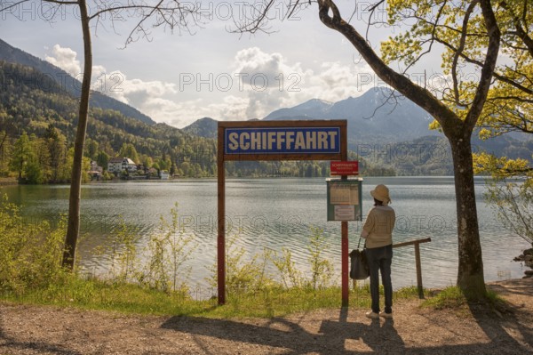
Lake Kochel, tourist reads the navigation map, Koc...
BRK25M47_106
Lake Kochel, tourist reads the navigation map, Koc...
BRK25M83_420
Health insurance contributions Symbolic image: hea...
BRK25M10_190
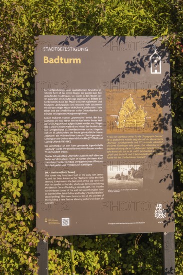
Information board about the Badturm with historica...
BRK25M32_493
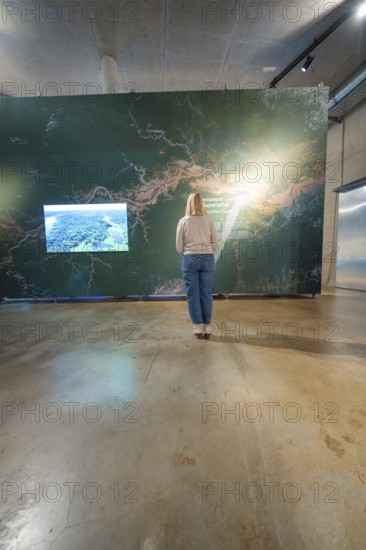
Woman looking at a wall map in a modern exhibition...
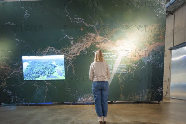
BRK25M32_492
Woman looking at a large wall map in a museum exhi...
BRK25M80_137
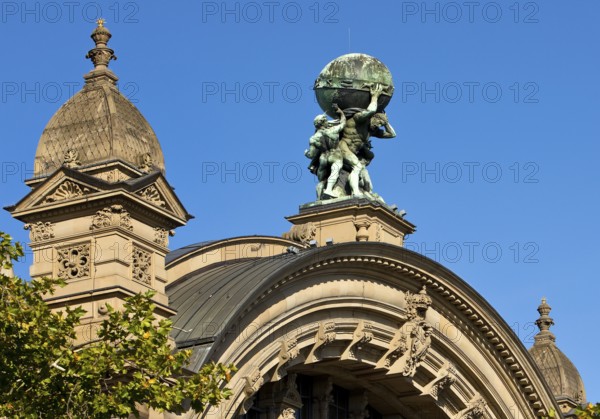
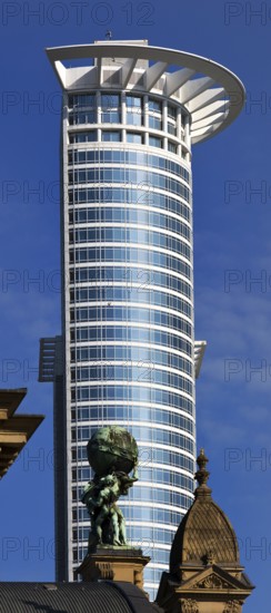
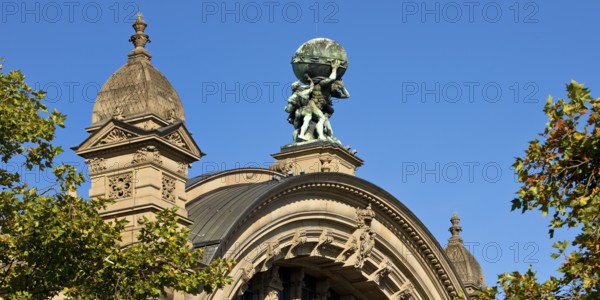
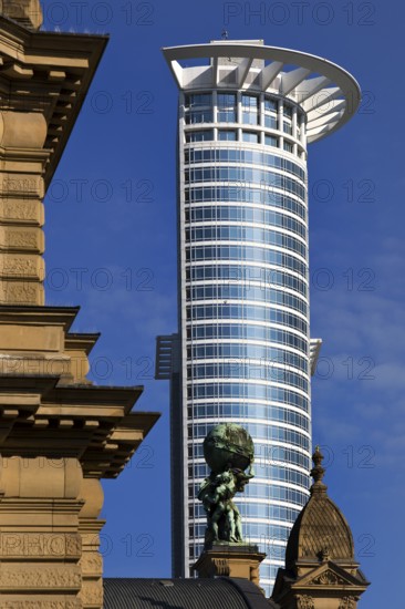
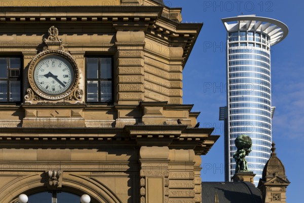
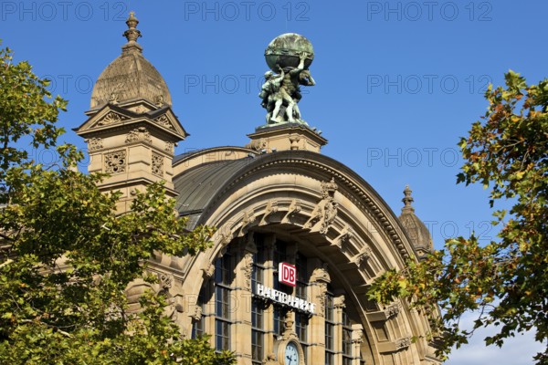
Main front of the main railway station with Atlas ...

BRK25M89_404
Map Butterfly (Araschnia levana, July, Saxony, Ger...
BRK25M61_099
Land carder (Araschnia levana), summer generation,...
BRK25M32_065
Map (Araschnia levana), summer generation, opened ...
BRK25M20_217
Land carder (Araschnia levana), summer generation,...
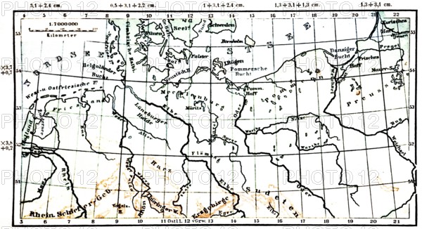
BRK25M48_034
North German Plain, historical geographical map, t...
BRK25M22_399
Land carder (Araschnia levana), summer generation,...
BRK25M44_030
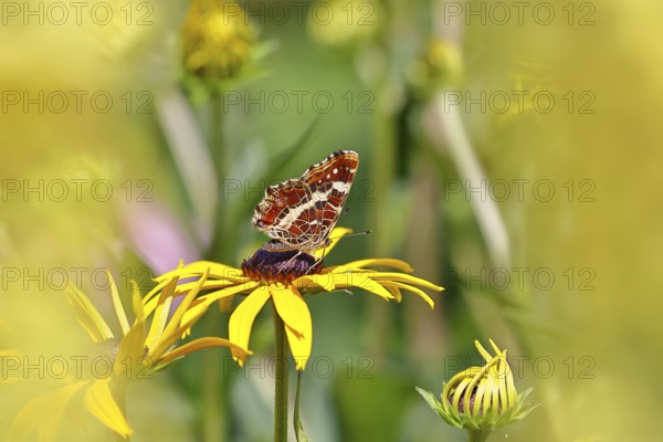
A Map Butterfly (Araschnia levana), summer form si...
BRK25L52_406
Inside GDK German Doner Kebab takeaway restaurant,...
BRK25L52_405
Map of Berlin inside GDK German Doner Kebab takeaw...
BRK25L86_281
Ruin Alter Lichtenstein near Lichtenstein Castle, ...
BRK25L92_407
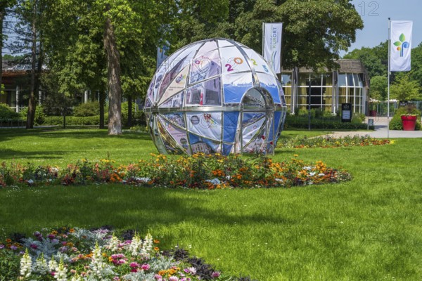
Park in front of the entrance to the garden show, ...
BRK25L93_233
Health insurance contributions Symbolic image: hea...
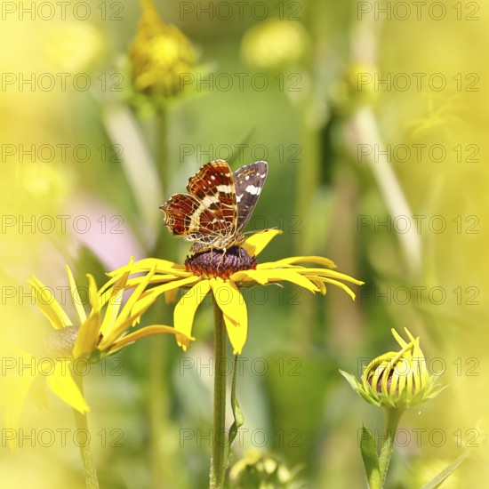
BRK25L74_111
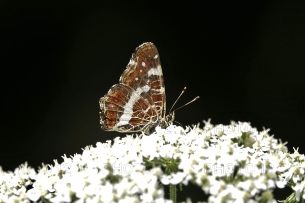
Butterfly Map Butterfly, Summer, Germany
BRK25L82_374
Central station with Atlas carrying the globe on h...
BRK25L82_327
Main front of the main railway station with Atlas ...
BRK25L82_330
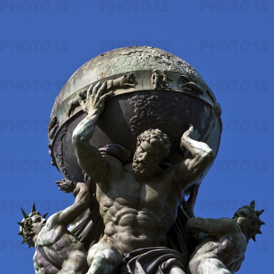
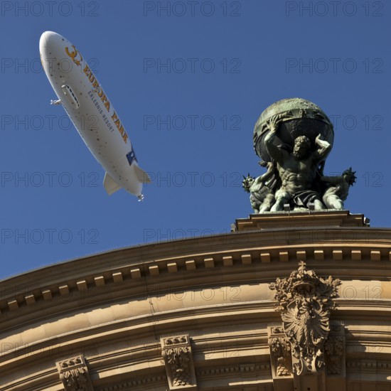
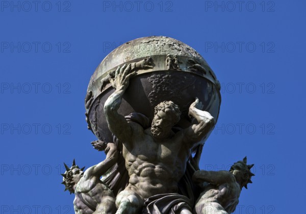
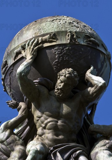
Atlas, carrying the globe, supported by steam and ...
BRK25L82_375
Side front of the main railway station with Atlas ...
BRK25L82_373
Side front of the main railway station with Atlas ...
BRK25L87_291
Land carder (Araschnia levana), summer generation,...
BRK25L89_135
Land carder (Araschnia levana), summer generation,...
BRK25L26_432
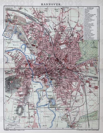
Hanover, historical city map from 1907
BRK25L26_429
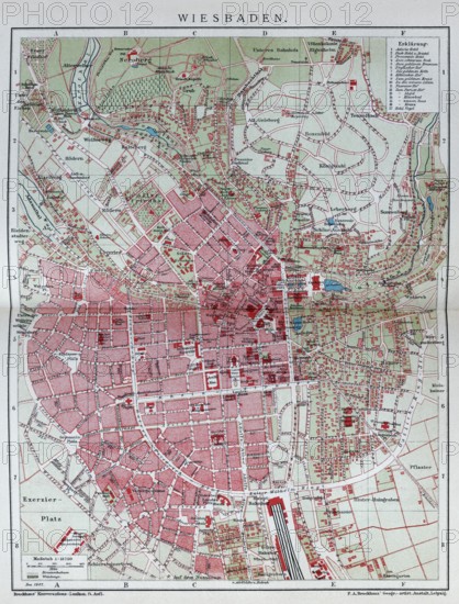
Wiesbaden, historical city map from 1907
BRK25L26_428
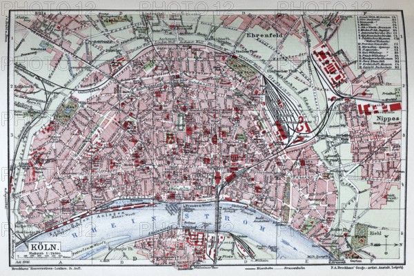
Cologne, historical city map from 1906
BRK25L26_435
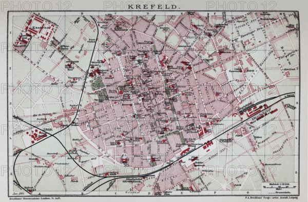
Krefeld, historical city map from 1907
BRK25L26_426
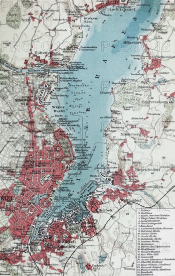
Kiel and Kiel harbour, historical city map from 19...
BRK25L26_427
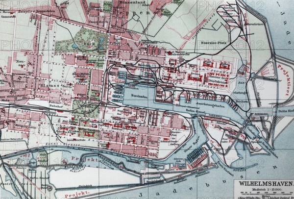
Wilhelmshaven, historical city map from the year19...
BRK25L26_424
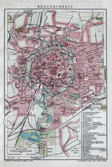
Brunswick, historical city map from 1907
BRK25L26_433
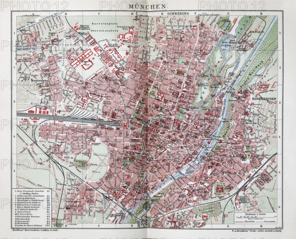
Munich, historical city map from 1907
BRK25L26_425
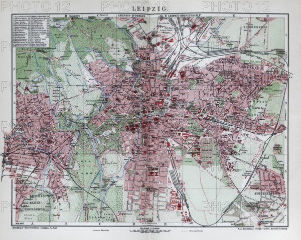
Leipzig, historical city map from 1907
BRK25L26_434
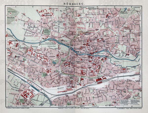
Nuremberg, historical city map from 1906
BRK25L26_398
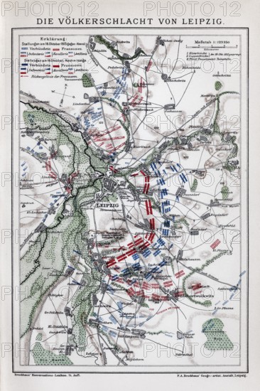
Battle of Leipzig, historical maps with positions ...
BRK25L26_430
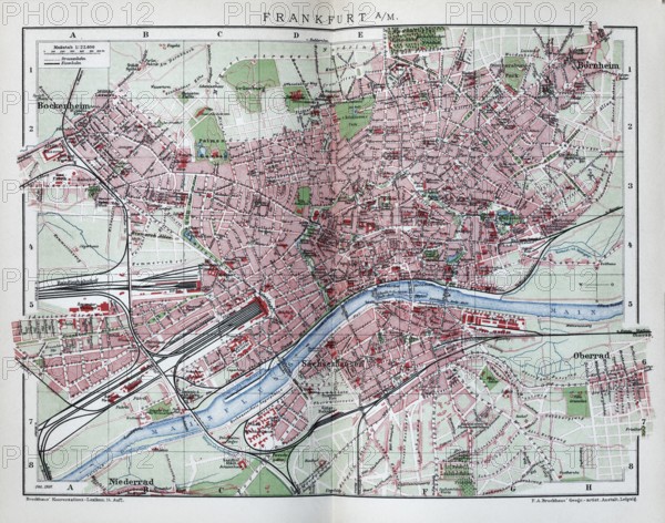
Frankfurt am Main, historical city map from 1907
BRK25L30_407
A city map with street names in a lively street wi...
BRK25L45_099
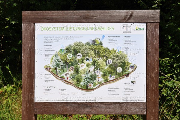
Forbach, Germany - July 12th 2025: Infographic abo...
BRK25L25_165
Butterfly Map Butterfly, Summer, Germany
BRK25L26_423
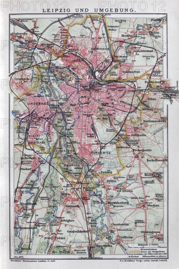
Leipzig and surroundings, historical map from 1907
BRK25L26_422
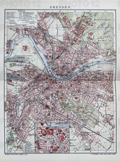
Dresden, historical city map from 1906
BRK25L42_469
Main front of the main railway station with Atlas ...
BRK25L42_476
Main front of the main railway station with Atlas ...
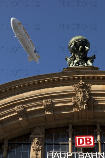
BRK25L42_473
Main front of the main railway station with Atlas ...
BRK25L42_455
Atlas, carrying the globe, supported by steam and ...
BRK25L42_474
Atlas, carrying the globe, supported by steam and ...
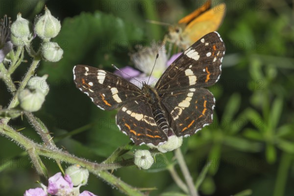
BRK25L49_242
Land carder (Araschnia levana), summer generation,...
BRK25L13_363
Company MAP loading equipment, pallets, Oberstenfe...
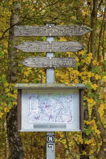
BRK25K67_364
Road sign, map, autumn forest, Neuenkleusheim, Olp...
BRK25K62_480
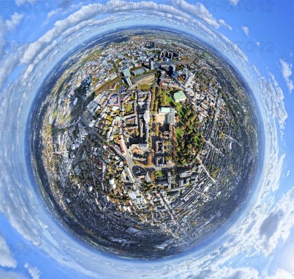
Aerial view, central station station, redesign of ...
BRK25K87_298
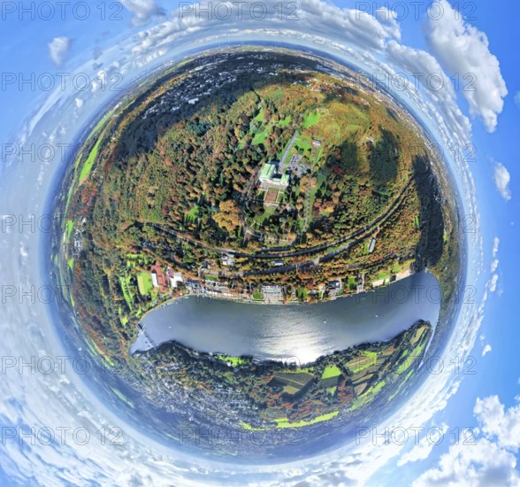
Aerial view, villa hill and hill park with autumna...
BRK25K62_485
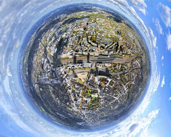
Aerial view, central station and city city center,...
BRK25K52_480
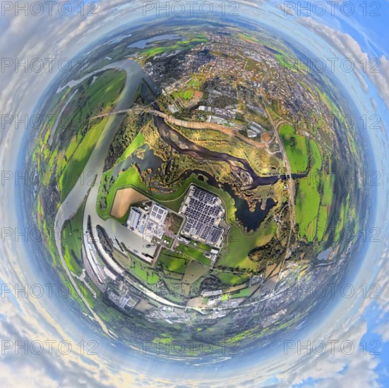
Aerial view, town view of Wesel, Rhine river and W...
- Page
-
- of
- 12