1776 results for: main village
- Page
-
- of
- 18
Please sign in for more results

BRK26C97_003
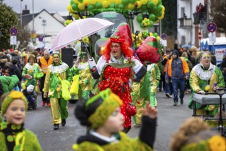
The Klaa Paris carnival parade passes through the ...
BRK26C59_123
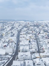
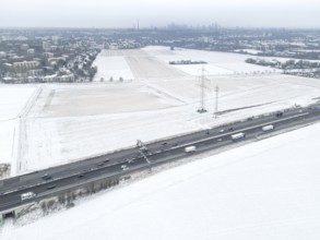
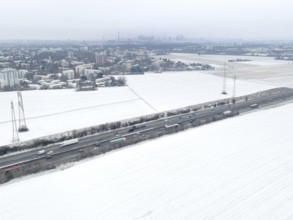
Small settlement under snow cover with straight ma...
BRK26C63_473
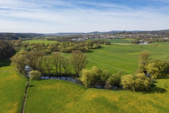
Wet meadows at the confluence or source of the Mai...
BRK26C57_064
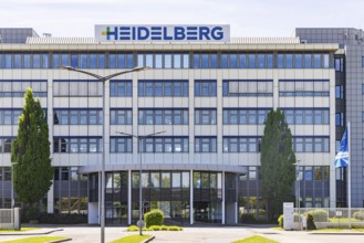
Heidelberger Druckmaschinen AG. Administration bui...
BRK26D03_377
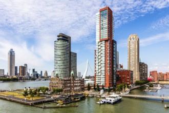
Hotel New York, historic art nouveau building on t...
BRK26C66_368
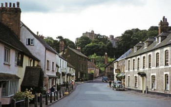
Dunster Castle and historic buildings, main street...
BRK26C80_223
Protestant parish church of St Michael. As Johanne...
BRK26C66_459
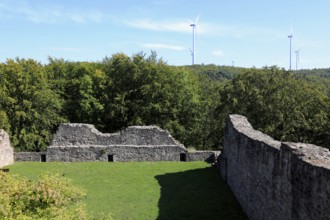
Steckelberg Castle, also known as Steckelburg or S...
BRK26C64_069
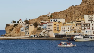
A coast with boats, colourful houses on rocks, sur...
BRK26C61_047
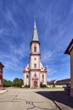
The Protestant-Lutheran Marktkirche zum Heiligen G...
BRK26D04_241
The Protestant-Lutheran Marktkirche zum Heiligen G...
BRK26C81_496
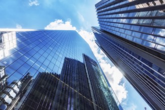
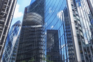
London, United Kingdom. July 9th 2022 Glass fronte...
BRK26B58_224
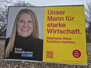
An election poster of the top FDP candidate Stepha...

BRK26C48_484
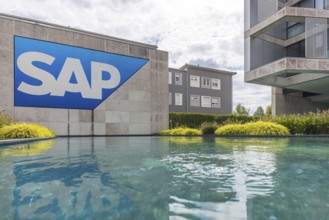
Logo and building of the software company SAP SE. ...
BRK26C26_026
The Klaa Paris carnival parade passes through the ...
BRK26C26_027
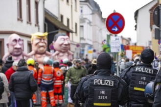
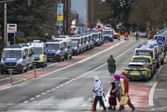
A large police force ensures safety on the Klaa Pa...
BRK26C23_473
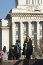
Sofia, Bulgaria, June 4th 2019 Young Bulgarian peo...
BRK26C50_071
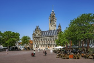
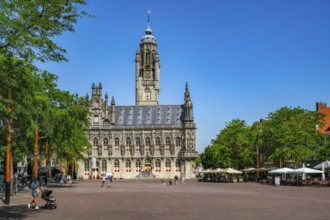
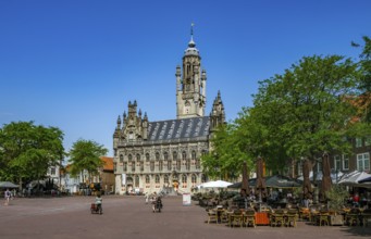
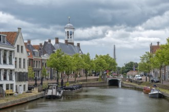
Middelburg, Zeeland, Netherlands - Stadhuis Middel...
BRK26C18_149
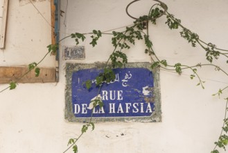
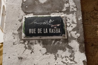
A Tunisian street sign for Rue de la Hafsia writte...
BRK26C18_280
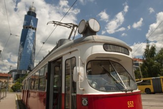
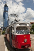
Sarajevo, Bosnia and Herzegovina July 25th 2019. A...
BRK26C18_278
Sarajevo, Bosnia and Herzegovina July 25th 2019. A...
BRK26C29_022
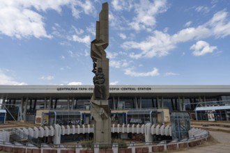
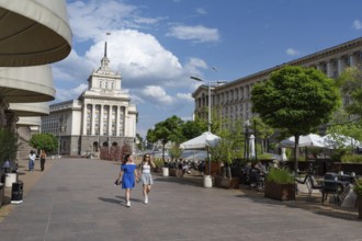
Sofia, Bulgaria. June 21st 2025. The Sofia Central...
BRK26C23_470
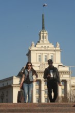
Sofia, Bulgaria, April 1st 2019. Bulgarian People ...
BRK26C18_152
Tunis, Tunisia. 13th May 2024 A Tunisian street si...
BRK26C23_469
Sofia, Bulgaria, June 4th 2019 Bulgarian People in...
BRK26C36_186
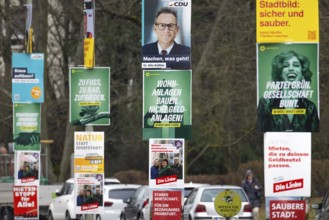
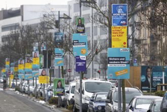
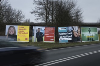
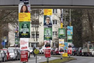
Numerous election posters for the 2026 local elect...
BRK26C45_317
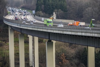
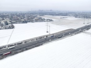
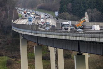
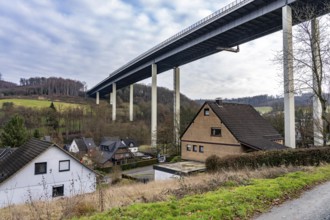
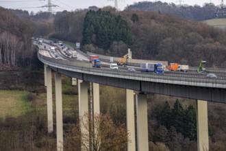
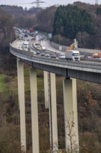
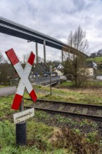
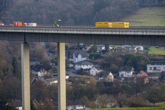
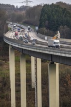
The Wiehl Valley Bridge, A4 motorway, the motorway...
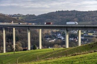
BRK26C45_318
The Wiehl Valley Bridge, A4 motorway, the motorway...
BRK26C19_299
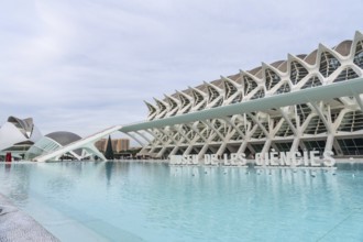
The museu de les ciencies principle building stand...
BRK26C36_348
Numerous election posters for the 2026 local elect...
BRK26C20_285
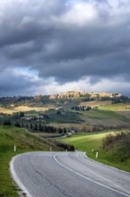
A scenic view of Pienza from the main road in Val ...
BRK26C32_028
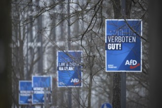
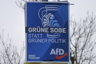
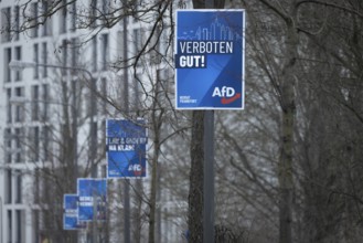
Numerous AfD election posters hang one behind the ...
BRK26C29_020
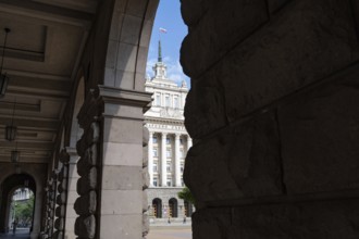
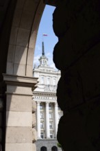
Sofia, Bulgaria. June 21st 2025. Former communist ...
BRK26C29_023
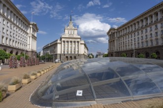
Sofia, Bulgaria. June 21st 2025. The Largo, an arc...
BRK26B67_414
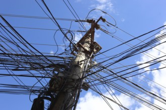
Romania, electricity, infrastructure, power line, ...
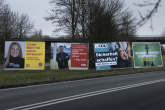
BRK26C32_027
Large election posters are standing on a street in...
BRK26C29_025
Sofia, Bulgaria. June 21st 2025. Café culture at T...
BRK26C29_021
Sofia, Bulgaria. June 21st 2025. Former communist ...
BRK26C19_083
London, United Kingdom. July 9th 2022 Glass fronte...
BRK26C53_139
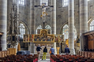
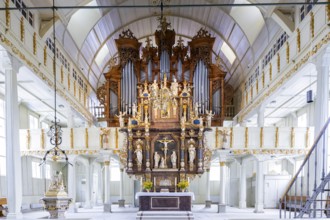
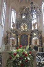
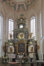
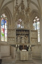
Chancel of the baroque, high altar, interior view,...
BRK26C44_133
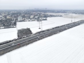
The fields in the north-west of Frankfurt am Main ...
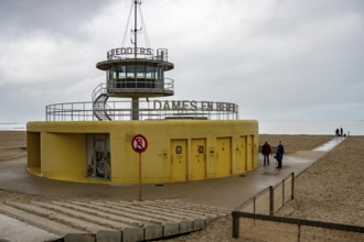
BRK26B62_333
Winter break, on Zeedijk-Knokke, beach promenade i...
BRK26B55_341
Sofia, Bulgaria, April 1st 2019. Bulgarian People ...
BRK26B55_340
Sofia, Bulgaria, June 4th 2019 Bulgarian People in...
BRK26B59_366
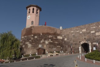
Ankara, Turkey. November 17th 2020 The clock tower...
BRK26B77_338
An Alternative for Germany (AfD) election poster w...
BRK26B58_160
A large police force ensures safety on the Klaa Pa...
BRK26B77_337
Numerous election posters for the 2026 local elect...

BRK26B58_161
The Klaa Paris carnival parade passes through the ...
BRK26B95_175
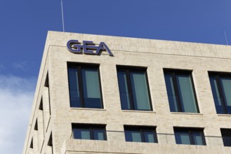
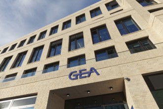
GEA Group AG, logo at the new corporate headquarte...
BRK26B70_111
Numerous AfD election posters hang one behind the ...
BRK26B95_306
The fields in the north-west of Frankfurt am Main ...
BRK26B70_110
Large election posters are standing on a street in...
BRK26B33_090
The Wiehl Valley Bridge, A4 motorway, the motorway...
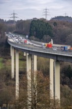
BRK26B33_091
The Wiehl Valley Bridge, A4 motorway, the motorway...
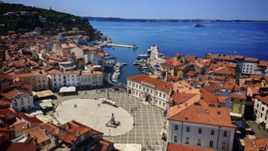
BRK26B06_415
Aerial view of a coastal town with red roofs, a ha...
BRK26B33_089
The Wiehl Valley Bridge, A4 motorway, the motorway...
BRK26B09_142
Numerous election posters for the 2026 local elect...
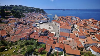
BRK26B06_412
Panoramic view of a coastal town with a main squar...
BRK26B35_060
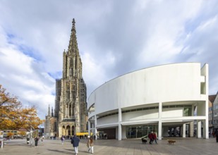
Ulm Minster, Gothic religious building in the Bade...
BRK26B06_477
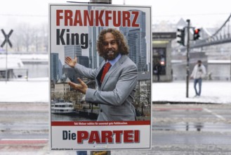
An election poster Fankfarz King - The Party hangs...
BRK26B29_352
GEA Group AG, logo at the new corporate headquarte...
BRK26B40_065
Logo and building of the software company SAP SE. ...
BRK26B17_453
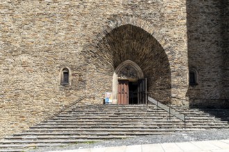
Impressive main portal of St. Anne's Church in Ann...
BRK26B32_086
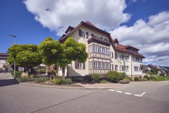
Town hall, municipality of Gutach Schwarzwaldbahn,...
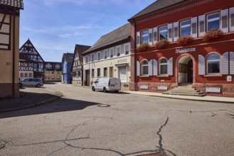
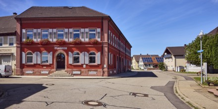
BRK26B26_211
Grafenhausen Town Hall, façade with windows, shutt...
BRK26B32_085
Town Hall, municipality of Gutach Schwarzwaldbahn,...
BRK26B42_049
Middelburg, Zeeland, Netherlands - Stadhuis Middel...
BRK26B46_341
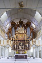
Chancel of the baroque, high altar, interior view,...
BRK26B30_068
The fields in the north-west of Frankfurt am Main ...
BRK26A81_331
The Wiehl Valley Bridge, A4 motorway, the motorway...
BRK26A89_106
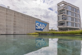
Logo and building of the software company SAP SE. ...
BRK26A81_330
The Wiehl Valley Bridge, A4 motorway, the motorway...
BRK26A84_431
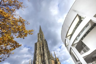
Ulm Minster, Gothic religious building in the Bade...
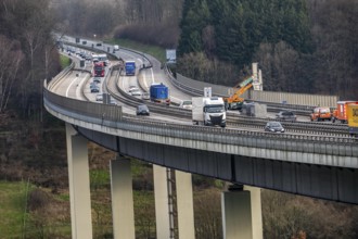
BRK26A81_329
The Wiehl Valley Bridge, A4 motorway, the motorway...
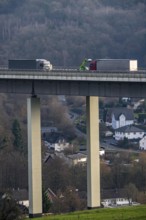
BRK26A81_332
The Wiehl Valley Bridge, A4 motorway, the motorway...
BRK26A74_069
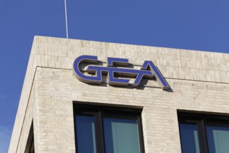
GEA Group AG, logo at the new corporate headquarte...
BRK26A86_312
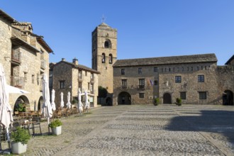
Plaza Mayor main square historic buildings medieva...
BRK26A89_108
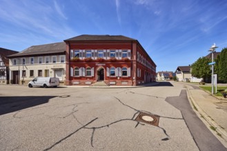
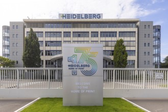
Heidelberger Druckmaschinen AG. The most important...
BRK26A84_430
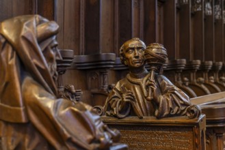
The choir stalls in Ulm Minster by Jörg Syrlin the...
BRK26A67_311
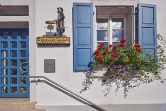
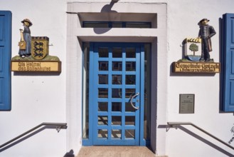
Grafenhausen Town Hall, façade with windows, shutt...
BRK26A75_383
The fields in the north-west of Frankfurt am Main ...
BRK26A67_309
Grafenhausen Town Hall, façade with windows, shutt...
BRK26A67_304
Grafenhausen Town Hall, façade with windows, shutt...
BRK26A90_207
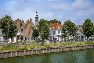
Middelburg, Zeeland, Netherlands - Townhouses on t...
BRK26A79_215
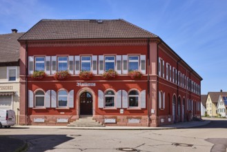
Gasthaus Lime tree, restaurant, hotel, house, gene...
BRK26A99_159
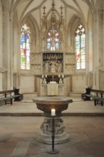
High altar of the Romanesque St. Mary's Church, in...
BRK26A99_209
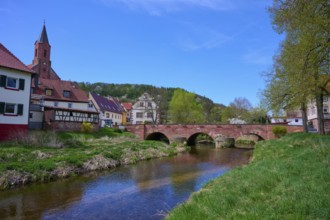
Picturesque small town view with river Saale, brid...
BRK26A67_310
St. James church, church tower, general architectu...
BRK26A90_205
Middelburg, Zeeland, Netherlands - Stadhuis Middel...
BRK26A99_160
High altar and baptismal font of the Romanesque St...
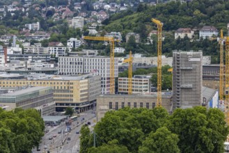
BRK26A34_184
View of the construction site of the new main rail...
BRK26A19_175
The Wiehl Valley Bridge, A4 motorway, the motorway...
BRK26A19_173
The Wiehl Valley Bridge, A4 motorway, the motorway...
BRK26A19_174
The Wiehl Valley Bridge, A4 motorway, the motorway...
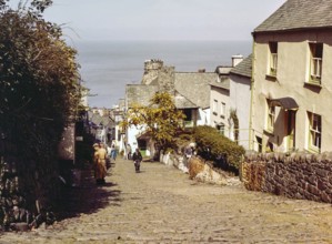
BRK26A04_235
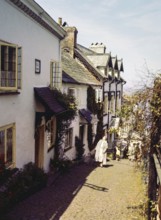
Steep hill of cobbled main street in coastal villa...
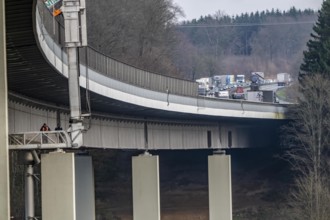
BRK26A19_172
The Wiehl Valley Bridge, A4 motorway, the motorway...
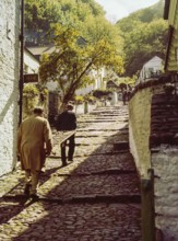
BRK26A04_233
Men carrying wooden sled or sledge used for transp...
BRK26A51_397
Main canal Dokkumer Ee, Dokkum, Friesland, Holland...
BRK26A04_232
Steep hill of cobbled main street in coastal villa...
- Page
-
- of
- 18