3114 results for: landscape arch
- Page
-
- of
- 32
Please sign in for more results
BRK26C75_087
Larpool Viaduct over River Esk and Esk Valley Viad...
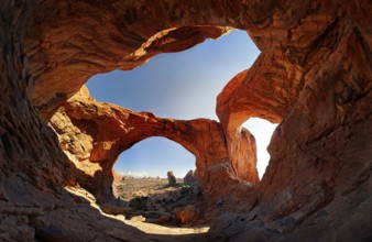
BRK26C55_332
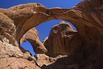
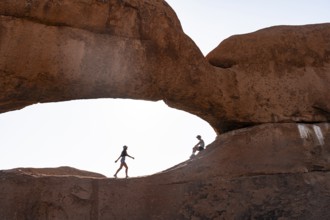
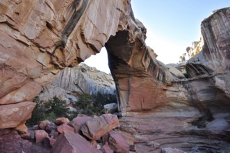
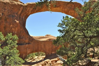
Double Arch, stone arches of red sandstone formed ...
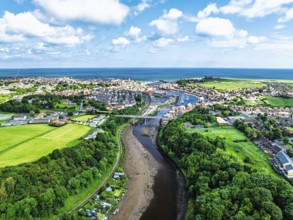
BRK26C62_061
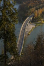
Aerial view of a town with viaduct, surrounded by ...
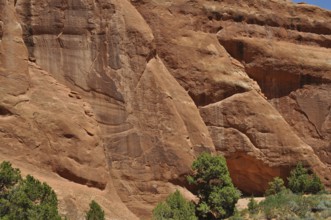
BRK26D04_206
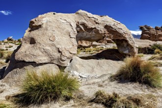
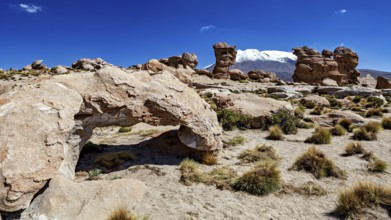
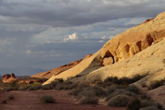
Impressive sandstone walls in the desert with few ...
BRK26C98_238
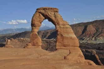
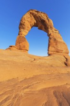
Delicate Arch, a beautiful natural rock arch in th...
BRK26C80_112
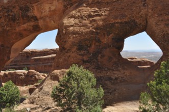
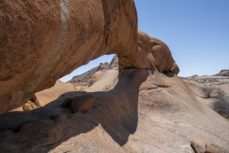
Sandstone formations with double windows offer spe...
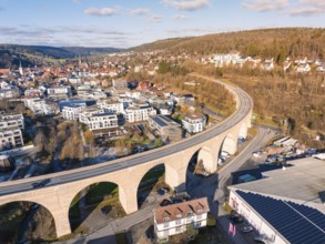
BRK26C90_384
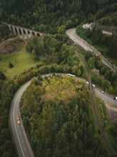
Winding road surrounded by forest and viaduct, Rav...
BRK26C92_199
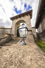
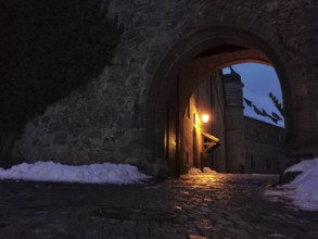
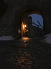
Historic stone arch with staircase and lantern in ...
BRK26C71_204
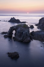
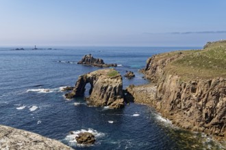
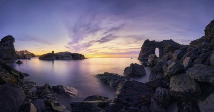
Coastal landscape at Land's End. The Enys Dodnan A...
BRK26C66_405
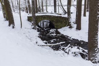
Historic stone arch bridge over the Lockwitzbach s...
BRK26C65_437
Malter, town view with dam and Weißeritz valley ra...
BRK26C60_150
Aerial view of La Porte d'Aval and l'Aiguille on t...
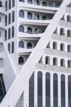
BRK26C85_031
A striking modern building features geometric patt...
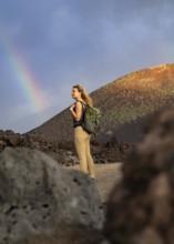
BRK26C92_345
A woman with a backpack stands on a rocky path in ...
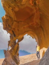
BRK26D03_081
A woman in a bright yellow jacket explores a strik...
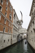
BRK26C83_252
A seagull soars above a Venetian canal, framed by ...
BRK26C97_044
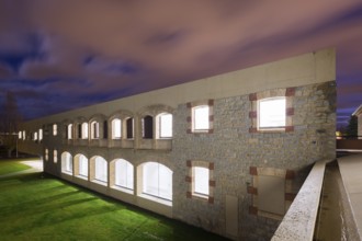
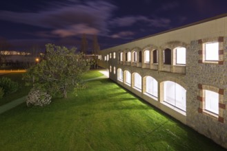
A beautifully illuminated stone hospital with arch...
BRK26C71_272
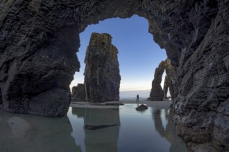
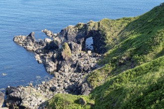
A person stands between towering sea arches, refle...
BRK26C68_374
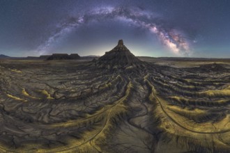
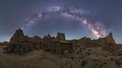
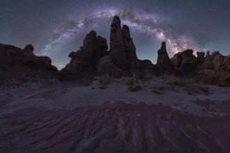
Stunning night scape of Utah sandstone desert unde...
BRK26C70_162
An awe inspiring view of the Milky Way galaxy illu...
BRK26D05_036
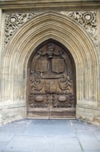
Wooden carved door of the abbey church, Bath, Engl...

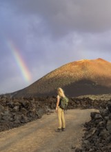
BRK26C95_411
A woman in a red jacket stands on volcanic terrain...
BRK26C83_309
An Asian woman walks through an arched entrance of...
BRK26C71_054
A stunning autumn scene at Mount Cook, New Zealand...
BRK26C74_424
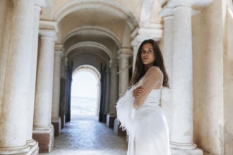
Elegant bride poses in an ancient villa in Treia, ...
BRK26C98_228
A woman with a backpack explores the volcanic land...
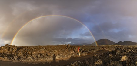
BRK26C90_052
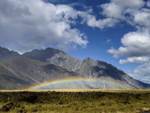
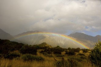
A vibrant rainbow arches over the rugged volcanic ...
BRK26C65_281
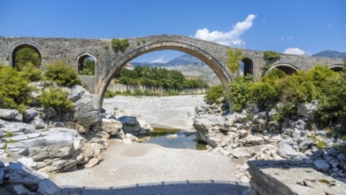
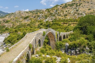
Aerial view of the Old Mes bridge near Shkoder fro...
BRK26C84_098
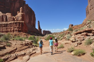
Three people hiking in a vast desert landscape wit...
BRK26D05_137
Night view of a well lit hospital with stone and b...
BRK26C90_057
A breathtaking autumn scene at Mount Cook, New Zea...
BRK26C65_038
Aerial view of the Old Mes bridge near Shkoder. Al...
BRK26C90_058
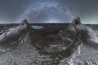
Stunning view of the Milky Way arching over a rugg...
BRK26C90_101
USA, Utah, Arches National Park, Double Arch, Rock...
BRK26C71_028
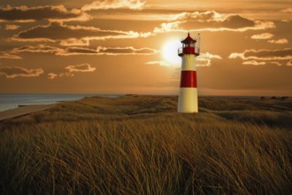
The lighthouse List Ost at the Ostellenbogen on th...
BRK26C83_447
Iceland, Cape Dyrholaey, Peninsula

BRK26C57_389
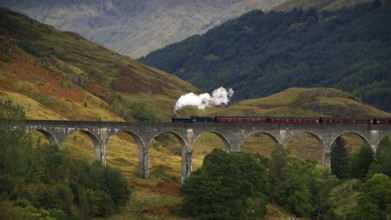
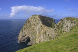
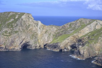
Europe, Scotland, Great Britain, England, landscap...
BRK26C74_024
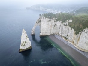
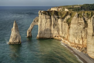
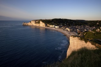
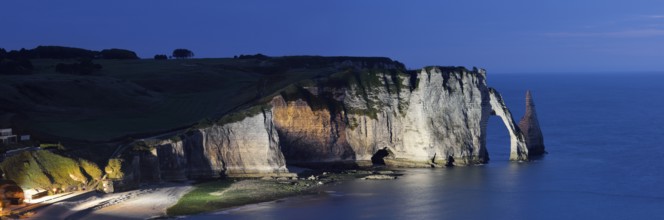
Europe, France, Normandy, the cliffs of Etretat, r...
BRK26C69_402
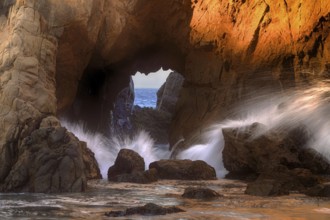
USA, California, rock gate, rocks, surf, Big Sur, ...
BRK26C61_213
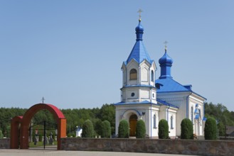
Orthodox church with blue roof and magnificent arc...
BRK26C90_084
Europe, Scotland, Great Britain, England, landscap...
BRK26C96_238
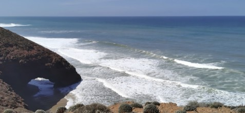
Coastal landscape at Land's End. The rock Enys Dod...
BRK26C04_018
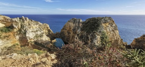
A picturesque coastline with a natural rock arch a...
BRK26C26_206
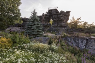
View of the courtyard of Rosenberg Fortress throug...
BRK26C42_396
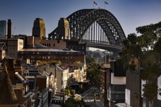
View from Cahill Expressway of Harbour Bridge and ...
BRK26C19_406
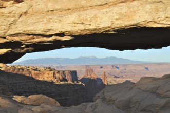
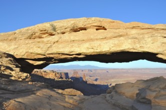
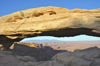
Natural Mesa Arch rock arch with views of mountain...
BRK26C37_211
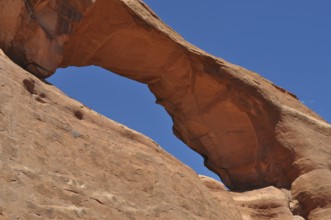
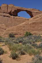
Natural stone arch in a dry desert landscape under...
BRK26C46_004
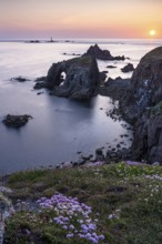
View of blue sea and cliffs with rock gate from Po...
BRK26C55_210
Tourists in a rock arch, round rock formations wit...
BRK26C19_394
Impressive Mesa Arch rock arch over the vast deser...
BRK26C19_405
Well-known Mesa Arch rock arch in desert landscape...
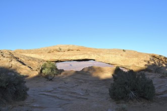
BRK26C19_407
Mesa Arch forms a natural passageway in the desert...
BRK26C26_205
View of the courtyard of Rosenberg Fortress throug...
BRK26C45_415
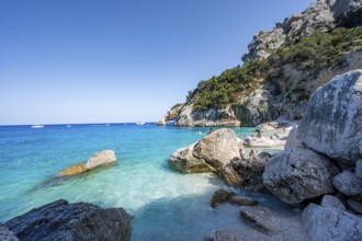
Light blue clear sea on a dream beach on Cala Golo...
BRK26C37_207
Desert landscape with stone arch and snow-covered ...
BRK26C50_324
Rock arch, rock formation, Pontok Mountains, Great...
BRK26C33_007
Rock Gate Potters with Sun Transit on Summer Solst...
BRK26C50_028
Rock arch Falaise or Porte d'Amont, beach, church ...
BRK26C53_365
Delicate Arch, Arches National Park, Moab, Utah, U...
BRK26C51_403
Rocky coast and rock gate on the south-east coast ...
BRK26C51_404
Rock formation and rock gate off the west coast of...
BRK26C53_072
UNESCO Luisium, classicist palace with arched brid...
BRK26C36_323
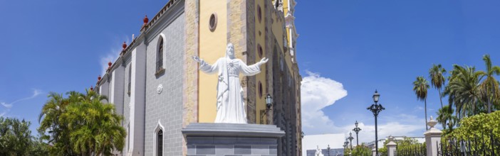
Immaculate Conception catholic Cathedral in Mazatl...
BRK26C15_350
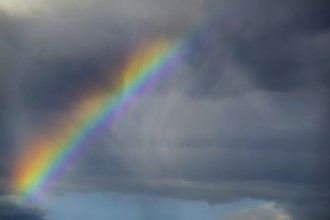
A stunning photograph capturing a vivid rainbow ar...
BRK26C15_217
A stunning Berbie Palace exhibits grand architectu...
BRK26C23_015
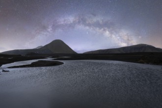
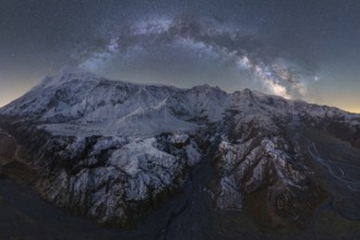
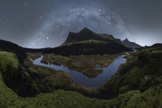
A breathtaking view of the Milky Way arching over ...
BRK26C24_454
A stunning sunset at Cala Flores, Cabo de Palos, C...
BRK26C16_011
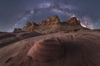
A mesmerizing night sky arches over unique sandsto...
BRK26C23_012
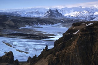
Stunning view of Icelandic mountains blanketed in ...
BRK26C22_483
Captivating Northern Night scene of Iceland's rugg...
BRK26C11_029
A picturesque Faller-Klamm Bridge gracefully arche...
BRK26C13_147
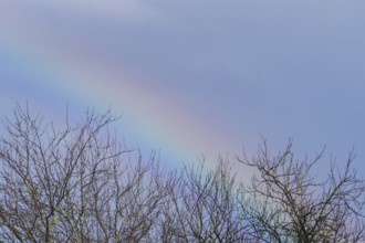
A delicate, colorful rainbow arches subtly above b...
BRK26C22_484
Experience the mesmerizing beauty of Iceland's nig...
BRK26C39_065
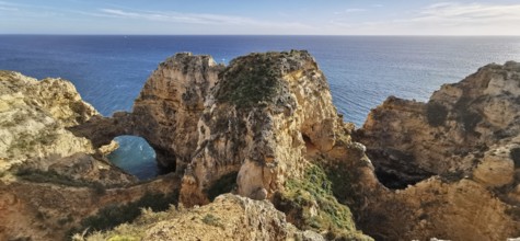
Cliff with the Falaise d'Aval rock gate and the Ai...

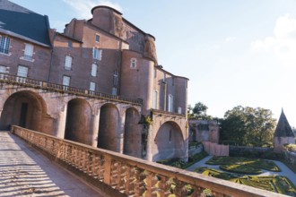
BRK26C13_492
A stunning view of Albi, a historic town in southe...
BRK26C22_183
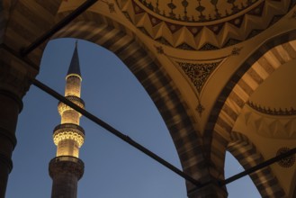
Istanbul, Turkey. November 22nd 2021 Beautiful Ott...
BRK26C05_225
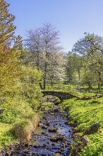
Beautiful spring landscape featuring a small stone...
BRK26B93_328
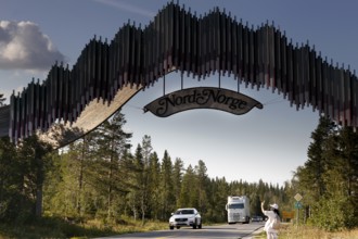
Distinctive wooden archway across the road with pa...

BRK26C00_474
Intercity Express ICE. Open-route passenger train ...
BRK26B61_212
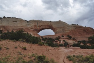
Large natural rock arch in a red desert landscape ...
BRK26B98_388
View of blue sea and cliffs with rock gate from Po...
BRK26B56_307
A wide valley with imposing sandstone cliffs, call...
BRK26B69_094
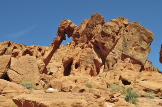
Famous elephant arch rock formation towering under...
BRK26B56_308
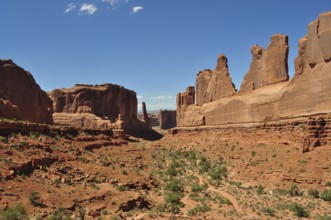
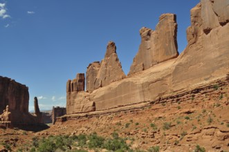
Majestic sandstone rocks, Wall Street, dominate th...
BRK26B59_253
Impressive rock arch with bright light below, surr...
BRK26B69_342
Archway, vast rocky landscape on the edge of the s...
BRK26B56_315
Skyline Arch, a massive sandstone arch in the dese...
BRK26B56_327
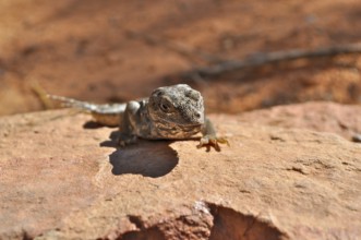
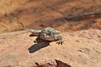
Leopard iguana (Gambelia wislizenii) sunbathing on...

BRK26B69_099
Yellow rocks in sunset light with dramatic shadows...
BRK26B56_317
Skyline Arch, a sandstone arch under clear blue sk...
BRK26B56_325
Leopard iguana (Gambelia wislizenii) on a reddish ...
BRK26B69_344
Archway, Dramatic rock formations overlooking the ...
BRK26B56_335
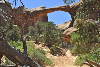
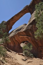
Double O Arch, a rock arch surrounded by vegetatio...
BRK26B68_343
A natural rock arch stretches across an expansive,...
BRK26B69_117
Landscape with yellow and red rocks and sparse veg...
BRK26B56_336
Double O Arch, a sprawling rock arch surrounded by...
BRK26B56_313
Skyline Arch, a distinctive rock arch in the deser...
BRK26B56_320
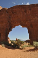
Pine Tree Arch, a large sandstone arch with clear ...
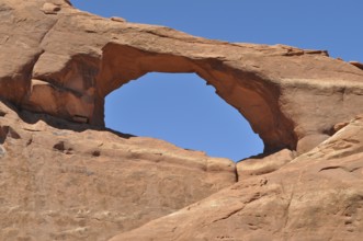
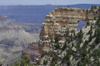
BRK26B56_332
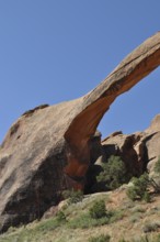
Detailed view of Landscape Arch, an impressive nat...
BRK26B56_337
Double O Arch, a double rock arch arching graceful...
- Page
-
- of
- 32