608 results for: land use
- Page
-
- of
- 7
Please sign in for more results
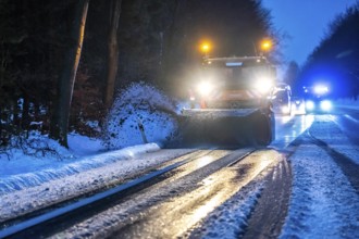
BRK26C99_062
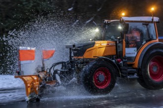
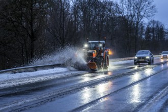
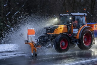
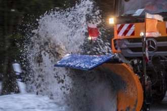
Winter service, spreader and snow plough in use, c...
BRK26C79_199
Farming in Entlebuch in Switzerland, 1882, men doi...
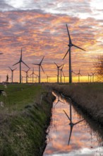
BRK26C77_006
Wind farm near the East Frisian town of Norden, ea...
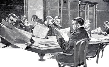
BRK26C97_480
In the Seamen's House in Kiel, the reading room, 1...

BRK26C81_049
Vibrant, high-resolution image showcasing the intr...
BRK26C41_026
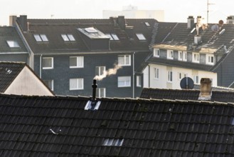
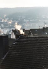
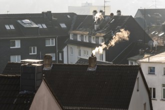
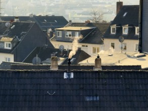
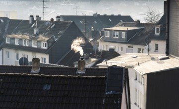
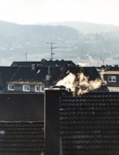
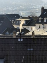
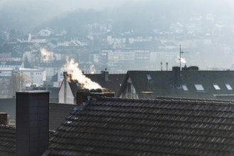
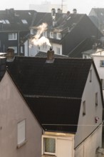
Smoke plume from a chimney over densely built resi...
BRK26C43_409
Winter service, spreader and snow plough in use, c...
BRK26C43_297
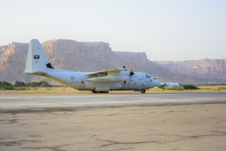
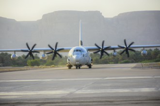
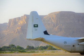
In Seiyun, Yemen on January 04, 2026, a Royal Saud...
BRK26C33_468
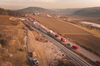
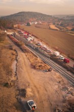
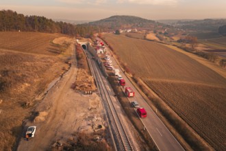
Fire trucks on a country road next to railroad tra...
BRK26C03_380
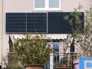
Two solar panels on a house wall in Wuppertal, Ger...
BRK26C33_453
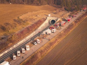
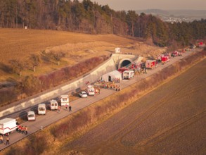
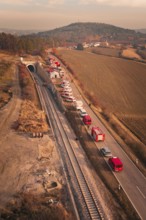
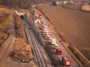
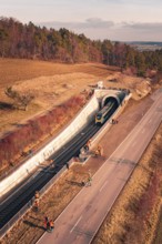
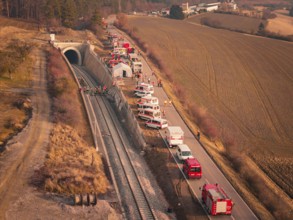
Fire engines and rescue workers in front of a tunn...
BRK26C33_467
Emergency vehicles with firefighters near a tunnel...
BRK26C33_444
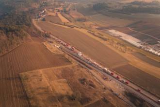
Emergency vehicle convoy on country road in vast, ...
BRK26C33_443
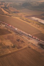
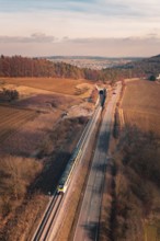
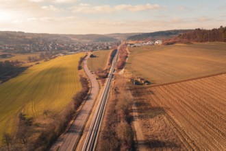
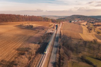
A train travels on rails parallel to a country roa...
BRK26C33_449
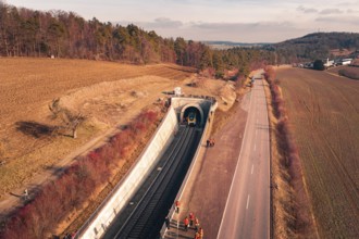
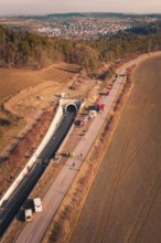
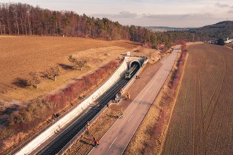
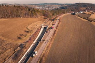
Aerial view of a railway tunnel next to a road and...
BRK26C33_465
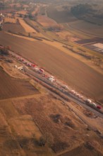
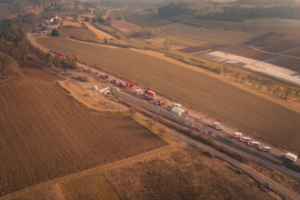
Long row of emergency vehicles on country road wit...
BRK26C33_460
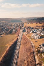
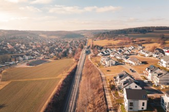
Aerial view of a village with railroad tracks surr...
BRK26C33_459
Aerial view of a tunnel with emergency vehicles an...
BRK26C33_469
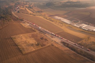
Aerial view of a scenario with emergency vehicles ...
BRK26C33_450
Aerial view of emergency vehicles on country road ...
BRK26C33_470
Aerial view of a rural area with railroad, road an...
BRK26C33_448
Aerial view of a train near a railway tunnel with ...
BRK26C33_458
Aerial view of a rural area with fields, village a...
BRK26C33_461
Aerial view of emergency vehicles and firefighters...
BRK26C33_447
Aerial view of a village and railroad tracks in a ...
BRK26C33_463
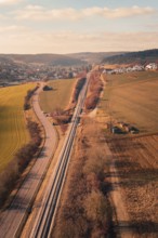
Wide landscape with railroad tracks and a distant ...
BRK26C33_462
Train leaves a railway tunnel surrounded by emerge...
BRK26C33_471
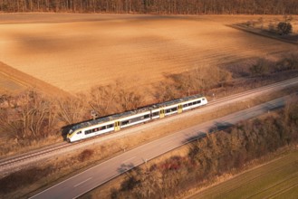
Train travels along railroad tracks between fields...
BRK26C33_452
Aerial view of fire engines on a country road with...
BRK26C33_456
Aerial view of emergency vehicles along a tunnel n...
BRK26C33_451
Fire trucks on a country road with a view of surro...
BRK26C33_457
Tunnel with emergency vehicles and barriers along ...
BRK26C33_454
Aerial view of rural scenery with vehicles, tunnel...
BRK26C33_455
Aerial view with emergency vehicles next to a tunn...
BRK26C41_027
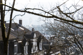
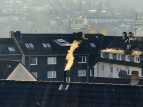
Smoke plume from a chimney over densely built resi...
BRK26C40_225
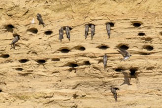
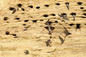
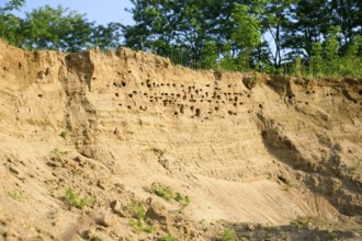
Several sand martins (Riparia riparia) nest in a s...

BRK26C06_412
A bull moose (Alces alces) stands flehmen between ...

BRK26C06_380
A bull moose (Alces alces) uses the pheromones it ...

BRK26C06_376
The bull moose (Alces alces) stands behind the cow...
BRK26B94_400
Winter service, spreader and snow plough in use, c...
BRK26B89_118
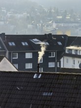
Smoke plume from a chimney over densely built resi...
BRK26B89_117
Smoke plume from a chimney over densely built resi...
BRK26B84_307
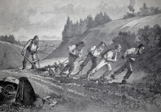
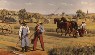
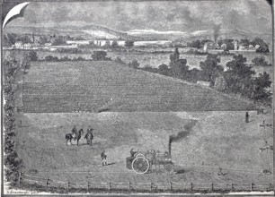
Farmers harvesting hay, around 1920, illustration,...
BRK26B21_255
Smoke plume from a chimney over densely built resi...
BRK26B21_254
Smoke plume from a chimney over densely built resi...
BRK26B21_245
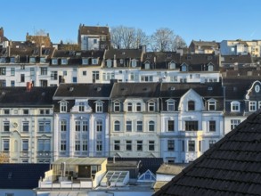
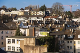
Residential district with residential buildings fr...
BRK26B21_243
Smoke plume from a chimney over densely built resi...
BRK26B28_379
Winter service, spreader and snow plough in use, c...
BRK26B21_248
Smoke plume from a chimney over densely built resi...
BRK26B21_244
Residential development with multi-family building...
BRK26B20_107
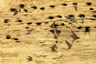
Several sand martins (Riparia riparia) nest in a s...
BRK26B20_115
Several sand martins (Riparia riparia) nest in a s...
BRK26B26_111
In Seiyun, Yemen on January 04, 2026, a Royal Saud...
BRK26B20_114
Steep sand hill with holes, surrounded by vegetati...
BRK26A54_156
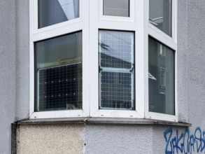
Window front, bay window with solar panels used, s...
BRK26A54_153
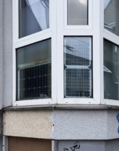
Window front, bay window with solar panels used, s...
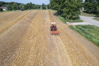
BRK26A90_144
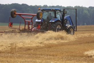
Hastings, Michigan - A farmer uses a New Holland P...
BRK26A54_149
Smoke plume from a chimney over densely built resi...
BRK26A54_137
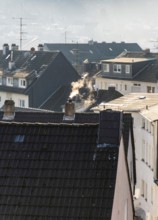
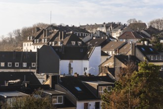
Roofs of a residential area with apartment buildin...
BRK26A54_138
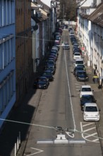
View from above of a street with parked cars and r...
BRK26A54_131
Smoke plume from a chimney over densely built resi...
BRK26A54_150
Smoke plume from a chimney over densely built resi...
BRK26B01_217
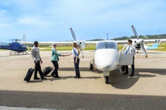
Business professionals arriving and greeting at a ...
BRK26A71_434
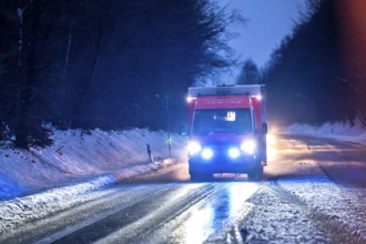
Ambulance during an alarm trip, with flashing ligh...
BRK26A54_132
Smoke plume from a chimney over densely built resi...
BRK26A54_133
Residential district with residential buildings fr...
BRK26A71_433
Winter service, spreader and snow plough in use, c...
BRK26A54_134
Residential development with multi-family building...

BRK26A94_450
Weather jackets from the manufacturer Schietwetter...
BRK26A80_289
Green field with commencing construction of solar ...
BRK26A66_281
In Seiyun, Yemen on January 04, 2026, a Royal Saud...
BRK26A94_310
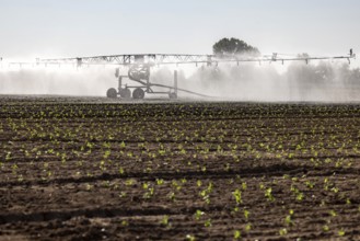
Hot days, little rainfall. Irrigation of young veg...
BRK26A95_453
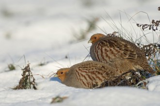
In pairs... Partridge (Perdix perdix), partridge p...
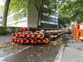
BRK26A44_032
A stack of district heating pipes at a constructio...
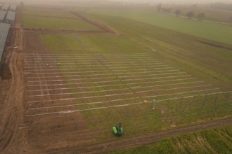
BRK26A03_034
Foggy fields with solar system installation in the...
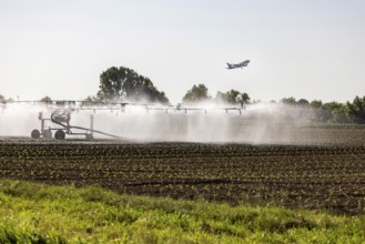
BRK26A40_085
Hot days, little rainfall. Irrigation of young veg...
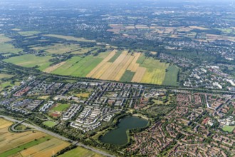
BRK25M87_201
Oberbillwerder, Bergedorf West, Neu-Allermöhe Ost,...
BRK25M15_277
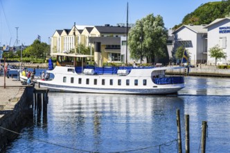
The MS Sunningen, an archipelago boat, docks in th...

BRK25M20_153
Hastings, Michigan - A farmer uses a New Holland P...

BRK25M35_126
Field with solar panels shows use of technology ne...
BRK25N03_329
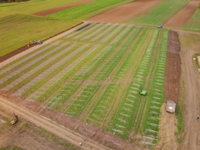
Agriculture, arable farming, use of the single-mac...
BRK25M06_294
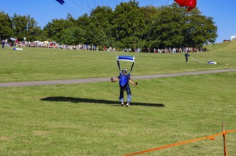
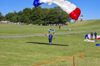
Landing of skydivers during an aerial acrobatic pe...
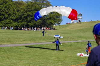
BRK25M76_434
Landing of skydivers during an aerial acrobatic pe...
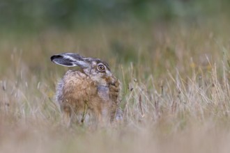
BRK25M53_092
A brown hare (Lepus europaeus) uses its teeth to g...
BRK25M96_016
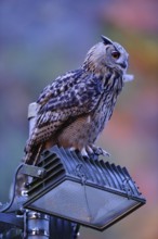
Man and nature... European Eagle Owl (Bubo bubo) u...

BRK25M97_165
Corn poppy (Papaver rhoeas) red flowering, general...
BRK25M51_297
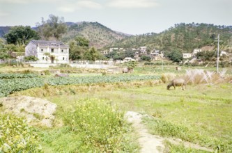
Farmland agriculture mixed use Tai Po, New Territo...

BRK25M34_095
Biblical story, Noah's sacrifice of thanks, Noah, ...
BRK25L87_327
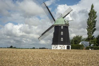
Windmill type Dutchman that was in use 1825, 1958,...
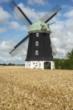
BRK25L87_328
Windmill type Dutchman that was in use 1825, 1958,...
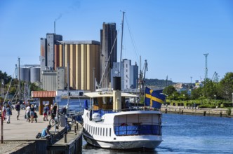
BRK25L87_091
The MS Sunningen, an archipelago boat, docks in th...
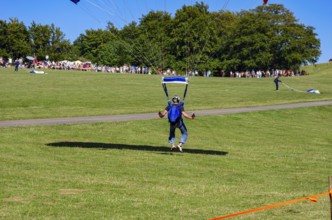
BRK25L69_260
Landing of skydivers during an aerial acrobatic pe...
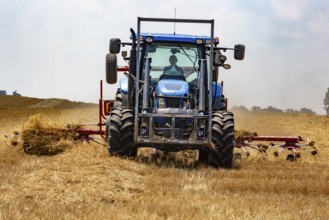
BRK25M00_009
Hastings, Michigan - A farmer uses a New Holland P...
BRK25L57_152
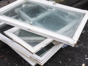
A pile of old white window frames with glass is ly...

BRK25L57_360
Billwerder, Oberbillwerder, Germany, Europe Hambur...
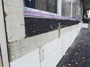
BRK25L57_151
A façade is being renovated with insulation boards...
BRK25M00_014
Wayland, Michigan - A farmer uses a rotary tedder ...
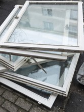
BRK25L57_150
A pile of old white window frames with glass is ly...
BRK25L74_363
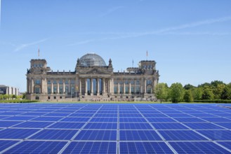
Symbolic image, solar park in the city, Reichstag ...
BRK25L15_403
Landing of skydivers during an aerial acrobatic pe...
- Page
-
- of
- 7