171 results for: hegauberge
- Page
-
- of
- 2
Please sign in for more results
BRK26C65_249
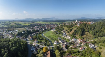
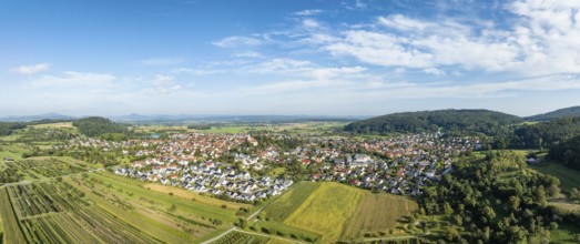
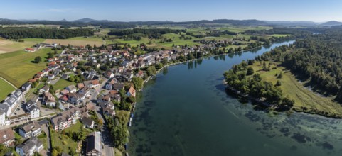
Aerial view, panorama of the town of Aach in Hegau...
BRK26C77_171
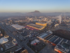
Aerial view of the industrial area of the city of ...
BRK26C99_218
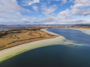
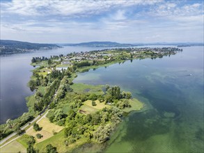
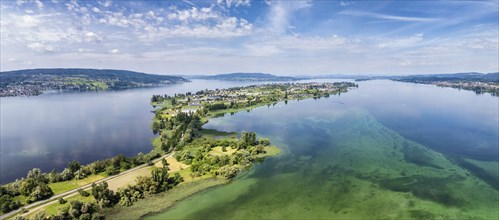
Aerial view of the Mettnau peninsula near Radolfze...
BRK26C65_412
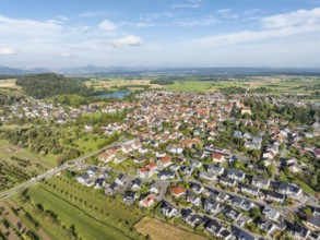
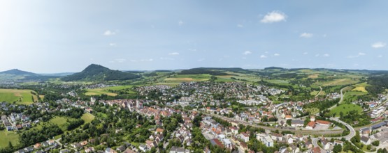
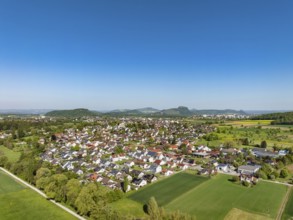
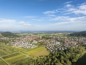
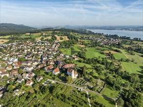
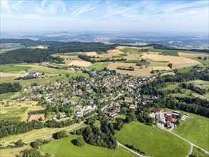
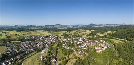
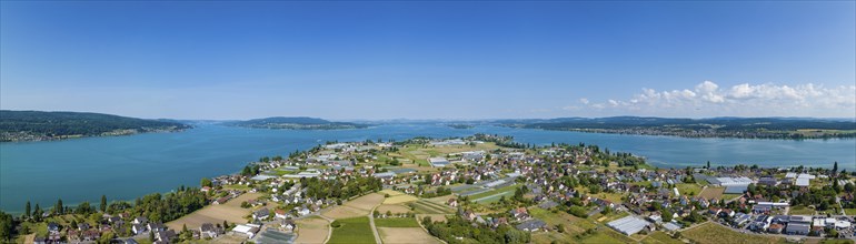
Aerial view of the municipality of Steißlingen, on...
BRK26C60_240
Aerial view, panorama of the municipality of Steiß...
BRK26C56_500
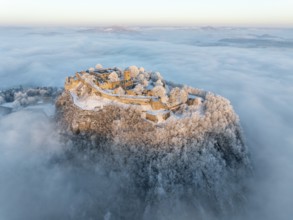
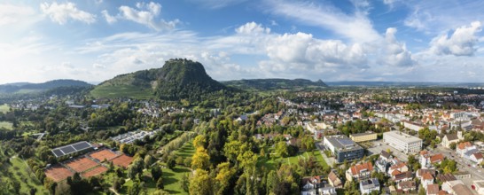
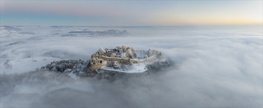
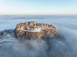
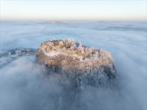
Aerial view of the Hegau volcano Hohentwiel with G...

BRK26C54_489
Schilder, Wegweiser, vom Schwarzwaldverein, der si...
BRK26B65_487
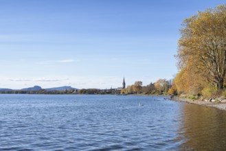
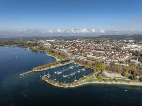
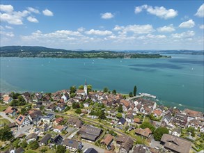
Aerial view of the town of Radolfzell on Lake Cons...
BRK26B01_130
Luftbild, Panorama von der Stadt Engen im Hegau mi...
BRK26B01_127
Luftbild, Panorama von der Stadt Engen im Hegau am...
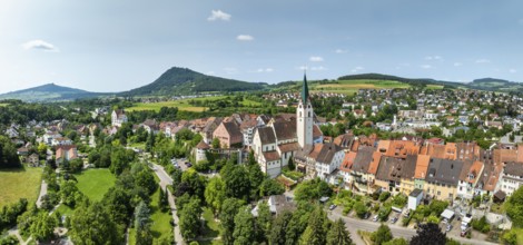
BRK26B01_126
Luftbild, Panorama von der Stadt Engen im Hegau mi...
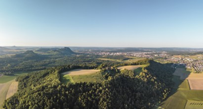
BRK25M81_209
Luftbild, Panorama von einer vulkanisch geprägten ...
BRK25M15_100
Luftbild, Panorama von einer vulkanisch geprägten ...
BRK25M07_338
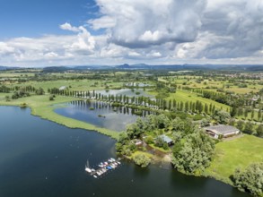
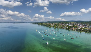
Aerial view of Lake Beech including Güttinger See,...
BRK25M06_118
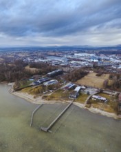
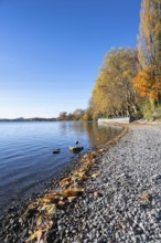
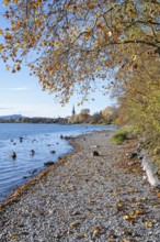
Gravel shore, Lake Constance shore at Mettnaupark ...
BRK25M06_116
Gravel shore, pebble beach, Lake Constance shore a...
BRK25M06_117
Gravel shore, pebble beach, Lake Constance shore a...
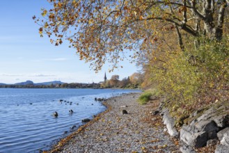
BRK25M06_115
Gravel shore, pebble beach, Lake Constance shore a...
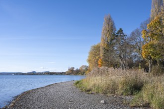
BRK25M06_114
Gravel shore, pebble beach, Lake Constance shore a...
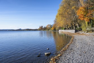
BRK25M06_113
Gravel shore, Lake Constance shore at Mettnaupark ...
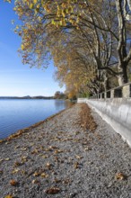
BRK25M06_111
Gravel shore, Lake Constance shore at Mettnaupark ...
BRK25L86_224
Luftbild, Panorama von einer vulkanisch geprägten ...
BRK25L71_288
Aerial view of Lake Beech including Güttinger See,...
BRK25L70_248
Aerial view of the town of Radolfzell on Lake Cons...
BRK25L86_225
Luftbild, Panorama von einer vulkanisch geprägten ...
BRK25L86_227
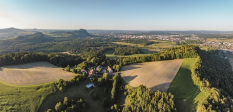
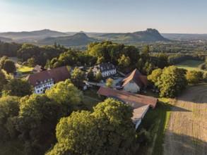
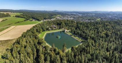
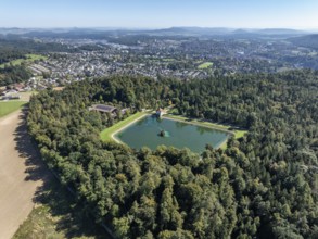
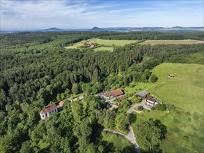
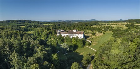
Luftbild von einer Hofsiedlung mit dem Berggasthau...
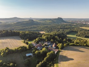
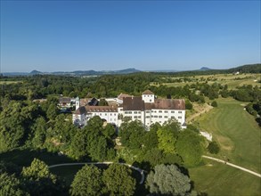
BRK25L86_228
Luftbild von einer Hofsiedlung mit dem Berggasthau...

BRK25L17_486
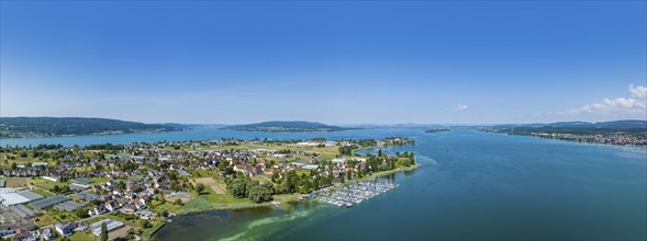
Aerial view of the town of Radolfzell on Lake Cons...

BRK25L26_031
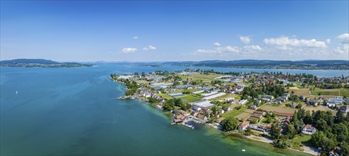
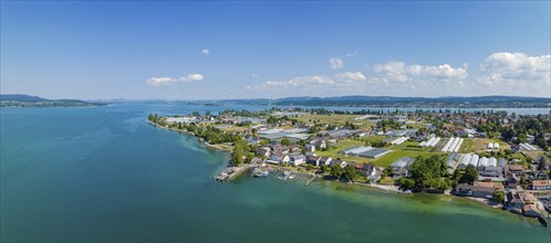
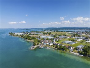
Aerial view of the Mettnau peninsula with the Mark...

BRK25L17_488
Aerial view, panorama of the town of Radolfzell on...
BRK25L17_487
Aerial view, panorama with view over Mettnaupark a...

BRK25K88_143
Aerial view of Lake Beech including Güttinger See,...
BRK25J87_426
Aerial view of the Engeweiher above Schaffhausen, ...
BRK25J87_429
Aerial view, panorama of the municipality and encl...
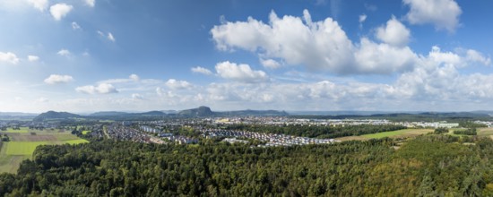
BRK25J64_069
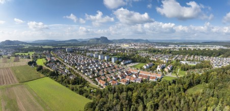
Aerial view, panorama of the town of Singen am Hoh...
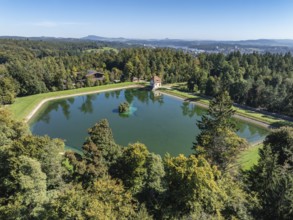
BRK25J87_425
Aerial view of the Engeweiher above Schaffhausen, ...
BRK25J87_427
Aerial view, panorama of the city of Schaffhausen ...
BRK25J87_423
Aerial view, panorama of the Engeweiher above Scha...
BRK25J64_075
Aerial view of the town of Singen am Hohentwiel wi...
BRK25J87_424
Aerial view of the Engeweiher above Schaffhausen, ...
BRK25J64_071
Aerial view of the town of Singen am Hohentwiel, o...
BRK25J64_080
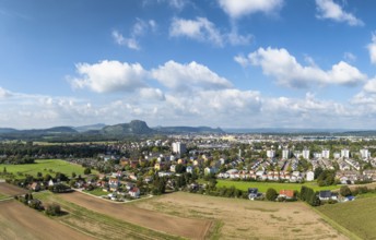
Aerial view, panorama of the town of Singen am Hoh...
BRK25J64_073
Aerial view of the town of Singen am Hohentwiel, o...
BRK25J87_430
Aerial view, panorama of the municipality and encl...
BRK25J64_072
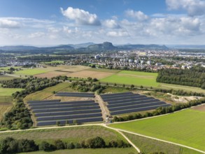
Aerial view, solar modules, solar park, photovolta...
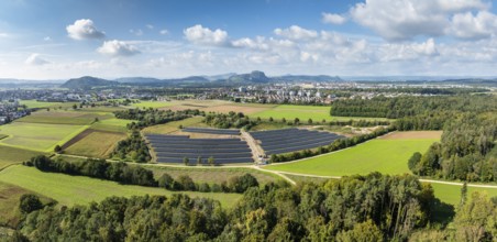
BRK25J64_082
Aerial view, panorama, solar modules, solar park, ...
BRK25J64_081
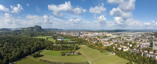
Aerial view, panorama of the town of Singen am Hoh...
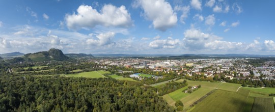
BRK25J64_077
Aerial view, panorama of the town of Singen am Hoh...
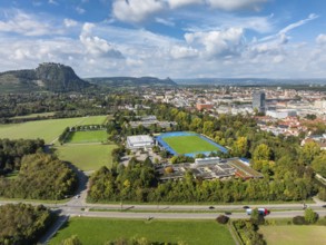
BRK25J64_083
Aerial view of the town of Singen am Hohentwiel wi...
BRK25H50_497
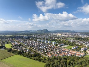
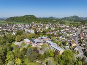
Aerial view, of the municipality of Rielasingen-Wo...
BRK25E76_307
Aerial view, panorama of Arenenberg with Arenenber...
BRK25E51_279
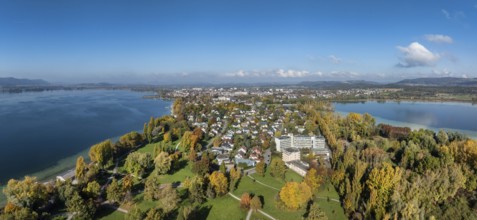
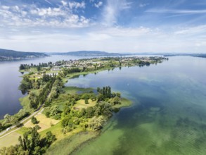
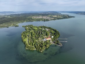
Aerial view of the island of Reichenau in Lake Con...
BRK25E73_402
Aerial view of the municipality Rielasingen-Worbli...
BRK25E45_355
Aerial view of the Mettnau peninsula near Radolfze...
BRK25D03_168
Aerial view of western Lake Constance with the Rad...
BRK25D06_296
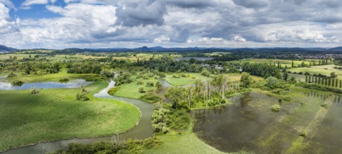
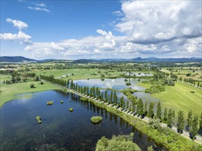
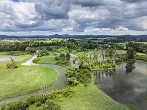
Aerial view, panorama of the Radolfzeller Aachried...
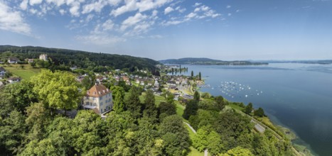
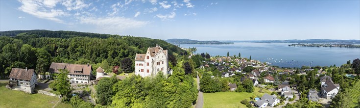
BRK25B83_452
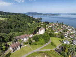
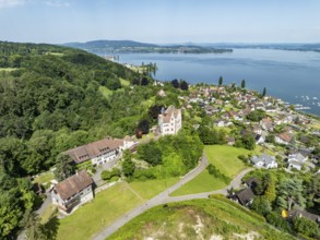
Aerial view of Salenstein Castle above the municip...
BRK25A54_039
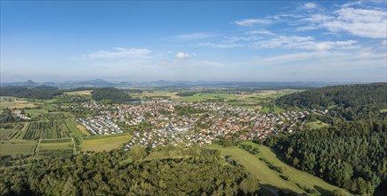
Aerial view of the municipality of Steißlingen, on...
BRK25A83_298
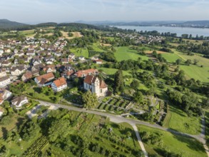
Aerial view of Salenstein Castle above the municip...
BRK25A27_258
The church of St Johann and Vitus in Horn on the H...
BRK24I81_426
Aerial view of western Lake Constance with the Rad...
BRK24I63_304
Aerial view of the Schenkenberg Chapel, a pilgrima...
BRK24I80_223
Aerial view of the island of Reichenau in Lake Con...
BRK24I05_332
The church of St Johann and Vitus in Horn on the H...
BRK24I00_084
Aerial panorama of the Hegau volcano Hohentwiel wi...
BRK24H45_389
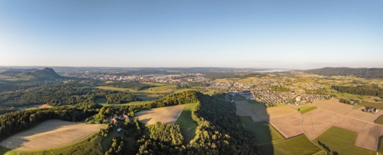
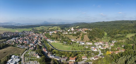
Aerial view, panorama of the town of Aach in Hegau...
BRK24H45_388
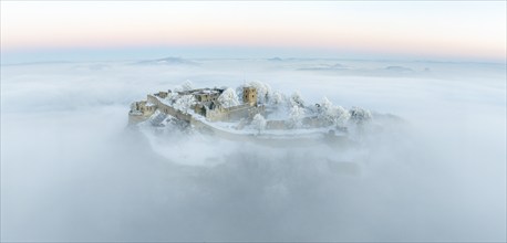
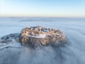
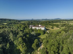
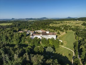
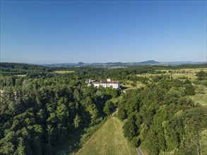
Aerial view of Langenstein Castle near Eigeltingen...
BRK24H21_146
Aerial view, panorama of the municipality of Steiß...
BRK24H21_204
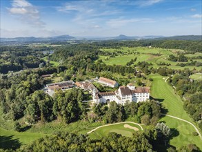
Aerial view, panorama of Salenstein Castle above t...
BRK24H32_369
Aerial view of the municipality of Schienen on the...
BRK24H27_096
Aerial panorama of the Hegau volcano Hohentwiel wi...
BRK24H43_262
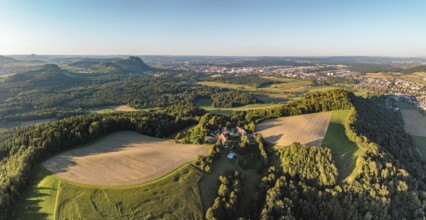
Aerial view of the Hegau volcano Hohentwiel with G...
BRK24H13_238
The island of Mainau in Lake Constance with the je...
BRK24F92_181
Aerial view of the town of Aach in Hegau, on the r...
BRK24F86_284
Aerial view of the island of Reichenau seen from t...
BRK24F92_402
Aerial view, panorama of the island of Reichenau i...
BRK24E64_075
Aerial panorama of the town of Aach im Hegau, with...
BRK24E64_472
Aerial panorama of the western part of Reichenau I...
BRK24E62_334
Aerial panorama of the town of Aach im Hegau, with...
BRK24E63_292
Aerial panorama of the western part of the island ...
BRK24E64_403
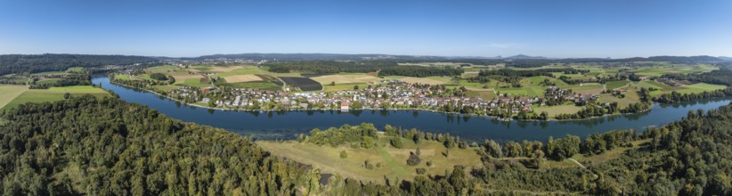
Aerial panorama of Lake Constance and the village ...
BRK24E65_348
Aerial panorama of the western part of the island ...
BRK24E63_226
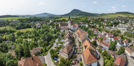
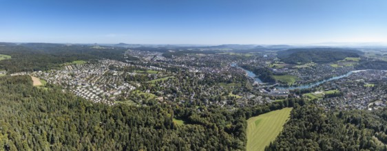
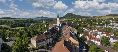
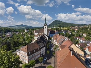
Aerial panorama of the old town of Engen, on the h...
BRK24E64_204
Aerial panorama of the western part of the island ...
BRK24E62_452
Aerial panorama of the western part of the island ...
BRK24E65_278
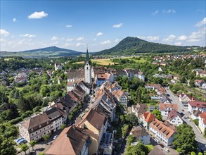
Aerial view of the old town of Engen, on the horiz...
BRK24E65_350
Aerial panorama of Langenstein Castle near Eigelti...
BRK24E63_301
Aerial view of Langenstein Castle near Eigeltingen...
BRK24E65_228
Aerial view of the town of Engen in Hegau with the...
BRK24E83_062
Aerial view of the Radolfzeller Aachried with the ...
BRK24E64_159
Aerial view of Langenstein Castle near Eigeltingen...
BRK24E64_464
Aerial view of the municipality of Berlingen, on t...
BRK24E64_490
Aerial view of Langenstein Castle near Eigeltingen...
BRK24E82_314
Aerial view, panorama of the island of Reichenau i...
BRK24E62_493
Aerial view of Langenstein Castle near Eigeltingen...
BRK24E66_100
Aerial view of the Hegau volcano Hohentwiel with G...
BRK24E65_236
Aerial view of the Hegau volcano Hohentwiel with G...
BRK24C86_122
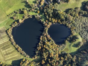
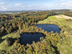
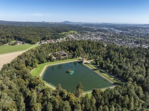
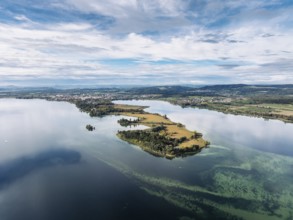
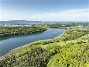
Aerial view of Mindelsee, a glacial tongue lake on...
BRK24C98_117
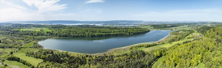
Aerial view of Lake Mindelsee, a glacier tongue la...
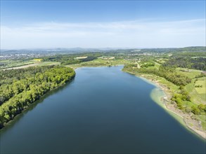
BRK24C91_216
Aerial view of Lake Mindelsee, a glacial tongue la...
- Page
-
- of
- 2