390 results for: geopark
- Page
-
- of
- 4
Please sign in for more results
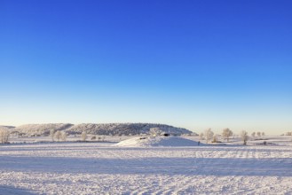
BRK26C66_214
Winter landscape with snow and frost in the countr...
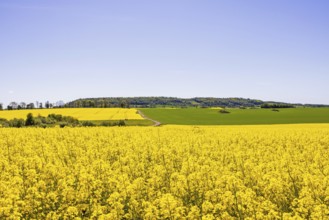
BRK26C61_067
View of a blooming rapeseed field in a rural summe...
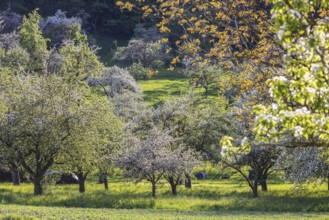
BRK26C67_295
Blossoming fruit trees on the Albtrauf of the Swab...
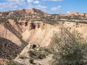
BRK26C65_184
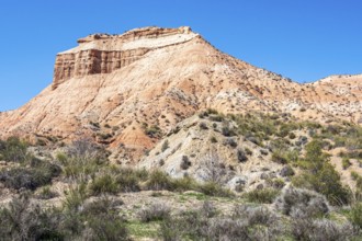
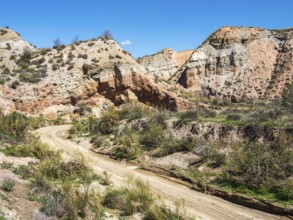
View over the Gorafe desert, colorful canyons, roc...
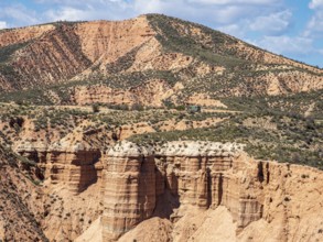
BRK26C55_150
View over the Gorafe desert, colorful canyons, roc...
BRK26C55_153
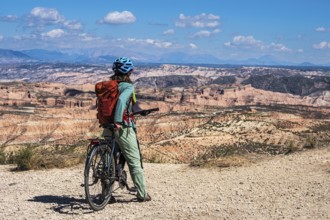
Woman on a bicycle looks over the desert, viewpoin...
BRK26C55_154
Cyclist looks over the desert, viewpoint, Gorafe D...
BRK26C55_158
Colorful mountain in the Gorafe desert, rock forma...
BRK26C55_148
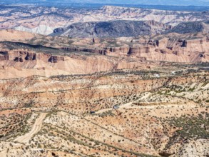
Gravel road, Gorafe desert, colorful canyons, rock...
BRK26C55_156
Canyons and gorges near village Gorafe, Gorafe Des...
BRK26C55_147
View over the slopes of the Gorafe desert, snow-co...
BRK26C55_155
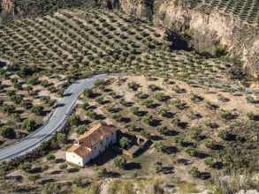
Olive trees in the Gorafe Desert, single farm at a...
BRK26C55_151
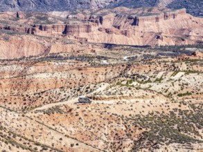
4x4 camper van driving on gravel road, Gorafe dese...
BRK26C55_145
Cyclist looks over the desert, viewpoint, Gorafe D...
BRK26C55_152
Gravel roads in the desert, 4x4 car, colorful cany...
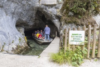
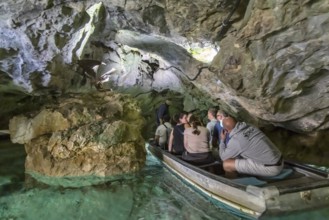
BRK26B42_147
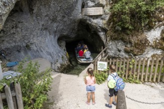
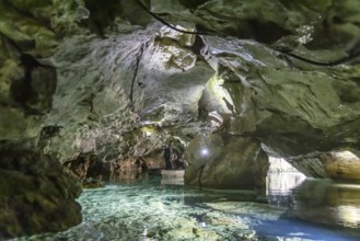
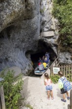
Excursion destination Wimsen Cave in the Swabian A...
BRK26A97_432
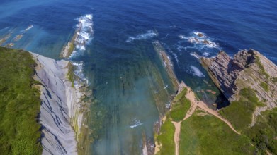
Breathtaking aerial view of the unique flysch rock...
BRK26A76_314
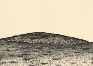
The Glambeck terminal moraine, example of a massiv...
BRK26A90_408
Excursion destination Wimsen Cave in the Swabian A...
BRK26A97_433
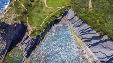
Aerial view of the impressive flysch cliffs of zum...
BRK26A05_255
The Glambeck terminal moraine, example of a massiv...
BRK26A32_024
Excursion destination Wimsen Cave in the Swabian A...
BRK26A32_025
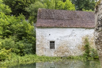
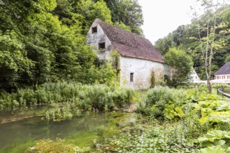
Old barn. The building is located near the source ...

BRK25M86_431
Excursion destination Wimsen Cave in the Swabian A...

BRK25M86_432
Old barn. The building is located near the source ...

BRK25M43_259
Excursion destination Wimsen Cave in the Swabian A...
BRK25M43_261
Excursion destination Wimsen Cave in the Swabian A...
BRK25M43_258
Old barn. The building is located near the source ...

BRK25M43_260
Old barn. The building is located near the source ...

BRK25M43_202
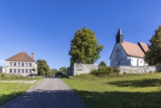
Zwiefalten Monastery, former Benedictine abbey. To...
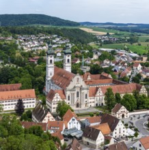
BRK25M43_201
Zwiefalten Monastery, former Benedictine abbey. To...
BRK25L84_136
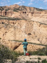
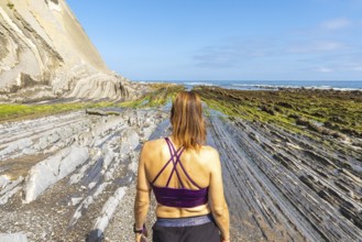
Female tourist exploring the unique geological for...
BRK25L49_014
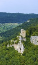
Reußenstein castle ruins. Historical sight near Ne...
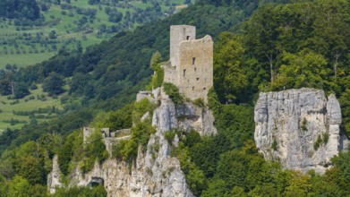
BRK25L49_015
Reußenstein castle ruins. Historical sight near Ne...
BRK25J82_229
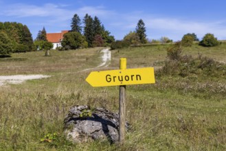
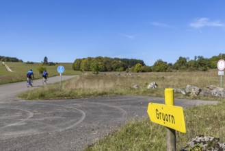
Gruorn is a deserted village near Münsingen in the...
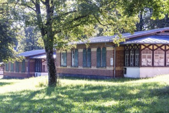
BRK25J82_236
The Old Camp in Münsingen has been a listed buildi...
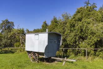
BRK25J82_228
Historic shepherd's cart of the travelling shepher...
BRK25J82_237
The Old Camp in Münsingen has been a listed buildi...
BRK25J82_227
Gruorn is a deserted village near Münsingen in the...
BRK25J82_234
The Old Camp in Münsingen has been a listed buildi...
BRK25J82_226
Trees and bushes like in a jungle. Wild growth ove...
BRK25J82_235
The Old Camp in Münsingen has been a listed buildi...
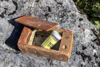
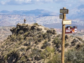
BRK25J82_474
Geocaching, very obvious hiding place in the area ...
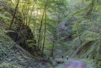
BRK25J83_021
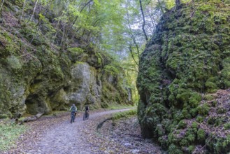
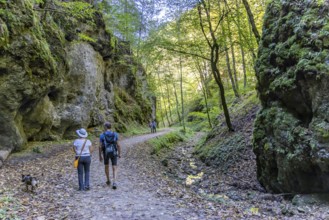
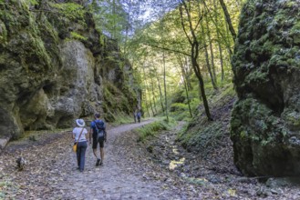
Trailfinger Gorge near Seeburg in the Swabian Alb....
BRK25J82_472
Geocaching, very obvious hiding place in the area ...
BRK25J83_020
Trailfinger Gorge near Seeburg in the Swabian Alb....
BRK25J82_232
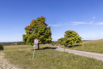
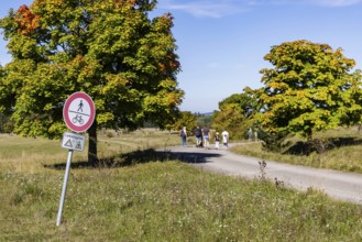
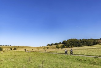
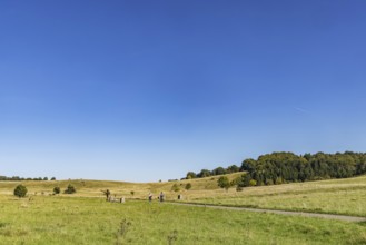
Hikers in the Swabian Alb biosphere reserve. The f...
BRK25J82_233
Hikers in the Swabian Alb biosphere reserve. The f...
BRK25J82_230
Gruorn is a deserted village near Münsingen in the...
BRK25J83_019
Trailfinger Gorge near Seeburg in the Swabian Alb....
BRK25J82_231
Gruorn is a deserted village near Münsingen in the...
BRK25J83_024
Trailfinger Gorge near Seeburg in the Swabian Alb....
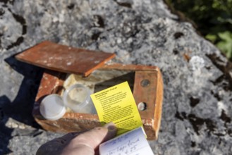
BRK25J82_206
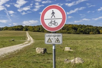
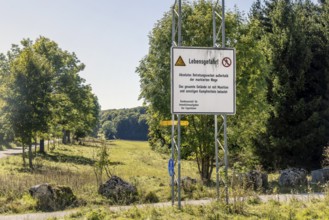
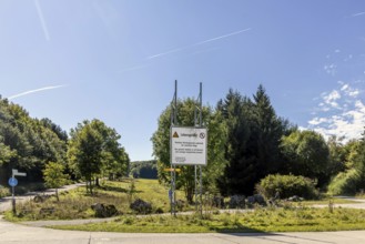
Danger to life from unexploded ordnance in the Swa...
BRK25J82_217
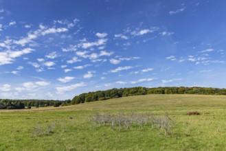
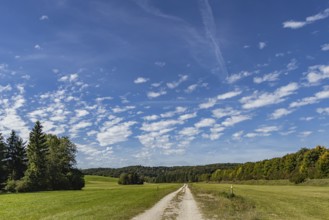
Pristine landscape in the Swabian Alb biosphere re...
BRK25J82_207
Pristine landscape in the Swabian Alb biosphere re...
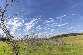
BRK25J82_216
Pristine landscape in the Swabian Alb biosphere re...
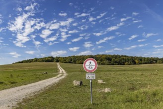
BRK25J82_212
Danger to life from unexploded ordnance in the Swa...
BRK25J82_218
Pristine landscape in the Swabian Alb biosphere re...
BRK25J82_203
Pristine landscape in the Swabian Alb biosphere re...
BRK25J82_213
Danger to life from unexploded ordnance in the Swa...
BRK25J82_205
Pristine landscape in the Swabian Alb biosphere re...
BRK25J82_214
Pristine landscape in the Swabian Alb biosphere re...
BRK25J82_204
Pristine landscape in the Swabian Alb biosphere re...
BRK25J82_215
Danger to life from unexploded ordnance in the Swa...
BRK25J82_208
Danger to life from unexploded ordnance in the Swa...
BRK25J82_209
Pristine landscape in the Swabian Alb biosphere re...
BRK25J82_210
Pristine landscape in the Swabian Alb biosphere re...
BRK25J82_211
Pristine landscape in the Swabian Alb biosphere re...
BRK25H73_059
Excursion destination Wimsen Cave in the Swabian A...
BRK25H50_066
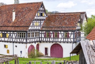
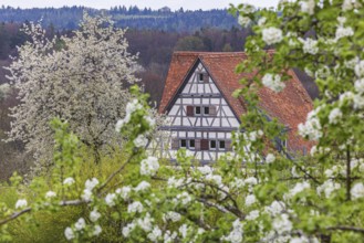
Historic farmhouse. Half-timbered building in the ...
BRK25H08_323
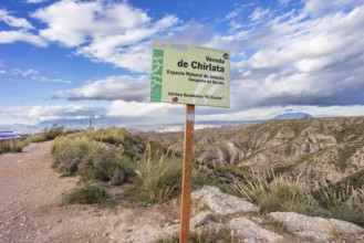
Geodetic vertex in the Chirlata area, Gorafe Ravin...
BRK25G50_089
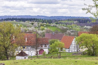
Historic village buildings. Half-timbered farmhous...
BRK25G20_142
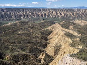
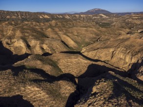
Gorafe Gullies, Puntal de Don Diego, Upper Turolia...
BRK25G42_355
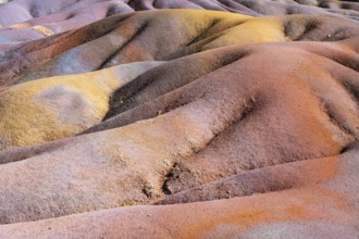
Seven Coloured Earth, 7th coloured earth, Minerals...
BRK25F52_356
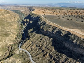
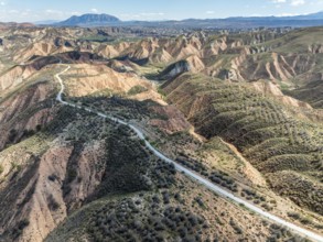
Deep canyon at the Gorafe desert, winding road to ...
BRK25F50_369
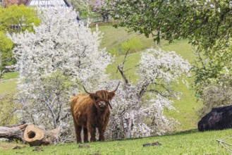
Highland cattle in the Beuren open-air museum on t...
BRK25F52_358
Canyons and gorges near village Gorafe, winding ro...
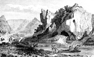
BRK25F50_009
Native people hunting and fishing, cave in the Swa...
BRK25F53_345
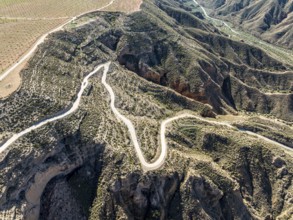
Winding road on a plateau, surrounded by colorful ...
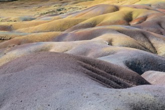
BRK25E80_345
Seven Coloured Earth, 7th coloured earth, Minerals...
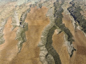
BRK25E80_030
Canyons and gorges cut into the surrounding cultiv...
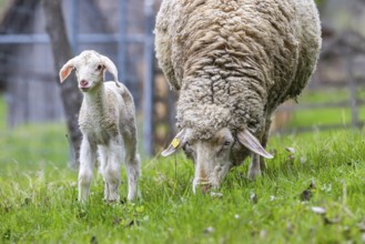
BRK25E69_437
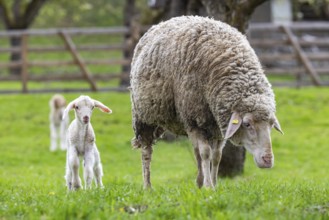
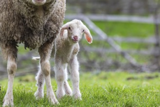
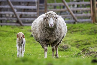
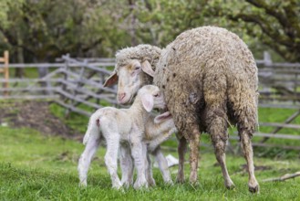
Sheep and young of the Württemberger breed, also k...
BRK25E71_331
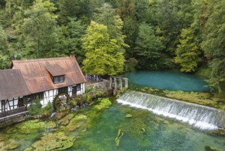
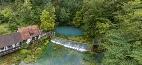
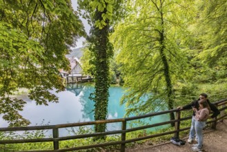
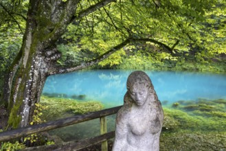
Blautopf Blaubeuren with industrial monument Hamme...
BRK25E66_120
Historic village buildings. Half-timbered farmhous...
BRK25E55_373
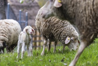
Sheep and young of the Württemberger breed, also k...
BRK25E34_228
Sheep and young of the Württemberger breed, also k...
BRK25E44_420
Blautopf Blaubeuren with industrial monument Hamme...
BRK25E13_259
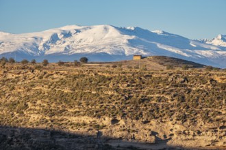
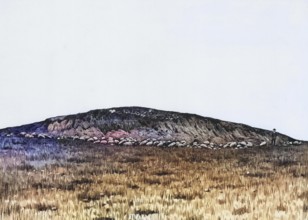
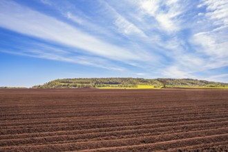
Plowed field in the countryside by a table mountai...
BRK25E43_294
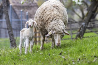
Sheep and young of the Württemberger breed, also k...
BRK25E40_367
Sheep and young of the Württemberger breed, also k...
BRK25E40_366
Sheep and young of the Württemberger breed, also k...
BRK25E08_106
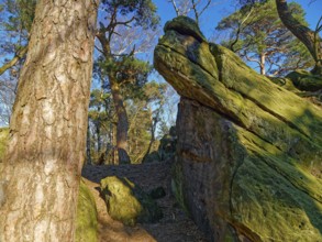
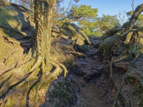
The Dörenther Cliffs, boulders and trees rooted in...
BRK25E13_203
The Dörenther Cliffs, boulders and trees rooted in...
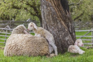
BRK25D83_340
Sheep and young of the Württemberger breed, also k...
BRK25D79_403
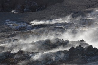
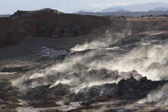
Steam evaporating of the ground at Gunnuhver, clos...
BRK25D88_142
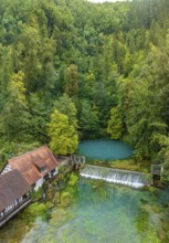
Last photos of the Blautopf in Blaubeuren in front...
BRK25D72_267
Steam evaporating of the ground at Gunnuhver, clos...
BRK25D92_220
Sheep and young of the Württemberger breed, also k...
BRK25D04_089
Last photos of the Blautopf in Blaubeuren in front...
BRK25D08_280
Blautopf Blaubeuren with industrial monument Hamme...
- Page
-
- of
- 4