194 results for: fröndenberg
- Page
-
- of
- 2
Please sign in for more results
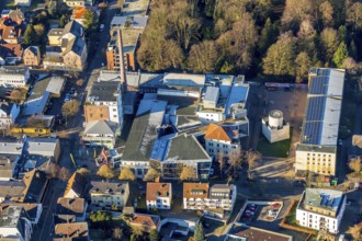
BRK25K28_431
Aerial view, Lindenbrauerei e. V. Kultur- und Komm...
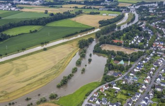
BRK25J11_035
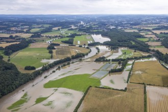
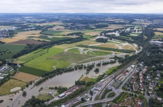
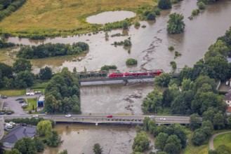
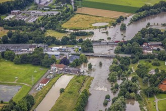
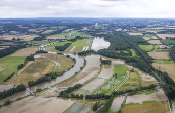
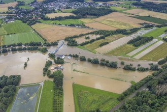
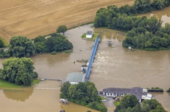
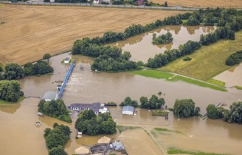
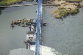
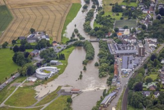
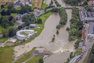
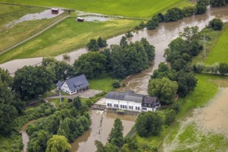
Aerial photo, Ruhr flood, Fröndenberg, Fröndenberg...

BRK25J35_184
Aerial photo, Ruhr flood, Altendorf, Fröndenberg/R...
BRK25J35_227
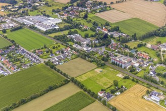
Aerial view, Schürenfeld planned industrial area a...
BRK25J35_283
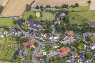
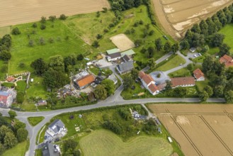
Aerial view, aerial view district Bentrop, Frönden...
BRK25J35_288
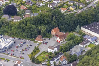
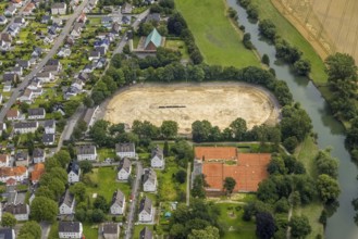
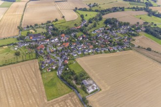
Aerial view, view of the town and Christ-König-Kir...
BRK25J35_319
Aerial view, planned reconstruction Harthaer Straß...

BRK25J11_037
Aerial photo, Ruhr flood, Fröndenberg, Fröndenberg...
BRK25J35_183
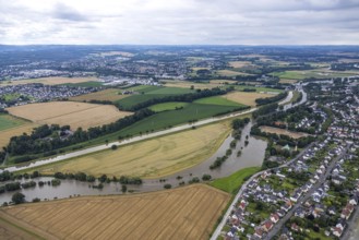
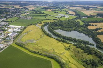
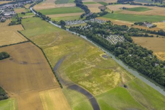
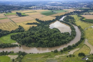
Aerial view, a week ago there was still land under...
BRK25J35_185
Aerial photo, Ruhr flood, Altendorf, Fröndenberg/R...
BRK25J35_226
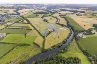
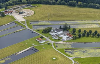
Aerial view, Wasserwerke Westfalen GmbH and Langsc...
BRK25J35_282
Aerial view, The Rammbach crosses Ölmühlenweg in W...
BRK25J35_289
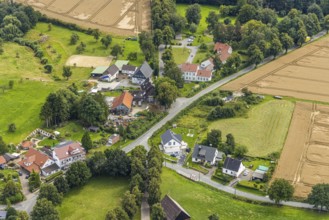
Aerial view, aerial view district Warmen, Fröndenb...
BRK25J35_316
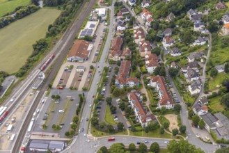
Aerial view, Fröndenberg station, Fröndenberg/Ruhr...
BRK25J11_048
Aerial photo, Ruhr flood, Fröndenberg, Fröndenberg...
BRK25J35_175
Aerial view, a week ago there was still land under...
BRK25J35_231
Aerial view, Schürenfeld planned industrial area a...

BRK25J35_302
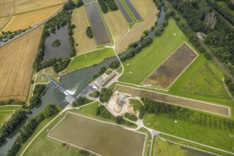
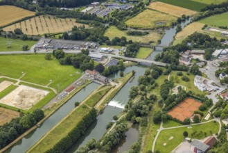
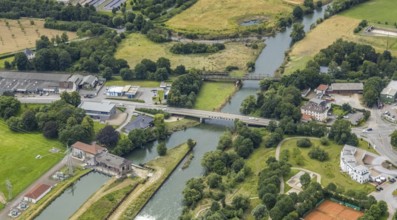
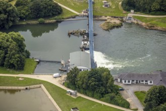
Aerial view, Obergraben with run-of-river power st...
BRK25J35_308
Aerial view, Christ-König-Kirche in the Frohnhause...
BRK25J35_327
Aerial view, planned new construction of the Frönd...
BRK25J11_046
Aerial photo, Ruhr flood, Fröndenberg, Fröndenberg...
BRK25J35_176
Aerial view, a week ago there was still land under...
BRK25J35_225
Aerial view, local view district Langschede and ca...
BRK25J35_300
Aerial view, Obergraben with run-of-river power st...
BRK25J35_307
Aerial view, local view and Christ-König-Kirche in...
BRK25J35_328
Aerial view, planned new construction of the Frönd...

BRK25J09_299
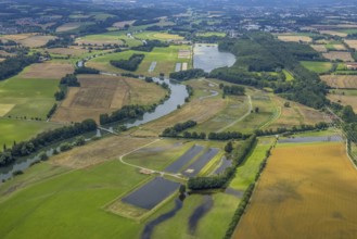
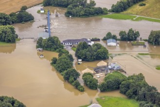
Aerial photo, Ruhr flood, Warmen, Fröndenberg/Ruhr...

BRK25J11_005
Aerial photo, Ruhr flood, Ardey, Fröndenberg/Ruhr,...
BRK25J35_219
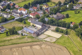
Aerial view, riding centre Christina Plotz in Stri...
BRK25J35_309
Aerial view, Christ-König-Kirche in the Frohnhause...

BRK25J10_062
Aerial photo, Ruhr flood, Warmen, Fröndenberg/Ruhr...

BRK25J11_002
Aerial photo, Ruhr flood, Ardey, Fröndenberg/Ruhr,...
BRK25J35_217
Aerial view, riding centre Christina Plotz and loc...
BRK25J35_306
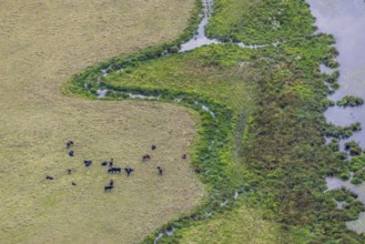
Aerial view, grazing cattle and river meander at t...

BRK25J10_500
Aerial photo, Ruhr flood, Frohnhausen, Fröndenberg...

BRK25J35_146
Aerial photo, Ruhr flood, Fröndenberg, Fröndenberg...
BRK25J35_155
Aerial photo, Ruhr flood, Fröndenberg, Fröndenberg...
BRK25J35_274
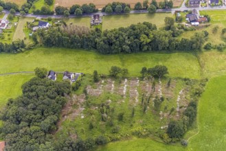
Aerial view, forest with felled trees at Holtkamp ...
BRK25J35_351
Aerial view, meadows and fields at Ostbürener Stra...
BRK25J35_359
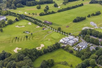
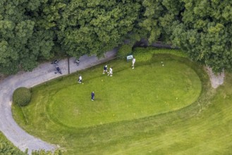
Aerial view, Golf Hotel and Golf Club Gut Neuenhof...

BRK25J11_036
Aerial photo, Ruhr flood, Fröndenberg, Fröndenberg...

BRK25J35_159
Aerial photo, Ruhr flood, Fröndenberg, Fröndenberg...
BRK25J35_232
Aerial view, Schürenfeld planned industrial area a...
BRK25J35_261
Aerial view, forest with felled trees at Holtkamp ...
BRK25J35_358
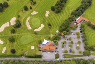
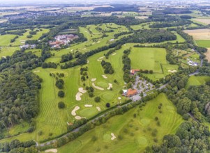
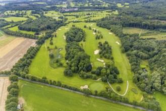
Aerial view, golf course and golf club Unna-Frönde...
BRK25J11_031
Aerial photo, Ruhr flood, Altendorf, Fröndenberg/R...
BRK25J11_041
Aerial photo, Ruhr flood, Fröndenberg, Fröndenberg...

BRK25J35_142
Aerial photo, Ruhr flood, Ardey, Fröndenberg/Ruhr,...
BRK25J35_148
Aerial photo, Ruhr flood, Fröndenberg, Fröndenberg...
BRK25J35_166
Aerial photo, Ruhr flood, Fröndenberg, Fröndenberg...
BRK25J35_171
Aerial view, a week ago there was still land under...
BRK25J35_187
Aerial view, a week ago there was still land under...
BRK25J35_262
Aerial view, construction site for fire station bu...
BRK25J35_271
Aerial view, Hammer Waterworks Warmen at the Mersc...
BRK25J35_276
Aerial view, forest with felled trees at Holtkamp ...
BRK25J35_281
Aerial view, Hammer Waterworks Warmen at the Mersc...
BRK25J35_299
Aerial view, Metallverarbeitung Finkendei GmbH in ...
BRK25J35_311
Aerial view, golf course and golf club Unna-Frönde...
BRK25J35_331
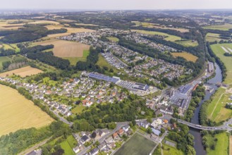
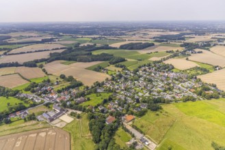
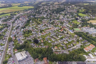
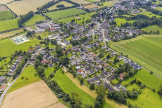
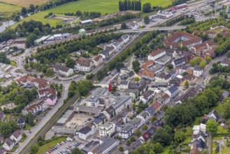
Aerial view, townscape and city centre Fröndenberg...
BRK25J35_335
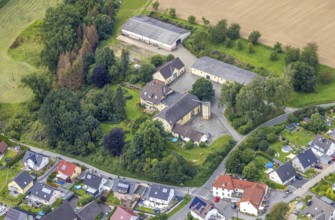
Aerial view, Schmallenbach-Haus Huberti retirement...
BRK25J35_355
Aerial view, golf course and golf club Unna-Frönde...
BRK25J23_246
Aerial view, a week ago there was still land under...

BRK25J11_034
Aerial photo, Ruhr flood, Altendorf, Fröndenberg/R...
BRK25J35_147
Aerial photo, Ruhr flood, Fröndenberg, Fröndenberg...
BRK25J35_161
Aerial photo, Ruhr flood, Frohnhausen, Fröndenberg...
BRK25J35_181
Aerial view, a week ago there was still land under...
BRK25J35_260
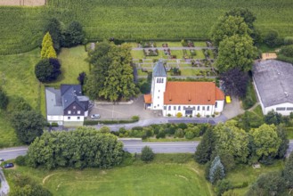
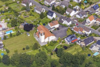
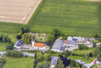
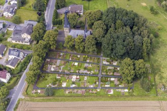
Aerial view, catholic church St. Agnes with cemete...
BRK25J35_269
Aerial view, Hammer waterworks Warmen at the Mersc...
BRK25J35_279
Aerial view, aerial view district Warmen, Fröndenb...
BRK25J35_287
Aerial view, intersection Palzstraße and Bausenhag...
BRK25J35_304
Aerial view, equestrian centre Neimen in the distr...
BRK25J35_312
Aerial view, golf course and golf club Unna-Frönde...
BRK25J35_333
Aerial view, planned new construction of the Frönd...
BRK25J23_247
Aerial view, a week ago there was still land under...
BRK25J35_141
Aerial photo, Ruhr flood, Ardey, Fröndenberg/Ruhr,...

BRK25J35_150
Aerial photo, Ruhr flood, Fröndenberg, Fröndenberg...
BRK25J35_160
Aerial photo, Ruhr flood, Warmen, Fröndenberg/Ruhr...
BRK25J35_172
Aerial view, a week ago there was still land under...
BRK25J35_180
Aerial view, a week ago there was still land under...
BRK25J35_263
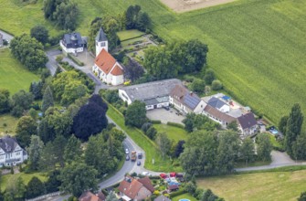
Aerial view, view of the village and evang. Villag...
BRK25J35_273
Aerial view, local view and Christ-König-Kirche in...
BRK25J35_275
Aerial view, construction site for fire station bu...
BRK25J35_293
Aerial view, The Rammbach crosses Ölmühlenweg in W...
BRK25J35_298
Aerial view, aerial view district Frohnhausen in F...
BRK25J35_313
Aerial view, planned reconstruction Harthaer Straß...
BRK25J35_332
Aerial view, site view, Alter cemetery und Gesamts...
BRK25J35_353
Aerial view, golf course and golf club Unna-Frönde...
BRK25J11_038
Aerial photo, Ruhr flood, Ardey, Fröndenberg/Ruhr,...
BRK25J35_144
Aerial photo, Ruhr flood, Ardey, Fröndenberg/Ruhr,...
BRK25J35_149
Aerial photo, Ruhr flood, Fröndenberg, Fröndenberg...
BRK25J35_162
Aerial photo, Ruhr flood, Warmen, Fröndenberg/Ruhr...
BRK25J35_167
Aerial view, a week ago there was still land under...
BRK25J35_216
Aerial view, riding centre Christina Plotz in Stri...
BRK25J35_259
Aerial view, construction site for fire station bu...
BRK25J35_266
Aerial view, village view with protestant village ...
BRK25J35_272
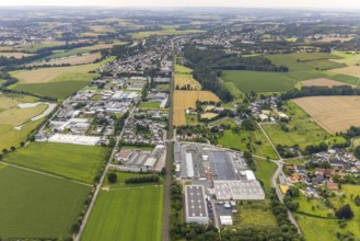
Aerial view, industrial area Neimen and Frohnhause...
BRK25J35_294
Aerial view, Hammer Waterworks Warmen at the Mersc...
BRK25J35_301
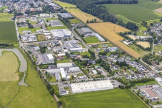
Aerial view, Neimen industrial estate, Fröndenberg...
BRK25J35_314
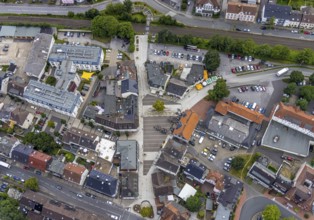
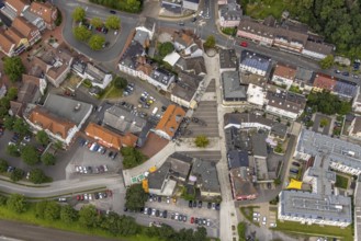
Aerial view, newly designed market place in Frönde...
BRK25J35_334
Aerial view, Schmallenbach-Haus Hubertia retiremen...
- Page
-
- of
- 2