2725 results for: county cornwall
- Page
-
- of
- 28
Please sign in for more results
BRK26C66_262
Felsen und Strand an einer Küste mit klarem Wasser...
BRK26C64_285
Hohe Klippen umrahmen Sandstrand mit sanftem Meer,...
BRK26C67_033
Langer Sandstrand in einer weiten Küstenlandschaft...
BRK26C71_204
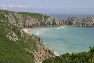
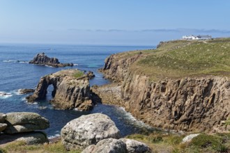
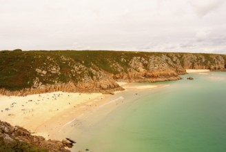
Coastal landscape at Land's End. The Enys Dodnan A...
BRK26C63_435
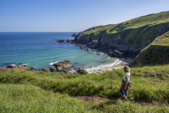
Coastal landscape in Cornwall between Gurnard's He...
BRK26C62_225
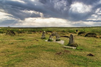
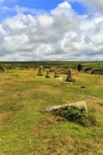
Mên-an-Tol, Men an Tol, Hole Stone in a Field, Bro...
BRK26C57_410
Rocks in Kynance Cove. Evening, blue hour. Long ex...
BRK26C58_289
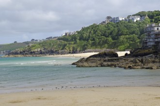
Sandy beach beach and rocks in Nanjizal Bay or Nan...
BRK26C59_481
Mên-an-Tol, Men an Tol, perforated stone and menhi...
BRK26C57_269
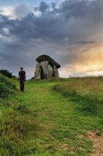
Trethevy Quoit Megalithic Stone Tomb, Dolmen, Port...
BRK26C61_038
A hiker on a coastal path. View of Rose-an Hale Co...
BRK26C62_067
A woman on a sandy beach in Nanjizal Bay. Evening,...
BRK26C65_260
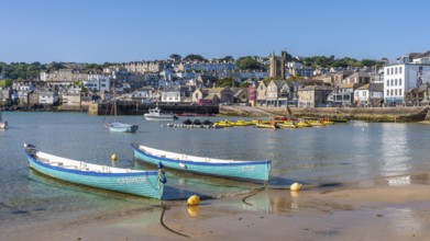
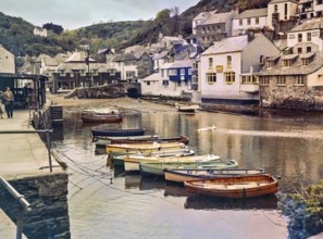
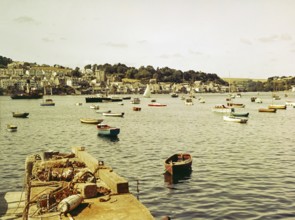
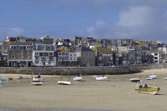
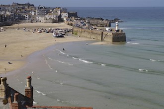
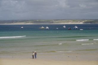
Boats in the harbour of St Ives. St Ives, Cornwall...

BRK26C99_394
Cornwall Terrace, Marylebone, City of Westminster,...
BRK26C67_485
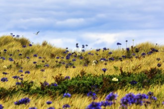
Dune Landscape, Blue and White lilies of the nile ...
BRK26C66_048
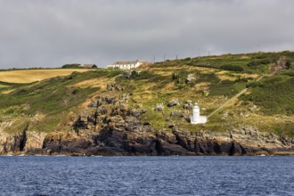
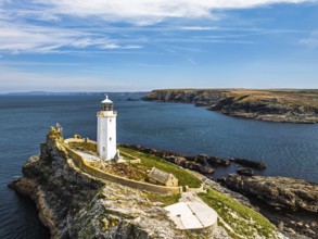
Tater-du lighthouse on rocky coast, Penzance, Corn...
BRK26C56_180
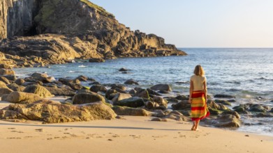
Coastal landscape. sandy beach beach and rocks in ...
BRK26D01_105
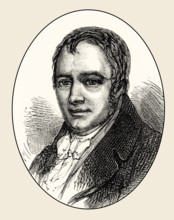
Richard Trevithick, 1771 – 1833, a British invento...
BRK26C56_226
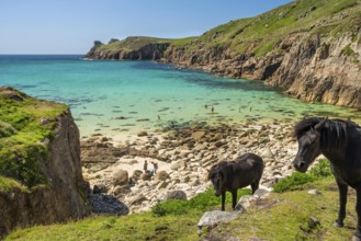
Free-roaming ponies in Nanjizal Bay or Nanjizal Be...
BRK26C66_218
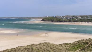
View from Hayle Sands to Hayle Beach and Riviere T...
BRK26C96_238
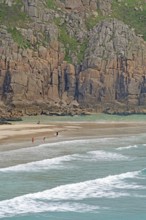
Coastal landscape at Land's End. The rock Enys Dod...
BRK26C61_150
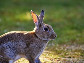
European rabbit (Oryctolagus cuniculus) in a meado...
BRK26C06_084
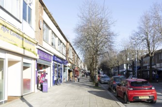
Shops and shoppers shopping street, Cornwall Stree...
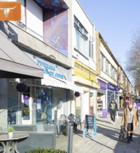
BRK26C06_083
Shops and shoppers shopping street, Cornwall Stree...
BRK26C31_349
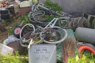
Old bikes and various objects lie messy in a garde...
BRK26C31_350
Small pier leading into the sea, colorful sky with...
BRK26C31_352
Large rope rolls lie on the shore with a wide view...

BRK26C31_353
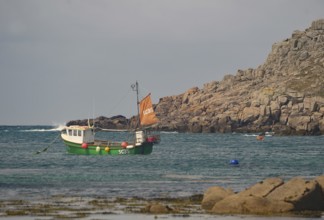
A small fishing boat out at sea off a rocky coast ...
BRK26C51_403
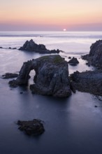
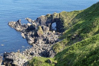
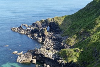
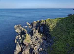
Rocky coast and rock gate on the south-east coast ...
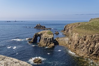
BRK26C51_404
Rock formation and rock gate off the west coast of...
BRK26B95_256
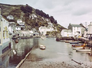
Historic waterfront buildings around the harbour r...
BRK26C48_427
Godrevy Lighthouse from a drone, Godrevy Island, S...
BRK26C31_351
Three greenhouses full of books stand along a sunl...
BRK26B40_034
Godrevy Lighthouse from a drone, Godrevy Island, S...
BRK26B29_363
Boats at moorings in harbour of town Fowey, Cornwa...
BRK26B29_477
Historic waterfront buildings around the harbour r...
BRK26B48_368
Sandy beach beach with sea view and hills covered ...
BRK26B48_374
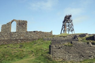
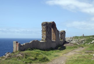
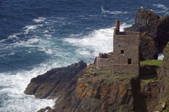
Historic ruins on a rocky cliff above the roaring ...

BRK26B48_363
Wide green fields stretch to the coast under a clo...
BRK26B48_369
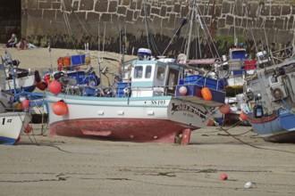
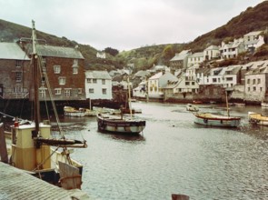
A busy coastal harbour with many boats and a town ...
BRK26B48_373
A red boat floats on calm blue water near a wide s...
BRK26B44_089
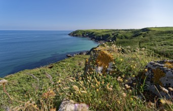
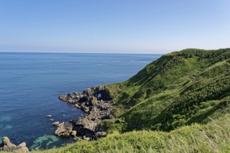
Landscape on the south-east coast near the souther...
BRK26B48_364
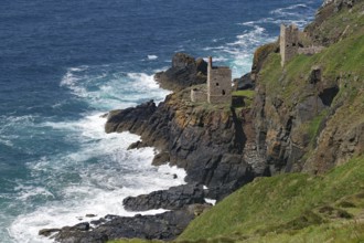
Mining ruins and a derelict tower stand on a grass...
BRK26B48_372
Coastal town with harbour and lighthouse, boats on...
BRK26B48_366
Several boats floating on a calm sea in front of a...
BRK26B48_361
A coastal ruin with a view of the blue sea and gre...
BRK26B48_375
Spacious beach with gentle waves and few people un...
BRK26B44_090
Rocky coast and rock gate on the south-east coast ...
BRK26B48_362
An old stone house perched on cliffs above a storm...
BRK26B44_093
Rock formation off the west coast of England on th...
BRK26B48_370
Fishing boats in the harbour on the dry dock, surr...
BRK26B44_091
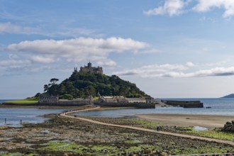
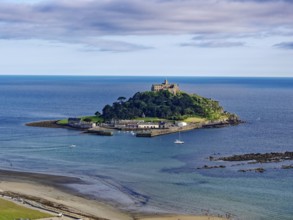
Saint Michael's Mount off the English coast in the...
BRK26B48_371
Several people walking on a quiet sandy beach, the...
BRK26B48_367
Boats anchored on calm waters off a wide, deserted...
BRK26B44_088
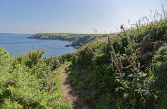
The South-West Coast Path in the south-west of Eng...
BRK26B44_092
Rock formation and rock gate off the west coast of...
BRK26B48_365
Small waves rolling towards a sandy beach with roc...
BRK26A74_127
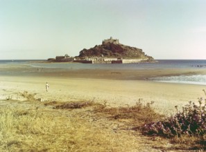
Beach at low tide, St Michael's Mount tidal island...
BRK26A74_133
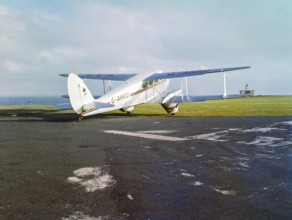
British European Airways G-AHKU De Havilland DH.89...
BRK26A74_128
Boats at moorings in harbour of town Fowey, Cornwa...
BRK26B03_140
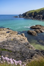
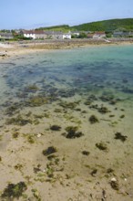
View of the coast with clear water, seaweed and ne...
BRK26A91_420
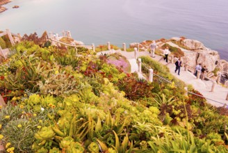
Minack Theatre, spectacular open-air theatre, circ...
BRK26A91_422
Minack Theatre, spectacular open-air theatre, view...
BRK26A74_132
Historic listed building, Huer's Hut, a hermitage ...
BRK26A80_468
Boats at moorings in the harbour at seaside fishin...
BRK26B03_114
Natural coastline with rocks and trees, turquoise ...
BRK26A74_129
View across River Fowey to Bodinnick, Cornwall, En...

BRK26A89_060
Godrevy Lighthouse from a drone, Godrevy Island, S...
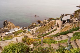
BRK26A91_421
Minack Theatre, spectacular open-air theatre, Sout...
BRK26B03_129
Small boat sailing through a rocky inlet on the wa...
BRK26B03_141
Four small boats close to the beach in front of tr...
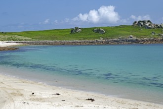
BRK26B03_116
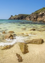
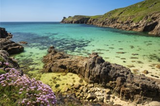
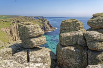
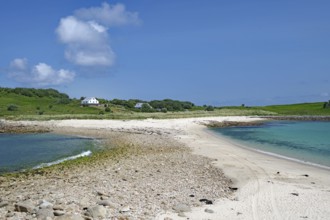
Pristine sandy beach with clear turquoise water an...
BRK26B03_142
A boat sails on the open sea between small islands...
BRK26A74_126
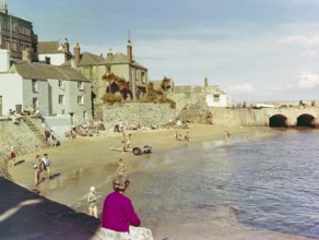
People in swimsuits on sandy beach at The Wharf, S...
BRK26A75_089
Historic waterfront buildings around the harbour r...
BRK26B03_115
Expansive sandy landscape with views of tranquil b...
BRK26B03_120
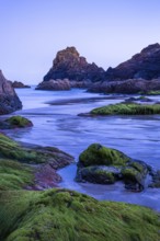
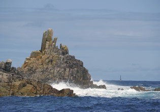
Barren rock formations by the sea with waves, a li...
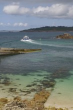
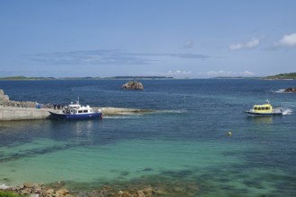
BRK26A74_135
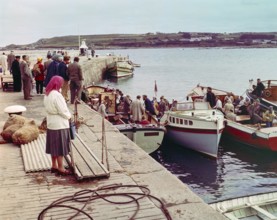
People boarding tour boats from the quayside in th...
BRK26B03_133
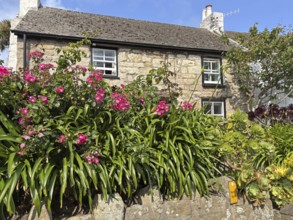
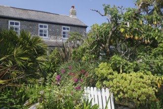
Stone house with flowering front garden and lush p...
BRK26B03_135
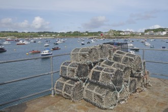
A harbour with stacked lobster pots, many boats on...
BRK26B03_139
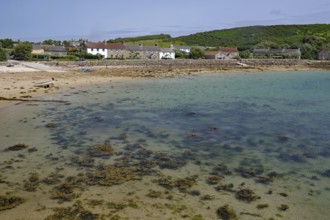
Beach with seaweed, calm sea and houses in the bac...
BRK26B03_134
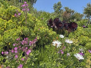
Lush garden with colourful flowers and succulents ...
BRK26B03_113
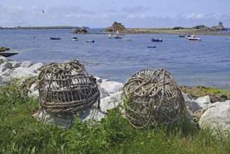
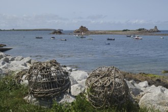
Rolled fishing baskets on a rocky coastline with b...
BRK26B03_132
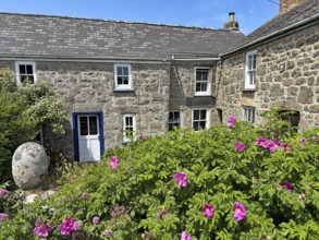
Traditional stone houses with pink garden flowers ...
BRK26B03_137
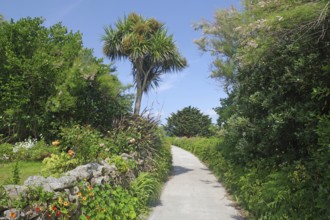
A narrow path lined with trees and palm trees, sur...
BRK26B03_136
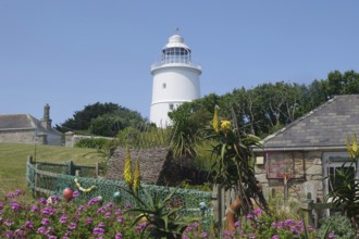
A lighthouse next to a sunny garden with blooming ...
BRK26A74_134
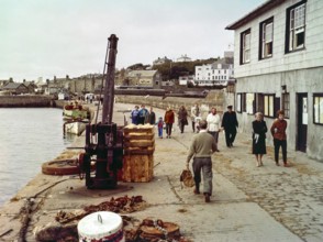
People walking along the quayside in the harbour a...
BRK26A75_476
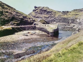
River Valency river mouth, harbour wall at fishing...
BRK26B03_138
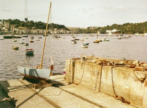
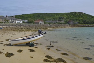
Small boat on a trailer on a quiet sandy beach nea...
BRK26A93_313
Landscape on the south-east coast near the souther...
BRK26A93_317
Saint Michael's Mount off the English coast in the...
BRK26B03_122
Small boat with orange sail in calm coastal waters...
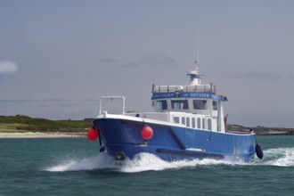
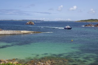
BRK26B03_124
Large blue boat in motion on wavy sea with red buo...
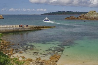
BRK26B03_130
A boat approaches the harbour on clear blue water ...
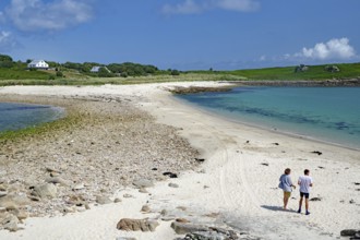
BRK26B03_131
Two people walking along a soft sandy beach with b...
BRK26B03_121
A stone house surrounded by a lush garden with tro...
BRK26B03_128
Two boats in the harbour area with a view of the o...
BRK26A93_314
Rocky coast and landscape on the south-east coast ...
BRK26A93_316
Rocky coast and rock gate on the south-east coast ...
BRK26B03_117
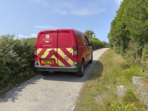
A red Royal Mail van on a rural road surrounded by...
- Page
-
- of
- 28