450 results for: city limit
- Page
-
- of
- 5
Please sign in for more results
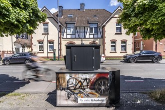
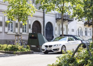
BRK26C50_261
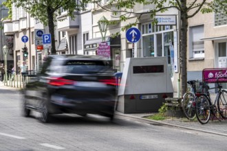
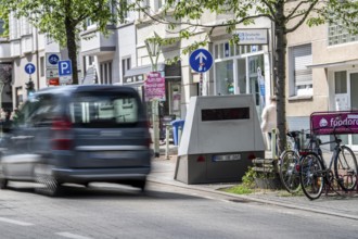
Semi-stationary speed camera in Nobelstraße, in th...
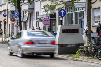
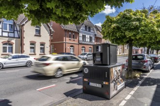
BRK26C50_275
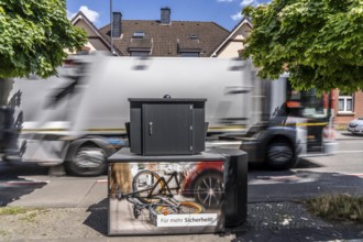
Mobile speed camera system, of the city of Essen, ...
BRK26B84_279
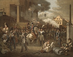
Battle of Paris on March 30, 1814, the last battle...
BRK26A91_078
Mobile speed camera system, of the city of Essen, ...
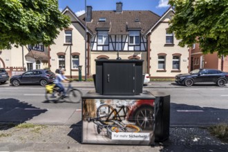
BRK26A91_052
Semi-stationary speed camera in Nobelstraße, in th...
BRK26A32_437
Mobile speed camera system, of the city of Essen, ...
BRK26A32_383
Semi-stationary speed camera in Nobelstraße, in th...
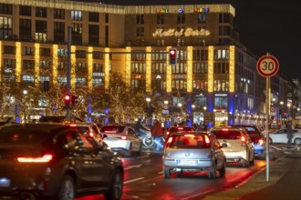
BRK26A24_130
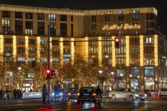
Leipziger Platz, Mall of Berlin, in Christmas ligh...
BRK25M50_092
Partially stationary speed camera in the city cent...

BRK25M46_245
Mobile speed camera system, of the city of Essen, ...
BRK25M88_147
Semi-stationary speed camera in Nobelstraße, in th...
BRK25M33_101
Leipziger Platz, Mall of Berlin, in Christmas ligh...

BRK25M88_258
Mobile speed camera system, of the city of Essen, ...
BRK25M36_175
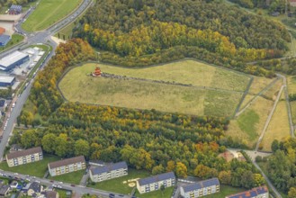
Sports center and swimming pool with flat roof and...
BRK25L71_241
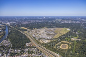
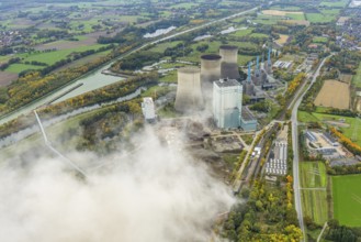
Castrop-Rauxel, North Rhine-Westphalia, Germany - ...
BRK25L71_240
Castrop-Rauxel, North Rhine-Westphalia, Germany - ...

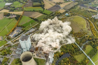
BRK25L19_194
Castrop-Rauxel, North Rhine-Westphalia, Germany - ...
BRK25L19_195
Castrop-Rauxel, North Rhine-Westphalia, Germany - ...
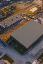
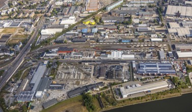
BRK25K87_355
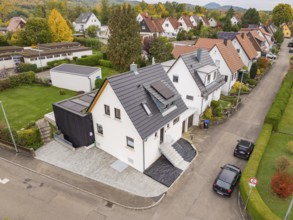
Aerial view of a quiet residential street with mod...
BRK25K46_395
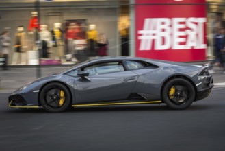
DEU Germany Germany Berlin A Lamborghini passes a ...
BRK25K46_394
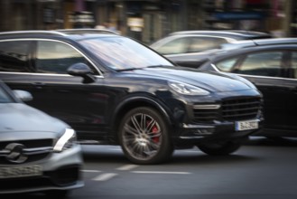
DEU Germany Germany Berlin An SUV, Porsche Cayenne...
BRK25K29_300
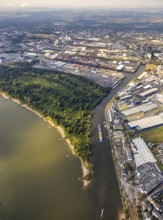
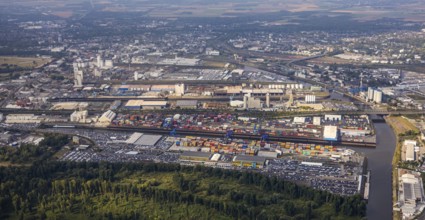
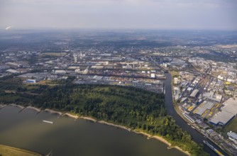
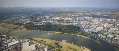
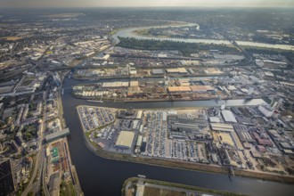
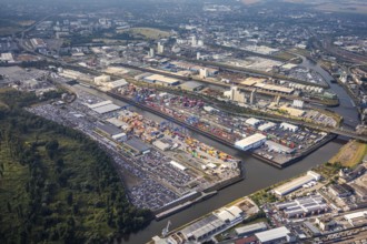
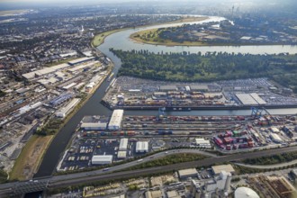
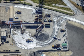
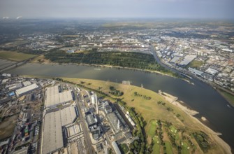
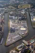
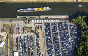
Aerial photo, harbour area, harbour facilities, Ob...
BRK25K29_341
Aerial photo, harbour area, harbour facilities, Ob...
BRK25K38_410
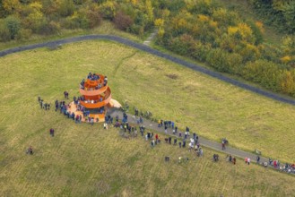
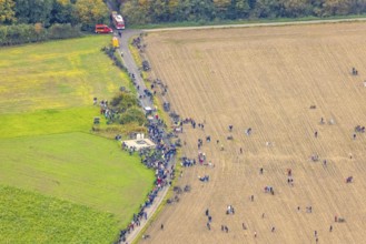
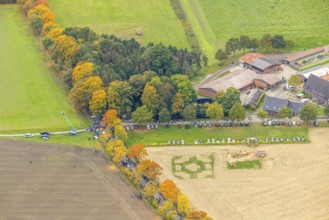
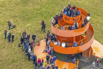
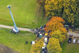
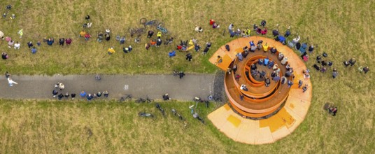
Aerial photo, thousands of spectators watched with...
BRK25K38_416
Aerial photo, thousands of spectators watched with...
BRK25K38_431
Aerial photo, thousands of spectators watched with...
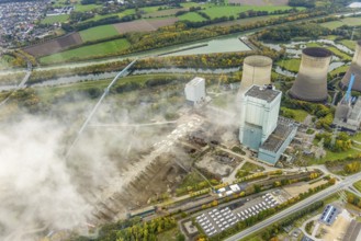
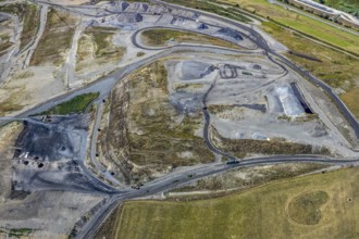
BRK25K48_200
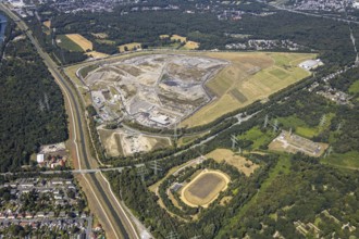
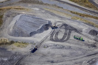
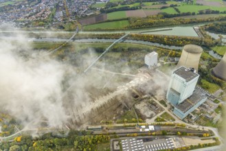
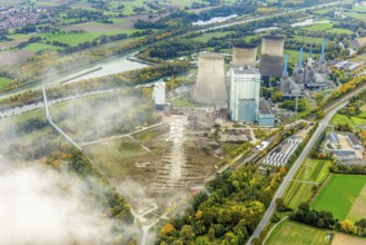
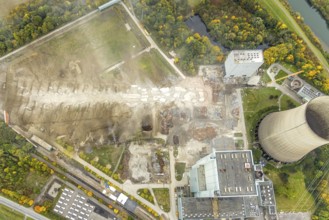
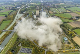
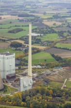
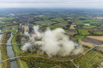
Aerial view, central landfill Emscherbruch ZDE, fo...
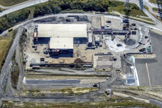
BRK25K48_216
Aerial view, central landfill Emscherbruch ZDE, fo...
BRK25K29_301
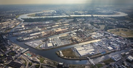
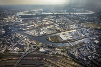
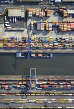
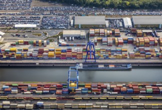
Aerial view, harbour area, harbour facilities, Con...
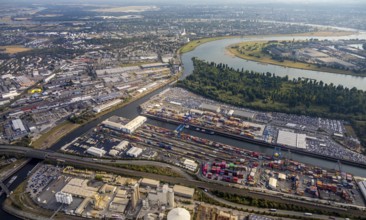
BRK25K29_342
Aerial photo, harbour area, harbour facilities, Ob...
BRK25K38_414
Aerial photo, thousands of spectators watched with...
BRK25K38_419
Aerial photo, thousands of spectators watched with...
BRK25K48_215
Aerial view, central landfill Emscherbruch ZDE, fo...
BRK25K29_302
Aerial photo, harbour area, harbour facilities, Ob...
BRK25K29_343
Aerial photo, harbour area, harbour facilities, Ob...
BRK25K38_428
Aerial photo, thousands of spectators watched with...
BRK25K48_217
Aerial view, central landfill Emscherbruch ZDE, fo...
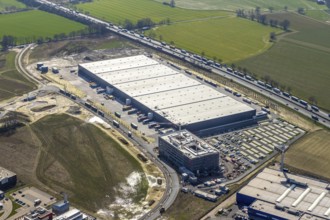
BRK25K28_449
Aerial view, new Woolworth headquarters and logist...
BRK25K29_303
Aerial photo, harbour area, harbour facilities, Ob...
BRK25K29_344
Aerial photo, harbour area, harbour facilities, Ob...
BRK25K38_415
Aerial photo, thousands of spectators watched with...
BRK25K38_430
Aerial photo, thousands of spectators watched with...
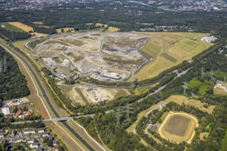
BRK25K48_214
Aerial view, central landfill Emscherbruch ZDE, fo...
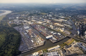
BRK25K29_323
Aerial photo, harbour area, harbour facilities, Ob...
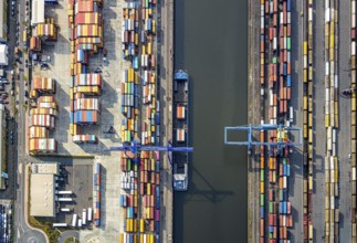
BRK25K29_326
Aerial view, harbour area, harbour facilities, Con...
BRK25K29_337
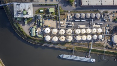
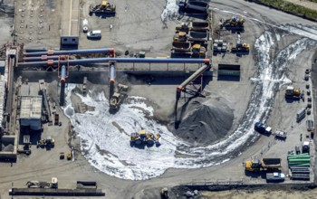
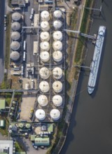
Aerial photo, tank farm, tanker, harbour area, har...
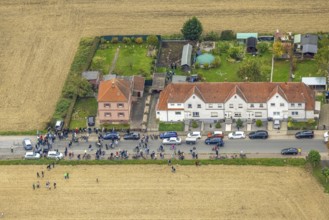
BRK25K38_407
Aerial photo, thousands of spectators watched with...

BRK25K38_411
Aerial photo, thousands of spectators watched with...
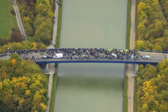
BRK25K38_413
Aerial photo, thousands of spectators watched with...
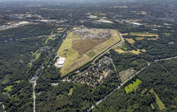
BRK25K48_212
Aerial view, central landfill Emscherbruch ZDE, fo...
BRK25K48_220
Aerial view, central landfill Emscherbruch ZDE, fo...
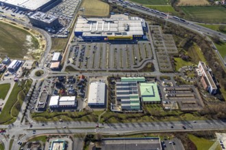
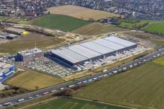
BRK25K28_444
Aerial view, Ikea furniture store, Dehner garden c...
BRK25K29_297
Aerial photo, harbour area, harbour facilities, Ob...
BRK25K29_327
Aerial view, harbour area, harbour facilities, Con...
BRK25K29_336
Aerial photo, harbour area, harbour facilities, Ob...
BRK25K38_406
Aerial photo, thousands of spectators watched with...
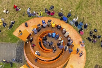
BRK25K38_426
Aerial photo, thousands of spectators watched with...
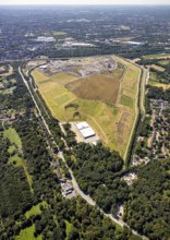
BRK25K48_209
Aerial view, central landfill Emscherbruch ZDE, fo...
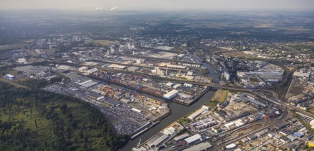
BRK25K29_299
Aerial photo, harbour area, harbour facilities, Ob...
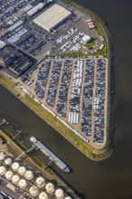
BRK25K29_340
Aerial photo, harbour area, harbour facilities, Ob...
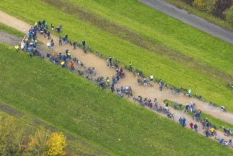
BRK25K38_408
Aerial photo, thousands of spectators watched with...
BRK25K38_429
Aerial photo, thousands of spectators watched with...
BRK25K48_210
Aerial view, central landfill Emscherbruch ZDE, fo...
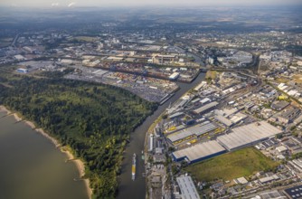
BRK25K29_298
Aerial photo, harbour area, harbour facilities, Ob...
BRK25K29_339
Aerial photo, tank farm, tanker, harbour area, har...
BRK25K38_427
Aerial photo, thousands of spectators watched with...
BRK25K38_433
Aerial photo, thousands of spectators watched with...
BRK25K38_434
Aerial photo, thousands of spectators watched with...
BRK25K38_437
Aerial photo, thousands of spectators watched with...
BRK25K48_211
Aerial view, central landfill Emscherbruch ZDE, fo...
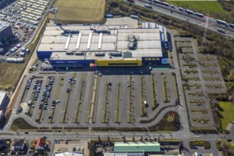
BRK25K28_441
Aerial view, Ikea furniture store, Unna-Königsborn...
BRK25K29_304
Aerial photo, harbour area, harbour facilities, Ob...
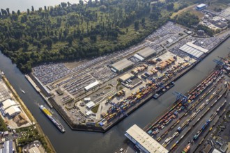
BRK25K29_329
Aerial view, harbour area, harbour facilities, Con...
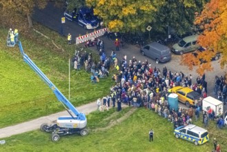
BRK25K38_418
Aerial photo, thousands of spectators watched with...
BRK25K38_438
Aerial photo, thousands of spectators watched with...
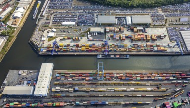
BRK25K29_331
Aerial view, harbour area, harbour facilities, Con...
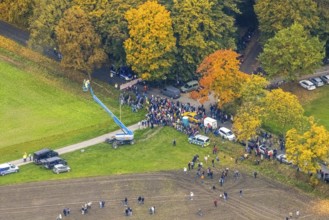
BRK25K38_420
Aerial photo, thousands of spectators watched with...
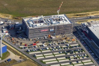
BRK25K28_448
Aerial view, new Woolworth headquarters and logist...
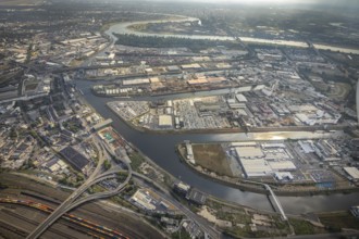
BRK25K29_295
Aerial photo, harbour area, harbour facilities, Ob...
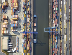
BRK25K29_328
Aerial view, harbour area, harbour facilities, Con...
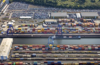
BRK25K29_338
Aerial view, harbour area, harbour facilities, Con...
BRK25K38_409
Aerial photo, thousands of spectators watched with...
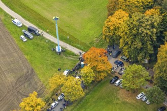
BRK25K38_425
Aerial photo, thousands of spectators watched with...
BRK25K38_432
Aerial photo, thousands of spectators watched with...
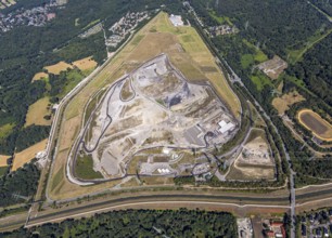
BRK25K48_207
Aerial view, central landfill Emscherbruch ZDE, fo...
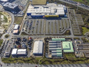
BRK25K28_442
Aerial view, Ikea furniture store, Dehner garden c...
BRK25K28_450
Aerial view, new Woolworth headquarters and logist...
BRK25K29_296
Aerial photo, harbour area, harbour facilities, Ob...
BRK25K29_330
Aerial photo, harbour area, harbour facilities, Ob...
BRK25K29_334
Aerial view, harbour area, harbour facilities, Con...
BRK25K38_405
Aerial photo, thousands of spectators watched with...
BRK25K38_412
Aerial photo, thousands of spectators watched with...
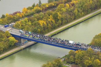
BRK25K38_424
Aerial photo, thousands of spectators watched with...
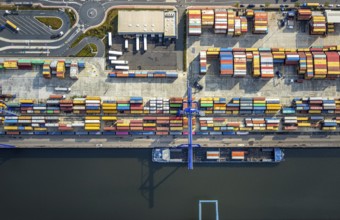
BRK25K29_325
Aerial view, harbour area, harbour facilities, Con...
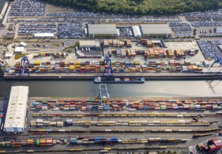
BRK25K29_333
Aerial view, harbour area, harbour facilities, Con...
BRK25K38_421
Aerial photo, thousands of spectators watched with...
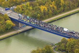
BRK25K38_423
Aerial photo, thousands of spectators watched with...
BRK25K38_435
Aerial photo, thousands of spectators watched with...
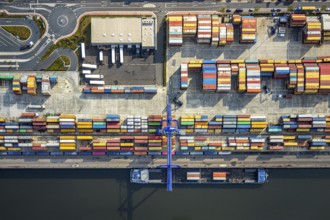
BRK25K29_324
Aerial view, harbour area, harbour facilities, Con...
BRK25K29_335
Aerial photo, harbour area, harbour facilities, Ob...
- Page
-
- of
- 5