3551 results for: camping trip
- Page
-
- of
- 36
Please sign in for more results
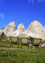
BRK26C79_430
Three camping chairs in a meadow at Passo Sella in...
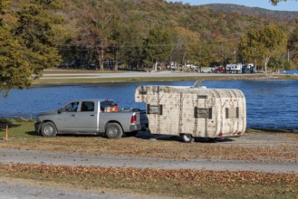
BRK26C64_443
Travel trailer camper at a camp site at Marion Cou...
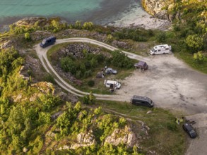
BRK26C92_097
Rest area at Sommaroy Bridge, camper vans, sunset,...
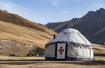
BRK26C64_408
Yurts with yellow hills, Atbashy district in the N...
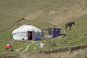
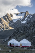
BRK26C68_193
Kyrgyz yurt, temporary summer nomad dwelling in th...
BRK26C99_481
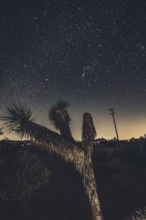
Camping in Joshua Tree National Park under a starr...
BRK26C64_194
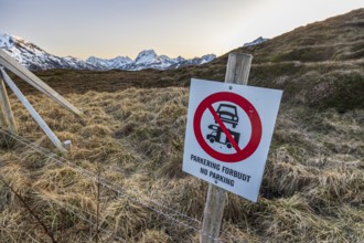
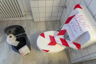
Camping and parking prohibited, prohibition sign, ...
BRK26C99_438
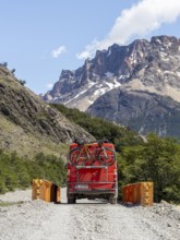
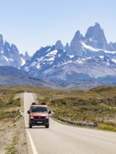
4x4 Campervan, Bridge over Rio Blanco, Mount Fitz ...
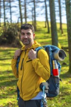
BRK26C90_489
Male hiker carrying a backpack, enjoying a sunny d...
BRK26C66_337
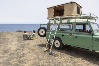
Campervan, Minicamper Nissan NV200 with pop-up roo...
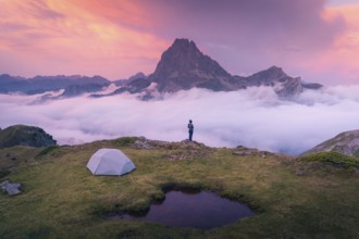
BRK26C70_043
A camper stands near a tent overlooking a majestic...
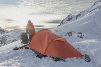
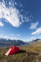
BRK26D02_284
A ski tourer sets up near a bright orange tent ami...
BRK26C76_225
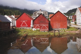
Charming red wooden huts reflect in the calm water...
BRK26C92_473
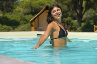
Young woman relaxing in a turquoise swimming pool ...
BRK26C94_453
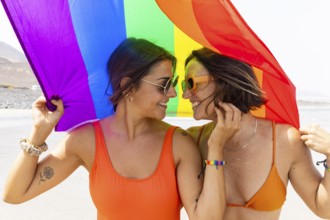
A joyful lesbian couple shares a moment under a co...
BRK26C58_294
4x4 Campervan, Fitz Roy, El Chalten, Santa Cruz, A...
BRK26C82_069
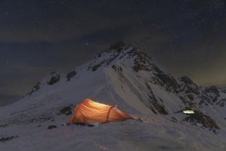
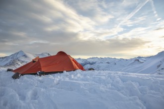
A glowing tent in a snowy mountain landscape under...
BRK26C81_445
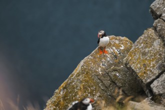
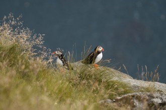
Puffins, Fratercula arctica, rest on mossy cliff e...
BRK26C84_062
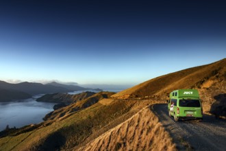
Experience the breathtaking scenery of Norway with...
BRK26C73_183
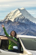
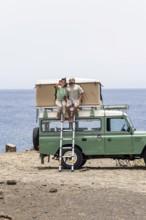
A woman stands joyfully in front of her car, surro...
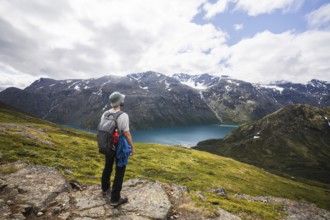
BRK26C78_246
Adventurer stands on a rocky ridge, overlooking a ...
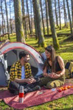
BRK26C58_158
Couple playing cards near tent and backpack in for...
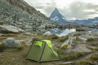
BRK26C74_307
A vibrant green tent is set by a tranquil alpine l...
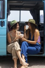
BRK26C83_494
Two lesbian women enjoy leisure time by a camper v...
BRK26C74_420
A vibrant orange tent sits atop a snow-covered pea...
BRK26C90_344
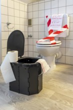
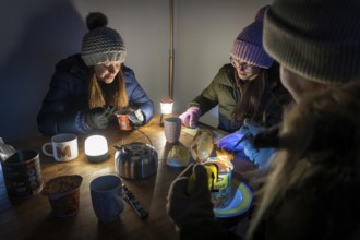
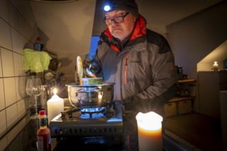
Symbolic picture blackout, extensive, prolonged po...
BRK26C63_405
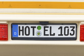
Caravan with the funny licence plate HOTEL in Hohe...
BRK26C94_470
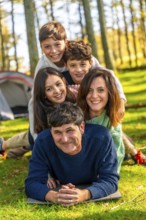
Caucasian family having fun together lying on the ...
BRK26D01_474
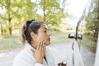
A woman enjoys her skincare routine while experien...
BRK26C62_406
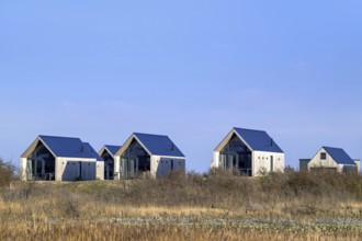
Tiny houses, beach houses in dunes at Molecaten Pa...
BRK26C78_350
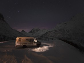
Winter motorhome under a starry sky on the island ...
BRK26C83_358
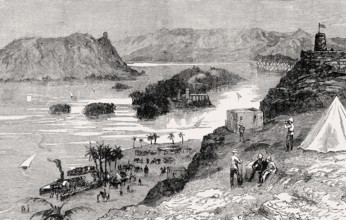
The British encampment at Aswan, Mahdist War, From...
BRK26C89_287
Yurts in a mountain valley in the Tien Shan Mounta...
BRK26C63_400
Camper vans enjoying the breathtaking view of the ...
BRK26C86_018
View of Rapadalen, Sarek National Park, Laponia Wo...
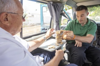
BRK26C13_482
An elderly man and his adult son enjoy playing a g...
BRK26C16_272
A blind man and a woman sit on the rooftop tent of...
BRK26C09_185
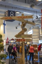
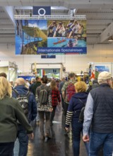
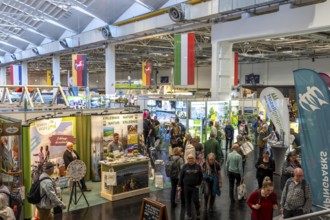
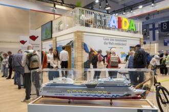
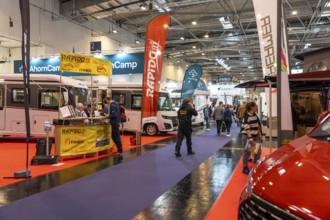
Messe Reise und Camping, in Essen, Global Guide, N...
BRK26C15_220
A traveler in a vibrant jacket walks along a windi...
BRK26C43_239
Symbolic blackout, extensive, prolonged power fail...
BRK26C09_183
Messe Reise und Camping, in Essen, Global Guide, N...
BRK26C09_189
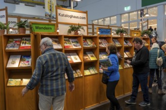
Travel and Camping trade fair, travel catalogs, in...
BRK26C15_206
Two adventurers enjoying a scenic road trip in Nor...
BRK26C21_497
A Latina woman laughs joyfully as she sits in the ...
BRK26C43_240
Symbolic picture blackout, extensive, prolonged po...
BRK26C09_184
Messe Reise und Camping, in Essen, North Rhine-Wes...
BRK26C16_282
A blind man, assisted by a companion, steps out of...
BRK26C09_165
Messe Reise und Camping, in Essen, North Rhine-Wes...
BRK26C13_484
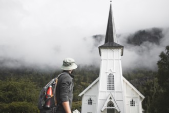
A traveler with a backpack and hat stops in front ...
BRK26C43_236
Symbolic picture blackout, extensive, prolonged po...
BRK26C54_192
Camper van, desert, rock formation Tozal Colasico,...
BRK26C13_467
A blind man and a woman drive a motorhome along a ...
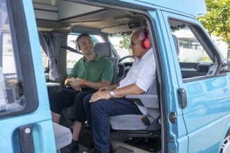
BRK26C13_475
A young man and an elderly man in a wheelchair sha...
BRK26C15_235
Two Atlantic puffins, Fratercula arctica, perched ...
BRK26C42_277
Camper drives along picturesque French Pass Road o...
BRK26C09_190
Messe Reise und Camping, Cruise Provider, Aida, in...
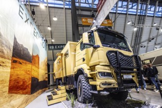
BRK26C38_071
Expedition motorhome from RB Expedition GmbH. 6x6 ...
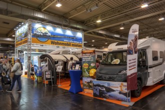
BRK26C09_193
Travel and Camping Fair in Essen, motorhomes, moto...
BRK26C49_193
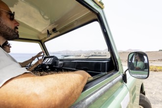
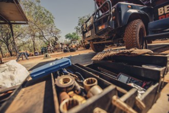
Australia Outback Landrover Camper, Australia
BRK26C13_240
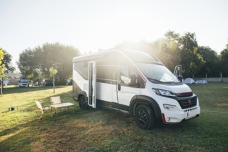
A modern camper van is parked in a sunny campgroun...
BRK26C13_468
A blind man and a woman sit on camping chairs near...
BRK26C43_235
Symbolic picture blackout, extensive, prolonged po...
BRK26C09_167
Reise und Camping exhibition, in Essen, motorhomes...
BRK26C43_237
Symbolic picture blackout, extensive, prolonged po...
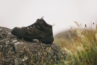
BRK26C13_258
A rugged brown hiking boot rests on a large rock i...
BRK26C16_281
A blind man and a woman sit on the rooftop tent of...
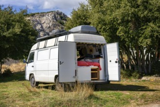
BRK26C11_455
A cozy camper van with open doors reveals a comfor...
BRK26C15_192
A blind man holds his cane as he steps out of a mo...
BRK26C43_241
Symbolic picture blackout, extensive, prolonged po...
BRK26C43_243
Symbolic blackout, extensive, prolonged power fail...
BRK26C43_232
Symbolic picture blackout, extensive, prolonged po...
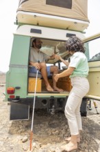
BRK26C13_470
A blind man and a woman sit on the rooftop tent of...
BRK26C15_190
A blind man sits at the back of a motorhome, holdi...
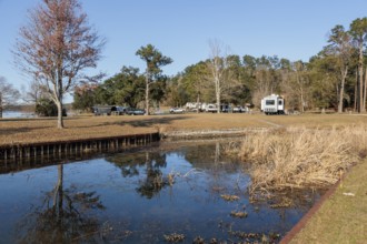
BRK26C54_329
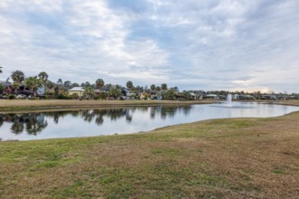
View of Lake Seminole from the Corps of Engineers ...
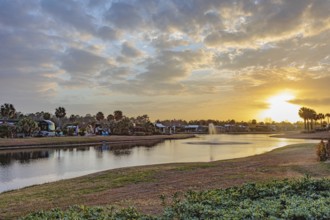
BRK26C54_004
Motorhomes with waterfront lots in RV Resort at su...
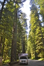
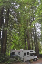
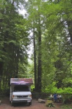
BRK26C04_150
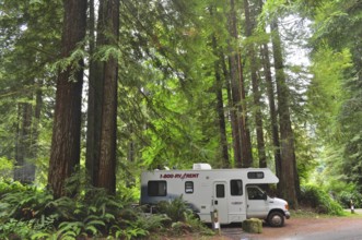
An RV drives through a redwood forest on a sunlit ...
BRK26C05_236
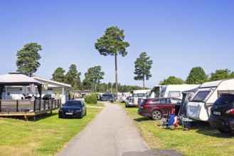
Family friendly campground featuring several carav...
BRK26C55_151
4x4 camper van driving on gravel road, Gorafe dese...
BRK26C54_002
Motorhomes with waterfront lots in RV Resort in so...
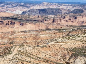
BRK26C27_072
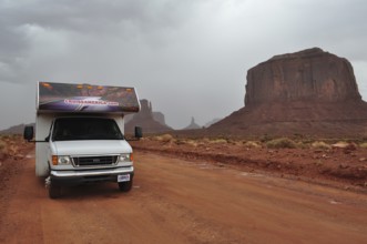
An RV on a road in Monument Valley surrounded by i...
BRK26C04_177
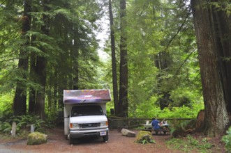
Motorhome next to picnic tables in a green forest,...
BRK26C54_218
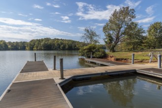
Floating dock on Pin Oak Lake at the Pin Oak Campg...
BRK26C54_222
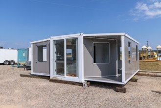
Foldable tiny house container kit home partially u...
BRK26C04_156
Motorhome in a green forest, surrounded by tall tr...
BRK26C17_068
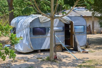
An outdated blue caravan stands in shade under tre...
BRK26C17_346
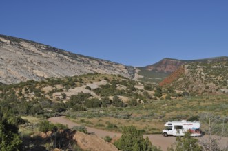
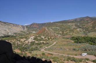
An RV parks in a picturesque mountain landscape wi...
BRK26C04_165
Motorhome parked in a dense forest with impressive...
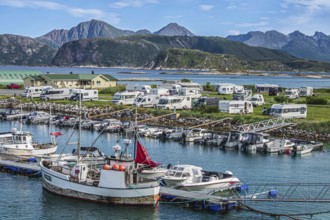
BRK26C04_271
Harbour and campsite, camper vans, Sommaroy Island...
BRK26C55_149
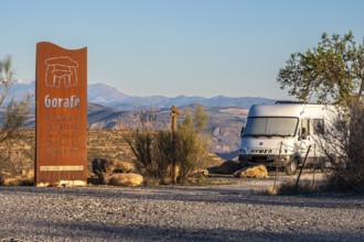
Signpost at the Gorafe megalithic park, camper van...
BRK26C17_347
View of a valley with an RV on a road surrounded b...
BRK26C04_160
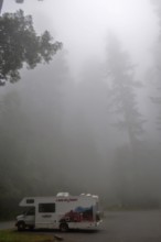
A motorhome stands in the misty redwood forest, co...
BRK26C54_344
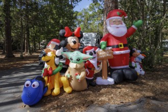
Inflatable Christmas decorations at a campsite in ...
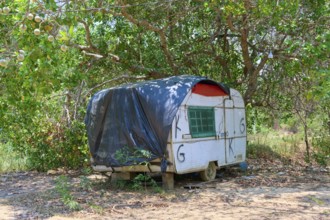
BRK26C17_065
An old caravan with black cover stands in a rustic...
BRK26C04_169
Motorhome in the forest, coast redwood (Sequoia se...
BRK26C55_152
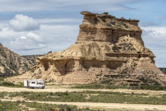
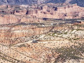
Gravel roads in the desert, 4x4 car, colorful cany...
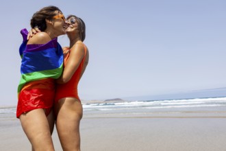
BRK26C13_459
Two lesbians women embrace on a sunny beach, wrapp...
BRK26C13_483
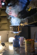
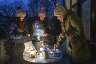
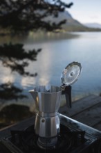
A moka pot sits on a camping stove beside a tranqu...
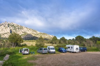
BRK26C20_275
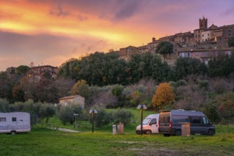
Camper vans and motorhomes parked in a scenic serv...
BRK26C13_458
A blind man relaxes in a motorhome while a woman d...
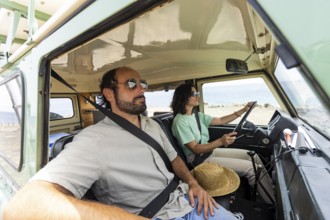
BRK26C13_477
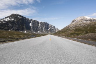
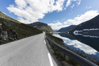
A stunning road in Norway stretches into the dista...
- Page
-
- of
- 36