4634 results for: bicycle pathes
- Page
-
- of
- 47
Please sign in for more results
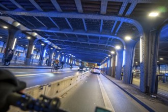
BRK26C96_286
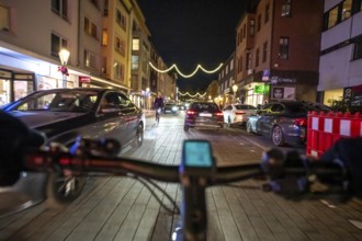
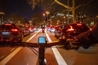
Cycling in the city, in the dark, in the evening, ...
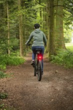
BRK26D00_319
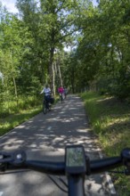
Person riding a bicycle in the forest. The surroun...
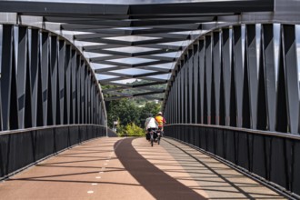
BRK26C81_412
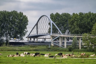
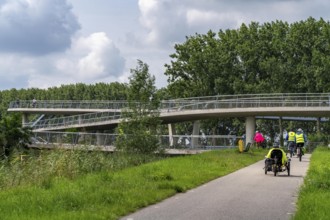
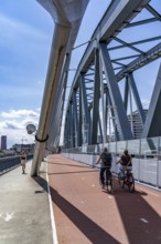
De Massover cycle path bridge, over the Meuse sout...
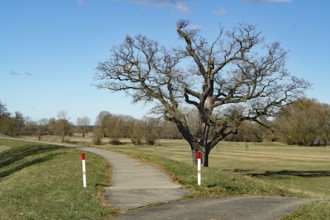
BRK26C65_305
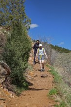
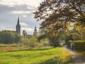
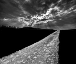
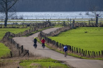
A lonely tree stands next to a rural footpath, sur...
BRK26C59_061
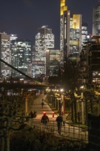
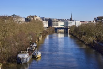
Skyline of the city centre of Frankfurt am Main, c...
BRK26C88_062
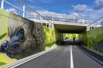
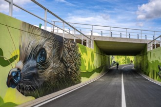
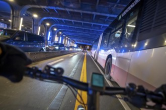
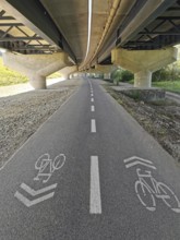
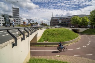
New bicycle tunnel at the junction of the B51 and ...
BRK26C66_375
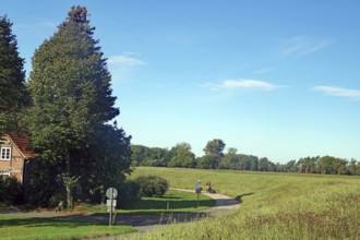
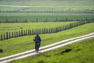
Cycle path along a dyke, green fields and trees un...
BRK26C63_166
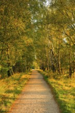
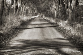
Country lane leads through a dreamy forest in the ...
BRK26C64_171
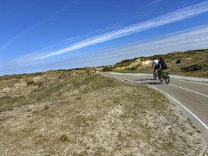
Cyclist on a wide cycle path through a dune landsc...
BRK26C65_110
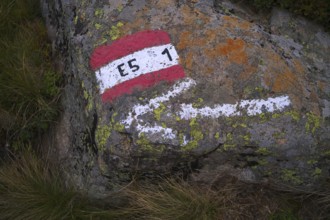
Marking, labelling, long-distance hiking trail E5,...
BRK26C79_439
Bike path R1 near Wesertal, Weser Uplands, Weserbe...
BRK26C60_192
Wendelmannweg, forest path, walk cycle tour, cycle...
BRK26C67_361
Striking red cycle path, Franconia, Bavaria, Germa...
BRK26C63_467
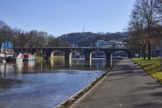
River Saar, riverbank, footpath and cycle path, pe...
BRK26D04_379
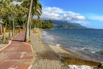
Bike path along the sea in the city of Ilhabela in...
BRK26C79_085
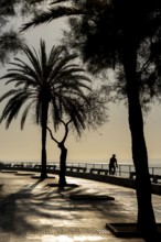
Promenade on the bay of Palma de Majorca, Spain
BRK26C66_363
Idledale, Colorado - Hikers on the Bruin Bluff Tra...

BRK26C93_374
Happy young woman walking with her vintage bicycle...
BRK26C82_223
Cycling in the city, in the dark, in the evening, ...
BRK26C64_310
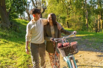
Young couple walking hand in hand through a pictur...
BRK26C66_111
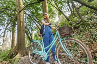
Young woman wearing casual clothes is walking with...

BRK26C61_174
Romantic couple sharing a tender kiss while stroll...
BRK26C62_226
Red marked cycle path in the city centre, Berlin, ...
BRK26C91_346
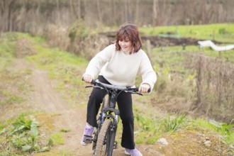
A young girl enjoys biking on a dirt trail, surrou...
BRK26C60_162
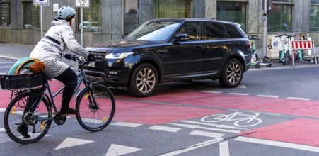
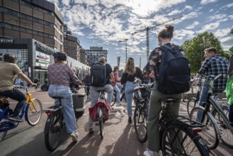
Cycling in the city, city centre road, car blockin...
BRK26C72_320
Weserradweg Rinteln Germany
BRK26C87_262
Biking way, near Oberweser, Weser Uplands, Weserbe...
BRK26C65_076
River Saar, riverbank, footpath and cycle path, sh...
BRK26C66_343
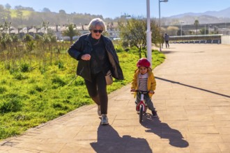
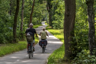
Grandmother jogging behind her grandson riding a b...
BRK26C72_221
Bikeway with oaks near State domain Beberbeck, Hof...
BRK26C62_457
River Saar, footpath and cycle path, river bank, g...
BRK26C46_108
Cycling in the city, in the dark, in the evening, ...
BRK26C49_275
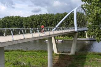
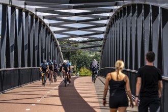
The Liniebrug, bicycle and pedestrian bridge over ...
BRK26C49_411
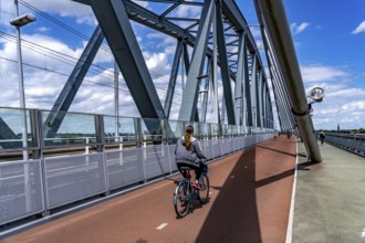
Cycle and pedestrian bridge Snelbinder Brug, over ...
BRK26C53_229
Symbolic image of cycle path in need of renovation...
BRK26C13_040
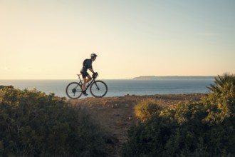
A young male cyclist rides along a scenic coastal ...
BRK26C48_478
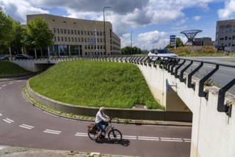
New bicycle tunnel at the junction of the B51 and ...
BRK26C49_277
The Liniebrug, bicycle and pedestrian bridge over ...
BRK26C49_412
Ride your bike on the central cycle path on Lange ...
BRK26C49_413
De Massover cycle path bridge, over the Meuse sout...
BRK26C53_056
Central cycle path along the Vredenburg, behind th...
BRK26C53_057
Central cycle path on the Lange Viestraat, lanes f...
BRK26B78_157
Wooden walkway with bicycle leading to a picturesq...
BRK26B98_194
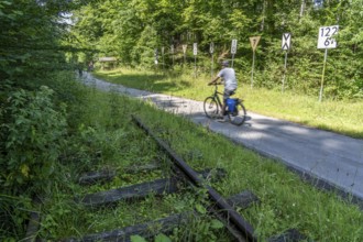
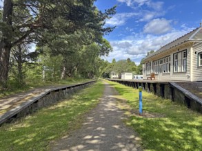
Former train station at village Olvera, now used f...
BRK26C37_189
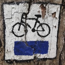
A bike path symbol on a tree shows peeling white a...
BRK26C50_149
Sauerlandring cycle path, an 84 km long circular c...
BRK26C53_061
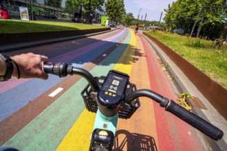
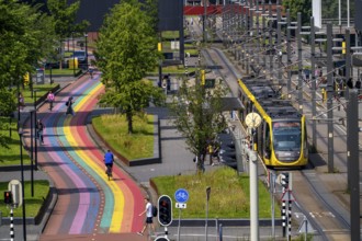
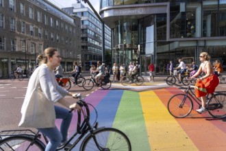
Rainbow cycle path through the university campus i...
BRK26C48_200
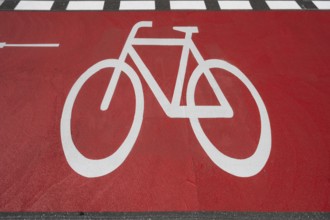
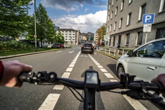
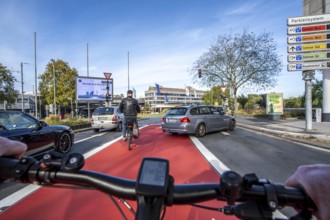
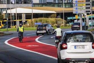
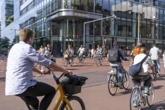
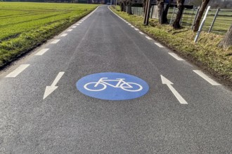
Riding a bike in a bike lane, marked in red to att...
BRK26C50_148
Landscape along the Sauerlandring cycle path, an 8...
BRK26C12_499
A young man enjoying a bike ride along the scenic ...
BRK26C46_107
Cycling in the city, in the dark, in the evening, ...
BRK26C48_201
Cycle path, cycle lane, marked in red to draw the ...
BRK26C49_293
Long-distance cycle path F28, so-called Doorfietsr...
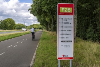
BRK26C49_296
Long-distance cycle path F28, so-called Doorfietsr...
BRK26C50_150
Sauerlandring cycle path, an 84 km long circular c...
BRK26C51_090
Country road south of Kampen, on the Lower Rhine, ...
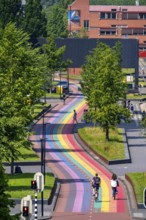
BRK26C53_066
Rainbow cycle path through the university campus i...
BRK26C53_054
Central cycle path on the Lange Viestraat, lanes f...
BRK26C53_062
Rainbow cycle path through the university campus i...
BRK26C12_500
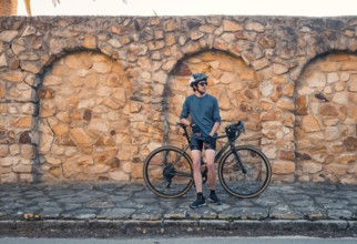
A young male cyclist stands next to his road bike,...
BRK26C35_093
A bicycle path goes under a bridge on an asphalted...
BRK26C53_055
Central cycle path along the Vredenburg, in the ci...
BRK26C49_276
Ramp on the Liniebrug, bicycle and pedestrian brid...
BRK26B79_157
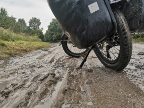
A bicycle is parked on a muddy and wet path, Polan...
BRK26C53_058
Central cycle path along the Vredenburg, in the ci...
BRK26C55_106
Cyclist on the Tranvía de Sierra Nevada, former ra...
BRK26C08_405
The Bislicher Insel, in winter, dyke path, nature ...
BRK26C50_151
Sauerlandring cycle path, an 84 km long circular c...
BRK26C08_398
Bislicher Insel, in winter, floods in the floodpla...
BRK26C07_108
Large marking on narrow district road country road...
BRK26C49_294
Roundabout in the Dutch city of Houten, the lanes ...
BRK26C49_297
Roundabout in the Dutch city of Houten, the lanes ...
BRK26C54_466
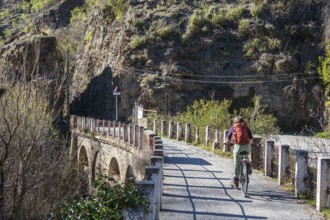
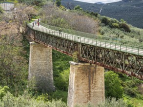
Cyclist on a bridge, cycle path Via Verde Del Acei...
BRK26C49_295
Long-distance cycle path F28, so-called Doorfietsr...
BRK26C49_410
Cycle and pedestrian bridge Snelbinder Brug, over ...
BRK26C18_361
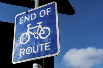
Oxford, England, UK. February 6th 2020 End of the ...
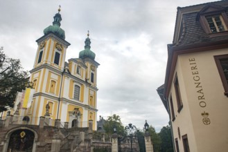
BRK26C29_036
Donaueschingen, Germany. 28th September 2024 The o...

BRK26C49_288
Cyclist on a cycle path between corn fields and tr...
BRK26B65_155
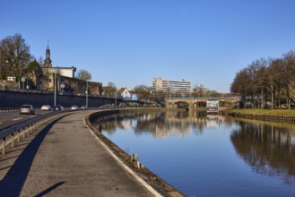
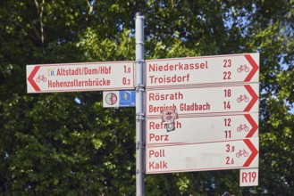
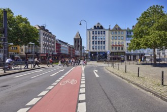
Guide to Altstadt - Dom - Hbf, Hohenzollernbrücke,...
BRK26C08_367
Common footpath and cycle path, traffic sign, foot...
BRK26C29_157
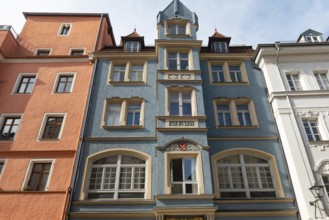
Row of houses, general architecture, houses, lante...
BRK26C29_296
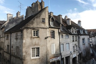
Dole, France. September 20th 2024 Beautiful archit...
BRK26C29_321
Dole, France. September 20th 2024 Roof top view of...
BRK26C31_355
Abandoned station area with wooden buildings and t...
BRK26C26_298
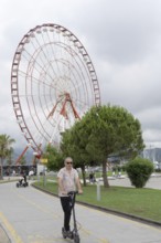
Batumi, Georgia. July 21st 2025. Visitors and tour...
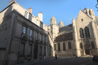
BRK26C29_305
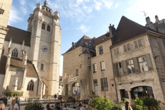
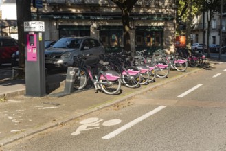
Dijon, France. September 19th 2024 Divia Velodi, s...
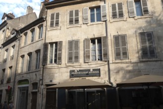
BRK26C29_322
Dole, France. September 20th 2024 Beautiful archit...

BRK26C29_304
Donaueschingen, Germany. 28th September 2024 The o...
BRK26C29_317
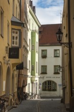
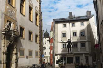
Regensburg, Germany. October 7th 2024 A cobbled al...
BRK26C29_330
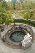
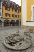
Donaueschingen, Germany. 28th September 2024 Bust ...
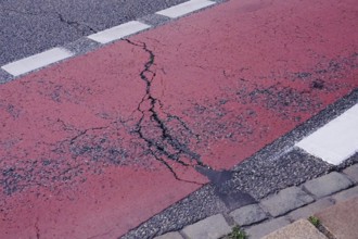
BRK26C29_332
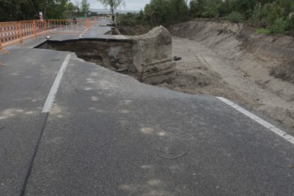
Flood damaged road subsidence in Lower Austria nea...
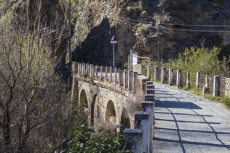
BRK26C54_462
Cycle path via verde del aceite, below Zuheros cas...
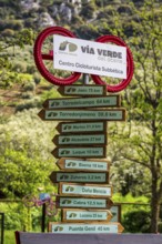
BRK26C54_463
Decorated signpost, cycle path Via Verde Del Aceit...
BRK26C29_316
Regensburg, Germany. October 7th 2024 Beautiful me...
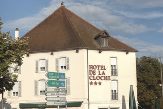
BRK26C29_324
Dole, France. September 20th 2024 Hotel De La Cloc...
BRK26C54_467
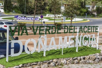
Sign of cycle path Via Verde Del Aceite, village D...
BRK26C55_107
Tranvía de Sierra Nevada, former railroad track, l...
BRK26C29_297
Dijon, France. September 19th 2024 The elegant arc...
BRK26C29_307
Donaueschingen, Germany. 28th September 2024 Catho...
BRK26C29_318
Regensburg, Germany. October 7th 2024 Beautiful me...
- Page
-
- of
- 47