Caption
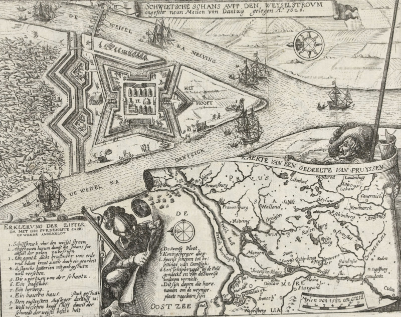
Swedish redoubt on the Weichsel River near Danzig, approximately nine miles from Danzig, 1626, Swedish redoubt on the Vistula near Danzig, Series 11: Varia Foreign Events, 1571-1631, print, album page, Series number, 422, 380?, Swedish redoubt built on the Vistula near Danzig, 1626. At the bottom, a cartouche in the shape of a paper scroll held up by two soldiers with a map of the mouth of the Vistula with title and captions in Dutch. On the left, Legend of the main illustration 1-11. Numbered in pen at the bottom right: 422., inscription: '422', printmaker: workshop of Frans Hogenberg, Cologne, 1626 - 1628, North Rhine-Westphalia, paper, etching, height 206 mm x width 264 mm, Compare the print by CJ Visscher (II), Hollstein vol. 38, p. 37, no. 57., fortifications, military engineering, Thirty Years' War, Prussia, Pomorian voivodeship, Danzig, Vistula, Period, A detailed black and white engraved map fragment showing a star-shaped fortified structure with bastions and inner buildings, surrounded by water channels and riverbanks with textured wave lines, several sailing ships and smaller boats in the rivers, a compass rose in the sky area, clusters of small human figures on and around the fort and along the banks, a large male figure wearing a hat and cloak holding a long staff positioned over the map edge, an ornate ribbon banner and decorative cartouche elements, densely lettered place names and map labels scattered across the land, a coastal area with marshy textures and reed-like markings, and an inset coastline and river network with numerous labeled settlements and topographical hatching.
Credit line
Photo12/Liszt Collection
Reference
LZT26B46_029
License type
Rights managed
Available size
47.1Mb (7.2Mb) / 15.2in x 12.0in / 4557 x 3611 (300dpi)