Caption
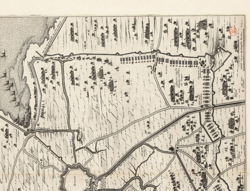
Siege of Hulst by Frederik Hendrik, 1645, The Siege of the City of Hulst by His Highness the Prince of Orange in the Year 1645, La Siege de Hulst Per Son Altesse la Prince d'Orangie, print, map, Siege and conquest of Hulst by the States Army under Frederik Hendrik from 28 September to 5 November 1645. Plan of the city of Hulst and the surrounding land with the encirclement and the besiegers' camps. Bottom left a cartouche with the legend 1-26. Bottom right a scale bar: Scale of 300 Rhineland Rods. On verso Dutch text., printmaker: workshop of Claes Jansz. Visscher (II), Amsterdam, printmaker: Pieter Hendricksz. Schut (possibly), Northern Netherlands, cartographer: Johan van Duynen, Zeeland, publisher: Johannes Willemszoon Blaeu, 1652, paper, etching, engraving, letterpress printing, etching and engraving, with text in letterpress on verso, height 441 mm x width 569 mm, Print used in: Blaeu, vol. 1., Person, Frederick Henry (Prince of Orange), maps of separate countries or regions, siege, position war, Siege and capture of Hulst (1645), Hulst, Period, A detailed black and white engraved map showing a coastal area with fortifications, walls, and bastions, intersecting straight and curving roads, and water channels; the coast features textured waves and several sailing ships offshore, while inland areas show fields with linear patterns, scattered small clusters of buildings, tents, and groups of mounted figures and foot soldiers arranged in formations; the map includes bridges over waterways, rectangular arrays of tents or structures near the walls, small trees and hedgerows, and decorative cartographic flourishes suc
Credit line
Photo12/Liszt Collection
Reference
LZT26B34_187
License type
Rights managed
Available size
58.5Mb (7.0Mb) / 17.2in x 13.2in / 5160 x 3964 (300dpi)