Caption
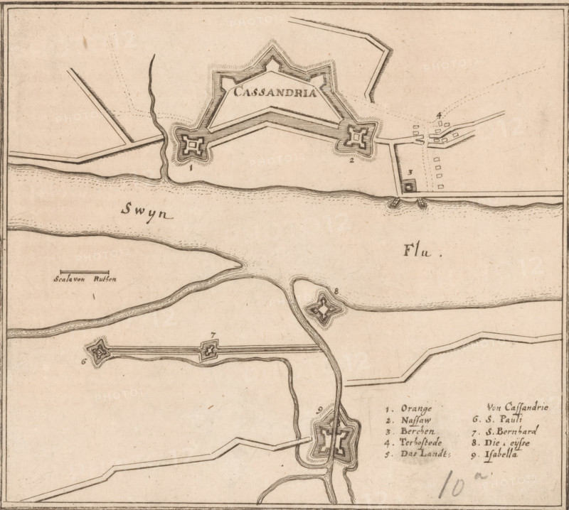
Fortress plan of Cadzand, Cassandria, area plan, print, Fortress plan of Cadzand. Lower right a German legend 1-9. Left a scale bar: Scala von 200 Ruhten., printmaker: Caspar Merian, Frankfurt am Main, after design by Johann Merck, 1654 - c. 1700, Hessen, paper, etching, height 160 mm x width 177 mm, Print used in: Zeiller, Martin. MZ Topographia Germaniae-Inferioris vel Circuli-Burgundici, 1659. Or in one of the two later editions of this publication which, although the year 1659 is mentioned therein as the year of publication, were published in ca. 1670 and ca. 1700 respectively., walls, fortified city, maps of cities, Cadzand, An aged map segment with hand-drawn fortifications and waterways on a beige background, showing star-shaped forts connected by angular ramparts and straight lines, sinuous rivers and marsh-like lines, small rectangular clusters suggesting buildings near one fort, stippled shading and hatching around the fort outlines, a framed border around the sheet, and scattered handwritten numerical marks.
Credit line
Photo12/Liszt Collection
Reference
LZT26B34_186
License type
Rights managed
Available size
48.7Mb (10.7Mb) / 14.5in x 13.0in / 4356 x 3910 (300dpi)