Caption
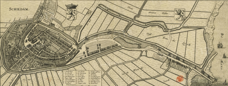
Map of Schiedam, Schiedam, area plan, print, Map in bird's-eye perspective. Top left the title, to the right of that the coat of arms of Holland and top right the coat of arms of Schiedam. Bottom left of center the legend 1-24 and the scale bar: 720 Pedes geometrici., printmaker, Johannes Janssonius, Johannes Janssonius van Waesberge (II), Willem de Jonge, paper, etching, engraving, height 195 mm x width 508 mm, An antique map rendered in sepia tones shows a fortified town with concentric streets, dense clusters of buildings, and canals surrounded by a ring of walls and bastions, adjacent expanses of parcelled fields and straight waterways, small sails and larger ships depicted in the open water at the edge, decorative shields with crowned lions placed over the countryside, a waterfront area with docks and elongated rectangular plots, tree-lined lanes and scattered groves, a boxed legend area with small columns of entries, and a circular red wax-like stamp near the lower right.
Credit line
Photo12/Liszt Collection
Reference
LZT26B34_131
License type
Rights managed
Available size
39.2Mb (5.7Mb) / 20.0in x 7.6in / 6004 x 2280 (300dpi)