Caption
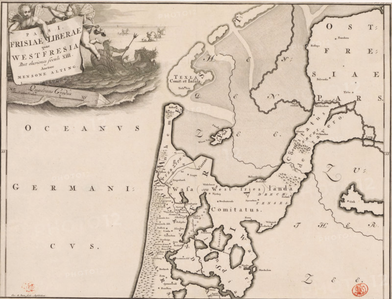
Pars I Frisiae Liberae quae Westfresia, Historical map of the Netherlands with the territories of the Batavians and Frisians, print, map, historical print, Map of Frisian territories in West Frisia in the Roman period. Top left cartouche with title, above it two putti. To the right of the cartouche in the background Neptune and a number of tritons. Scale bar below cartouche: Quadrans gradus. Degree division along left and right edges., printmaker: Gerrit de Broen (I), Amsterdam, printmaker: Joseph Mulder, Netherlands, writer (clerical worker): Menso Alting, 1697 - 1700, 1725, writer (clerical worker), paper, engraving, etching, height 317 mm x width 420 mm, Part of 16 maps of the land of the Batavians and the Frisians first produced for and included in Alting, Menso. Descriptio, secundum antiquos, agri Batavi & Frisii. 2 volumes. Amsterdam: Henricus Wetstein, 1697-1700. Reused in Halma, François. Tooneel der Vereenigde Nederlanden, en onderhorige landschaps, 2 volumes. Leeuwarden: Hendrik Halma, 1725. This map was used in Halma's Tooneel der Vereenigde Nederlanden (1725) and can probably be found in part 2, p. 308., maps of separate countries or regions, (story of) Neptune (Poseidon), triton(s), Roman period in the Netherlands, Batavians, Frisians, West-Friesland, A section of an antique map showing a coastline with islands and peninsulas, stippled sea textures and shaded land contours, numerous small place labels, and decorative cartography elements; a large cartouche in the upper left held by two cherubs with a figure in a shell boat and stylized waves extending from that scene; dotted and hatched patterns indicating water and land, thin border lines framing the map, and a circular red stamp near the lower right edge.
Credit line
Photo12/Liszt Collection
Reference
LZT26B34_052
License type
Rights managed
Available size
53.5Mb (11.4Mb) / 16.5in x 12.6in / 4954 x 3772 (300dpi)