Caption
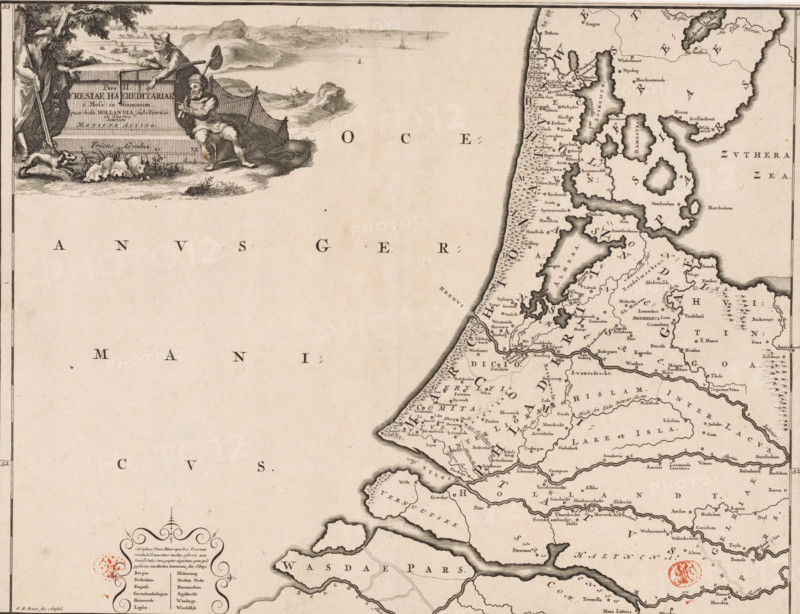
Pars II Fresiae haereditariae, Historical map of the Netherlands with the territories of the Batavians and Frisians, print, map, historical print, Map of the Frisian territories in the western Netherlands in the Roman period. In the upper left, a cartouche with the title, surrounded by a hunter, a farmer, and a fisherman. Scale bar below the cartouche: Triens gradus. In the lower left, a cartouche with a number of old places that are not depicted on the map because their exact location could no longer be determined. Degree division along left and right edges., printmaker: Gerrit de Broen (I), Amsterdam, writer (clerical worker): Menso Alting, 1697 - 1700, 1725, writer (clerical worker), paper, engraving, etching, height 317 mm x width 417 mm, Part of 16 maps of the land of the Batavians and the Frisians first produced for and included in Alting, Menso. Descriptio, secundum antiquos, agri Batavi & Frisii. 2 volumes. Amsterdam: Henricus Wetstein, 1697-1700. Reused in Halma, François. Tooneel der Vereenigde Nederlanden, en onderhorige landschaps, 2 volumes. Leeuwarden: Hendrik Halma, 1725. This map was used in Halma's Tooneel der Vereenigde Nederlanden (1725) and can probably be found in part 1, p. 425., maps of separate countries or regions, Roman period in the Netherlands, Batavians, Frisians, Netherlands, An aged map fragment showing a detailed coastline and inland region on the right with numerous small place names and topographic markings, and a large blank sea area on the left with scattered large letters. In the upper left corner an ornate cartouche features three male figures near a stone slab, one standing with a long pole, one seated holding a net and fisher's tools, and one leaning on the slab; nearby are a dog and some plants. The coastline is heavily inked with darker shading around bays and islands, and the map includes decorative compass-like ornamentation and a red circular mark near the lower l
Credit line
Photo12/Liszt Collection
Reference
LZT26B34_049
License type
Rights managed
Available size
51.7Mb (12.0Mb) / 16.2in x 12.4in / 4853 x 3725 (300dpi)