Caption
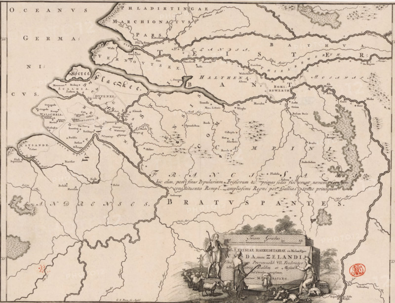
Historical map of the Netherlands with the territories of the Batavians and Frisians, Pars I Frisiae haereditariae cis Mosam quae Wasda, nunc Zelandia, print, map, historieprent, Map of the Frisian territories in the southern Netherlands in Roman times. Lower right cartouche with title, surrounded by images of shepherds with a flock of sheep. Scale bar above cartouche: Triens gradus. Degree division along left and right edges., printmaker: Gerrit de Broen (I), Amsterdam, printmaker: Joseph Mulder, writer (clerical worker): Menso Alting, 1697 - 1700, 1725, writer (clerical worker), paper, engraving, etching, height 324 mm x width 420 mm, Part of 16 maps of the land of the Batavians and the Frisians first produced for and included in Alting, Menso. Descriptio, secundum antiquos, agri Batavi & Frisii. 2 volumes. Amsterdam: Henricus Wetstein, 1697-1700. Reused in Halma, François. Tooneel der Vereenigde Nederlanden, en onderhorige landschaps, 2 volumes. Leeuwarden: Hendrik Halma, 1725. This map was used in Halma's Tooneel der Vereenigde Nederlanden (1725) and can probably be found in volume 2, p. 292., maps of separate countries or regions, herding, herdsman, herdswoman, shepherd, shepherdess, cowherd, Roman period in the Netherlands, Batavians, Frisians, Netherlands, An aged map printed in sepia tones showing coastlines, rivers, islands, and inland borders with many place names in a serif script, featuring a decorative cartouche at the lower right with human figures, livestock, and a large inscribed stone block, shaded hachure marks indicating hills and wooded areas, finely drawn wavy lines for waterways, a border line framing the map, and a circular red seal near the lower right.
Credit line
Photo12/Liszt Collection
Reference
LZT26B34_048
License type
Rights managed
Available size
52.6Mb (11.3Mb) / 16.3in x 12.5in / 4891 x 3758 (300dpi)