Caption
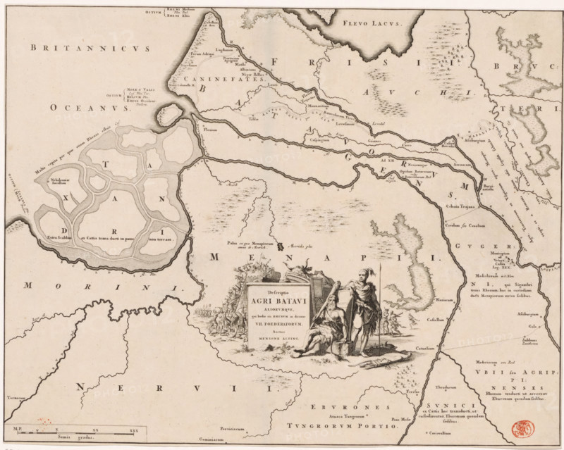
Historical map of the Netherlands with the territories of the Batavians and Frisians, Descriptio agri Batavi, print, map, historical print, Map of the Batavian territories in the Roman period. In the center a cartouche with title, next to it two Germanic warriors depicted (possibly a Batavian and a Frisian), in the background a battle scene. Lower left scale bar: Semis gradus., printmaker: Jan Luyken, Netherlands, writer (clerical worker): Menso Alting, 1697 - 1700, 1725, writer (clerical worker), paper, engraving, etching, etching and engraving, height 331 mm x width 420 mm, Part of 16 maps of the land of the Batavians and the Frisians first produced for and included in Alting, Menso. Descriptio, secundum antiquos, agri Batavi & Frisii. 2 volumes. Amsterdam: Henricus Wetstein, 1697-1700. Reused in Halma, François. Tooneel der Vereenigde Nederlanden, en onderhorige landschaps, 2 volumes. Leeuwarden: Hendrik Halma, 1725. This map was used in Halma's Tooneel der Vereenigde Nederlanden (1725) and is likely to be found in volume 1, p. 113., maps of separate countries or regions, Roman period in the Netherlands, Batavians, Frisians, An aged map printed in sepia tones showing coastline features, stylized rivers and islands, and shaded inland areas; cartographic hachures and stippling indicate terrain and marshes, while sinuous river courses wind across the sheet; an ornate cartouche near the center depicts two human figures by a rectangular plaque, one seated and partially draped and the other standing with a staff, surrounded by small decorative elements and a cluster of supplies or gear; clusters of tiny symbols and small pictorial marks represent settlements, and patterned textures fill open spaces; a scale bar appears along the bottom edge and a round red stamp is visible near the lower right corner; the overall composition is bordered by a thin frame line.
Credit line
Photo12/Liszt Collection
Reference
LZT26B34_044
License type
Rights managed
Available size
58.1Mb (11.0Mb) / 16.8in x 13.4in / 5042 x 4030 (300dpi)