Caption
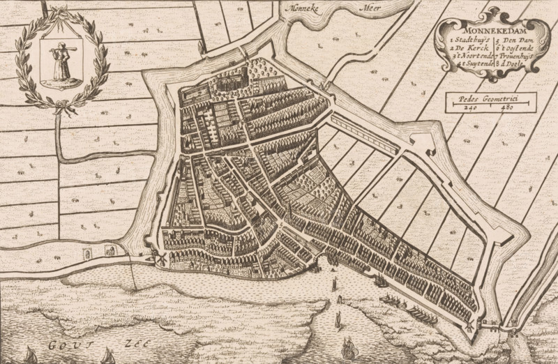
Map of Monnickendam, Monnekedam, area plan, print, printmaker, publisher, Amsterdam, paper, etching, height 150 mm x width 226 mm, Print used in: Blaeu, Johannes Willemszoon. Toonneel der steden van de Vereenighde Nederlanden. 2 vols. Amsterdam: Johannes Willemszoon Blaeu, 1652, vol. 1., maps of cities, Monnickendam, A detailed monochrome map showing a fortified town with angular walls and bastions surrounded by water channels and marshy fields, a dense arrangement of narrow streets and closely packed buildings with pitched roofs, open yards and tree-lined blocks within the town, small docks and moored sailing ships along the waterfront, a wreath-like decorative cartouche with a figure holding a long object, patterned agricultural plots outside the defenses, bridges and causeways connecting the town to surrounding land, and stylized waves and sailing vessels in the adjacent sea.
Credit line
Photo12/Liszt Collection
Reference
LZT26B33_280
License type
Rights managed
Available size
57.2Mb (6.2Mb) / 18.4in x 12.0in / 5532 x 3613 (300dpi)