Caption
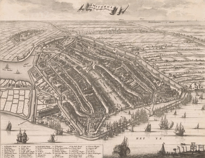
Map of Amsterdam, 1500, Amsterdam presented itself thus in the year 1500, area plan, print, book illustration, Legend 1-41 in the lower left., printmaker, after print by, publisher, Amsterdam, paper, etching, height 265 mm x width 342 mm, A detailed bird's-eye engraving of a walled port city with concentric canals, rows of densely packed gabled buildings, churches with tall steeples, and bridges spanning the waterways; ships with sails and masts crowd the harbor and approach the shoreline, while smaller boats move along the canals; fortifications and towers sit at the waterfront, and windmills and scattered farm plots appear beyond the city walls; faint clouds fill the sky above a distant flat landscape with tree-lined paths and scattered structures.
Credit line
Photo12/Liszt Collection
Reference
LZT26B33_080
License type
Rights managed
Available size
45.0Mb (6.9Mb) / 15.1in x 11.6in / 4523 x 3480 (300dpi)