Caption
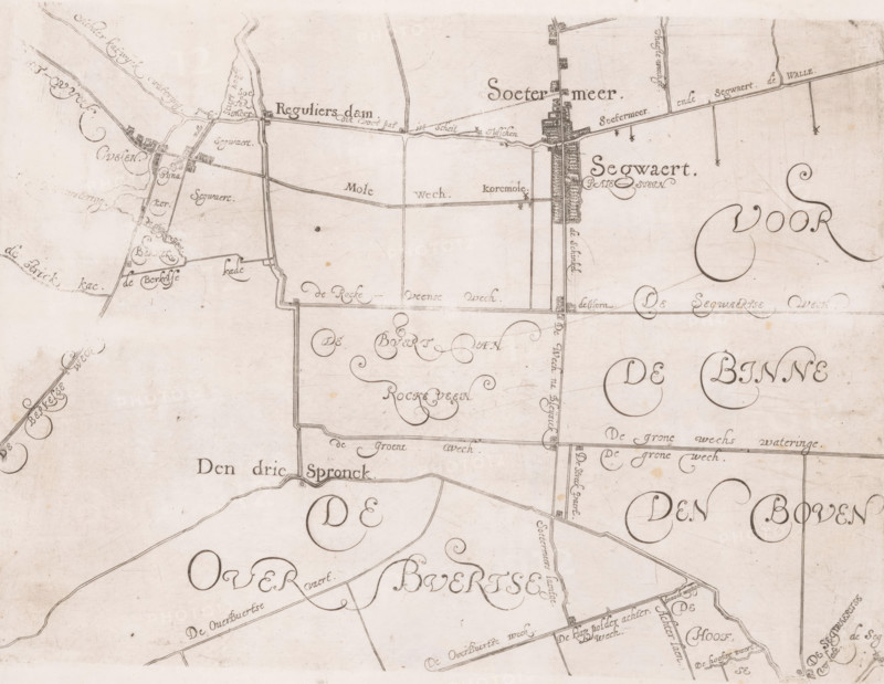
Map of the Schieland Water Board, with Zoetermeer and Seghwaert, print, map, printmaker: Floris Balthasarsz. van Berckenrode, printmaker: Balthasar Florisz. van Berckenrode, commissioner (person who orders works): Schieland Water Board, 1611 - 1635, commissioner (person who orders works), paper, etching, engraving, height 220 mm x width 300 mm, This map was published five times between 1611 and 1635 without the plates being updated. Unclear to which edition this copy belongs., armorial bearing, heraldry, maps of separate countries or regions, Schieland, A sepia-toned hand-drawn map showing parcels of land divided by straight and curved lines, with a network of narrow roads and canals, clusters of small rectilinear building shapes along some roads, decorative curled flourishes and ornamental compass-like embellishments, and shaded linear banks along watercourses; the surface has small stains and age spots and the ink varies in darkness across the page.
Credit line
Photo12/Liszt Collection
Reference
LZT26B32_499
License type
Rights managed
Available size
58.3Mb (9.7Mb) / 17.1in x 13.2in / 5129 x 3971 (300dpi)