Caption
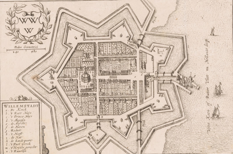
Willemstadt, Map of Willemstad, area plan, print, book illustration, printmaker, paper, etching, letterpress printing, with two strips of text in letterpress on recto, height 146 mm x width 221 mm, A sepia-toned bird's-eye illustration shows a star-shaped fortified town surrounded by layered angular earthworks and moats, with bastions projecting outward and narrow causeways connecting to the surrounding land. Inside the walls a grid of streets and densely packed rows of buildings and houses fill the interior, interspersed with clusters of small trees and garden plots. A central square features a domed building surrounded by open space and smaller structures. Defensive details such as ramparts, gates, and small watch posts are visible along the perimeter, and docks with moored sailing ships extend into a textured body of water at the edge of the image. Decorative elements include a wreathed cartouche in an empty corner and a scale bar nearby. Small boats and sailing vessels appear on the water, and fine line shading denotes terrain, water ripples, and building roofs.
Credit line
Photo12/Liszt Collection
Reference
LZT26B32_372
License type
Rights managed
Available size
55.8Mb (5.6Mb) / 18.1in x 12.0in / 5425 x 3593 (300dpi)