Caption
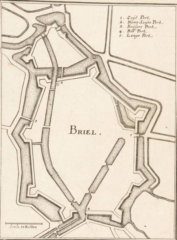
Briel, Fortification map of Brielle, area plan, print, book illustration, Map of the fortifications of Brielle, top right a legend 1-5. Bottom left a scale bar: Scala 50 Ruhten., printmaker: Caspar Merian, Frankfurt am Main, after design by Johann Merck, 1654, Hessen, paper, etching, height 176 mm x width 134 mm, A portion of a detailed black and white map showing angular fortifications and water-filled moats with textured hatch marks, thick boundary lines and stepped bastions surrounding an open central area, segmented straight and curved waterways connecting the defensive structures, narrow bridge-like connectors across channels, and finely drawn parallel lines indicating banks and pathways; the drawing has aged paper tones and several small decorative pen flourishes around junctions and corners.
Credit line
Photo12/Liszt Collection
Reference
LZT26B32_259
License type
Rights managed
Available size
41.9Mb (9.0Mb) / 11.0in x 14.8in / 3295 x 4446 (300dpi)