Caption
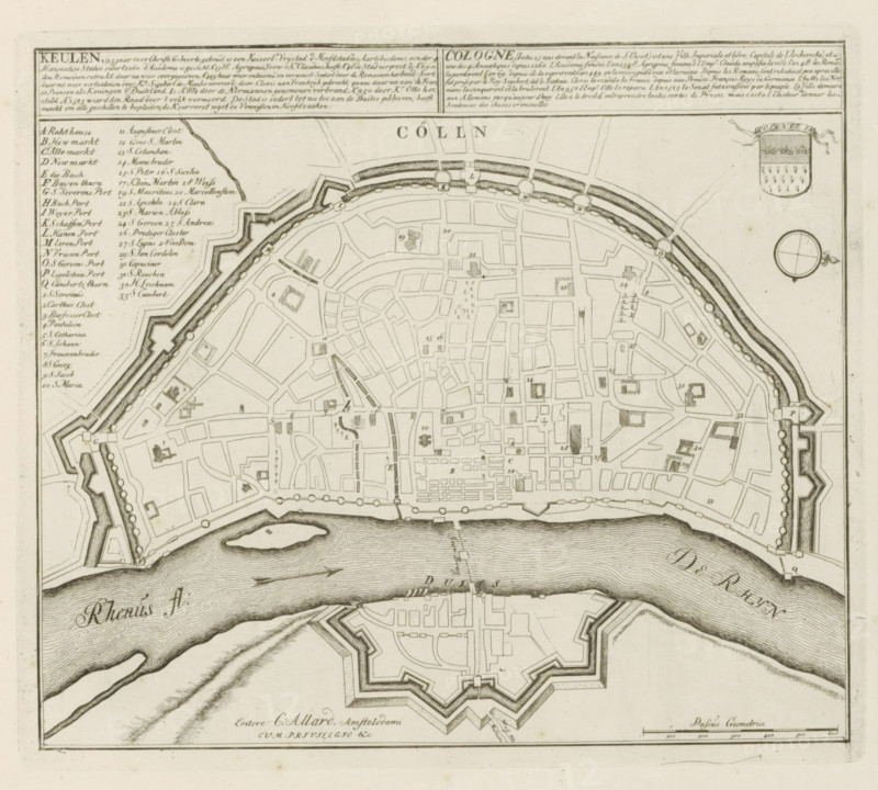
Cologne, (built 25 years before the Nativity of Christ) is an imperial free city, Map of Cologne, The Principal Fortifications & Fortified Cities of Spain, France, Italy, Savoy, Germany & the Netherlands, Accurate Illustrations of the Main Strong Cities and Fortifications in Spain, Germany and the Netherlands, print, album page, map, Map of Cologne. With texts in Dutch and French., printmaker: Abraham Allard, Amsterdam, printmaker: Carel Allard, publisher: Pieter van der Aa (I), Leiden, grantor of privilege: States of Holland and West Friesland, 1701 - 1733, paper, etching, height 240 mm x width 276 mm, fortifications, military engineering, maps of cities, War of Spanish Succession, North Rhine-Westphalia, Period, 1701 - 1713, A detailed black and white engraved map showing a fortified city plan with irregular streets, blocks, and small shaded building footprints inside defensive walls and bastions; a river runs along the lower edge with textured waterlines and a small island, and opposite the city is a star-shaped fort with angular ramparts and interior layouts; along the top border there is a boxed panel and a shield-like emblem and a circular compass rose, while the left margin shows a vertical list of labeled entries in a neat hand; the map includes bridges across the river, gates in the walls, small towers and quays, and finely drawn hatching and stippling for shading and topographic detail.
Credit line
Photo12/Liszt Collection
Reference
LZT26B29_161
License type
Rights managed
Available size
53.6Mb (10.6Mb) / 15.2in x 13.7in / 4561 x 4106 (300dpi)