Caption
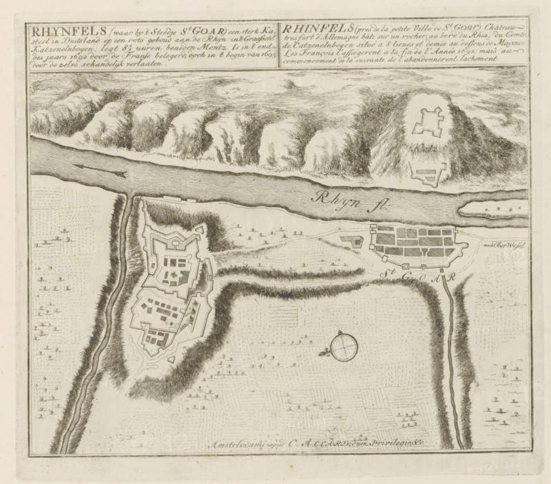
Map of Rheinfels Castle and the town of Sankt Goar, Rhynfels (where by the small town of St. Goar) a strong castle in Germany, besieged by the French at the end of the year 1692, but shamefully abandoned by them at the beginning of 1693, Les Principales Forteresses & Villes Fortes, d'Espagne, de France, d'Italie, de Savoië, d'Allemagne & des Païs-Bas, Accurate Illustrations of the Main Strong Cities and Fortresses in Spain, France, Italy, Savoy, Germany and the Netherlands, print, album page, map, Map of Rheinfels and Sankt Goar. With texts in Dutch and French., printmaker: Abraham Allard, Amsterdam, printmaker: Carel Allard, publisher: Carel Allard, publisher: Pieter van der Aa (I), Leiden, grantor of privilege: States of Holland and West Friesland, 1702 - 1733, Abraham Allard, Carel Allard, Pieter van der Aa (I), States of Holland and West Friesland, publisher, grantor of privilege, paper, etching, height 244 mm x width 276 mm, fortifications, military engineering, maps of cities, War of Spanish Succession, Rhineland-Palatinate, Rheinfels Castle, Period, 1701 - 1713, An aged map showing a river running horizontally with textured water strokes and two small arrows, steep hilly terrain with dense crosshatched shading along the riverbanks, fortified star-shaped structures on raised ground, a walled town layout with rectangular blocks and perimeter defenses, winding roads and paths, scattered small tree symbols and field patterns, a circular compass rose with directional ticks near the center, and a decorative rectangular border around the map.
Credit line
Photo12/Liszt Collection
Reference
LZT26B29_159
License type
Rights managed
Available size
53.2Mb (10.3Mb) / 15.3in x 13.5in / 4597 x 4047 (300dpi)